Category:Blueskin Bay
Jump to navigation
Jump to search
bight in New Zealand  | |||||
| Upload media | |||||
| Instance of |
| ||||
|---|---|---|---|---|---|
| Location | Dunedin City, Otago Region, New Zealand | ||||
| Inflows |
| ||||
 | |||||
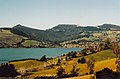
Blueskin Bay is an estuary in Dunedin, New Zealand. The Bay also lends its name to the surrounding rural district which includes the towns and villages of Doctors Point, Waitati, Evansdale, Warrington and Seacliff.
Media in category "Blueskin Bay"
The following 9 files are in this category, out of 9 total.
-
 Bag of cockles.jpg 640 × 480; 61 KB
-
 Blueskin Bay banner.jpg 2,476 × 354; 605 KB
-
 BlueskinbayMountCargill.JPG 4,608 × 3,072; 3.08 MB
-
 Cockle gatherers 021.jpg 640 × 480; 79 KB
-
 Cockle gatherers.jpg 640 × 459; 77 KB
-
 Fallen rock pillar pieces on steep hillside.jpg 6,144 × 4,000; 10.43 MB
-
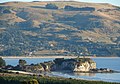 Mapoutahi Pa (Goat Island Blueskin Bay) (4506262890).jpg 2,476 × 1,728; 2.74 MB
-
 Māpoutahi pā (Goat Island) Blueskin Bay, Dunedin New Zealand.jpg 17,584 × 3,840; 6.66 MB
-
 Orokonui valley.jpg 450 × 298; 30 KB


_(4506262890).jpg)

_Blueskin_Bay,_Dunedin_New_Zealand.jpg)