Category:Blue bricks
Jump to navigation
Jump to search
type of brick  | |||||
| Upload media | |||||
| Subclass of | |||||
|---|---|---|---|---|---|
| |||||
Subcategories
This category has the following 6 subcategories, out of 6 total.
C
- Catesby Viaduct (19 F)
H
- Helmdon Viaduct (3 F)
R
- Rådhusgata 3, Kristiansand (3 F)
S
- Scoria bricks (7 F)
Media in category "Blue bricks"
The following 102 files are in this category, out of 102 total.
-
 1-18 Qiu’s Mansion.jpg 512 × 343; 257 KB
-
 1113 R Street, N.W..jpg 2,168 × 2,957; 2.3 MB
-
 1921 17th Street, N.W..JPG 1,990 × 1,979; 1.71 MB
-
 A patchwork bridge - geograph.org.uk - 1005024.jpg 640 × 480; 102 KB
-

-
 Artistic blue paving.jpg 2,048 × 1,536; 759 KB
-
 Bakehouse Theatre, Angas Street, Adelaide.jpg 2,588 × 1,833; 1.78 MB
-
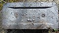
 Bench mark on Chester Bridge - geograph.org.uk - 1547586.jpg 480 × 640; 191 KB
-

-
 Big Blue Brick Buttress - geograph.org.uk - 1196828.jpg 479 × 640; 70 KB
-
 Blue Anchor Webberbus MX58AAE.jpg 1,024 × 768; 249 KB
-
 Blue Brick Cottage - geograph.org.uk - 276681.jpg 600 × 450; 240 KB
-
 Boulton (6255227728).jpg 3,648 × 2,056; 3.07 MB
-
 Bradenham Road Bridge.jpg 4,000 × 3,000; 5.48 MB
-
 Bricks by Joseph Hamblet - geograph.org.uk - 1120235.jpg 640 × 428; 91 KB
-
 Bridge 32, Clark's Bridge - geograph.org.uk - 944763.jpg 640 × 453; 119 KB
-
-
 Bridge No3 - geograph.org.uk - 421889.jpg 640 × 480; 78 KB
-
 Bridleway bridge - geograph.org.uk - 1715007.jpg 4,000 × 3,000; 5.15 MB
-
 ChesterfieldHornsBridgeViaductRemnant20130720.jpg 4,000 × 3,000; 1.96 MB
-

-
 Close-up of paving in the West Midlands.jpg 3,264 × 2,448; 2.71 MB
-
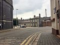 Corn Hill, Wolverhampton.jpg 3,264 × 2,448; 2.1 MB
-
 Dudley Road, Round Oak - geograph.org.uk - 1493723.jpg 640 × 471; 95 KB
-
 Evangelička Crkva.jpg 1,760 × 2,640; 790 KB
-

-
 Fishergate Tunnel approach ramp, Preston - geograph.org.uk - 954383.jpg 640 × 480; 109 KB
-

-
 Footpath Underpass - geograph.org.uk - 187620.jpg 480 × 640; 130 KB
-

-
 Gabrielina Huť - detail zříceniny domu.jpg 4,288 × 2,848; 7.77 MB
-
 Gun Barrel Proof House, Banbury Street, Digbeth - sign removed.jpg 3,648 × 2,736; 2.42 MB
-
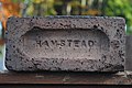 Hamstead brick - 2021-11- 17- Andy Mabbett.jpg 3,872 × 2,592; 4.63 MB
-
 Haunchwood (5579514965) (2).jpg 3,648 × 2,056; 3.31 MB
-
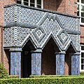
 Haynstraße 2, 4 (Hamburg-Eppendorf).Portal.1.29253.ajb.jpg 4,000 × 6,000; 16.29 MB
-
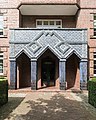
 Haynstraße 2, 4 (Hamburg-Eppendorf).Portal.2.29253.ajb.jpg 4,000 × 4,000; 9.4 MB
-
 Haynstraße 2, 4 (Hamburg-Eppendorf).Portal.3.29253.ajb.jpg 4,000 × 5,000; 11.49 MB
-
 Haynstraße 2, 4 (Hamburg-Eppendorf).Portal.4.29253.ajb.jpg 3,900 × 3,120; 8.64 MB
-
 Haynstraße 2, 4 (Hamburg-Eppendorf).Portal.Detail.1.29253.ajb.jpg 5,756 × 3,837; 13.46 MB
-
 Haynstraße 2, 4 (Hamburg-Eppendorf).Portal.Detail.2.29253.ajb.jpg 4,000 × 6,000; 14.46 MB
-
 Haynstraße 2, 4 (Hamburg-Eppendorf).Portal.Detail.3.29253.ajb.jpg 6,000 × 4,000; 16.3 MB
-
 Haynstraße 2, 4 (Hamburg-Eppendorf).Portal.Detail.4.29253.ajb.jpg 4,000 × 6,000; 15.25 MB
-
 Great Central Railway Helmdon - geograph.org.uk - 1339212.jpg 640 × 480; 95 KB
-
 Helmdon Station - geograph.org.uk - 1341903.jpg 640 × 480; 129 KB
-
 Helmdon Station Road - geograph.org.uk - 1339295.jpg 640 × 480; 83 KB
-

-
 Holy Trinity Sunday School - geograph.org.uk - 938380.jpg 640 × 594; 100 KB
-
 Houses east of the church, Sandbach - geograph.org.uk - 59656.jpg 640 × 427; 67 KB
-
 Joseph Hamblet (Bolsover to Glapwell Branch Line) (5497291651).jpg 3,648 × 2,736; 3.8 MB
-
 Joseph Hamblet (Seymour Junction to Elmton and Creswell Jct branch) (5961232943).jpg 3,648 × 2,736; 3.2 MB
-
 Lilbourne Station - geograph.org.uk - 1601863.jpg 640 × 480; 79 KB
-
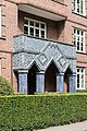
 Lodge to Stanmore Park - geograph.org.uk - 423509.jpg 600 × 450; 279 KB
-
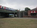
 Looking down onto platform at 19th Street Oakland station, January 2020.JPG 5,184 × 3,888; 3.94 MB
-

-
 Metal (5461550573).jpg 3,648 × 2,056; 1.61 MB
-
 Mid-City Wall with Plants.jpg 3,330 × 2,498; 7.31 MB
-
 Bridge over dismantled railway - geograph.org.uk - 339339.jpg 640 × 480; 113 KB
-
 Old and new at Befcote Farm - geograph.org.uk - 390459.jpg 600 × 458; 175 KB
-
 Old San Juan's Blue Brick Roads I.jpg 4,288 × 2,848; 9.78 MB
-
 Old San Juan's Blue Brick Roads II.jpg 4,288 × 2,848; 6.78 MB
-
 Oriel window - geograph.org.uk - 1743540.jpg 683 × 1,024; 262 KB
-
 - Flickr - Edna Winti.jpg 3,648 × 4,864; 8.85 MB
-
 Quill Depot-Javits Ctr 04.jpg 5,152 × 3,864; 7.8 MB
-
 Railway bridge and abutments - geograph.org.uk - 1576056.jpg 640 × 480; 97 KB
-
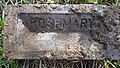 Rosemary (5479051557).jpg 3,648 × 2,056; 2.96 MB
-
 School in Chicago's Lakeview neighborhood (4351450229).jpg 2,592 × 1,944; 1.14 MB
-
 School in Chicago's Lakeview neighborhood (4352198710).jpg 2,592 × 1,944; 1,003 KB
-
 School in Chicago's Lakeview neighborhood (4352199192).jpg 2,592 × 1,944; 1.09 MB
-
 School in Chicago's Lakeview neighborhood (4352199392).jpg 2,592 × 1,944; 1.1 MB
-
 Shipley (5598999626).jpg 3,648 × 2,056; 2.56 MB
-
 St. Mary's church, Fryerning - geograph.org.uk - 340854.jpg 640 × 445; 104 KB
-
 Stairs in 19th Street Oakland station, January 2020.JPG 5,184 × 3,888; 3.96 MB
-
 Stanley Road Footbridge - geograph.org.uk - 887408.jpg 640 × 385; 172 KB
-
 Steps to Water Meadows - geograph.org.uk - 1073341.jpg 480 × 640; 195 KB
-

-
 St. Peter's community mosaic at Stoke - geograph.org.uk - 337249.jpg 640 × 469; 135 KB
-
 Sutherland Works, Normacot Road, Longton - geograph.org.uk - 312815.jpg 640 × 468; 128 KB
-
 The Aqueduct at Burrs - geograph.org.uk - 1800226.jpg 2,816 × 2,112; 1.92 MB
-
 The Blue Brick, Round Oak. - geograph.org.uk - 1100286.jpg 640 × 480; 88 KB
-
 The Corn House, Wyle Cop, Shrewsbury - geograph.org.uk - 118599.jpg 460 × 640; 69 KB
-
 Utopia (5479684796) (2).jpg 3,648 × 2,056; 3.4 MB
-
 Versöhnungskirche (Hamburg-Eilbek).Turm.Uhr.3.24542.ajb.jpg 4,873 × 4,177; 12.79 MB
-

-
 Village Farm, Grafham - geograph.org.uk - 1203900.jpg 640 × 480; 77 KB
-
 Vitros (5950648195).jpg 3,648 × 2,056; 1.59 MB
-

-
 Blue bricks - geograph.org.uk - 1457919.jpg 640 × 428; 71 KB
-
 Wellow Brook - geograph.org.uk - 359414.jpg 640 × 480; 126 KB
-
 White and blue stone brick wall.jpg 2,592 × 1,944; 879 KB
-
 Whitebull Hotel, Armidale, NSW. (6335520425).jpg 4,225 × 2,803; 1.56 MB
-
 Wolverhampton Low Level Station - geograph.org.uk - 575254.jpg 640 × 480; 72 KB
-
 Worcester Shrub Hill Station (6368365083).jpg 3,648 × 2,736; 2.32 MB
-
 Worcester Shrub Hill Station - Porte-cochre (6368368675).jpg 3,648 × 2,736; 2.37 MB
-
 Worcester Shrub Hill Station - red telephone box (6368372037).jpg 2,736 × 3,648; 2.42 MB
-
 Wren Hall, Wroxhall - geograph.org.uk - 43569.jpg 640 × 480; 128 KB
-
 Bank Street, Bishop's Waltham - geograph.org.uk - 226818.jpg 485 × 640; 128 KB
-
 Blue brick railway bridge - geograph.org.uk - 286154.jpg 500 × 375; 202 KB
-
 Bridge abutment - geograph.org.uk - 322461.jpg 640 × 480; 169 KB
-
 Bridge No3 - geograph.org.uk - 421897.jpg 640 × 480; 111 KB
-
 Bridge No30 - geograph.org.uk - 423262.jpg 640 × 480; 73 KB
-

-
 The viaduct at Shoscombe Vale - geograph.org.uk - 359406.jpg 640 × 480; 122 KB


.jpg)


_-_geograph.org.uk_-_797727.jpg)


_(2).jpg)
.Portal.1.29253.ajb.jpg)
.Portal.2.29253.ajb.jpg)
.Portal.3.29253.ajb.jpg)
.Portal.4.29253.ajb.jpg)
.Portal.Detail.1.29253.ajb.jpg)
.Portal.Detail.2.29253.ajb.jpg)
.Portal.Detail.3.29253.ajb.jpg)
.Portal.Detail.4.29253.ajb.jpg)


_(5497291651).jpg)
_(5961232943).jpg)


.jpg)


.jpg)
.jpg)
.jpg)
.jpg)
.jpg)
.jpg)


_(2).jpg)
.Turm.Uhr.3.24542.ajb.jpg)


.jpg)


.jpg)

.jpg)
.jpg)
.jpg)


