Category:Blue Hills Reservation
Jump to navigation
Jump to search
landform  | |||||
| Upload media | |||||
| Instance of | |||||
|---|---|---|---|---|---|
| Location | Massachusetts | ||||
| IUCN protected areas category | |||||
| Highest point |
| ||||
 | |||||
Blue Hills Reservation incorporates the Blue Hills to the southwest of Boston.
Subcategories
This category has the following 9 subcategories, out of 9 total.
Media in category "Blue Hills Reservation"
The following 27 files are in this category, out of 27 total.
-
 2012 07 21 great-blue-hill 28 (43254623450).jpg 2,078 × 4,322; 4.85 MB
-
 BAT route 12 bus in the Blue Hills Reservation, July 2018.jpg 4,032 × 2,125; 2.33 MB
-
 Blue Hills blue rocks.jpg 3,888 × 2,592; 5.82 MB
-
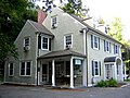
 Blue Hills Headquarters MA 01.jpg 1,127 × 1,085; 170 KB
-
 Blue Hills Headquarters MA 02.jpg 1,600 × 1,200; 307 KB
-
 Blue Hills P1140207.jpg 2,560 × 1,920; 1.79 MB
-
 Blue Hills P1140223.jpg 2,560 × 1,920; 1.7 MB
-
 Blue Hills Reservation P1140209.jpg 2,560 × 1,920; 1.71 MB
-
 Boardwalk through Ponkapoag Bog Clearing.jpg 4,869 × 3,225; 12.92 MB
-

-

-

-
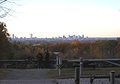
 Boston Skyline from GBH.jpg 2,048 × 434; 210 KB
-
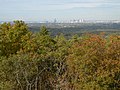
 Boston-from-blue-hills.jpg 765 × 175; 8 KB
-
 Brookwood Farm MA 01.jpg 1,600 × 794; 99 KB
-
 CantonMA LittleBlueHill.jpg 1,024 × 680; 195 KB
-
 Chickatawbut Road Quincy MA.jpg 1,561 × 1,089; 678 KB
-
 Great Blue Hill in Milton.jpg 480 × 360; 23 KB
-
 Houghton's Pond at Blue Hills Reservation.JPG 5,184 × 3,456; 6.08 MB
-
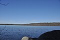
 Houghton's Pond, Milton MA.jpg 2,745 × 2,060; 3.75 MB
-
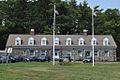 MiltonMA BlueHillsPoliceHQ.jpg 1,024 × 680; 271 KB
-
 PonkapoagPondWithGBH.jpg 1,024 × 680; 170 KB
-
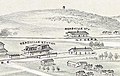 Readville stations on 1893 bird's eye view map.jpg 722 × 456; 94 KB
-
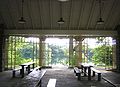
 Refreshment Pavilion MIlton MA 01.jpg 1,600 × 1,200; 284 KB
-
 Refreshment Pavilion MIlton MA 02.jpg 1,555 × 1,129; 183 KB
-
 Refreshment Pavilion MIlton MA 03.jpg 1,471 × 861; 252 KB
-
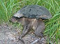 Turtle-back-galawebdesign.jpg 900 × 663; 680 KB
.jpg)


_(19779698703).jpg)
_(20212576560).jpg)
_(20213989149).jpg)


