Category:Blue Book maps of Manhattan published in 1868
Jump to navigation
Jump to search
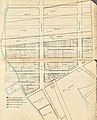
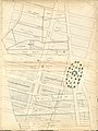
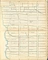
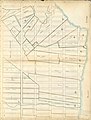
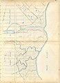
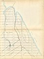
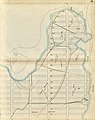
Maps from: Sackersdorff, Otto. Maps of Farms Commonly Called The Blue Book. 1815. [Updated to 1868]. Drawn from the Original on file in the Street Commissioner's Office in the City of New York, together with lines of Streets and Avenues, laid out by John Randel, jr., 1819–1920. (New York: 1868), comprising title page plus 26 maps (pages).
Online at The New York Public Library Digital Collection website, Map of farms….
Subcategories
This category has only the following subcategory.
Media in category "Blue Book maps of Manhattan published in 1868"
The following 27 files are in this category, out of 27 total.
-
 Blue Book title page publ. 1868.jpg 4,808 × 5,465; 16.58 MB
-
 Blue Book Page 01 publ. 1868.jpg 4,661 × 5,772; 24.98 MB
-
 Blue Book Page 02 publ. 1868.jpg 4,799 × 6,098; 25.07 MB
-
 Blue Book Page 03 publ. 1868.jpg 4,731 × 6,308; 25.95 MB
-
 Blue Book Page 04 publ. 1868.jpg 4,835 × 6,344; 25.24 MB
-
 Blue Book Page 05 publ. 1868.jpg 4,856 × 6,362; 25.67 MB
-
 Blue Book Page 06 publ. 1868.jpg 4,864 × 6,054; 24.68 MB
-
 Blue Book Page 07 publ. 1868.jpg 4,652 × 6,409; 25.08 MB
-
 Blue Book Page 08 publ. 1868.jpg 4,818 × 6,226; 24.92 MB
-
 Blue Book Page 09 publ. 1868.jpg 4,866 × 6,101; 24.29 MB
-
 Blue Book Page 10 publ. 1868.jpg 4,324 × 6,031; 22.14 MB
-
 Blue Book Page 11 publ. 1868.jpg 4,627 × 5,869; 21.14 MB
-
 Blue Book Page 12 publ. 1868.jpg 4,825 × 6,386; 25.41 MB
-
 Blue Book Page 13 publ. 1868.jpg 4,172 × 5,900; 20.69 MB
-
 Blue Book Page 14 publ. 1868.jpg 4,771 × 6,282; 23.51 MB
-
 Blue Book Page 15 publ. 1868.jpg 4,609 × 6,428; 25.97 MB
-
 Blue Book Page 16 publ. 1868.jpg 4,647 × 6,284; 24.94 MB
-
 Blue Book Page 17 publ. 1868.jpg 4,622 × 6,351; 23.8 MB
-
 Blue Book Page 18 publ. 1868.jpg 4,831 × 6,233; 25.85 MB
-
 Blue Book Page 19 publ. 1868.jpg 4,831 × 6,146; 26.08 MB
-
 Blue Book Page 20 publ. 1868.jpg 4,821 × 6,145; 22.48 MB
-
 Blue Book Page 21 publ. 1868.jpg 4,482 × 6,108; 24.8 MB
-
 Blue Book Page 22 publ. 1868.jpg 4,646 × 6,195; 21.28 MB
-
 Blue Book Page 23 publ. 1868.jpg 4,830 × 5,849; 21.62 MB
-
 Blue Book Page 24 publ. 1868.jpg 4,805 × 6,302; 25.25 MB
-
 Blue Book Page 25 publ. 1868.jpg 5,868 × 4,559; 21.62 MB
-
 Blue Book Page 26 publ. 1868.jpg 4,808 × 6,097; 27.09 MB


