Category:Bloemgracht 76, Amsterdam
Jump to navigation
Jump to search
| Object location | | View all coordinates using: OpenStreetMap |
|---|
 | |||||
| Upload media | |||||
| Instance of | |||||
|---|---|---|---|---|---|
| Location | Amsterdam, North Holland, Netherlands | ||||
| Street address |
| ||||
| Located on street | |||||
| Heritage designation |
| ||||
 | |||||
|
This is a category about rijksmonument number 562
|
| Address |
|
Media in category "Bloemgracht 76, Amsterdam"
The following 8 files are in this category, out of 8 total.
-
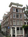 Amsterdam - Bloemgracht 76.jpg 2,304 × 3,072; 2.57 MB
-
 Amsterdam Bloemgracht 76 across Bloemgracht.jpg 1,728 × 2,304; 1.28 MB
-
 Amsterdam Bloemgracht 76 corner with Tweede Leliedwarsstraat.jpg 1,728 × 2,304; 1.15 MB
-
 Amsterdam Bloemgracht 76 door from Bloemgracht.jpg 1,728 × 2,304; 1.07 MB
-
 Amsterdam Bloemgracht 76 door from Tweede Leliedwarsstraat.jpg 2,304 × 1,728; 1.02 MB
-
 Amsterdam Bloemgracht 76 plaque.jpg 1,728 × 2,304; 977 KB
-
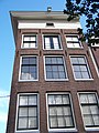 Amsterdam Bloemgracht 76 top from Bloemgracht.jpg 1,728 × 2,304; 1.03 MB
-
 Amsterdam Bloemgracht 76 top from Tweede Leliedwarsstraat.jpg 1,728 × 2,304; 980 KB


