Category:Bloemgracht 13, Amsterdam
Jump to navigation
Jump to search
| Object location | | View all coordinates using: OpenStreetMap |
|---|
 | |||||
| Upload media | |||||
| Instance of |
| ||||
|---|---|---|---|---|---|
| Location | Amsterdam, North Holland, Netherlands | ||||
| Street address |
| ||||
| Located on street | |||||
| Heritage designation |
| ||||
 | |||||
|
This is a category about rijksmonument number 509
|
| Address |
|
Media in category "Bloemgracht 13, Amsterdam"
The following 7 files are in this category, out of 7 total.
-
 Amsterdam Bloemgracht 13 door.jpg 1,728 × 2,304; 1.04 MB
-
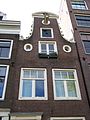 Amsterdam Bloemgracht 13 top.jpg 1,728 × 2,304; 988 KB
-
 Exterieur VOORGEVELS, OVERZICHT - Amsterdam - 20298464 - RCE.jpg 954 × 1,200; 263 KB
-
 Gerrit Lamberts (1776-1850), Afb KOG-AA-2-18-326.jpg 2,774 × 3,031; 1.3 MB
-
 Gerrit Lamberts (1776-1850), Afb KOG-AA-2-18-327.jpg 2,370 × 2,361; 982 KB
-
 Gerrit Lamberts (1776-1850), Afb KOG-AA-2-18-328.jpg 2,901 × 3,171; 1.63 MB
-
 Gerrit Lamberts (1776-1850), Afb KOG-AA-2-18-329.jpg 1,834 × 1,996; 614 KB


,_Afb_KOG-AA-2-18-326.jpg)
,_Afb_KOG-AA-2-18-327.jpg)
,_Afb_KOG-AA-2-18-328.jpg)
,_Afb_KOG-AA-2-18-329.jpg)