Category:Bliedersdorf
Jump to navigation
Jump to search
municipality of Germany     | |||||
| Upload media | |||||
| Instance of |
| ||||
|---|---|---|---|---|---|
| Location | |||||
| Population |
| ||||
| Area |
| ||||
| Elevation above sea level |
| ||||
| official website | |||||
 | |||||
Deutsch: Dateien zum Ort Bliedersdorf im Landkreis Stade in Niedersachsen, Deutschland.
English: Files from the village Bliedersdorf in the district Stade in Lower Saxony, Germany.
Plattdüütsch: Biller to'n Oort Bliedersdörp in'n Landkreis Stood in Neddersassen, Düütschland.
Subcategories
This category has the following 3 subcategories, out of 3 total.
G
K
R
Media in category "Bliedersdorf"
The following 39 files are in this category, out of 39 total.
-
 DEU Bliedersdorf COA.svg 392 × 477; 555 bytes
-
 Aue-Fruehjahr.JPG 2,032 × 1,524; 576 KB
-
 Auetal-Fruehjahr.JPG 2,032 × 1,524; 1.01 MB
-
 AuetalSpringGate.jpg 2,032 × 1,524; 1.44 MB
-
 AuetalTor.jpg 2,032 × 1,524; 912 KB
-
 AuetalWolken.jpg 2,032 × 1,524; 829 KB
-
 Bliedersdorf - panoramio.jpg 2,816 × 2,112; 1.02 MB
-
 Bliedersdorf in STD.png 327 × 341; 10 KB
-
 Bliedersdorf Ortsschild.jpg 2,032 × 1,524; 1 MB
-
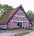
 Bliedersdorf Schönes Haus.jpg 2,048 × 1,536; 2.23 MB
-
 Bliedersdorf Unterer Daudieckerweg.jpg 2,032 × 1,524; 1.12 MB
-
 Bliedersdorf Wappen.gif 597 × 737; 26 KB
-
 Bliedersdorf Wappen.svg 512 × 631; 477 bytes
-
 Bliedersdorfer Feuerwehr.jpg 2,272 × 1,410; 674 KB
-
 Bliedersdorfer grundschule.jpg 2,032 × 1,524; 1.09 MB
-
 Bliedersdorfer kindergarten rückseite.jpg 1,422 × 1,067; 287 KB
-
 Bliedersdorfer kindergarten.jpg 2,032 × 1,260; 517 KB
-
 Bliedersdorfer Spargel Feld.jpg 2,272 × 1,704; 796 KB
-
 Bliedersdorfer Spargel Schild.jpg 1,263 × 654; 121 KB
-
 Bliedersdorfer Spargelfeld 2.jpg 2,032 × 1,524; 663 KB
-
 Bliedersdorfer Spargelfeld.jpg 2,032 × 1,524; 631 KB
-
 Bliedersdorfer Spargelhof.jpg 1,412 × 1,520; 801 KB
-
 Gelbes viertel.jpg 2,272 × 1,704; 666 KB
-
 GutDaudieck.jpg 1,257 × 771; 303 KB
-
 Neubaugebiet Unterer DaudieckerWeg im Frühjahr.jpg 2,272 × 1,704; 1.31 MB
-
 Oortsschild Bliersdörp 2.jpg 2,592 × 1,944; 1.65 MB
-
 Oortsschild Bliersdörp-Postmoor 2.jpg 2,592 × 1,944; 1.53 MB
-
 Oortsschild Bliersdörp-Postmoor.jpg 1,944 × 2,592; 1.82 MB
-
 Oortsschild Bliersdörp.jpg 1,944 × 2,592; 1.86 MB
-
 Schild Auetal.jpg 1,524 × 2,032; 1,022 KB
-
 Technikmuseum Stade, 132.jpg 3,032 × 3,896; 4.12 MB
-
 UntererDaudieckerWeg2.JPG 2,032 × 1,524; 890 KB
-
 Weg ins Auetal 2006 Bild2.jpg 2,272 × 1,704; 774 KB
-
 Weg ins Auetal 2006 Bild3.jpg 2,168 × 1,440; 1.1 MB
-
 Weg ins Auetal 2006 Bild4.jpg 1,524 × 2,032; 1.32 MB
-
 Weg ins Auetal 2006.jpg 1,704 × 2,272; 1.08 MB
-
 WegZurAue.JPG 1,524 × 2,032; 795 KB
-
 WegZurAue2.JPG 1,524 × 2,032; 687 KB
-
 Wiese im Auetal 2006.jpg 2,272 × 1,704; 702 KB


