Category:Blennerville
Jump to navigation
Jump to search
village in Munster, Ireland  | |||||
| Upload media | |||||
| Instance of | |||||
|---|---|---|---|---|---|
| Location | County Kerry, Munster, Ireland | ||||
 | |||||
Subcategories
This category has the following 2 subcategories, out of 2 total.
B
- Blennerville Windmill (73 F)
T
- Tralee Ship Canal (8 F)
Media in category "Blennerville"
The following 44 files are in this category, out of 44 total.
-
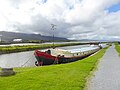 Barge on the Tralee Ship Canal - geograph.org.uk - 4666832.jpg 640 × 480; 387 KB
-
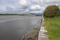
 Blennerville Bridge - geograph.org.uk - 2568083.jpg 480 × 640; 309 KB
-
 Blennerville Bridge - geograph.org.uk - 4666829.jpg 640 × 480; 379 KB
-
 Blennerville Co Kerry - geograph.org.uk - 3659721.jpg 3,648 × 2,736; 6.46 MB
-
 Blennerville Dusk.jpg 4,923 × 3,192; 893 KB
-
 Blennerville Windmill - geograph.org.uk - 6121302.jpg 3,167 × 4,223; 2.91 MB
-
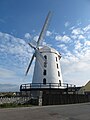 Blennerville Windmill - geograph.org.uk - 6121308.jpg 3,888 × 5,184; 3.83 MB
-
 Blennerville Windmill - geograph.org.uk - 6314323.jpg 800 × 533; 430 KB
-
 Blennerville, Tralee (5244642092).jpg 600 × 459; 53 KB
-
 Blennerville.JPG 2,048 × 1,536; 704 KB
-
 Blennerville.jpg 4,000 × 3,000; 2.71 MB
-
 Canal Road and Blennerville Bridge - geograph.org.uk - 6314320.jpg 800 × 533; 515 KB
-
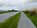
 Canal Road, Tralee - geograph.org.uk - 6314315.jpg 800 × 533; 459 KB
-
 Curraheen, Saint Brendan's Church.jpg 6,312 × 4,479; 2.54 MB
-
 Embankment at Blennerville - geograph.org.uk - 4666837.jpg 640 × 480; 383 KB
-
 Estuary of the River Lee at Blennerville - geograph.org.uk - 4666830.jpg 640 × 480; 340 KB
-
 Lock gates, Tralee Ship Canal - geograph.org.uk - 4666813.jpg 640 × 480; 434 KB
-
 Lock gates, Tralee Ship Canal - geograph.org.uk - 4666822.jpg 640 × 480; 475 KB
-
 Looking across canal to Lohercannon - geograph.org.uk - 5961243.jpg 1,024 × 681; 139 KB
-
 N86 - geograph.org.uk - 5961257.jpg 1,024 × 641; 99 KB
-

-
 Not the Blennerville Windmill - geograph.org.uk - 5249065.jpg 4,608 × 3,456; 3.6 MB
-
 Quay, Blennerville - geograph.org.uk - 2568077.jpg 640 × 425; 243 KB
-
 Quay, Blennerville - geograph.org.uk - 2568078.jpg 640 × 425; 234 KB
-
 River Lee and Tralee Ship Canal at Blennerville - geograph.org.uk - 6121305.jpg 5,183 × 2,915; 4.39 MB
-
 River Lee estuary at Blennerville - geograph.org.uk - 6289681.jpg 1,024 × 768; 160 KB
-
 Robert Emmet Park - geograph.org.uk - 511145.jpg 640 × 480; 130 KB
-
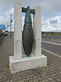 Sculpture at Blennerville Bridge - geograph.org.uk - 4666851.jpg 479 × 640; 415 KB
-
 Sculpture, Blennerville - geograph.org.uk - 2568085.jpg 425 × 640; 255 KB
-
 Sea lock, Tralee Ship Canal - geograph.org.uk - 4666810.jpg 640 × 480; 394 KB
-
 Sea lock, Tralee Ship Canal - geograph.org.uk - 4666817.jpg 640 × 480; 367 KB
-
 Sunset Over Blennerville - geograph.org.uk - 3464341.jpg 1,697 × 1,268; 412 KB
-
 The Courtyard, Blennerville - geograph.org.uk - 509224.jpg 640 × 480; 94 KB
-
 The River Lee and saltmarsh at Blennerville - geograph.org.uk - 6289685.jpg 1,024 × 768; 153 KB
-
 The River Lee from Blennerville Bridge - geograph.org.uk - 4146855.jpg 1,600 × 1,093; 731 KB
-
 The Station House, Blennerville - geograph.org.uk - 511153.jpg 640 × 480; 83 KB
-
 Tralee and Dingle railway - geograph.org.uk - 6277781.jpg 1,024 × 768; 167 KB
-
 Tralee and Dingle Railway at Blennerville - geograph.org.uk - 6121316.jpg 5,184 × 3,888; 5.49 MB
-
 Tralee and Dingle Railway at Blennerville - geograph.org.uk - 6121320.jpg 5,184 × 3,888; 6.42 MB
-
 Tralee and Dingle Railway at Blennerville - geograph.org.uk - 6121327.jpg 5,103 × 3,827; 6.2 MB
-
 Tralee Ship Canal - geograph.org.uk - 4666826.jpg 640 × 480; 410 KB
-
 Tralee Ship Canal and N86 - geograph.org.uk - 5961273.jpg 1,024 × 496; 66 KB
-
 Tralee Ship Canal, Blennerville - geograph.org.uk - 2568080.jpg 640 × 425; 229 KB
-
 Tralee Ship Canal, Blennerville - geograph.org.uk - 2568081.jpg 640 × 425; 261 KB


.jpg)


_on_curved_lock,_dock_on_canal_entrance,_another_bridge,_towns_old_mill,_hills,_in_background_(29044158092).jpg)


