Category:Blaston
Jump to navigation
Jump to search
English: Blaston is a village and civil parish in the Harborough district of Leicestershire. It is a small parish with a population of 54 according to the 2001 census. The village is nearby Nevill Holt, Medbourne and Hallaton.
village in the United Kingdom  | |||||
| Upload media | |||||
| Instance of | |||||
|---|---|---|---|---|---|
| Location | Harborough, Leicestershire, East Midlands, England | ||||
| Population |
| ||||
 | |||||
Media in category "Blaston"
The following 101 files are in this category, out of 101 total.
-
 A bend in Uppingham Road (B664) - geograph.org.uk - 4134810.jpg 640 × 480; 61 KB
-
 Approaching the village of Blaston - geograph.org.uk - 566640.jpg 640 × 480; 148 KB
-
 Belcher's Hill near Bolt Wood - geograph.org.uk - 3366524.jpg 4,000 × 3,000; 3.24 MB
-
 Belcher's Lodge viewed from Uppingham Road - geograph.org.uk - 3366532.jpg 2,966 × 2,054; 1.94 MB
-
 Blaston at 12-55 - geograph.org.uk - 3412675.jpg 2,736 × 3,648; 1.67 MB
-
 Blaston Church - geograph.org.uk - 4877627.jpg 640 × 640; 126 KB
-
 Blaston Hill - geograph.org.uk - 3487464.jpg 640 × 515; 43 KB
-
 Blaston Hill - geograph.org.uk - 566644.jpg 640 × 423; 122 KB
-
 Blaston Hill at Blaston - geograph.org.uk - 6395677.jpg 800 × 497; 79 KB
-
 Blaston Hill descending to Blaston Pastures - geograph.org.uk - 3366536.jpg 3,766 × 2,760; 2.95 MB
-
 Blaston Hill east of the village of Blaston - geograph.org.uk - 3366547.jpg 4,000 × 3,000; 4.53 MB
-
 Blaston Hill in Blaston Hollows - geograph.org.uk - 3366545.jpg 3,099 × 2,471; 2.38 MB
-
 Blaston Hill in the village of Blaston - geograph.org.uk - 3368581.jpg 3,260 × 2,405; 2.31 MB
-
 Blaston Hill leading off Uppingham Road - geograph.org.uk - 5930452.jpg 3,776 × 2,520; 4.27 MB
-
 Blaston Lodge viewed from Blaston Hill - geograph.org.uk - 3366541.jpg 3,631 × 2,716; 3.08 MB
-
 Blaston Lodge, seen from the bridleway near Highland wood - geograph.org.uk - 3412793.jpg 3,648 × 2,736; 2.67 MB
-
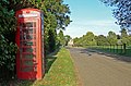
 Blaston phone box - geograph.org.uk - 5176585.jpg 480 × 640; 117 KB
-
 Blaston, Leicestershire - geograph.org.uk - 566645.jpg 640 × 489; 118 KB
-
 Bridleway to Nevill Holt Hall - geograph.org.uk - 3368597.jpg 3,264 × 2,227; 2.2 MB
-
 Church Barn in the village of Blaston - geograph.org.uk - 3372650.jpg 3,707 × 2,489; 2.8 MB
-
 Country lane - geograph.org.uk - 4912485.jpg 6,480 × 4,320; 6.88 MB
-
 Diversion - geograph.org.uk - 4912481.jpg 6,480 × 4,320; 7.44 MB
-
 Door and arch, Blaston - geograph.org.uk - 3412671.jpg 2,736 × 3,648; 2.1 MB
-
 Driveway along Hallaton Road - geograph.org.uk - 3372661.jpg 3,106 × 1,857; 1.7 MB
-
 Farm building at Blaston Hollow - geograph.org.uk - 3366542.jpg 3,607 × 2,626; 3.34 MB
-
 Farm gates along Hallaton Road - geograph.org.uk - 3372645.jpg 4,000 × 3,000; 2.3 MB
-
 Farmland along Horninghold Lane - geograph.org.uk - 3372834.jpg 3,421 × 2,889; 3.01 MB
-
 Farmland near Blaston - geograph.org.uk - 3366549.jpg 3,789 × 2,742; 3.13 MB
-
 Farmland near Blaston - geograph.org.uk - 3368635.jpg 2,253 × 1,763; 1.43 MB
-
 Farmland south of Blaston - geograph.org.uk - 3368640.jpg 2,926 × 2,365; 2.37 MB
-
 Farmland west of the village of Blaston - geograph.org.uk - 3372633.jpg 3,430 × 2,379; 2.45 MB
-
 Fields and hedges south of Blaston - geograph.org.uk - 3368650.jpg 4,000 × 3,000; 4.95 MB
-
 Flush fitting Stella rooflights in a barn conversion.jpg 2,048 × 1,365; 651 KB
-

-
 Footpath to Hallaton Road - geograph.org.uk - 3368595.jpg 3,389 × 2,563; 2.74 MB
-
 Gate along the Horninghold Gated Road - geograph.org.uk - 3372760.jpg 3,696 × 2,494; 2.74 MB
-
 Grazing off Uppingham Road - geograph.org.uk - 4134800.jpg 640 × 480; 61 KB
-
 Hallaton Road at Blaston - geograph.org.uk - 6411716.jpg 800 × 470; 130 KB
-
 Hallaton Road in Blaston - geograph.org.uk - 3372654.jpg 2,345 × 1,632; 1.23 MB
-
 Hallaton Road, Blaston - geograph.org.uk - 566643.jpg 640 × 468; 144 KB
-
 Heading north along Blaston Field Road - geograph.org.uk - 3368637.jpg 4,000 × 3,000; 3.55 MB
-
 Heading north along Horninghold Gated Road - geograph.org.uk - 3372665.jpg 3,276 × 2,247; 2.28 MB
-
 Heading south along Horninghold Gated Road - geograph.org.uk - 3372756.jpg 4,000 × 3,000; 3.3 MB
-
 Highland Wood near Blaston - geograph.org.uk - 3412703.jpg 3,648 × 2,736; 2.61 MB
-
 Home Farm near Medbourne - geograph.org.uk - 3368655.jpg 2,684 × 2,104; 1.92 MB
-
 Horninghold Lane descending to Sturrad Spinney - geograph.org.uk - 3372821.jpg 3,111 × 2,259; 1.43 MB
-
 Horninghold Lane northwards - geograph.org.uk - 3487462.jpg 640 × 487; 62 KB
-
 Horninghold Lane towards Blaston - geograph.org.uk - 3498891.jpg 640 × 460; 40 KB
-
 Horninghold Lane towards Horninghold - geograph.org.uk - 6411660.jpg 800 × 435; 87 KB
-
 House or shed waiting for development - geograph.org.uk - 3412660.jpg 3,648 × 2,736; 2.72 MB
-

-
 Leviathan Wood along the Blaston Field Road - geograph.org.uk - 3368656.jpg 4,000 × 3,000; 4.76 MB
-
 Leviathan Wood near Medbourne - geograph.org.uk - 3368657.jpg 4,000 × 3,000; 3.44 MB
-
 Leviathan Wood on the Nevill Holt Estate - geograph.org.uk - 4891188.jpg 5,344 × 3,006; 4.29 MB
-
 Looking north along Horninghold Lane - geograph.org.uk - 3372806.jpg 3,369 × 2,277; 1.87 MB
-
 Narrow lane across Blaston Pastures - geograph.org.uk - 3366538.jpg 4,000 × 2,758; 3.4 MB
-
 Near New Lodge, Uppingham Road - geograph.org.uk - 6699869.jpg 768 × 1,024; 110 KB
-
 North along Horninghold Lane - geograph.org.uk - 3372841.jpg 3,602 × 2,536; 2.78 MB
-
 Northwest from Stockerston Crossroads - geograph.org.uk - 6699870.jpg 768 × 1,024; 108 KB
-
 Ordnance Survey Trig Pillar S2092 - geograph.org.uk - 3293159.jpg 4,000 × 3,000; 3.77 MB
-
 Pastures Farm - geograph.org.uk - 3412695.jpg 3,648 × 2,736; 2.64 MB
-
 Pond on the eastern edge of Blaston - geograph.org.uk - 3366548.jpg 3,214 × 2,412; 2.47 MB
-
 Public footpath at Stockerston Cross Roads - geograph.org.uk - 3366528.jpg 4,000 × 3,000; 4.93 MB
-
 Public footpath at Stockerston Cross Roads - geograph.org.uk - 3366530.jpg 4,000 × 3,000; 3.53 MB
-

-
 Red Hovel viewed from Uppingham Road - geograph.org.uk - 3366531.jpg 3,277 × 2,256; 2.3 MB
-
 Ripe for development - geograph.org.uk - 3412647.jpg 3,648 × 2,736; 2.57 MB
-
 Road to Horninghold - geograph.org.uk - 4877521.jpg 640 × 640; 134 KB
-
 Saint Giles church - geograph.org.uk - 4906242.jpg 640 × 480; 37 KB
-
 Small pond at Cranesclose Spinney - geograph.org.uk - 3372675.jpg 4,000 × 3,000; 3.39 MB
-
 Small wood along the Blaston Field Road - geograph.org.uk - 3368643.jpg 3,473 × 2,369; 2.29 MB
-
 Small wood along the Blaston Field Road - geograph.org.uk - 3368646.jpg 3,432 × 2,607; 2.93 MB
-
 St Giles Blaston - geograph.org.uk - 3487463.jpg 640 × 428; 40 KB
-
 St. Giles's chapel in Blaston - geograph.org.uk - 3368588.jpg 3,539 × 2,284; 2.68 MB
-
 Stockerston Cross Roads - geograph.org.uk - 3366527.jpg 4,000 × 2,475; 3.2 MB
-
 Stockerston Cross Roads - geograph.org.uk - 4134812.jpg 640 × 480; 47 KB
-

-
 Stockerston trigpoint and field - geograph.org.uk - 5990347.jpg 640 × 468; 79 KB
-
 Stockerston trigpoint flush bracket - geograph.org.uk - 5990348.jpg 640 × 543; 131 KB
-

-
 The eastern edge of Blaston village - geograph.org.uk - 3366550.jpg 4,000 × 3,000; 3.46 MB
-
 The Manor House in Blaston village - geograph.org.uk - 6395678.jpg 800 × 445; 116 KB
-
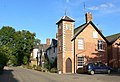 The Manor House, Blaston - geograph.org.uk - 566646.jpg 640 × 435; 97 KB
-
 Too wet to plough - geograph.org.uk - 3412751.jpg 2,736 × 3,648; 2.04 MB
-
 Top of Stockerston trigpoint - geograph.org.uk - 5990350.jpg 640 × 439; 118 KB
-
 Tree along Horninghold Gated Road - geograph.org.uk - 3372683.jpg 3,001 × 2,331; 2.59 MB
-
 Trees along Horninghold Gated Road - geograph.org.uk - 3372677.jpg 3,695 × 2,322; 2.55 MB
-
 Trees and woodland along Horninghold Gated Road - geograph.org.uk - 3372670.jpg 4,000 × 3,000; 3.56 MB
-
 Triangulation pillar at Stockerston Cross Roads - geograph.org.uk - 3366529.jpg 4,000 × 3,000; 3.51 MB
-
 Trig point at Stockerston Cross Roads - geograph.org.uk - 5930448.jpg 3,776 × 2,520; 3.83 MB
-
 Uppingham Road (B664) - geograph.org.uk - 4134801.jpg 640 × 480; 62 KB
-
 Wooded gully at Blaston Hollows - geograph.org.uk - 3366546.jpg 3,700 × 2,518; 2.74 MB
-
 Woodland at Blaston Hollows - geograph.org.uk - 3366540.jpg 4,000 × 3,000; 3.53 MB
-
 Woodland in Blaston Hollows - geograph.org.uk - 3366543.jpg 3,278 × 2,533; 2.61 MB
-
 Woodland in Blaston Hollows - geograph.org.uk - 3366544.jpg 3,531 × 2,692; 3.25 MB
-
 Blaston Field Road, Leicestershire - geograph.org.uk - 566639.jpg 640 × 475; 118 KB
-
 Blaston Hill - geograph.org.uk - 309707.jpg 640 × 480; 96 KB
-
 Blaston Hollows - geograph.org.uk - 309709.jpg 640 × 450; 104 KB
-
 Footpath to Nevill Holt - geograph.org.uk - 566638.jpg 640 × 460; 118 KB
-
 Sheep and Fields - geograph.org.uk - 309708.jpg 640 × 480; 70 KB
-
 Towards Blaston - geograph.org.uk - 309706.jpg 640 × 480; 77 KB
_-_geograph.org.uk_-_4134810.jpg)


_-_geograph.org.uk_-_4134803.jpg)


_-_geograph.org.uk_-_4134801.jpg)


