Category:Blank maps of Switzerland to 2012
Jump to navigation
Jump to search
Media in category "Blank maps of Switzerland to 2012"
The following 15 files are in this category, out of 15 total.
-
 Karte Bezirke und Kreise der Schweiz 2012.png 4,133 × 2,848; 2.53 MB
-
 Karte Gemeinden der Schweiz 2012.01.01.png 4,133 × 2,848; 3.68 MB
-
 Karte Gemeinden der Schweiz 2012.04.01.png 4,133 × 2,848; 3.68 MB
-
 Karte Gemeinden des Kantons Aargau 2012.png 2,952 × 2,820; 1.7 MB
-
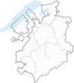
 Karte Gemeinden des Kantons Bern 2012.png 2,952 × 2,446; 1.65 MB
-
 Karte Gemeinden des Kantons Fribourg 2012.png 2,952 × 3,304; 1.9 MB
-
 Karte Gemeinden des Kantons Graubünden 2012.png 3,836 × 2,751; 2.12 MB
-
 Karte Gemeinden des Kantons Jura 2009.png 2,952 × 2,151; 1,010 KB
-
 Karte Gemeinden des Kantons Luzern 2010.png 2,951 × 2,972; 1.38 MB
-
 Karte Gemeinden des Kantons Neuenburg 2009.png 2,952 × 2,043; 777 KB
-
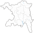
 Karte Gemeinden des Kantons Schaffhausen 2009 blank.png 1,476 × 1,094; 390 KB
-
 Karte Gemeinden des Kantons St. Gallen 2010.png 2,952 × 3,400; 1.33 MB
-
 Karte Gemeinden des Kantons Tessin 2010 2.png 1,771 × 2,926; 1.11 MB
-
 Karte Gemeinden des Kantons Waadt 2012.png 2,952 × 2,923; 1.83 MB
-
 Karte Gemeinden des Kantons Wallis 2011.png 3,836 × 2,598; 1.71 MB


