Category:Blandikow
Jump to navigation
Jump to search
| Object location | | View all coordinates using: OpenStreetMap |
|---|
village in Brandenburg state, Germany  | |||||
| Upload media | |||||
| Instance of |
| ||||
|---|---|---|---|---|---|
| Location | Heiligengrabe, Ostprignitz-Ruppin District, Brandenburg, Germany | ||||
| Area |
| ||||
| Elevation above sea level |
| ||||
 | |||||
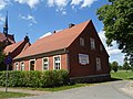
English: The village Blandikow is part of Heiligengrabe municipality, Ostprignitz-Ruppin district, Brandenburg state, Germany
Deutsch: Das Dorf Blandikow gehört zur Gemeinde Heiligengrabe, Landkreis Ostprignitz-Ruppin, Land Brandenburg, Deutschland.
Français : Le village de Blandikow fait partie de la commune de Heiligengrabe, arrondissement Prignitz-de-l'Est-Ruppin, état fédéral de Brandebourg, Allemagne
Media in category "Blandikow"
The following 2 files are in this category, out of 2 total.
-
 BlandikowDorfstr24.jpg 3,648 × 2,736; 4.34 MB
-
 BlandikowDorfstr59+60.jpg 3,226 × 2,416; 3.39 MB

