Category:Blackthorpe
Jump to navigation
Jump to search
hamlet in Rushbrooke with Rougham, West Suffolk, Suffolk, England | |||||
| Upload media | |||||
| Instance of | |||||
|---|---|---|---|---|---|
| Location | Rushbrooke with Rougham, West Suffolk, Suffolk, East of England, England | ||||
 | |||||
Subcategories
This category has only the following subcategory.
Media in category "Blackthorpe"
The following 19 files are in this category, out of 19 total.
-
 Blackthorpe Lane - geograph.org.uk - 29462.jpg 640 × 427; 85 KB
-
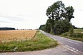
 Blackthorpe, looking west - geograph.org.uk - 3611212.jpg 2,304 × 1,536; 1.38 MB
-
 Cottages, Blackthorpe - geograph.org.uk - 4664639.jpg 640 × 507; 65 KB
-
 Cycle Route 51 - geograph.org.uk - 1469517.jpg 480 × 640; 95 KB
-
 End Of Bridleway - geograph.org.uk - 1381771.jpg 480 × 640; 114 KB
-
 End Of Route - geograph.org.uk - 1467366.jpg 640 × 480; 83 KB
-
 Farm building, Blackthorpe Farm - geograph.org.uk - 814871.jpg 640 × 480; 98 KB
-
 Farmland near Blackthorpe - geograph.org.uk - 1075618.jpg 640 × 427; 119 KB
-
 Footpath, Blackthorpe - geograph.org.uk - 4703690.jpg 640 × 480; 147 KB
-
 House, Blackthorpe - geograph.org.uk - 4664633.jpg 640 × 480; 55 KB
-
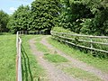
 House, Blackthorpe - geograph.org.uk - 4703885.jpg 640 × 454; 80 KB
-
 Is it still in use - geograph.org.uk - 975241.jpg 480 × 640; 116 KB
-

-
 Layby on Eastbound A14 near Blackthorpe - geograph.org.uk - 3844156.jpg 640 × 427; 275 KB
-
 Parkland, Blackthorpe - geograph.org.uk - 814383.jpg 640 × 480; 98 KB
-
 Parkland, Blackthorpe - geograph.org.uk - 814389.jpg 640 × 480; 108 KB
-
 Parkland, Blackthorpe - geograph.org.uk - 814866.jpg 640 × 480; 122 KB
-
 Unmade road, Blackthorpe - geograph.org.uk - 814345.jpg 640 × 480; 138 KB
-
 Unnamed road, Blackthorpe - geograph.org.uk - 814357.jpg 640 × 480; 107 KB


