Category:Blackdown, Warwickshire
Jump to navigation
Jump to search
English: Blackdown is a village and civil parish in the Warwick district of Warwickshire, England. According to the 2001 census it had a population of 128. The village is about two miles north of Leamington Spa, between Leamington/Warwick and Kenilworth.
village and civil parish in Warwickshire, United Kingdom | |||||
| Upload media | |||||
| Instance of | |||||
|---|---|---|---|---|---|
| Location | Warwick, Warwickshire, West Midlands, England | ||||
| Population |
| ||||
 | |||||
Media in category "Blackdown, Warwickshire"
The following 49 files are in this category, out of 49 total.
-
 A field of beans - geograph.org.uk - 6161200.jpg 2,000 × 1,330; 2.4 MB
-

-
 A452 Kenilworth Road at Blackdown - geograph.org.uk - 2064622.jpg 640 × 480; 108 KB
-

-

-
 Bericote Road Leamington Spa - geograph.org.uk - 3693637.jpg 640 × 480; 91 KB
-

-
 Blackdown Lodge on Sandy Lane - geograph.org.uk - 4453067.jpg 1,024 × 708; 154 KB
-
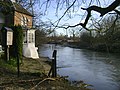
 Blackdown Mill - geograph.org.uk - 3061564.jpg 800 × 600; 92 KB
-
 Blackdown Mill - geograph.org.uk - 3541814.jpg 1,024 × 768; 250 KB
-
 Blackdown Mill Frontage - geograph.org.uk - 3061567.jpg 800 × 600; 132 KB
-
 Blackdown Mill on the River Avon - geograph.org.uk - 1594570.jpg 512 × 640; 93 KB
-
 Blackdown Mill – 1 - geograph.org.uk - 5301904.jpg 1,280 × 960; 352 KB
-
 Blackdown Mill – 2 - geograph.org.uk - 5301907.jpg 1,280 × 960; 347 KB
-
 Blackdown Mill – 3 - geograph.org.uk - 5301915.jpg 960 × 1,280; 440 KB
-
 Blackdown Mill – 4 - geograph.org.uk - 5301919.jpg 1,280 × 960; 440 KB
-
 Blackdown Mill, 1980 - geograph.org.uk - 3624878.jpg 640 × 410; 96 KB
-
 Blackdown roundabout - geograph.org.uk - 1540484.jpg 640 × 427; 96 KB
-
-
 Chesford Bridge - geograph.org.uk - 5301886.jpg 1,280 × 960; 378 KB
-
 Chesford Bridge - geograph.org.uk - 5301890.jpg 1,280 × 960; 529 KB
-
 Countryside at Blackdown - geograph.org.uk - 2280596.jpg 640 × 480; 73 KB
-
 Cycle path , Chesford - geograph.org.uk - 2280389.jpg 640 × 480; 108 KB
-
 Cycleway past the Ramada Hotel - geograph.org.uk - 5301881.jpg 1,280 × 960; 454 KB
-
 Double arch - geograph.org.uk - 1703524.jpg 6,048 × 4,032; 1.78 MB
-
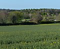
 Farmland on the edge of Lillington - geograph.org.uk - 4453058.jpg 1,024 × 709; 222 KB
-
 Field near Cubbington - geograph.org.uk - 2280617.jpg 640 × 440; 88 KB
-
 Fields by Leicester Lane - geograph.org.uk - 3038855.jpg 800 × 600; 148 KB
-
 Hill Wootton Bridge - geograph.org.uk - 5301894.jpg 1,280 × 926; 498 KB
-
 Ivy covered Blackdown Mill - geograph.org.uk - 3915918.jpg 583 × 640; 211 KB
-

-
 Leamington Rugby Union Football Club - geograph.org.uk - 2498623.jpg 640 × 480; 62 KB
-
 Long shadows across the road - geograph.org.uk - 6161196.jpg 2,000 × 1,330; 1.52 MB
-

-
 New Farm near Chesford Bridge - geograph.org.uk - 4165450.jpg 640 × 427; 80 KB
-
 Northwest on the A452 approaching Chesford Bridge - geograph.org.uk - 4340709.jpg 1,280 × 960; 1.44 MB
-
 Quarry Farm, Blackdown - geograph.org.uk - 1545223.jpg 640 × 427; 108 KB
-
 River Avon below the Hill Wootton Road bridge - geograph.org.uk - 4340728.jpg 1,280 × 960; 1.6 MB
-
 Roundabout on the B4113 - geograph.org.uk - 4453099.jpg 1,024 × 563; 122 KB
-
 Sandy Lane towards Lillington - geograph.org.uk - 4453055.jpg 1,024 × 759; 348 KB
-
 Southeast on the A452 at Chesford Bridge - geograph.org.uk - 4340694.jpg 640 × 480; 117 KB
-

-

-

-
 The Lodge at Blackdown Hall - geograph.org.uk - 3038856.jpg 800 × 600; 92 KB
-
 The new gas main has been laid - geograph.org.uk - 1594396.jpg 640 × 427; 74 KB
-
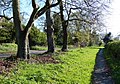 Trees along Stoneleigh Road in Blackdown - geograph.org.uk - 4453084.jpg 1,024 × 713; 385 KB
-
 View towards The Crofts Rugby Football Club - geograph.org.uk - 4453093.jpg 1,024 × 834; 304 KB
-
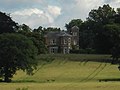 Westhill House - geograph.org.uk - 3038852.jpg 800 × 600; 66 KB


