Category:Blackcap, East Sussex
Jump to navigation
Jump to search
hill in East Sussex, England, UK  | |||||
| Upload media | |||||
| Instance of | |||||
|---|---|---|---|---|---|
| Part of | |||||
| Location | East Chiltington, Lewes, East Sussex, South East England, England | ||||
 | |||||
Media in category "Blackcap, East Sussex"
The following 30 files are in this category, out of 30 total.
-
 Blackcap's meadow above Ashcombe Bottom East.jpg 3,827 × 2,168; 2.5 MB
-
 Blackcap, South Downs - geograph.org.uk - 2371778.jpg 640 × 480; 127 KB
-
 Blackcap, South Downs 01.jpg 4,000 × 3,000; 4.15 MB
-
 Blackcap, South Downs 02.jpg 4,000 × 3,000; 3.86 MB
-
 Blackcap, South Downs 03.jpg 4,000 × 3,000; 3.55 MB
-
 Blackcap, South Downs 04.jpg 4,000 × 3,000; 4.58 MB
-
 Blackcap, South Downs 05.jpg 4,000 × 3,000; 5.26 MB
-
 Cyclist heading for Blackcap on the South Downs - geograph.org.uk - 2643119.jpg 4,000 × 3,000; 3.42 MB
-
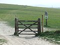
 Footpath junction at Blackcap - geograph.org.uk - 2371769.jpg 640 × 480; 72 KB
-
 Footpath near Blackcap - geograph.org.uk - 2371774.jpg 640 × 480; 63 KB
-
 Grassland below Blackcap - geograph.org.uk - 2823082.jpg 1,600 × 1,200; 372 KB
-
 Looking like its name, Blackcap - geograph.org.uk - 2088774.jpg 2,592 × 1,944; 1.38 MB
-
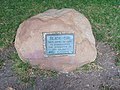
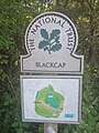
 National Trust sign at Blackcap - geograph.org.uk - 2823094.jpg 768 × 1,024; 155 KB
-
 National Trust sign at Blackcap 01.jpg 4,000 × 3,000; 3.41 MB
-
 National Trust sign at Blackcap 02.jpg 4,000 × 3,000; 4.09 MB
-
 National Trust sign at Blackcap 03.jpg 3,000 × 4,000; 4.83 MB
-
 On Blackcap - geograph.org.uk - 2954065.jpg 4,320 × 3,240; 4.93 MB
-
 Path at Blackcap, South Downs - geograph.org.uk - 2373083.jpg 640 × 480; 103 KB
-
 Path near Blackcap - geograph.org.uk - 2421712.jpg 1,600 × 1,200; 467 KB
-
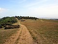
 South Downs at Blackcap - geograph.org.uk - 2371752.jpg 640 × 480; 90 KB
-
 South Downs Way approaching Blackcap - geograph.org.uk - 2954053.jpg 4,320 × 3,240; 4.87 MB
-
 South Downs Way at Blackcap - geograph.org.uk - 2371743.jpg 640 × 480; 79 KB
-
 Trees and shrubs near Blackcap - geograph.org.uk - 2421672.jpg 1,600 × 1,200; 659 KB
-
 Triangulation point at Blackcap - geograph.org.uk - 2371789.jpg 640 × 480; 55 KB
-
 Triangulation point at Blackcap - geograph.org.uk - 2371798.jpg 640 × 480; 33 KB
-
 Trig Point - Blackcap - geograph.org.uk - 2421687.jpg 1,600 × 1,200; 581 KB
-
 View across to Blackcap from Mount Harry - geograph.org.uk - 2822969.jpg 1,024 × 768; 115 KB
-

-
 View from Blackcap - geograph.org.uk - 2421696.jpg 1,600 × 1,200; 551 KB
-
 View NW across the lower slopes of Blackcap - geograph.org.uk - 2088806.jpg 2,592 × 1,944; 1.24 MB


