Category:Black Mountains (Iron and Beaver counties, Utah)
Jump to navigation
Jump to search
mountain range in Iron and Beaver counties in Utah, United States | |||||
| Upload media | |||||
| Instance of | |||||
|---|---|---|---|---|---|
| Location |
| ||||
| Width |
| ||||
| Elevation above sea level |
| ||||
| Different from | |||||
 | |||||
English: Media related to the Black Mountains (Utah), a 30-mile (48 km) mountain range in northeastern Iron County and southeastern Beaver County, Utah, United States. The en:Escalante Desert is on the range's southwestern, western, and northwestern border.
Subcategories
This category has only the following subcategory.
P
- Parowan Canyon (Black Mountains) (empty)
Media in category "Black Mountains (Iron and Beaver counties, Utah)"
The following 8 files are in this category, out of 8 total.
-
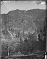 ALUM COVE, PAROWAN CANYON OR PAROVAN LEFTFORK, UTAH - NARA - 524366.jpg 2,420 × 3,000; 4.19 MB
-
 Black Mountain in Utah 2012.JPG 7,203 × 4,641; 20.84 MB
-
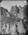
 PEAKS, GEOLOGIC FORMATION PAROWAN OR PAROVAN CANYON, LEFTHAND FORK, UTAH - NARA - 524355.jpg 2,426 × 3,000; 4.89 MB
-
 PEAKS, GEOLOGIC FORMATION PAROWAN OR PAROVAN CANYON, LEFTHAND FORK, UTAH - NARA - 524355.tif 2,426 × 3,000; 6.94 MB
-
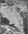
 WEST FROM HIEROGLYPHIC ROCKS, WEST FROM PAROWAN - NARA - 524334.jpg 2,415 × 3,000; 4.77 MB
-
 WEST FROM HIEROGLYPHIC ROCKS, WEST FROM PAROWAN - NARA - 524334.tif 2,415 × 3,000; 6.91 MB
-
 WEST FROM HIEROGLYPHIC ROCKS, WEST FROM PAROWAN - NARA - 524335.jpg 2,424 × 3,000; 4.64 MB
-
 WEST FROM HIEROGLYPHIC ROCKS, WEST FROM PAROWAN - NARA - 524335.tif 2,424 × 3,000; 6.94 MB


