Category:Black Lane, Royal Leamington Spa
Jump to navigation
Jump to search
Media in category "Black Lane, Royal Leamington Spa"
The following 11 files are in this category, out of 11 total.
-
 Alleyway between Black Lane and Buckley Road - geograph.org.uk - 1723871.jpg 1,500 × 1,991; 261 KB
-
 Black Lane Allotments - geograph.org.uk - 110178.jpg 640 × 480; 41 KB
-
 Black Lane allotments, south-east corner - geograph.org.uk - 1560268.jpg 640 × 480; 399 KB
-
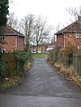
 Black Lane, Leamington Spa - geograph.org.uk - 6163267.jpg 1,703 × 1,277; 909 KB
-
 Campion Water Treatment Works - geograph.org.uk - 2977998.jpg 640 × 480; 76 KB
-
 Footpath on Campion Hills - geograph.org.uk - 110182.jpg 640 × 480; 93 KB
-
 Horses near Redhouse Farm riding school - geograph.org.uk - 1567767.jpg 640 × 427; 347 KB
-
 Junction of Gresham Avenue and Black Lane - geograph.org.uk - 1723854.jpg 2,000 × 1,502; 237 KB
-
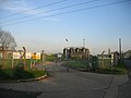
 Water treatment works and mobile phone mast - geograph.org.uk - 1729350.jpg 2,000 × 1,458; 253 KB
-
 Water treatment works, Campion Hills - geograph.org.uk - 1560367.jpg 640 × 427; 453 KB
-
 Campion Hills Waterworks - geograph.org.uk - 159652.jpg 640 × 480; 246 KB


