Category:Bix, Oxfordshire
Jump to navigation
Jump to search
village in Oxfordshire, England  | |||||
| Upload media | |||||
| Instance of | |||||
|---|---|---|---|---|---|
| Location | Bix and Assendon, South Oxfordshire, Oxfordshire, South East England, England | ||||
 | |||||
English: Bix is a village in the civil parish of Bix and Assendon in South Oxfordshire, about northwest of Henley-on-Thames. The village is about 130 metres above sea level in the Chiltern Hills.
Subcategories
This category has the following 2 subcategories, out of 2 total.
B
- St James' Church, Bix (13 F)
J
- St James' Old Church ruins, Bix (17 F)
Media in category "Bix, Oxfordshire"
The following 63 files are in this category, out of 63 total.
-
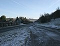 A4130 Henley to Wallingford road - geograph.org.uk - 81940.jpg 600 × 460; 84 KB
-
 Another view of the Fox - geograph.org.uk - 2687337.jpg 1,024 × 683; 130 KB
-
 Army advance^ - geograph.org.uk - 1049712.jpg 425 × 640; 167 KB
-
 Bromsden Cottages - geograph.org.uk - 1049710.jpg 640 × 427; 199 KB
-
 Greenmarsh Farm, Bix - geograph.org.uk - 1067357.jpg 640 × 480; 104 KB
-
 Lawrence's Farm, Bix - geograph.org.uk - 1067364.jpg 640 × 480; 108 KB
-
 Old Milestone (geograph 6114953).jpg 879 × 1,650; 196 KB
-
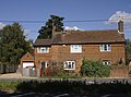 The Cottage, Bix - geograph.org.uk - 557647.jpg 640 × 477; 95 KB
-
 Bix and Assendon - Bromsden Farmhouse - 20231021152001.jpg 4,000 × 3,000; 4.29 MB
-
 Bix and Assendon - Bromsden Farmhouse - 20231021152010.jpg 4,000 × 3,000; 4.34 MB
-

-

-

-
 Bix and Assendon - Lawrences Farmhouse - 20231021154550.jpg 4,000 × 3,000; 3.91 MB
-
 Bix Bottom - geograph.org.uk - 626642.jpg 640 × 480; 131 KB
-
 Bix Bottom - geograph.org.uk - 86960.jpg 597 × 400; 46 KB
-
 Bix Common - geograph.org.uk - 626621.jpg 640 × 480; 159 KB
-
 Bix Manor - geograph.org.uk - 87237.jpg 640 × 481; 42 KB
-
 Bix Valley - Felder.jpg 1,920 × 1,330; 2.69 MB
-
 Bix Valley - Oxfordshire.jpg 1,920 × 1,440; 2.9 MB
-
 Bix Village - geograph.org.uk - 1036962.jpg 640 × 428; 86 KB
-
 Bix Village from Common Field - geograph.org.uk - 1193931.jpg 640 × 480; 88 KB
-
 Bluebells near Bix, Oxfordshire - geograph.org.uk - 67418.jpg 640 × 480; 163 KB
-
 Bridleway heading into Famous Copse - geograph.org.uk - 1546669.jpg 640 × 480; 126 KB
-
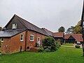
 Bromsden Farm, Bix 01.jpg 4,000 × 3,000; 2.73 MB
-
 Bromsden Farm, Bix 02.jpg 4,000 × 3,000; 3.48 MB
-
 Cattle at Bix Manor Farm - geograph.org.uk - 557633.jpg 640 × 477; 109 KB
-
 Cattle at Bix Manor Farm - geograph.org.uk - 557636.jpg 640 × 477; 99 KB
-
 Lane to Bix - geograph.org.uk - 1546684.jpg 640 × 480; 94 KB
-
 Orchard at Rocky Lane - geograph.org.uk - 1049721.jpg 640 × 427; 198 KB
-
 The Barn at Bix Manor - geograph.org.uk - 87241.jpg 640 × 481; 53 KB
-
 The Fox at Bix - geograph.org.uk - 2687320.jpg 1,024 × 683; 197 KB
-
 The Fox at Bix - geograph.org.uk - 36346.jpg 640 × 481; 32 KB
-
 The Fox that died - geograph.org.uk - 2918375.jpg 3,550 × 2,665; 1.65 MB
-
 Approaching Bix - geograph.org.uk - 557641.jpg 640 × 477; 89 KB
-
 Approaching Valley End Farm - geograph.org.uk - 557752.jpg 640 × 477; 127 KB
-
 Arable land near Bromsden Farm - geograph.org.uk - 1049703.jpg 640 × 427; 222 KB
-
 Bix Common - geograph.org.uk - 626633.jpg 640 × 480; 147 KB
-
 Chiltern Way - geograph.org.uk - 557618.jpg 640 × 477; 108 KB
-
 Er, this way chaps^ - geograph.org.uk - 557622.jpg 640 × 477; 142 KB
-
 First view of Valley End Farm - geograph.org.uk - 557746.jpg 640 × 477; 113 KB
-
 Footpath north from Bix - geograph.org.uk - 557649.jpg 640 × 477; 107 KB
-
 Footpath south to Bix - geograph.org.uk - 557652.jpg 640 × 477; 107 KB
-
 Footpath through Wellgrove Wood - geograph.org.uk - 557787.jpg 640 × 477; 137 KB
-
 Gathering winter fuel - geograph.org.uk - 557610.jpg 640 × 477; 115 KB
-
 Henley Road - geograph.org.uk - 87247.jpg 640 × 481; 80 KB
-
 Lane at Bix - geograph.org.uk - 626608.jpg 640 × 480; 169 KB
-
 Lawrence's Farm - geograph.org.uk - 557624.jpg 477 × 640; 67 KB
-
 Leaving Bushey Copse - geograph.org.uk - 557738.jpg 640 × 477; 111 KB
-
 Leaving Bushey Copse - geograph.org.uk - 557739.jpg 477 × 640; 110 KB
-
 Little Bix Bottom - geograph.org.uk - 87211.jpg 640 × 481; 54 KB
-
 Little Bix Bottom Farm - geograph.org.uk - 87214.jpg 640 × 481; 43 KB
-
 Maize at Bix Bottom - geograph.org.uk - 557782.jpg 640 × 477; 132 KB
-
 Man, dog and horses above Bix Bottom - geograph.org.uk - 107893.jpg 640 × 640; 66 KB
-
 Middle Assenden village - geograph.org.uk - 61389.jpg 640 × 480; 161 KB
-
 Not through here, thank you - geograph.org.uk - 557628.jpg 640 × 477; 117 KB
-
 Stable block at Valley End Farm - geograph.org.uk - 557760.jpg 640 × 477; 130 KB
-
 The Assendon Valley - geograph.org.uk - 626646.jpg 640 × 480; 106 KB
-
 The Old Rectory and the common, Bix - geograph.org.uk - 626627.jpg 640 × 480; 132 KB
-
 The Old School, Bix - geograph.org.uk - 87234.jpg 640 × 481; 46 KB
-
 The Oxfordshire Way - geograph.org.uk - 87219.jpg 640 × 481; 52 KB
-
 The Rainbow Inn, Middle Assenden - geograph.org.uk - 36331.jpg 640 × 481; 45 KB
-
 Valley Farm, Bix Bottom - geograph.org.uk - 87225.jpg 640 × 481; 53 KB


.jpg)


