Category:Bishton
Jump to navigation
Jump to search
village and community in Newport, Wales, UK   | |||||
| Upload media | |||||
| Instance of | |||||
|---|---|---|---|---|---|
| Location | Newport, Wales | ||||
| Population |
| ||||
| Area |
| ||||
 | |||||
Subcategories
This category has the following 3 subcategories, out of 3 total.
C
- Saint Cadwaladr Church (Bishton) (13 F)
- Bishton Crossing (20 F)
U
- Underwood, Newport (2 F)
Media in category "Bishton"
The following 115 files are in this category, out of 115 total.
-
 Access lane to Castle Farm, Bishton - geograph.org.uk - 1835784.jpg 640 × 480; 81 KB
-
 Approaching Magor Road from Wilcrick - geograph.org.uk - 1837748.jpg 480 × 640; 67 KB
-
 B4245 heads for Magor - geograph.org.uk - 1837773.jpg 640 × 413; 50 KB
-
 B4245 leaves Magor - geograph.org.uk - 2039775.jpg 640 × 480; 69 KB
-

-
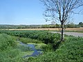 Bend in the road - and the stream. - geograph.org.uk - 406755.jpg 640 × 480; 128 KB
-
 Bend in the road to Wilcrick - geograph.org.uk - 406757.jpg 640 × 480; 75 KB
-
 Bishton Crossing - geograph.org.uk - 1835900.jpg 640 × 480; 61 KB
-
 Bishton House - geograph.org.uk - 1835866.jpg 640 × 537; 77 KB
-
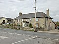
 Bishton houses - geograph.org.uk - 1835829.jpg 640 × 466; 62 KB
-
 Bishton MMB 01 South Wales Main Line.jpg 3,561 × 2,166; 2.71 MB
-
 Bishton MMB 03 South Wales Main Line.jpg 3,348 × 2,121; 2.84 MB
-
 Bishton Road, Underwood - geograph.org.uk - 1834807.jpg 640 × 525; 74 KB
-
 Bishton Village Hall - geograph.org.uk - 4863040.jpg 640 × 480; 86 KB
-
 Castle Farm, Bishton - geograph.org.uk - 1834896.jpg 640 × 523; 70 KB
-
 Central Bishton - geograph.org.uk - 1835825.jpg 640 × 538; 115 KB
-
 Church Farm, Wilcrick - geograph.org.uk - 1837739.jpg 640 × 480; 61 KB
-
 Church of the Latter Day Druids - panoramio.jpg 640 × 480; 123 KB
-
 Common Farm House, Bishton - geograph.org.uk - 1835846.jpg 640 × 480; 69 KB
-
 Country road junction - geograph.org.uk - 406715.jpg 640 × 480; 138 KB
-
 Dogs loose will be shot, Magor - geograph.org.uk - 1837828.jpg 631 × 640; 109 KB
-
 East along Waltwood Road, Underwood - geograph.org.uk - 5651735.jpg 800 × 548; 86 KB
-
 Entrance road to Waltwood Hill reservoir - geograph.org.uk - 1834857.jpg 640 × 480; 101 KB
-
 Entrance to Magor Raceway - geograph.org.uk - 2039881.jpg 640 × 480; 57 KB
-

-
 Entrance to Tump Farm - geograph.org.uk - 1837776.jpg 640 × 480; 101 KB
-
 Farm track adjacent to M4 motorway - geograph.org.uk - 2057033.jpg 640 × 480; 109 KB
-
 Feeding time is near - geograph.org.uk - 1837814.jpg 640 × 480; 88 KB
-

-
 Good Choice and A^K in Underwood - geograph.org.uk - 5651802.jpg 800 × 511; 87 KB
-

-
 Grey House and White House, Bishton - geograph.org.uk - 1835878.jpg 640 × 480; 69 KB
-
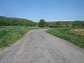
 Hedged country road nearing Bishton - geograph.org.uk - 1834878.jpg 640 × 480; 102 KB
-
 High Meadow Cottage, Bishton - geograph.org.uk - 1835804.jpg 640 × 537; 94 KB
-
 Iscoed Tafarn name sign, Underwood - geograph.org.uk - 5651723.jpg 800 × 702; 127 KB
-

-
 Lager cans at Magor - geograph.org.uk - 3190545.jpg 640 × 480; 53 KB
-
 Large field, Wilcrick Common - geograph.org.uk - 1837682.jpg 640 × 480; 68 KB
-
 Large tree beside Bishton Road - geograph.org.uk - 2266777.jpg 2,816 × 2,112; 2.31 MB
-
 Lay-by, Magor Road - geograph.org.uk - 2039840.jpg 640 × 432; 55 KB
-
 Llandavenny to Wilcrick fort - panoramio.jpg 2,048 × 1,536; 777 KB
-
 Llanmartin Pharmacy, Underwood - geograph.org.uk - 5651793.jpg 800 × 600; 80 KB
-
 Llanwern Steelworks - geograph.org.uk - 4479985.jpg 1,600 × 1,067; 157 KB
-

-
 M4 westbound at Wilcrick - geograph.org.uk - 3262414.jpg 640 × 480; 44 KB
-
 M4 westbound near Llanmartin - geograph.org.uk - 3262415.jpg 640 × 480; 36 KB
-
 M4, Waltwood Rd Bridge - geograph.org.uk - 3666038.jpg 640 × 430; 36 KB
-
 Magor Autograss Racing Centre - geograph.org.uk - 3190982.jpg 640 × 480; 65 KB
-
 Magor Raceway - geograph.org.uk - 2039875.jpg 640 × 398; 65 KB
-

-

-
 Magor Road heading northwest - geograph.org.uk - 1837767.jpg 640 × 480; 67 KB
-
 Magor Road turning for Wilcrick - geograph.org.uk - 1837755.jpg 640 × 480; 61 KB
-
 Monmouthshire border, Magor - geograph.org.uk - 1837890.jpg 640 × 480; 66 KB
-
 Newport boundary, Magor Road - geograph.org.uk - 1837819.jpg 640 × 480; 62 KB
-
 North along Birch Grove, Underwood - geograph.org.uk - 5651646.jpg 800 × 700; 119 KB
-
 Northern edge of Bishton - geograph.org.uk - 1834892.jpg 640 × 474; 69 KB
-

-
 Oasis Community Centre, Underwood - geograph.org.uk - 5651656.jpg 800 × 609; 101 KB
-
 Oliver Cromwell at Bishton - geograph.org.uk - 1834541.jpg 595 × 640; 99 KB
-
 Ordnance Survey Cut Mark - geograph.org.uk - 6157238.jpg 1,024 × 720; 302 KB
-
 Ordnance Survey Cut Mark - geograph.org.uk - 6157247.jpg 1,024 × 729; 186 KB
-
 Ordnance Survey Cut Mark - geograph.org.uk - 6157249.jpg 1,024 × 717; 259 KB
-
 Ordnance Survey Cut Mark - geograph.org.uk - 6157251.jpg 1,024 × 913; 420 KB
-
 Over or under - geograph.org.uk - 4863036.jpg 640 × 469; 83 KB
-
 Passing place, Bishton road - geograph.org.uk - 1834824.jpg 640 × 480; 88 KB
-
 Passing place, Wilcrick - geograph.org.uk - 1837725.jpg 640 × 480; 82 KB
-
 Path along treeline - panoramio.jpg 2,048 × 1,536; 817 KB
-
 Path from Llandavenny to Wilcrick Fort - panoramio.jpg 900 × 200; 55 KB
-
 Path to Farm - panoramio.jpg 2,048 × 1,536; 770 KB
-
 Path to Wilcrick Fort - panoramio.jpg 2,592 × 1,944; 1.2 MB
-
 Path towards Llandevenny - panoramio.jpg 2,592 × 1,944; 1.17 MB
-

-
 Red House, Bishton - geograph.org.uk - 1835872.jpg 640 × 480; 68 KB
-
 Reen - geograph.org.uk - 522334.jpg 427 × 640; 128 KB
-
 Reen bridge - geograph.org.uk - 1835994.jpg 640 × 480; 101 KB
-

-
 Resident of field, near Wilcrick - geograph.org.uk - 2787588.jpg 640 × 480; 95 KB
-
 Road Junction, Underwood - geograph.org.uk - 406760.jpg 640 × 480; 114 KB
-
 Roundup time, Wilcrick Hill - geograph.org.uk - 1837849.jpg 640 × 585; 100 KB
-
 Sewage Pumping Station, Wilcrick - geograph.org.uk - 1837692.jpg 640 × 480; 92 KB
-
 South along Birch Grove, Underwood - geograph.org.uk - 5651773.jpg 800 × 743; 107 KB
-
 St Cadwaladr's Church, Bishton - geograph.org.uk - 4863052.jpg 640 × 480; 113 KB
-
 St Cadwaladr's Church, Bishton - geograph.org.uk - 6302038.jpg 640 × 411; 81 KB
-
 St. Cadwaladr's Church, Bishton - geograph.org.uk - 4479939.jpg 2,985 × 1,886; 4.89 MB
-
 Stile, Magor Road - geograph.org.uk - 2039827.jpg 640 × 480; 102 KB
-
 Storage area, Magor brewery - geograph.org.uk - 1837869.jpg 640 × 480; 82 KB
-
 Summit of Wilcrick - panoramio.jpg 640 × 480; 124 KB
-

-
 The Cedars, Underwood - geograph.org.uk - 5651685.jpg 800 × 455; 72 KB
-
 Three-storey flats in Underwood - geograph.org.uk - 5651706.jpg 800 × 512; 100 KB
-
 Track across fields near Bishton - geograph.org.uk - 1834886.jpg 640 × 480; 99 KB
-
 Ty Newydd, Wilcrick - geograph.org.uk - 1837708.jpg 640 × 480; 66 KB
-
 Underwood Baptist Community Church - geograph.org.uk - 1834710.jpg 640 × 391; 62 KB
-
 Underwood Community Church - geograph.org.uk - 5651674.jpg 800 × 600; 113 KB
-
 Underwood Police Station - geograph.org.uk - 1834750.jpg 640 × 604; 94 KB
-
 Underwood Post Office and Spar - geograph.org.uk - 5651692.jpg 800 × 667; 93 KB
-
 Underwood Social Club - geograph.org.uk - 1834792.jpg 640 × 381; 52 KB
-

-

-
 View from a Bristol-Cardiff train - Llanwern Steelworks - geograph.org.uk - 4624712.jpg 1,600 × 1,143; 492 KB
-

-
 Wales Newport Community Bishton map.svg 512 × 443; 416 KB
-
 Waltwood Road, Underwood - geograph.org.uk - 5651678.jpg 800 × 602; 93 KB
-

-
 Wellsworth, Bishton - geograph.org.uk - 1835815.jpg 640 × 522; 78 KB
-
 Western end of Hazel Road, Underwood - geograph.org.uk - 5651637.jpg 800 × 496; 85 KB
-
 Wilcrick Common - geograph.org.uk - 1837672.jpg 640 × 480; 61 KB
-
 Wilcrick footpath - panoramio.jpg 1,000 × 172; 52 KB
-
 Wilcrick Wishing Well. - geograph.org.uk - 245181.jpg 640 × 480; 154 KB
-

-

-
 Green Moor - geograph.org.uk - 148587.jpg 640 × 426; 121 KB
-

-
 Reen and field - geograph.org.uk - 522328.jpg 640 × 427; 116 KB


