Category:Bishopstrow
Jump to navigation
Jump to search
village in the United Kingdom  | |||||
| Upload media | |||||
| Instance of | |||||
|---|---|---|---|---|---|
| Location | Wiltshire, South West England, England | ||||
| Population |
| ||||
 | |||||
English: Bishopstrow is a village and civil parish in Wiltshire, England, on the River Wylye about two miles south-east of Warminster, at .
Nederlands: Bishopstrow is een dorp (village) en civil parish in de unitary authority Wiltshire, in het Engelse graafschap Wiltshire. De civil parish telt
Subcategories
This category has the following 3 subcategories, out of 3 total.
B
- Bishopstrow House (3 F)
Media in category "Bishopstrow"
The following 62 files are in this category, out of 62 total.
-
 18 June Bishopstrow-71 edit3.jpg 1,887 × 1,366; 2.73 MB
-

-

-

-
 2010 , Bishopstrow Road looking north - geograph.org.uk - 1969177.jpg 800 × 670; 219 KB
-

-

-

-
 2011 , Looking south from the road to Imber - geograph.org.uk - 2412459.jpg 4,752 × 2,339; 3.78 MB
-
 2011 , North of east from Battlesbury Hill - geograph.org.uk - 2385093.jpg 4,598 × 2,389; 3.7 MB
-
 A36 Warminster Bypass - geograph.org.uk - 109687.jpg 640 × 480; 112 KB
-
 Bench Mark, Old Stones, Boreham - geograph.org.uk - 2307697.jpg 480 × 640; 109 KB
-
 Bigbury Wood, Wiltshire - geograph.org.uk - 6717574.jpg 1,024 × 477; 159 KB
-
 Bishopstrow church - geograph.org.uk - 5300210.jpg 640 × 480; 132 KB
-
 Bishopstrow Down, Wiltshire - geograph.org.uk - 6717569.jpg 1,024 × 482; 126 KB
-
 Bishopstrow Hotel, Bishopstrow, Wiltshire, England arp.jpg 2,962 × 2,101; 2.22 MB
-

-
 Boreham, observation posts - geograph.org.uk - 5512225.jpg 1,024 × 749; 130 KB
-
 Boreham, track - geograph.org.uk - 5512233.jpg 1,024 × 768; 166 KB
-
 Bridge over the River Wylyle near Bishopstrow - geograph.org.uk - 5895126.jpg 1,024 × 683; 317 KB
-
 Church of St Aldhelm, Bishopstrow - geograph.org.uk - 5895117.jpg 1,024 × 683; 148 KB
-
 Cottages, Boreham - geograph.org.uk - 2307680.jpg 640 × 481; 95 KB
-
 Dead deer, Boreham - geograph.org.uk - 2307805.jpg 640 × 480; 102 KB
-
 Eastleigh Court, Bishopstrow - geograph.org.uk - 1987916.jpg 1,600 × 1,197; 612 KB
-
 Eastleigh Farm - geograph.org.uk - 5300214.jpg 640 × 428; 131 KB
-
 Eastleigh Wood Lane junction - geograph.org.uk - 903614.jpg 640 × 480; 119 KB
-
 Footpath, Boreham - geograph.org.uk - 2307777.jpg 480 × 640; 120 KB
-
 Inside St Aldhelm, Bishopstrow (F) - geograph.org.uk - 3676682.jpg 640 × 480; 50 KB
-
 Inside St Aldhelm, Bishopstrow (G) - geograph.org.uk - 3676686.jpg 480 × 640; 64 KB
-
 Inside St Aldhelm, Bishopstrow (J) - geograph.org.uk - 3676692.jpg 640 × 480; 74 KB
-
 Letterbox, Bishopstrow - geograph.org.uk - 1129153.jpg 640 × 480; 155 KB
-
 Middle Hill - geograph.org.uk - 1900233.jpg 2,304 × 1,704; 1.1 MB
-
 Middle Hill, Wiltshire - geograph.org.uk - 6717578.jpg 1,024 × 510; 120 KB
-
 River Wylye, Boreham - geograph.org.uk - 2307790.jpg 480 × 640; 105 KB
-
 River Wylye, Boreham - geograph.org.uk - 2307799.jpg 640 × 480; 75 KB
-
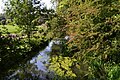 River Wylyle near Bishopstrow - geograph.org.uk - 5895128.jpg 1,024 × 683; 383 KB
-
 Rush hour in Bishopstrow - geograph.org.uk - 3659188.jpg 640 × 480; 81 KB
-
 Salisbury Plain (7) - geograph.org.uk - 5750693.jpg 4,320 × 3,240; 2.48 MB
-
 Salisbury Plain (8) - geograph.org.uk - 5750701.jpg 4,320 × 3,240; 2.14 MB
-
 Salisbury Plain (9) - geograph.org.uk - 5750704.jpg 4,214 × 3,160; 2.39 MB
-

-

-

-
-

-
 Strip lynchets south of Bigbury Wood, Bishopstrow 01.jpg 4,000 × 3,000; 4.02 MB
-
 Strip lynchets south of Bigbury Wood, Bishopstrow 02.jpg 4,000 × 3,000; 3.69 MB
-
 Strip lynchets, Middle Hill, Warminster 01.jpg 4,000 × 3,000; 3.08 MB
-
 Strip lynchets, Middle Hill, Warminster 02.jpg 4,000 × 3,000; 3.65 MB
-
 Summer Down, Wiltshire - geograph.org.uk - 6716477.jpg 1,024 × 521; 183 KB
-
 Summer Down, Wiltshire - geograph.org.uk - 6716482.jpg 1,024 × 490; 132 KB
-
 Terraced housing, Bishopstrow - geograph.org.uk - 1129124.jpg 640 × 568; 142 KB
-
 Terraced housing, Bishopstrow - geograph.org.uk - 1129127.jpg 640 × 492; 145 KB
-

-
 Victorian postbox, Bishopstrow - geograph.org.uk - 1129113.jpg 640 × 480; 212 KB
-
 Wylye Valley , Grassy Field - geograph.org.uk - 1324614.jpg 640 × 480; 39 KB
-
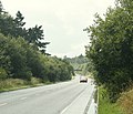 A36 Warminster bypass looking west - geograph.org.uk - 1416843.jpg 640 × 552; 161 KB
-
 Eastleigh Farm - geograph.org.uk - 348177.jpg 640 × 480; 25 KB
-

-
 Footpath through Woodcroft Wood - geograph.org.uk - 348195.jpg 640 × 480; 54 KB
-
 Forest track in Southleigh Wood - geograph.org.uk - 348163.jpg 480 × 640; 51 KB
-
 Thatched house in Boreham, Warminster - geograph.org.uk - 237322.jpg 640 × 480; 88 KB


_-_geograph.org.uk_-_3676682.jpg)
_-_geograph.org.uk_-_3676686.jpg)
_-_geograph.org.uk_-_3676692.jpg)


_-_geograph.org.uk_-_5750693.jpg)
_-_geograph.org.uk_-_5750701.jpg)
_-_geograph.org.uk_-_5750704.jpg)
_-_geograph.org.uk_-_3676649.jpg)
_-_geograph.org.uk_-_3676665.jpg)
_-_geograph.org.uk_-_3676722.jpg)
_-_geograph.org.uk_-_3676746.jpg)


