Category:Bishopstone, Swindon
Jump to navigation
Jump to search
village and civil parish in Swindon, Wiltshire, UK  | |||||
| Upload media | |||||
| Instance of | |||||
|---|---|---|---|---|---|
| Location | Swindon, Wiltshire, South West England, England | ||||
| Population |
| ||||
| official website | |||||
 | |||||
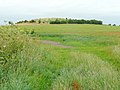
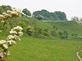
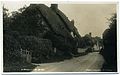
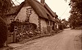
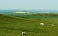
English: Bishopstone is a civil parish in the Swindon unitary authority of Wiltshire, England, about six miles east of Swindon, and just west of the county border with Oxfordshire. According to the 2001 census it had a population of 648. Bishopstone is located between Wanborough and Ashbury on the historic Icknield Way. It is a picturesque village with two pubs and a large number of thatched cottages, centred around a mill-pond.
Subcategories
This category has the following 3 subcategories, out of 3 total.
H
R
- Royal Oak, Bishopstone (4 F)
Media in category "Bishopstone, Swindon"
The following 200 files are in this category, out of 284 total.
(previous page) (next page)-
 "Keep Out" sign on footpath near Earlscourt Manor - geograph.org.uk - 2993088.jpg 4,000 × 3,000; 2.92 MB
-
 "White Cottages", Bishopstone - geograph.org.uk - 817172.jpg 640 × 480; 111 KB
-
 A closer look at a coombe south of Bishopstone, Swindon - geograph.org.uk - 2382403.jpg 1,440 × 1,080; 834 KB
-
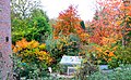
 A garden in Bishopstone, Swindon - geograph.org.uk - 601726.jpg 640 × 480; 146 KB
-
 A garden in Bishopstone, Swindon - geograph.org.uk - 601996.jpg 640 × 395; 311 KB
-

-

-
 Above Russley Park - geograph.org.uk - 3876761.jpg 1,024 × 768; 298 KB
-

-
 Aircraft over Swindon, the Ridgeway, Foxhill - geograph.org.uk - 6481501.jpg 1,024 × 768; 178 KB
-
 Ashdown House, Lambourn - geograph.org.uk - 2382358.jpg 1,440 × 1,080; 447 KB
-
 At the head of the coombe south of Bishopstone, Swindon - geograph.org.uk - 2382578.jpg 1,440 × 1,080; 731 KB
-
 Bailey Hill seen from Idstone Down - geograph.org.uk - 6013874.jpg 4,000 × 3,000; 4.86 MB
-
 Barn and Tombstones - geograph.org.uk - 6564233.jpg 3,888 × 2,592; 2.97 MB
-
 Bishopstone - geograph.org.uk - 816334.jpg 640 × 325; 51 KB
-
 Bishopstone Pond - geograph.org.uk - 3588729.jpg 1,500 × 999; 155 KB
-
 Bishopstone Pond - geograph.org.uk - 6103422.jpg 1,882 × 1,220; 1.39 MB
-
 Bishopstone Pond - geograph.org.uk - 6384643.jpg 1,920 × 1,280; 1.56 MB
-
 Bishopstone Pond - geograph.org.uk - 816347.jpg 640 × 480; 115 KB
-
 Bishopstone pond.JPG 2,048 × 1,536; 1.02 MB
-
 Bishopstone School - geograph.org.uk - 1870838.jpg 3,484 × 2,500; 2.42 MB
-
 Bishopstonelynchets2.jpg 2,550 × 1,112; 483 KB
-
 Bodyhorse Hill at the junction of White Hill - geograph.org.uk - 6103415.jpg 1,920 × 1,280; 1.76 MB
-
 Bodyhorse Hill turns into City Corner - geograph.org.uk - 3074906.jpg 3,521 × 2,700; 1.44 MB
-
 Botswicky Copse - geograph.org.uk - 305775.jpg 640 × 480; 82 KB
-
 Bridleway above Fox Hill - geograph.org.uk - 3857397.jpg 4,000 × 3,000; 2.91 MB
-
 Bridleway into the coombe above Bishopstone - geograph.org.uk - 5311504.jpg 4,000 × 3,000; 4.01 MB
-
 Bridleway to Bishopstone - geograph.org.uk - 1012276.jpg 640 × 480; 80 KB
-
 Bridleway to Bourton - geograph.org.uk - 6568100.jpg 3,888 × 2,592; 1.89 MB
-
 Bridleway, Hinton Downs - geograph.org.uk - 3857372.jpg 4,000 × 3,000; 2.91 MB
-
 Building work at the Mill - geograph.org.uk - 6545869.jpg 3,273 × 2,349; 1.48 MB
-
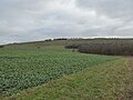
 Cereal crop on Lammy Down, Swindon - geograph.org.uk - 2382901.jpg 1,440 × 1,080; 473 KB
-
 Chapel Church Row - geograph.org.uk - 3282668.jpg 640 × 480; 115 KB
-
 Charlbury Hill - geograph.org.uk - 1420950.jpg 640 × 480; 186 KB
-
 Charlbury Hill - geograph.org.uk - 6568045.jpg 3,888 × 2,592; 3.09 MB
-
 Church Row - geograph.org.uk - 6551170.jpg 1,200 × 802; 1.27 MB
-
 Church Row meets Bodyhorse Hill - geograph.org.uk - 3074903.jpg 3,648 × 2,736; 1.21 MB
-
 City Corner runs down to Wanborough - geograph.org.uk - 4171801.jpg 1,500 × 999; 167 KB
-
 Combe by Bishopstone - geograph.org.uk - 816260.jpg 640 × 480; 80 KB
-
 Combe by Bishopstone - geograph.org.uk - 816292.jpg 640 × 480; 69 KB
-
 Combe South of Bishopstone - geograph.org.uk - 816255.jpg 640 × 480; 87 KB
-
 Coombe above Hinton Parva - geograph.org.uk - 5423002.jpg 4,000 × 3,000; 4.75 MB
-
 Coombe south of Bishopstone, Swindon - geograph.org.uk - 2382393.jpg 1,440 × 1,080; 612 KB
-

-
 Cottages on Church Row, Hinton Parva - geograph.org.uk - 5355645.jpg 640 × 360; 98 KB
-

-

-
 Derelict Site at the end of The Lane - geograph.org.uk - 6564258.jpg 3,276 × 1,868; 1.81 MB
-
 Disabled Access signpost to Bishopstone Church - geograph.org.uk - 6007187.jpg 4,608 × 2,592; 5.53 MB
-
 Downland near the Ridgeway - geograph.org.uk - 5422994.jpg 4,000 × 3,000; 4.96 MB
-
 Downland near the Ridgeway above Bishopstone - geograph.org.uk - 6291699.jpg 4,000 × 3,000; 4.58 MB
-
 Downland south of Bishopstone - geograph.org.uk - 3092571.jpg 3,648 × 2,736; 3.09 MB
-

-
 Early crop of winter wheat below Lammy Down - geograph.org.uk - 2148689.jpg 3,072 × 2,304; 3.33 MB
-
 East along the Ridgeway, south of Bishopstone, Swindon - geograph.org.uk - 2382892.jpg 1,440 × 1,080; 648 KB
-
 Eastbrook Valley - geograph.org.uk - 6544620.jpg 4,905 × 3,500; 3.79 MB
-
 Entering Bishopstone - geograph.org.uk - 817201.jpg 640 × 480; 113 KB
-
 Farm track to Russley Park - geograph.org.uk - 6013867.jpg 4,000 × 3,000; 4.81 MB
-
 Farm track, Russley Downs - geograph.org.uk - 6013870.jpg 4,000 × 3,000; 4.65 MB
-
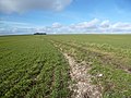
 Farmland between Bishopstone, Swindon and Lammy Down - geograph.org.uk - 2382345.jpg 1,440 × 1,080; 672 KB
-
 Farmland west of Charlbury Hill, Swindon - geograph.org.uk - 2382925.jpg 1,440 × 1,080; 397 KB
-
 Farmland, Bishopstone - geograph.org.uk - 2815210.jpg 640 × 480; 143 KB
-
 FCP Swindon 003.jpg 3,362 × 2,135; 4.44 MB
-
 Field edge boundary below Lammy Down - geograph.org.uk - 2148685.jpg 3,072 × 2,304; 3.25 MB
-
 Field edge northwest of The Ridgeway - geograph.org.uk - 4062564.jpg 4,608 × 3,456; 3.47 MB
-

-
 Fields near Hassock's Copse - geograph.org.uk - 3289118.jpg 640 × 480; 75 KB
-
 First lunchtime pint for quite a while - geograph.org.uk - 6545892.jpg 4,695 × 3,170; 2.47 MB
-
 Footpath from Bishopstone, Swindon - geograph.org.uk - 2383181.jpg 1,440 × 1,080; 1.04 MB
-
 Footpath to Bishopstone - geograph.org.uk - 2208603.jpg 640 × 480; 108 KB
-
 Footpath to Idstone - geograph.org.uk - 2208608.jpg 640 × 480; 122 KB
-

-
 Fred C Palmer 010.jpg 3,240 × 2,035; 3.96 MB
-
 Free range pig farming north of Ridgeway Farm - geograph.org.uk - 3092548.jpg 3,648 × 2,736; 3.12 MB
-
 Gate in the Valley - geograph.org.uk - 6545562.jpg 4,785 × 3,288; 2.72 MB
-
 Gate to the Coombe - geograph.org.uk - 6545523.jpg 4,397 × 3,162; 2.48 MB
-

-
 Gore Lane - geograph.org.uk - 3878061.jpg 1,600 × 1,200; 501 KB
-
 Gore Lane Farm - geograph.org.uk - 6013853.jpg 4,000 × 3,000; 4.09 MB
-
 Heading north westwards - geograph.org.uk - 6545553.jpg 5,472 × 3,648; 3.55 MB
-
 High Street, Bishopstone - geograph.org.uk - 816313.jpg 640 × 480; 82 KB
-
 Hill Manor, Hinton Parva, Swindon - geograph.org.uk - 6480266.jpg 1,024 × 576; 229 KB
-
 Hinton Hill to Wanborough - geograph.org.uk - 4171785.jpg 1,500 × 999; 159 KB
-
 Hinton Manor, Hinton Parva (Little Hinton) - geograph.org.uk - 5024489.jpg 2,751 × 2,148; 1.4 MB
-
 Hinton Marsh Farm - geograph.org.uk - 2989682.jpg 4,000 × 3,000; 2.87 MB
-
 Hinton Marsh Farm - geograph.org.uk - 6468079.jpg 4,608 × 3,456; 7.27 MB
-
 Hinton Parva Village Hall - geograph.org.uk - 6103414.jpg 1,920 × 1,280; 971 KB
-
 Hinton Springs - geograph.org.uk - 6732314.jpg 1,200 × 800; 1.14 MB
-
 Hockerbench - geograph.org.uk - 6551208.jpg 1,200 × 821; 1.1 MB
-
 Hockerbench, Bishopstone - geograph.org.uk - 6103420.jpg 1,920 × 1,280; 1.38 MB
-
 Home Farm, Hinton Parva - geograph.org.uk - 6468065.jpg 4,608 × 3,456; 7.18 MB
-
 Horse riders in Hinton Parva - geograph.org.uk - 5423009.jpg 4,000 × 3,000; 4.74 MB
-
 Horses in field at Lower Farm - geograph.org.uk - 6007200.jpg 4,608 × 2,592; 4.8 MB
-
 House by Bishopstone Pond - geograph.org.uk - 3588724.jpg 1,500 × 999; 219 KB
-
 House entrance on Body Horse Hill, Hinton Parva - geograph.org.uk - 6308110.jpg 1,848 × 1,162; 1.05 MB
-
 House on City Corner, Hinton Parva - geograph.org.uk - 6308137.jpg 1,824 × 1,114; 1.36 MB
-
 House on the corner, City Corner - geograph.org.uk - 6568146.jpg 3,888 × 2,592; 1.79 MB
-
 Houses in Hinton Parva from Bodyhorse Hill - geograph.org.uk - 6733293.jpg 3,000 × 2,250; 4.3 MB
-
 Houses near Mount Pleasant Farm - geograph.org.uk - 2985526.jpg 4,000 × 3,000; 2.84 MB
-
 Icknield Way - geograph.org.uk - 6732311.jpg 1,200 × 804; 1.3 MB
-
 Icknield Way to Hinton Parva - geograph.org.uk - 3588728.jpg 1,500 × 999; 168 KB
-
 Icknield Way, Bishopstone - geograph.org.uk - 6103417.jpg 1,920 × 1,280; 1.22 MB
-
 Icknield Way, Bishopstone - geograph.org.uk - 6315515.jpg 1,920 × 1,280; 1.16 MB
-
 Icknield Way, Bishopstone - geograph.org.uk - 6315544.jpg 1,920 × 1,280; 1.11 MB
-
 Intersection of Hatchet Hill and White Hill - geograph.org.uk - 3074916.jpg 3,648 × 2,736; 1.65 MB
-
 Junction on Ridgeway - geograph.org.uk - 816246.jpg 640 × 480; 101 KB
-
 Just off the Ridgeway, south-east of Hinton Parva - geograph.org.uk - 2382690.jpg 1,440 × 1,080; 629 KB
-
 Lane near Mount Pleasant Farm Cottages - geograph.org.uk - 6468091.jpg 4,608 × 3,456; 5.43 MB
-
 Lane to Starveall Farm - geograph.org.uk - 6545447.jpg 5,472 × 3,648; 3.52 MB
-
 Lane to Starveall Farm crosses Ridgeway - geograph.org.uk - 3076033.jpg 3,648 × 2,736; 1.42 MB
-
 Lane with Apples - geograph.org.uk - 6565550.jpg 2,750 × 2,442; 2.13 MB
-
 Large field alongside The Ridgeway - geograph.org.uk - 4062595.jpg 4,608 × 3,456; 3.92 MB
-
 Littlecot - geograph.org.uk - 3092259.jpg 3,648 × 2,736; 1.84 MB
-

-
 Lower Earlscourt Farm - geograph.org.uk - 2985540.jpg 4,000 × 3,000; 2.87 MB
-
 Meadow Crane's-bill, Geranium pratense - geograph.org.uk - 1420942.jpg 640 × 480; 249 KB
-
 Minor road to Bishopstone - geograph.org.uk - 6007192.jpg 4,608 × 2,592; 5.17 MB
-
 Minor road to Bishopstone - geograph.org.uk - 6007194.jpg 4,608 × 2,592; 4.86 MB
-

-
 Near Ridgeway Farm - geograph.org.uk - 6732167.jpg 1,200 × 800; 898 KB
-
 Near Ridgeway Farm - geograph.org.uk - 6732173.jpg 1,200 × 805; 1.29 MB
-
 Near Ridgeway Farm - geograph.org.uk - 6732177.jpg 1,200 × 800; 1,017 KB
-
 North from the bridleway from Bishopstone, Swindon - geograph.org.uk - 2383051.jpg 1,440 × 1,080; 649 KB
-

-

-

-
 Old Stables, Russley Park - geograph.org.uk - 3876728.jpg 1,600 × 984; 507 KB
-
 On top of Charlbury Hill - geograph.org.uk - 6568061.jpg 3,888 × 2,592; 3.31 MB
-
 One that did make it, south of Bishopstone, Swindon - geograph.org.uk - 2383073.jpg 1,440 × 1,080; 893 KB
-
 One that didn't make it, south of Bishopstone, Swindon - geograph.org.uk - 2383066.jpg 1,440 × 1,080; 1.11 MB
-
 Outbuildings at Ridgeway Farm - geograph.org.uk - 1012268.jpg 640 × 480; 102 KB
-
 Outfall of duckpond, Bishopstone, Swindon - geograph.org.uk - 367752.jpg 640 × 480; 194 KB
-
 Over the line to Idstone - geograph.org.uk - 4171774.jpg 1,500 × 999; 149 KB
-
 Paddock by Hill Manor - geograph.org.uk - 816214.jpg 640 × 480; 112 KB
-
 Palmer sites 2011 Bishopstone 031.jpg 3,444 × 2,128; 3.2 MB
-

-
 Pasture and arable land, south of Bishopstone, Swindon - geograph.org.uk - 2382415.jpg 1,440 × 1,080; 719 KB
-
 Path crossing the Ridgeway - geograph.org.uk - 3289101.jpg 640 × 480; 58 KB
-
 Path heading to Gore Lane - geograph.org.uk - 3289158.jpg 640 × 480; 94 KB
-
 Path heading to Gore Lane - geograph.org.uk - 3289179.jpg 640 × 480; 76 KB
-

-
 Path heading up towards Upper Farm - geograph.org.uk - 3282653.jpg 640 × 480; 84 KB
-
 Path to Hill Manor - geograph.org.uk - 3289009.jpg 640 × 480; 87 KB
-
 Path to the top of Charlbury Hill - geograph.org.uk - 6568024.jpg 3,888 × 2,592; 2.97 MB
-
 Pig housing near Ridgeway Farm - geograph.org.uk - 238704.jpg 640 × 480; 123 KB
-
 Pond in Bishopstone - geograph.org.uk - 6732309.jpg 1,200 × 805; 1.07 MB
-
 Prebendal Farm on fete day - geograph.org.uk - 5423037.jpg 4,000 × 3,000; 4.85 MB
-
 Pub sign on the Ridgeway - geograph.org.uk - 6545460.jpg 5,342 × 3,465; 3.77 MB
-
 Public bridleway, near Foxhill, Wilts - geograph.org.uk - 5158790.jpg 1,024 × 675; 181 KB
-

-

-
 Reservoir, Lammy Down, Swindon - geograph.org.uk - 2382898.jpg 1,440 × 1,080; 324 KB
-
 Reservoir, west of Charlbury Hill, Swindon - geograph.org.uk - 2382912.jpg 1,440 × 1,080; 272 KB
-
 Ridgeway - Closed to Motor Vehicles - geograph.org.uk - 6545470.jpg 5,472 × 3,648; 2.81 MB
-
 Ridgeway near Foxhill - geograph.org.uk - 6732155.jpg 1,200 × 800; 1.05 MB
-
 Ridgeway on Charlbury Hill - geograph.org.uk - 1012282.jpg 640 × 480; 93 KB
-
 River Cole at Botswicky Copse - geograph.org.uk - 6565574.jpg 2,445 × 3,080; 2.65 MB
-
 Road down to Bishopstone - geograph.org.uk - 4062616.jpg 4,608 × 3,456; 3.62 MB
-
 Road junction at Hinton Springs - geograph.org.uk - 3074232.jpg 3,399 × 2,625; 1.82 MB
-
 Road junction on Hinton Springs, Hinton Parva - geograph.org.uk - 6308034.jpg 1,920 × 1,280; 1.15 MB
-
 Road junction, Bishopstone to Bourton roads - geograph.org.uk - 6007196.jpg 4,608 × 2,592; 4.2 MB
-
 Rolling Downland, Bishopstone - geograph.org.uk - 817192.jpg 640 × 480; 98 KB
-
 Sarsens and Snowdrops - geograph.org.uk - 3876735.jpg 800 × 600; 228 KB
-
 Several Colours of Thatch - geograph.org.uk - 6568138.jpg 3,888 × 2,592; 2.1 MB
-
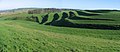
 Sheep and strip lynchets, south of Bishopstone, Swindon - geograph.org.uk - 2383099.jpg 1,440 × 1,080; 695 KB
-
 Sheep and the coombe south of Bishopstone, Swindon - geograph.org.uk - 2382655.jpg 1,440 × 1,080; 779 KB
-
 Sheep grazing at Hinton Marsh Farm - geograph.org.uk - 2989690.jpg 4,000 × 3,000; 2.94 MB
-
 Sheep in the coombe south of Bishopstone, Swindon - geograph.org.uk - 2382661.jpg 1,440 × 1,080; 535 KB
-
-
 Short Drove in Hinton Parva - geograph.org.uk - 4171795.jpg 1,500 × 999; 245 KB
-
 Silage collecting southwest of Starveall farm - geograph.org.uk - 3092497.jpg 3,648 × 2,736; 2.08 MB
-
 Silage field southwest of Starveall farm - geograph.org.uk - 3076024.jpg 3,648 × 2,736; 3.49 MB
-
 Small valley near Bishopstone, Swindon - geograph.org.uk - 2383044.jpg 1,440 × 1,080; 577 KB
-
 South of Bishopstone, Swindon - geograph.org.uk - 2806929.jpg 640 × 480; 75 KB
-
 St Mary the Virgin Church, Bishopstone, Swindon - geograph.org.uk - 6480276.jpg 1,024 × 768; 382 KB
-
 St Mary's Church - geograph.org.uk - 6551197.jpg 1,200 × 802; 1.08 MB
-
 St Swithun, Hinton Parva - geograph.org.uk - 5355642.jpg 360 × 640; 99 KB
-
 St Swithun, Hinton Parva - geograph.org.uk - 6543249.jpg 1,024 × 768; 224 KB
-
 Straw Fox, Real Pigeon - geograph.org.uk - 6564236.jpg 1,600 × 989; 369 KB
-
 Strip Lynchet by Bishopstone - geograph.org.uk - 816304.jpg 640 × 480; 106 KB
-
 Strip Lynchets - geograph.org.uk - 816273.jpg 640 × 480; 59 KB
-

-

-
 Strip Lynchets in the evening sun, Bishopstone, Swindon - geograph.org.uk - 2382594.jpg 1,440 × 1,080; 467 KB
-
 Strip lynchets, Bishopstone, Swindon - geograph.org.uk - 2383205.jpg 4,745 × 2,053; 2.72 MB
-
 Strip Lynchets, Bishopstone, Swindon - geograph.org.uk - 2806568.jpg 640 × 480; 92 KB
-
 Sunlit valley - geograph.org.uk - 4062633.jpg 4,608 × 3,456; 3.77 MB
-
 Sunset near Bishopstone, Swindon - geograph.org.uk - 601982.jpg 640 × 480; 170 KB
-
 Sunset over Liddington - geograph.org.uk - 2382706.jpg 1,440 × 1,080; 230 KB
-
 Thatched cottage by a pool, The City, Bishopstone - geograph.org.uk - 5311300.jpg 4,000 × 3,000; 4.96 MB
-
 Thatched cottage on Body Horse Hill - geograph.org.uk - 4171790.jpg 1,500 × 999; 130 KB
-
 Thatched cottage on Cues Lane, Bishopstone - geograph.org.uk - 6103419.jpg 1,900 × 1,248; 1.44 MB
-
 Thatched Cottage, Bishopstone - geograph.org.uk - 816341.jpg 640 × 480; 104 KB
-
 Thatched cottage, Tucker's Lane, Hinton Parva - geograph.org.uk - 5024490.jpg 3,264 × 2,448; 2.05 MB
-
 Thatched House in Bishopstone - geograph.org.uk - 6545875.jpg 5,063 × 3,116; 3.1 MB
-
 Thatched House, Tuckers Lane, Hinton Parva - geograph.org.uk - 6568161.jpg 3,357 × 2,347; 2.25 MB
-
 Thatched White Cottage in Bishopstone - geograph.org.uk - 817178.jpg 640 × 480; 89 KB
-
 The Coombes - geograph.org.uk - 3282714.jpg 640 × 480; 78 KB
-
 The Downs in the distance - geograph.org.uk - 6566981.jpg 5,078 × 3,167; 2.24 MB
-


_-_geograph.org.uk_-_5024489.jpg)


