Category:Bishopsbourne
Jump to navigation
Jump to search
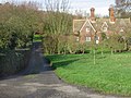
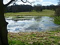
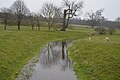
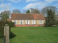
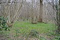
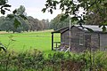
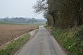
English: Bishopsbourne is a small village and civil parish in Kent, England. It lies in the Nailbourne valley some from Dover. It has a public house, The Mermaid, built in 1861, and a church, St Mary's, with 14th-century wall paintings. Author Joseph Conrad lived here and his house, "Oswalds", still stands. The village hall is called "Conrad Hall" in his honour. Bishopsbourne was on the Elham Valley Railway until traffic stopped in 1947, the original railway station is now a private residence.
Polski: Bishopsbourne, wieś w Wielkiej Brytanii, w Anglii, w regionie South East England, w hrabstwie Kent.

village in Kent, UK  | |||||
| Upload media | |||||
| Instance of | |||||
|---|---|---|---|---|---|
| Location | Canterbury, Kent, South East England, England | ||||
| Population |
| ||||
| Area |
| ||||
| Said to be the same as | Bishopsbourne (Wikimedia duplicated page, civil parish) | ||||
| official website | |||||
 | |||||
Subcategories
This category has the following 7 subcategories, out of 7 total.
Media in category "Bishopsbourne"
The following 200 files are in this category, out of 370 total.
(previous page) (next page)-
 'Crows Camp' near Bishopsbourne. - geograph.org.uk - 322900.jpg 640 × 480; 280 KB
-
 002osd000000015u00374000.jpg 3,983 × 4,000; 4.91 MB
-
 A dried up tributary of the Nail Bourne in Bourne Park - geograph.org.uk - 3763888.jpg 4,000 × 3,000; 4.36 MB
-
-
 A footpath leaves Pett Bottom Road - geograph.org.uk - 3762761.jpg 4,000 × 3,000; 4.17 MB
-
 A short chalk stream - geograph.org.uk - 5025890.jpg 640 × 426; 67 KB
-
 A short chalk stream - geograph.org.uk - 5025892.jpg 640 × 426; 75 KB
-
 A2, Barham Downs - geograph.org.uk - 5203405.jpg 640 × 426; 50 KB
-
 Access road to Gorsley House - geograph.org.uk - 1779328.jpg 3,072 × 2,304; 3.16 MB
-
 An arable hillside - geograph.org.uk - 5014720.jpg 640 × 426; 45 KB
-
 Approach to Lenhall Farm - geograph.org.uk - 3763988.jpg 4,000 × 3,000; 4.05 MB
-
 Arable land by Crow's Camp Rd - geograph.org.uk - 5014695.jpg 640 × 426; 39 KB
-
 Bishopsbourne - geograph.org.uk - 5021567.jpg 640 × 426; 84 KB
-
 Bishopsbourne 1.jpg 2,000 × 3,008; 1.81 MB
-
 Bishopsbourne cricket pavilion - geograph.org.uk - 323533.jpg 640 × 480; 167 KB
-
 Bishopsbourne Ford - geograph.org.uk - 3741444.jpg 3,872 × 2,592; 4.85 MB
-

-
 Bishopsbourne village sign - geograph.org.uk - 4499492.jpg 2,272 × 1,704; 1.2 MB
-
 Bishopsbourne village sign - geograph.org.uk - 4500524.jpg 1,704 × 2,272; 1.26 MB
-
 Bishopsbourne War Memorial - geograph.org.uk - 4500544.jpg 1,704 × 2,272; 938 KB
-
 Bishopsbourne, Kent, UK - panoramio.jpg 1,024 × 754; 705 KB
-
 BocheBusterFiring7May1941.jpg 800 × 800; 73 KB
-
 Bourne House - geograph.org.uk - 2593980.jpg 640 × 466; 85 KB
-
 Bourne Park - geograph.org.uk - 5025931.jpg 640 × 426; 38 KB
-
 Bourne Park - geograph.org.uk - 5025935.jpg 640 × 426; 44 KB
-
 Bourne Park Cottage - geograph.org.uk - 5025937.jpg 640 × 426; 86 KB
-
 Bourne Park Cottages on Bourne Park Road - geograph.org.uk - 6399981.jpg 5,456 × 3,632; 2.97 MB
-
 Bourne Park House - geograph.org.uk - 5025901.jpg 640 × 426; 38 KB
-
 Bourne Park House - geograph.org.uk - 5025905.jpg 640 × 426; 47 KB
-
 Bourne Park House - geograph.org.uk - 5025906.jpg 640 × 426; 42 KB
-
 Bourne Park House - geograph.org.uk - 5026124.jpg 640 × 426; 65 KB
-
 Bourne Park Lake - geograph.org.uk - 5025907.jpg 640 × 426; 96 KB
-
 Bourne Park Rd - geograph.org.uk - 5025925.jpg 640 × 426; 54 KB
-
 Bourne Park Rd - geograph.org.uk - 5025927.jpg 640 × 426; 70 KB
-
 Bourne Park Rd - geograph.org.uk - 5025932.jpg 640 × 426; 68 KB
-
 Bourne Park Road - geograph.org.uk - 1776661.jpg 3,072 × 2,304; 1.59 MB
-
 Bourne Park Road - geograph.org.uk - 6399921.jpg 5,456 × 3,632; 3.71 MB
-
 Bourne Park Road, Bishopsbourne - geograph.org.uk - 4500546.jpg 2,272 × 1,704; 883 KB
-
 Bourne Park Road, Bridge - geograph.org.uk - 4500552.jpg 2,272 × 1,704; 808 KB
-
 Bourne Park Road, near Bridge - geograph.org.uk - 4500548.jpg 2,272 × 1,704; 1.03 MB
-
 Brambling Road in the snow. - geograph.org.uk - 316906.jpg 480 × 640; 149 KB
-
 Bridge Hill - geograph.org.uk - 4890984.jpg 640 × 426; 79 KB
-

-
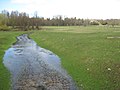
 Bridge over Nail Bourne, Bishopsbourne - geograph.org.uk - 5523770.jpg 640 × 480; 143 KB
-
 Bridge over Nail Bourne, Bishopsbourne - geograph.org.uk - 5523786.jpg 640 × 480; 153 KB
-
 Bridge over the dismantled railway - geograph.org.uk - 5014728.jpg 640 × 426; 83 KB
-
 Bridge over the former Elham Valley Railway - geograph.org.uk - 3762767.jpg 4,000 × 3,000; 4.01 MB
-
 Bridge over the former Elham Valley Railway - geograph.org.uk - 3762769.jpg 4,000 × 3,000; 4.01 MB
-
 Bridge over the Nailbourne - geograph.org.uk - 5025936.jpg 640 × 426; 47 KB
-
 Bridge turning, A2 - geograph.org.uk - 5203402.jpg 640 × 426; 44 KB
-
 Bridleway beside Charlton Wood - geograph.org.uk - 1779258.jpg 3,072 × 2,304; 2.24 MB
-
 Bridleway to Charlton Wood - geograph.org.uk - 1779262.jpg 3,072 × 2,304; 2.61 MB
-
 Broken stile near Redhill Wood - geograph.org.uk - 1780377.jpg 3,072 × 2,304; 2.72 MB
-

-
 Bursted Cottage - geograph.org.uk - 5004107.jpg 640 × 426; 40 KB
-
 Bursted Manor - geograph.org.uk - 5004082.jpg 640 × 426; 87 KB
-

-
 Bursted Wood - geograph.org.uk - 5007046.jpg 640 × 426; 56 KB
-
 Bursted Wood - geograph.org.uk - 5007048.jpg 640 × 426; 50 KB
-
 By the corner of Gorsley Wood - geograph.org.uk - 3762790.jpg 4,000 × 3,000; 4.41 MB
-
 Byway across field - geograph.org.uk - 5007057.jpg 640 × 426; 92 KB
-
 Byway to Peasants' Hall Road - geograph.org.uk - 1779286.jpg 3,072 × 2,304; 1.7 MB
-
 Byway to Woodgate - geograph.org.uk - 1779279.jpg 3,072 × 2,304; 2.57 MB
-
 Cattle grazing - geograph.org.uk - 5004089.jpg 640 × 426; 51 KB
-
 Chalk farmland - geograph.org.uk - 5007066.jpg 640 × 426; 63 KB
-
 Chalk Farmland - geograph.org.uk - 5007076.jpg 640 × 426; 40 KB
-
 Chalk farmland - geograph.org.uk - 5007087.jpg 640 × 426; 67 KB
-
 Charlton Park, Bishopsbourne. - geograph.org.uk - 323525.jpg 640 × 480; 297 KB
-
 Charlton Wood, near Kingston, Kent - geograph.org.uk - 2018066.jpg 426 × 640; 222 KB
-
 CharltonParkHouseFrontMay2010 002.jpg 2,592 × 1,944; 2.36 MB
-
 Church Cottages - geograph.org.uk - 5021597.jpg 640 × 426; 78 KB
-
 Church of St Mary - geograph.org.uk - 5021548.jpg 640 × 426; 45 KB
-
 Coldharbour Lane passes under the A2 - geograph.org.uk - 5522699.jpg 640 × 428; 158 KB
-
 Conrad Hall - geograph.org.uk - 1776801.jpg 3,072 × 2,304; 2.36 MB
-
 Conrad Hall, Bishopsbourne - geograph.org.uk - 2023162.jpg 640 × 425; 186 KB
-
 Conrad Hall, Bishopsbourne - geograph.org.uk - 6398404.jpg 5,456 × 3,632; 3.4 MB
-
 Coppicing, Gorsley Wood - geograph.org.uk - 5007098.jpg 640 × 426; 126 KB
-
 Corrugated barn - geograph.org.uk - 5004039.jpg 640 × 426; 66 KB
-
 Cottage by Woodgate - geograph.org.uk - 5007056.jpg 640 × 426; 89 KB
-
 Cottages at the junction - geograph.org.uk - 4776185.jpg 640 × 480; 144 KB
-
 Cottages on Bourne Park Road - geograph.org.uk - 3762782.jpg 4,000 × 3,000; 4.3 MB
-
 Court House - geograph.org.uk - 5021654.jpg 640 × 426; 57 KB
-
 Court House - geograph.org.uk - 5021671.jpg 640 × 426; 56 KB
-
 Cricket Pavilion, Bishopsbourne - geograph.org.uk - 4680732.jpg 1,024 × 682; 230 KB
-
 Crows Camp - geograph.org.uk - 5014706.jpg 640 × 411; 84 KB
-
 Crows Camp Rd - geograph.org.uk - 5007106.jpg 640 × 426; 72 KB
-
 Crows Camp Rd - geograph.org.uk - 5007109.jpg 640 × 426; 58 KB
-
 Crows Camp Rd - geograph.org.uk - 5014687.jpg 640 × 426; 64 KB
-
 Crows Camp Rd - geograph.org.uk - 5014691.jpg 640 × 426; 65 KB
-
 Crows Camp Rd - geograph.org.uk - 5014696.jpg 640 × 426; 56 KB
-
 Crows Camp Rd - geograph.org.uk - 5014703.jpg 640 × 426; 64 KB
-
 Crows Camp Rd - geograph.org.uk - 5014707.jpg 640 × 426; 62 KB
-
 Crows Camp Rd - geograph.org.uk - 5014714.jpg 640 × 426; 48 KB
-
 Crows Camp Rd - geograph.org.uk - 5014719.jpg 640 × 426; 53 KB
-
 Crows Camp Rd - geograph.org.uk - 5014722.jpg 640 × 426; 69 KB
-
 Crows Camp Rd - geograph.org.uk - 5014741.jpg 640 × 426; 59 KB
-
 Crows Camp Rd - geograph.org.uk - 5021553.jpg 640 × 426; 84 KB
-
 Direction Sign – Signpost - geograph.org.uk - 6522320.jpg 550 × 734; 154 KB
-
 Dried pond - geograph.org.uk - 5007055.jpg 640 × 426; 120 KB
-
 Dried up river bed, Charlton Park. - geograph.org.uk - 323535.jpg 640 × 480; 202 KB
-
 Driveway to Bourne House - geograph.org.uk - 1776681.jpg 3,072 × 1,728; 1.14 MB
-
 Elham Valley Way - geograph.org.uk - 5021661.jpg 640 × 426; 50 KB
-
 Elham Valley Way - geograph.org.uk - 5021708.jpg 640 × 426; 39 KB
-
 Elham Valley Way - geograph.org.uk - 5025894.jpg 640 × 426; 53 KB
-
 Elham Valley Way - geograph.org.uk - 5025902.jpg 640 × 426; 62 KB
-
 Elham Valley Way - geograph.org.uk - 5025933.jpg 640 × 426; 110 KB
-
 Elham Valley Way at Bourne Park Road - geograph.org.uk - 6399912.jpg 5,456 × 3,632; 3.36 MB
-
 Elham Valley Way at Bourne Park Road - geograph.org.uk - 6399915.jpg 5,456 × 3,632; 3.54 MB
-
 Elham Valley Way at Charlton Park - geograph.org.uk - 6397820.jpg 4,898 × 3,197; 2.9 MB
-
-
 Elham Valley Way leaves Bourne Park Road - geograph.org.uk - 6399924.jpg 5,456 × 3,632; 4.55 MB
-

-
 Elham Valley Way towards Bishopsbourne - geograph.org.uk - 6397897.jpg 4,847 × 3,299; 2.93 MB
-
 Elham Valley Way towards Bishopsbourne - geograph.org.uk - 6397900.jpg 5,456 × 3,632; 5.1 MB
-
 Elham Valley Way towards Bridge - geograph.org.uk - 6398601.jpg 5,456 × 3,632; 2.27 MB
-
 Elham Valley Way towards Bridge - geograph.org.uk - 6398607.jpg 5,456 × 3,632; 2.57 MB
-
 Elham Valley Way towards Bridge - geograph.org.uk - 6398610.jpg 5,456 × 3,632; 2.3 MB
-
 Elham Valley Way towards Bridge - geograph.org.uk - 6399976.jpg 5,456 × 3,632; 4.27 MB
-
 Enjoying the hay - geograph.org.uk - 5004124.jpg 640 × 426; 81 KB
-
 Entering Bishopsbourne - geograph.org.uk - 4680459.jpg 1,024 × 682; 193 KB
-
 Entering Bishopsbourne - geograph.org.uk - 5014725.jpg 640 × 426; 110 KB
-
 Entrance Drive to Juniper Rough ^ Lodge - geograph.org.uk - 1931951.jpg 1,024 × 768; 249 KB
-
 Entrance to Bourne Park - geograph.org.uk - 5025929.jpg 640 × 426; 89 KB
-
 Entrance to Middle Pett Farm - geograph.org.uk - 3762787.jpg 4,000 × 3,000; 4.17 MB
-
 Fallow field - geograph.org.uk - 5007064.jpg 640 × 426; 74 KB
-
 Farm outbuilding - geograph.org.uk - 5004104.jpg 640 × 426; 51 KB
-
 Farmhouse near Bishopsbourne - geograph.org.uk - 4502925.jpg 1,920 × 1,080; 640 KB
-
 Feeder stream to River Nailbourne - geograph.org.uk - 1776750.jpg 3,072 × 2,304; 1.94 MB
-
 Field by Gorsley Wood - geograph.org.uk - 5007107.jpg 640 × 426; 59 KB
-
 Field by Gorsley Wood - geograph.org.uk - 5007108.jpg 640 × 426; 60 KB
-
 Field by Woodgate - geograph.org.uk - 5004095.jpg 640 × 426; 53 KB
-
 Field edge near Gorsley Wood - geograph.org.uk - 3762744.jpg 4,000 × 3,000; 4.33 MB
-
 Field near Bishopsbourne - geograph.org.uk - 5021525.jpg 640 × 426; 44 KB
-
 Field, Crows Camp Rd - geograph.org.uk - 5007100.jpg 640 × 426; 42 KB
-

-
 Footbridge over the Nail Bourne - geograph.org.uk - 6398604.jpg 5,456 × 3,632; 2.48 MB
-
 Footbridge, Elham Valley Way - geograph.org.uk - 5025889.jpg 640 × 426; 72 KB
-
 Footpath off Pett Bottom Rd - geograph.org.uk - 4873832.jpg 640 × 426; 90 KB
-
 Footpath off Woodgate - geograph.org.uk - 5004112.jpg 640 × 426; 114 KB
-
 Footpath to Pett Bottom Road - geograph.org.uk - 3762788.jpg 4,000 × 3,000; 4.42 MB
-
 Frog Lane, Bishopsbourne - geograph.org.uk - 1299420.jpg 640 × 480; 281 KB
-
 Frog Lane, Bishopsbourne - geograph.org.uk - 4499495.jpg 2,272 × 1,704; 1.31 MB
-
 Frog Lane, near Bishopsbourne - geograph.org.uk - 4499488.jpg 2,272 × 1,704; 1.08 MB
-
 Fruit Farm (Middle Pett Farm) - geograph.org.uk - 4873825.jpg 640 × 426; 71 KB
-
 Gate, Elham Valley Way - geograph.org.uk - 5025893.jpg 640 × 426; 57 KB
-
 Gated track off Woodgate. - geograph.org.uk - 323575.jpg 640 × 480; 316 KB
-
 Gates to Mill House - geograph.org.uk - 5007052.jpg 640 × 426; 74 KB
-
 Georgian post box at Bishopsbourne - geograph.org.uk - 6397910.jpg 2,633 × 3,526; 1.39 MB
-
 Gorsley House - geograph.org.uk - 1779324.jpg 3,072 × 2,304; 2.42 MB
-
 Gorsley Wood - geograph.org.uk - 1931961.jpg 1,024 × 768; 297 KB
-
 Gorsley Wood - geograph.org.uk - 5007072.jpg 640 × 426; 70 KB
-
 Gorsley Wood - geograph.org.uk - 5007079.jpg 640 × 426; 125 KB
-
 Gorsley Wood - geograph.org.uk - 5007082.jpg 640 × 426; 117 KB
-
 Gorsley Wood - geograph.org.uk - 5007089.jpg 640 × 426; 119 KB
-
 Gorsley Wood - geograph.org.uk - 5014688.jpg 640 × 426; 65 KB
-
 Gorsley Wood - geograph.org.uk - 5014690.jpg 640 × 426; 58 KB
-
 Gorsley Wood - geograph.org.uk - 5014692.jpg 640 × 426; 73 KB
-
 Gorsley Wood across a field - geograph.org.uk - 5014697.jpg 640 × 426; 39 KB
-
 Graveyard, Church of St Mary - geograph.org.uk - 5021618.jpg 640 × 426; 96 KB
-
 Hedge of trees - geograph.org.uk - 5007094.jpg 640 × 426; 67 KB
-
 House by Woodgate - geograph.org.uk - 5007054.jpg 640 × 426; 100 KB
-
 House, Bishopsbourne - geograph.org.uk - 5014735.jpg 640 × 426; 88 KB
-
 In the woods on Woodgate. - geograph.org.uk - 323566.jpg 640 × 480; 289 KB
-
 Inn sign, The Mermaid Inn, Bishopsbourne - geograph.org.uk - 5523652.jpg 480 × 640; 156 KB
-
 Joseph Conrad lived here - geograph.org.uk - 3763933.jpg 4,000 × 3,000; 4.12 MB
-

-
 Keeper's Cottage - geograph.org.uk - 5014693.jpg 640 × 426; 59 KB
-
 Lake in Bourne Park - geograph.org.uk - 3763905.jpg 4,000 × 3,000; 4.44 MB
-
 Lake, Bourne Park - geograph.org.uk - 5025910.jpg 640 × 426; 116 KB
-
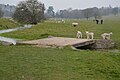
 Lambs - geograph.org.uk - 5021696.jpg 640 × 426; 76 KB
-
 Lambs, Bourne Park - geograph.org.uk - 5025908.jpg 640 × 426; 86 KB
-
 Lane to Bursted Wood - geograph.org.uk - 1779307.jpg 3,072 × 2,304; 2.3 MB
-
 Langham Park Cottages - geograph.org.uk - 5007095.jpg 640 × 426; 55 KB
-
 Langham Park Farm (2) - geograph.org.uk - 1779266.jpg 3,072 × 2,304; 2.01 MB
-
 Langham Park Farm - geograph.org.uk - 1779263.jpg 3,072 × 2,304; 1.6 MB
-
 Langham Park Farm - geograph.org.uk - 5007093.jpg 640 × 426; 59 KB
-
 Lenhall Farm and Oast - geograph.org.uk - 5014713.jpg 640 × 426; 46 KB
-
 Lenhall Farm Oast - geograph.org.uk - 5014709.jpg 640 × 426; 51 KB
-
 Lenhall Farm Oast - geograph.org.uk - 5014712.jpg 640 × 426; 42 KB
-
 Lenhall Farm Oast - geograph.org.uk - 5014715.jpg 640 × 426; 31 KB
-
 Lenhall Farm Oast - geograph.org.uk - 5014717.jpg 640 × 426; 35 KB
-
 Little Pett Farm - geograph.org.uk - 4873808.jpg 640 × 546; 79 KB
-
 Looking east-southeast along The Street - geograph.org.uk - 3894320.jpg 946 × 709; 256 KB
-
 Looking towards Bourne Park Road - geograph.org.uk - 3762795.jpg 4,000 × 3,000; 4.12 MB
-
 Looking towards the former Elham Valley Railway - geograph.org.uk - 3762796.jpg 4,000 × 3,000; 4.31 MB
-

-
 Lych gate at St Mary's, Bishopsbourne - geograph.org.uk - 6398446.jpg 3,632 × 5,456; 2.26 MB
-
 Lych gate, Church of St Mary - geograph.org.uk - 5021591.jpg 640 × 426; 114 KB
-
 Mermaid Inn, Bishopsbourne - geograph.org.uk - 6397907.jpg 5,456 × 3,632; 1.7 MB
-
 Mermaid Inn, Bishopsbourne - geograph.org.uk - 6397911.jpg 5,456 × 3,632; 2.16 MB
-
 Muddy track in Gorsley Wood. - geograph.org.uk - 323542.jpg 640 × 480; 203 KB
-
 Nail Bourne (stream) at Charlton Park - geograph.org.uk - 6397887.jpg 5,456 × 3,632; 4.35 MB
-
 Nail Bourne Valley - geograph.org.uk - 5021713.jpg 640 × 426; 39 KB
-
 Old School House - geograph.org.uk - 5014743.jpg 640 × 426; 69 KB
-
 Orchard, Middle Pett Farm - geograph.org.uk - 4873829.jpg 640 × 426; 75 KB
-
 Oswald Lodge - geograph.org.uk - 5021678.jpg 640 × 426; 52 KB
-

-
 Oswald Lodge, Bishopsbourne - geograph.org.uk - 5522697.jpg 640 × 428; 154 KB
-
 Oswalds House - geograph.org.uk - 1776789.jpg 3,072 × 2,304; 2.67 MB
-
 Oswalds in Bishopsbourne.jpg 4,608 × 3,456; 2.96 MB


_-_geograph.org.uk_-_4873825.jpg)


_-_geograph.org.uk_-_1779266.jpg)


_at_Charlton_Park_-_geograph.org.uk_-_6397887.jpg)


