Category:Bishop Monkton
Jump to navigation
Jump to search
village in North Yorkshire, England, UK  | |||||
| Upload media | |||||
| Instance of | |||||
|---|---|---|---|---|---|
| Location | Harrogate, North Yorkshire, Yorkshire and the Humber, England | ||||
| Population |
| ||||
 | |||||
English: Bishop Monkton is a village and civil parish in the Harrogate district of North Yorkshire, England, about five miles south of Ripon. According to the 2001 census it had a population of 775.
Subcategories
This category has the following 5 subcategories, out of 5 total.
Media in category "Bishop Monkton"
The following 200 files are in this category, out of 253 total.
(previous page) (next page)-

-
 A61 at Bishop Monkton crossroads - geograph.org.uk - 4730812.jpg 640 × 480; 28 KB
-

-
 A61 near Rigg House - geograph.org.uk - 2041338.jpg 640 × 480; 56 KB
-
 A61 near Rigg House - geograph.org.uk - 5642896.jpg 4,288 × 2,848; 1.37 MB
-
 A61 North of Warmold Green - geograph.org.uk - 5780843.jpg 1,024 × 683; 273 KB
-
 A61 towards Ripon - geograph.org.uk - 2041329.jpg 640 × 480; 50 KB
-
 A61 towards Ripon - geograph.org.uk - 2775100.jpg 640 × 480; 44 KB
-
 Agricultural land at Wormald Green - geograph.org.uk - 6735990.jpg 5,019 × 3,420; 2.47 MB
-
 Anchor House - geograph.org.uk - 1203308.jpg 640 × 480; 102 KB
-
 Army Camp - geograph.org.uk - 834950.jpg 640 × 427; 55 KB
-
 Ash by Moor Road - geograph.org.uk - 5643298.jpg 2,828 × 4,099; 1.91 MB
-
 Ashbrook Farm - geograph.org.uk - 817687.jpg 640 × 427; 109 KB
-
 Beck beside road, Bishop Monkton - geograph.org.uk - 2466604.jpg 1,600 × 1,200; 726 KB
-
 Benchmark on a gatepost at Ivy House Farm - geograph.org.uk - 3135821.jpg 2,048 × 1,536; 588 KB
-
 Benchmark on the face of Southlands, Moor Road - geograph.org.uk - 3135791.jpg 2,048 × 1,536; 577 KB
-
 Benchmark on wall of the old Coach ^ Horses - geograph.org.uk - 6469486.jpg 1,808 × 4,032; 974 KB
-
 Bishop Monkton - geograph.org.uk - 384322.jpg 464 × 640; 91 KB
-
 Bishop Monkton - geograph.org.uk - 388845.jpg 640 × 478; 227 KB
-
 Bishop Monkton beck, looking towards the old Mechanics' Institute.jpg 640 × 480; 119 KB
-
 Bishop Monkton CE Primary School - geograph.org.uk - 630143.jpg 640 × 480; 72 KB
-
 Bishop Monkton Cottages - geograph.org.uk - 1203122.jpg 640 × 480; 117 KB
-
 Bishop Monkton Cricket field - geograph.org.uk - 5773002.jpg 640 × 427; 214 KB
-
 Bishop Monkton Crossroads - geograph.org.uk - 5642891.jpg 4,288 × 2,848; 1.73 MB
-
 Bishop Monkton Cut - geograph.org.uk - 1983995.jpg 3,500 × 2,596; 7.85 MB
-
 Bishop Monkton Cut - geograph.org.uk - 817509.jpg 640 × 427; 142 KB
-
 Bishop Monkton Ford - geograph.org.uk - 1203134.jpg 640 × 480; 123 KB
-
 Bishop Monkton Ford - geograph.org.uk - 3892592.jpg 3,872 × 2,592; 4.73 MB
-
 Bishop Monkton ford - geograph.org.uk - 630125.jpg 480 × 640; 128 KB
-
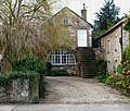 Bishop Monkton Granary - geograph.org.uk - 1203099.jpg 640 × 542; 151 KB
-
 Bishop Monkton Methodist Church - geograph.org.uk - 6617811.jpg 1,600 × 1,065; 524 KB
-
 Bishop Monkton Moor - geograph.org.uk - 4901683.jpg 640 × 359; 37 KB
-
 Bishop Monkton Moor - geograph.org.uk - 4901685.jpg 640 × 426; 46 KB
-
 Bishop Monkton Moor - geograph.org.uk - 5637707.jpg 3,884 × 2,569; 1.87 MB
-
 Bishop Monkton village - geograph.org.uk - 781719.jpg 640 × 480; 115 KB
-
 Bishop's Barn - geograph.org.uk - 1046363.jpg 640 × 469; 111 KB
-
 Boroughbridge Road approaching Dordy Flats Wood - geograph.org.uk - 6355037.jpg 4,000 × 3,000; 3.46 MB
-
 Boroughbridge Road crossing the Holbeck - geograph.org.uk - 5509871.jpg 1,024 × 768; 707 KB
-
 Boroughbridge Road enters Bishop Monkton - geograph.org.uk - 6617688.jpg 1,600 × 1,065; 640 KB
-
 Boroughbridge Road heading east - geograph.org.uk - 2466599.jpg 640 × 480; 75 KB
-
 Boroughbridge Road heading east - geograph.org.uk - 2466618.jpg 1,600 × 1,200; 650 KB
-
 Boroughbridge Road in Bishop Monkton - geograph.org.uk - 6355015.jpg 4,000 × 3,000; 3.75 MB
-
 Boroughbridge Road towards Bishop Monkton - geograph.org.uk - 6617685.jpg 1,600 × 1,065; 594 KB
-
 Bowling Green, Bishop Monkton - geograph.org.uk - 630180.jpg 640 × 480; 55 KB
-
 Bridge and Water Pump - geograph.org.uk - 2529721.jpg 1,600 × 1,200; 677 KB
-
 Bridge over Holbeck - geograph.org.uk - 384306.jpg 640 × 479; 42 KB
-
 Bridgend Cottage - geograph.org.uk - 1203110.jpg 640 × 480; 99 KB
-
 By Knaresborough Road - geograph.org.uk - 5650784.jpg 2,751 × 4,244; 2.27 MB
-
 Caravan Site, Milner Hill - geograph.org.uk - 272151.jpg 640 × 426; 90 KB
-
 Cattle With Tags in Their Ears - geograph.org.uk - 835005.jpg 640 × 427; 97 KB
-
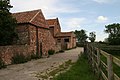
 Church Farm, Bishop Monkton - geograph.org.uk - 6617969.jpg 1,600 × 1,065; 406 KB
-
 Converted telephone exchange - geograph.org.uk - 5643301.jpg 2,848 × 4,288; 2.37 MB
-
 Cricket in Bishop Monkton - geograph.org.uk - 5390159.jpg 640 × 427; 204 KB
-
 Croft Lane - geograph.org.uk - 817351.jpg 640 × 427; 86 KB
-
 Crossing on the A61 - geograph.org.uk - 2041344.jpg 640 × 480; 49 KB
-

-
 Deck of the Bridge - geograph.org.uk - 839499.jpg 480 × 640; 106 KB
-
 Demains Beck - geograph.org.uk - 3098693.jpg 4,320 × 3,240; 4.78 MB
-
 Demains Rains - geograph.org.uk - 1599374.jpg 640 × 480; 91 KB
-
 Dismantled railway - geograph.org.uk - 4781619.jpg 640 × 427; 57 KB
-
 Dismantled railway, from Monkton Moor Bridge - geograph.org.uk - 5642937.jpg 3,110 × 1,754; 563 KB
-
 Disused railway bridge - geograph.org.uk - 2466556.jpg 2,592 × 1,944; 1.08 MB
-
 Dordy Flats Wood - geograph.org.uk - 834934.jpg 640 × 427; 103 KB
-
 Ducks in Bishop Monkton - geograph.org.uk - 384331.jpg 640 × 479; 68 KB
-
 Entrance drive to Park Green - geograph.org.uk - 5650563.jpg 2,797 × 3,664; 1.97 MB
-
 Fairfield Fishery Track - geograph.org.uk - 372860.jpg 640 × 480; 125 KB
-
 Farm and railway embankment - geograph.org.uk - 4781614.jpg 640 × 427; 113 KB
-
 Farm Buildings - geograph.org.uk - 817660.jpg 640 × 427; 75 KB
-
 Farm road to Leyton Lees - geograph.org.uk - 6735986.jpg 3,861 × 4,576; 2.71 MB
-
 Farmers Bridge over Holbeck - geograph.org.uk - 839492.jpg 640 × 395; 61 KB
-
 Farmland by Mains Lane - geograph.org.uk - 6010424.jpg 4,266 × 2,428; 1.37 MB
-
 Farmland in heavy rainfall - geograph.org.uk - 4901662.jpg 640 × 350; 25 KB
-
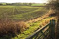
 Farmland near Bishop Monkton - geograph.org.uk - 2466581.jpg 1,600 × 1,200; 303 KB
-
 Farmland near Bishop Monkton - geograph.org.uk - 372843.jpg 640 × 480; 85 KB
-
 Farmland near Park Green - geograph.org.uk - 4781615.jpg 640 × 427; 71 KB
-
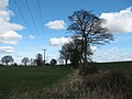
 Farmland near Wormald Green - geograph.org.uk - 6010128.jpg 4,288 × 2,848; 2.72 MB
-
 Farmland off Boroughbridge Road - geograph.org.uk - 2466614.jpg 1,600 × 1,200; 498 KB
-
 Farmland off Mains Lane - geograph.org.uk - 2775094.jpg 640 × 480; 76 KB
-
 Farmland off Moor Road - geograph.org.uk - 4781618.jpg 640 × 427; 89 KB
-
 Farmland off Pottery Lane - geograph.org.uk - 2466542.jpg 1,600 × 1,200; 369 KB
-
 Farmland off Thwaites Lane - geograph.org.uk - 2775116.jpg 640 × 480; 73 KB
-
 Farmland, Bishop Monkton Moor - geograph.org.uk - 2775118.jpg 640 × 480; 47 KB
-
 Field by Knaresborough Road - geograph.org.uk - 6011714.jpg 4,288 × 2,848; 1.35 MB
-
 Field by Mains Lane - geograph.org.uk - 6009380.jpg 4,254 × 2,434; 1.9 MB
-
 Field by Mains Lane - geograph.org.uk - 6010165.jpg 3,855 × 2,243; 1.54 MB
-
 Field by Mains Lane - geograph.org.uk - 6010172.jpg 3,546 × 2,124; 1.3 MB
-
 Field by Mains Lane - geograph.org.uk - 6010175.jpg 3,825 × 2,468; 1.03 MB
-
 Field by Mains Lane - geograph.org.uk - 6010397.jpg 4,288 × 2,848; 2.47 MB
-
 Field by Mains Lane - geograph.org.uk - 6011460.jpg 2,180 × 1,178; 354 KB
-
 Field by Mains Lane - geograph.org.uk - 6011472.jpg 2,140 × 1,227; 427 KB
-
 Field by Moor Road - geograph.org.uk - 5642913.jpg 4,288 × 2,848; 2.11 MB
-
 Field by Moor Road - geograph.org.uk - 5642924.jpg 4,265 × 2,616; 1.28 MB
-
 Field near Monkton Mains - geograph.org.uk - 6009834.jpg 4,263 × 2,552; 1.19 MB
-
 Field near Monkton Mains - geograph.org.uk - 6010018.jpg 4,021 × 2,445; 1.45 MB
-
 Field near Wormald Green - geograph.org.uk - 6007227.jpg 4,288 × 2,848; 2.53 MB
-
 Footbridge over Demains Beck - geograph.org.uk - 694471.jpg 640 × 480; 131 KB
-

-
 Footpath to Burton Leonard - geograph.org.uk - 6009993.jpg 4,288 × 2,575; 1.89 MB
-
 Former Bishop Monkton Mill, Bishop Monkton - geograph.org.uk - 6617806.jpg 1,600 × 1,065; 547 KB
-
 Former railway bridge on Knaresborough Road - geograph.org.uk - 6618338.jpg 1,600 × 1,065; 669 KB
-
 Garage, Wormald Green - geograph.org.uk - 2775097.jpg 640 × 480; 41 KB
-
 Gathering for the start - geograph.org.uk - 5390151.jpg 640 × 427; 225 KB
-
 Grantley Wood - geograph.org.uk - 1142620.jpg 640 × 354; 55 KB
-
 Graveyard at St John the Baptist Church, Bishop Monkton - geograph.org.uk - 6617963.jpg 1,600 × 1,065; 811 KB
-
 Hall Farm - geograph.org.uk - 1208499.jpg 640 × 480; 101 KB
-
 Hedge by Knaresborough Road - geograph.org.uk - 6011703.jpg 3,863 × 1,724; 1.64 MB
-
 Hedgerow trees along the Demains Beck - geograph.org.uk - 5636076.jpg 2,686 × 1,455; 538 KB
-
 Hedgerow trees along the Demains Beck - geograph.org.uk - 5650652.jpg 4,288 × 2,039; 712 KB
-
 Holbeck Culvert - geograph.org.uk - 839447.jpg 640 × 490; 120 KB
-

-
 Houses, Bishop Monkton - geograph.org.uk - 5650561.jpg 4,149 × 2,722; 895 KB
-
 Ings Drain - geograph.org.uk - 817441.jpg 640 × 427; 86 KB
-
 Ings Lane (West) - geograph.org.uk - 271063.jpg 640 × 426; 81 KB
-
 Ings Lane - geograph.org.uk - 817372.jpg 640 × 427; 106 KB
-
 Junction of Thwaites lane with the A61 - geograph.org.uk - 5730573.jpg 4,084 × 2,474; 2.17 MB
-
 Knaresborough Road - geograph.org.uk - 5650790.jpg 3,883 × 2,537; 1.27 MB
-
 Knaresborough Road - geograph.org.uk - 6009605.jpg 1,942 × 1,297; 301 KB
-
 Knaresborough Road - geograph.org.uk - 6011564.jpg 3,229 × 1,920; 988 KB
-
 Knaresborough Road Bridge - geograph.org.uk - 1599360.jpg 640 × 417; 94 KB
-
 Knaresborough road towards Bishop Monkton - geograph.org.uk - 2466588.jpg 1,600 × 1,200; 439 KB
-
 Knaresborough Road, Bishop Monkton - geograph.org.uk - 6618286.jpg 1,600 × 1,065; 458 KB
-
 Knaresborough Road, Bishop Monkton - geograph.org.uk - 6618288.jpg 1,600 × 1,068; 512 KB
-
 Lake through the trees - geograph.org.uk - 533880.jpg 640 × 480; 151 KB
-
 Low Demains - geograph.org.uk - 4781612.jpg 640 × 427; 80 KB
-
 Low Demains - geograph.org.uk - 5637947.jpg 4,286 × 2,642; 2.57 MB
-
 Low Demains Farm on Knaresborough Road - geograph.org.uk - 6618345.jpg 1,600 × 1,065; 448 KB
-
 Mains Lane (track) - geograph.org.uk - 2775096.jpg 640 × 480; 103 KB
-
 Mains Lane - geograph.org.uk - 3097388.jpg 4,320 × 3,240; 6.59 MB
-
 Mains Lane - geograph.org.uk - 6007233.jpg 2,908 × 1,616; 863 KB
-
 Mains Lane - geograph.org.uk - 6009364.jpg 4,288 × 2,848; 1.63 MB
-
 Mains Lane - geograph.org.uk - 6009385.jpg 3,264 × 1,832; 1.42 MB
-
 Mains Lane - geograph.org.uk - 6009394.jpg 2,851 × 1,710; 1,006 KB
-
 Mains Lane - geograph.org.uk - 6009397.jpg 1,832 × 3,150; 1.64 MB
-
 Mains Lane - geograph.org.uk - 6010155.jpg 2,775 × 1,537; 506 KB
-
 Mains Lane - geograph.org.uk - 6010210.jpg 3,541 × 2,172; 1.4 MB
-
 Mains Lane - geograph.org.uk - 6010384.jpg 1,397 × 1,585; 282 KB
-
 Mains Lane - geograph.org.uk - 6010412.jpg 4,288 × 2,848; 1.96 MB
-
 Mains Lane - geograph.org.uk - 6011075.jpg 2,536 × 3,833; 1.93 MB
-
 Mains Lane approaching Bishop Monkton - geograph.org.uk - 3098651.jpg 4,320 × 3,240; 5.9 MB
-
 Mains Lane Bridleway - geograph.org.uk - 351214.jpg 640 × 480; 93 KB
-
 Mason Arms public house, Bishop Monkton - geograph.org.uk - 6617822.jpg 1,600 × 1,065; 473 KB
-
 Masons Arms - geograph.org.uk - 1204014.jpg 640 × 480; 100 KB
-
 Masons Arms, Bishop Monkton - geograph.org.uk - 630147.jpg 640 × 444; 73 KB
-
 Mechanics Institution - geograph.org.uk - 817726.jpg 640 × 521; 74 KB
-
 Mill Pond - geograph.org.uk - 1983946.jpg 1,928 × 1,352; 1.76 MB
-
 Minor road junction near Bishop Monkton - geograph.org.uk - 2466572.jpg 1,600 × 1,200; 520 KB
-
 Minor road towards Bishop Monkton - geograph.org.uk - 2466551.jpg 1,600 × 1,200; 468 KB
-
 Minor road towards Bishop Monkton - geograph.org.uk - 2466568.jpg 1,600 × 1,200; 626 KB
-
 Monkton Mains - geograph.org.uk - 1133904.jpg 640 × 480; 110 KB
-
 Monkton Moor Bridge - geograph.org.uk - 5642933.jpg 3,244 × 1,832; 473 KB
-
 Monkton Moor Bridge - geograph.org.uk - 5643289.jpg 4,157 × 2,534; 1.04 MB
-
 Monkton Moor Garage on Harrogate Road, Wormald Green - geograph.org.uk - 6618258.jpg 1,600 × 1,239; 625 KB
-
 Moor Lane heading towards Burton Grange - geograph.org.uk - 6354982.jpg 4,000 × 3,000; 2.74 MB
-
 Moor Rd - geograph.org.uk - 4901668.jpg 640 × 426; 43 KB
-
 Moor Road - geograph.org.uk - 3216206.jpg 1,600 × 1,200; 692 KB
-
 Moor Road - geograph.org.uk - 5637719.jpg 1,536 × 945; 322 KB
-
 Moor Road - geograph.org.uk - 5642917.jpg 3,729 × 2,570; 1.63 MB
-
 Moor Road - geograph.org.uk - 5642925.jpg 4,066 × 2,496; 969 KB
-
 Moor Road approaching its junction with Harrogate Road (A61) - geograph.org.uk - 6354974.jpg 4,000 × 3,000; 3.37 MB
-
 Moor Road approaching Monkton Moor Bridge - geograph.org.uk - 6068467.jpg 1,024 × 683; 198 KB
-
 Moor Road crossing Bishop Monkton Moor - geograph.org.uk - 6354968.jpg 4,000 × 3,000; 3.19 MB
-

-
 Moor Road towards Bishop Monkton - geograph.org.uk - 6618266.jpg 1,600 × 1,105; 590 KB
-
 Moor Road towards Bishop Monkton - geograph.org.uk - 6618268.jpg 1,600 × 1,099; 529 KB
-
 Moor Road, Bishop Monkton - geograph.org.uk - 6068466.jpg 1,024 × 683; 279 KB
-
 Mud ahead^ - geograph.org.uk - 694461.jpg 480 × 640; 88 KB
-
 Narrowboats on the south bank of the River Ure - geograph.org.uk - 5872360.jpg 1,024 × 768; 182 KB
-
 New arrivals in Bishop Monkton - geograph.org.uk - 805419.jpg 640 × 436; 77 KB
-
 New housing off Knaresborough Road, Bishop Monkton - geograph.org.uk - 6618332.jpg 1,600 × 1,065; 346 KB
-

-
 Not much more than a ditch - geograph.org.uk - 5219698.jpg 3,240 × 4,320; 4.62 MB
-
 Old Milepost by the A61, Harrogate Road, Bishop Monkton parish (geograph 6072544).jpg 1,722 × 2,565; 370 KB
-
 Old Railway Bridge - geograph.org.uk - 271089.jpg 640 × 426; 108 KB
-
 Old railway bridge - geograph.org.uk - 4781621.jpg 640 × 427; 80 KB
-
 Old railway embankment, Low Demains - geograph.org.uk - 5650802.jpg 4,273 × 2,467; 1.56 MB
-
 On Mains Lane - geograph.org.uk - 3098594.jpg 4,320 × 3,240; 3 MB
-
 Park Green - geograph.org.uk - 5650562.jpg 3,250 × 1,371; 386 KB
-
 Park Green, Bishop Monkton - geograph.org.uk - 630169.jpg 640 × 480; 45 KB
-
 Path and track junction, Monkton Mains - geograph.org.uk - 6010035.jpg 4,288 × 2,622; 2.34 MB
-
 Path through woodland near Newby Hall - geograph.org.uk - 2466677.jpg 640 × 480; 152 KB
-
 Pond, Bishop Monkton - geograph.org.uk - 6009587.jpg 4,069 × 2,496; 1.65 MB
-
 Postbox in lay-by, A61 - geograph.org.uk - 5642911.jpg 4,288 × 2,848; 1.03 MB
-
 Postbox on A61 - geograph.org.uk - 5986325.jpg 2,848 × 4,288; 994 KB
-
 Pottery Lane, Littlethorpe - geograph.org.uk - 372853.jpg 640 × 480; 132 KB
-
 Puddles and farmland by Knaresborough Road - geograph.org.uk - 6009599.jpg 3,824 × 2,165; 1.49 MB
-
 Railway bridge on Pottery Lane - geograph.org.uk - 5509842.jpg 1,024 × 768; 755 KB
-
 Railway bridge, Knaresborough Road - geograph.org.uk - 5637731.jpg 3,881 × 2,573; 1.21 MB
-
 Rains at Low Demains - geograph.org.uk - 1599348.jpg 640 × 480; 105 KB
-
 Rape growing - geograph.org.uk - 388842.jpg 640 × 478; 260 KB
-
 Reflections in the Ure - geograph.org.uk - 694464.jpg 480 × 640; 114 KB
-
 Relief bridge over the Holbeck - geograph.org.uk - 5509867.jpg 1,024 × 768; 642 KB
-
 Renton Close, Bishop Monkton - geograph.org.uk - 6617809.jpg 1,600 × 1,078; 532 KB
-
 Residences next to the A61 north of Wormald Green - geograph.org.uk - 3518178.jpg 2,491 × 2,087; 1.47 MB
-
 Ridge and furrow by Moor Road - geograph.org.uk - 5650560.jpg 4,036 × 2,154; 954 KB
-
 Ripon Canal - geograph.org.uk - 5191.jpg 640 × 480; 46 KB
-
 Ripon Rowel beside the River Ure - geograph.org.uk - 4537989.jpg 5,184 × 3,456; 7.7 MB
-
 Ripon Rowel Walk leaves Boroughbridge Road - geograph.org.uk - 3135961.jpg 2,048 × 1,536; 568 KB
-
 River Ure near Bishop Monkton - geograph.org.uk - 4537983.jpg 5,184 × 3,456; 7.2 MB
-
 Road to Copgrove - geograph.org.uk - 6009614.jpg 3,049 × 1,663; 852 KB
-
 Rockery Bridge - geograph.org.uk - 835214.jpg 640 × 427; 101 KB


_-_geograph.org.uk_-_271063.jpg)


_-_geograph.org.uk_-_2775096.jpg)


_-_geograph.org.uk_-_6354974.jpg)


.jpg)


