Category:Bishop Burton
Jump to navigation
Jump to search
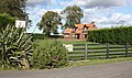
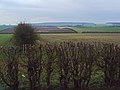
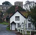
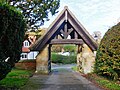
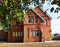
English: Bishop Burton is a village and civil parish in the East Riding of Yorkshire, England. It lies on the A1079 road approximately 3 miles (4.8 km) to the west of the market town of Beverley.
village and civil parish in East Riding of Yorkshire, United Kingdom   | |||||
| Upload media | |||||
| Instance of | |||||
|---|---|---|---|---|---|
| Location | East Riding of Yorkshire, Yorkshire and the Humber, England | ||||
| Population |
| ||||
 | |||||
Subcategories
This category has the following 6 subcategories, out of 6 total.
A
B
- Bishop Burton College (7 F)
- Bishop Burton War Memorial (5 F)
H
- Hedges in Bishop Burton (34 F)
K
- Killingwoldgraves (6 F)
T
- Trees in Bishop Burton (35 F)
Media in category "Bishop Burton"
The following 200 files are in this category, out of 632 total.
(previous page) (next page)-
 "The Altisidora", Bishop Burton - geograph.org.uk - 184469.jpg 640 × 480; 95 KB
-

-

-
-
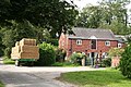
 A House in Pudding Gate, Bishop Burton - geograph.org.uk - 698528.jpg 640 × 480; 116 KB
-
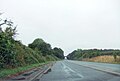
 A lay-by on the A1079(T) - geograph.org.uk - 2389834.jpg 800 × 600; 270 KB
-
 A minor road to Bishop Burton - geograph.org.uk - 1278229.jpg 640 × 480; 139 KB
-
 A Ploughed Wolds' Field - geograph.org.uk - 1278307.jpg 640 × 480; 152 KB
-
 A quiet corner of Bishop Burton - geograph.org.uk - 6152161.jpg 1,024 × 768; 280 KB
-
 A walk in Dale Gate - geograph.org.uk - 3877782.jpg 640 × 427; 101 KB
-
 A Way To Church, Bishop Burton - geograph.org.uk - 184495.jpg 640 × 480; 111 KB
-
 A wet day on the A1079 - geograph.org.uk - 6260698.jpg 1,024 × 691; 110 KB
-
 A Wolds' Farm Track - geograph.org.uk - 1278313.jpg 480 × 640; 161 KB
-
 A Wolds' Farm Track - geograph.org.uk - 1278318.jpg 640 × 480; 123 KB
-
 A1035 - geograph.org.uk - 5358617.jpg 640 × 426; 62 KB
-
 A1035, Dog Kennel Lane - geograph.org.uk - 5358623.jpg 640 × 426; 73 KB
-
 A1079 at Bishop Burton village boundary - geograph.org.uk - 5923809.jpg 1,024 × 741; 179 KB
-
 A1079 Beverley Road - geograph.org.uk - 5923823.jpg 1,024 × 758; 158 KB
-
 A1079 towards Beverley - geograph.org.uk - 1861781.jpg 640 × 480; 98 KB
-
 A1174 eastbound near Burton Bushes - geograph.org.uk - 5923838.jpg 1,024 × 753; 128 KB
-
 Abandoned trailers - geograph.org.uk - 4211511.jpg 1,024 × 768; 239 KB
-
 Access Bridge, A1079 - geograph.org.uk - 5358622.jpg 640 × 426; 47 KB
-
 Across York Road, Bishop Burton - geograph.org.uk - 6507407.jpg 1,024 × 745; 1.48 MB
-
 All Pylon - geograph.org.uk - 2507733.jpg 2,638 × 3,464; 1.55 MB
-
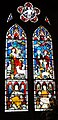
 All Saint's Church, Bishop Burton - geograph.org.uk - 5461692.jpg 1,200 × 799; 328 KB
-

-
 All Saints Church Graveyard - geograph.org.uk - 2432062.jpg 640 × 480; 80 KB
-
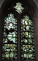
 All Saints church, Bishop Burton - geograph.org.uk - 3403211.jpg 1,024 × 768; 275 KB
-
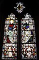
 All Saints Church, Bishop Burton - geograph.org.uk - 4675457.jpg 4,848 × 3,624; 4.73 MB
-
 All Saints Church, Church Lane, Bishop Burton - geograph.org.uk - 3254634.jpg 1,600 × 1,200; 395 KB
-
 All Saints Church, Church Lane, Bishop Burton - geograph.org.uk - 3254641.jpg 1,600 × 1,200; 266 KB
-
 All Saints Parish Church. Bishop Burton - geograph.org.uk - 6672614.jpg 4,608 × 3,456; 3.96 MB
-
 All Saints' Church, Bishop Burton - geograph.org.uk - 5459987.jpg 756 × 1,200; 424 KB
-
 All Saints' Church, Bishop Burton - geograph.org.uk - 5459992.jpg 748 × 1,200; 439 KB
-
 All Saints' Church, Bishop Burton - geograph.org.uk - 5459997.jpg 679 × 1,200; 414 KB
-
 All Saints' Church, Bishop Burton - geograph.org.uk - 5459999.jpg 715 × 1,200; 435 KB
-
 All Saints' Church, Bishop Burton - geograph.org.uk - 5460005.jpg 721 × 1,200; 428 KB
-
 All Saints' Church, Bishop Burton - geograph.org.uk - 5460027.jpg 762 × 1,200; 429 KB
-
 All Saints' Church, Bishop Burton - geograph.org.uk - 5460031.jpg 699 × 1,200; 396 KB
-
 All Saints' Church, Bishop Burton - geograph.org.uk - 5460038.jpg 1,200 × 799; 226 KB
-
 All Saints' Church, Bishop Burton - geograph.org.uk - 5460042.jpg 580 × 1,200; 375 KB
-
 All Saints' Church, Bishop Burton - geograph.org.uk - 5460046.jpg 1,200 × 799; 288 KB
-
 All Saints' Church, Bishop Burton - geograph.org.uk - 5460049.jpg 618 × 1,200; 379 KB
-
 All Saints' Church, Bishop Burton - geograph.org.uk - 5460051.jpg 730 × 1,200; 311 KB
-
 All Saints' Church, Bishop Burton - geograph.org.uk - 5460053.jpg 906 × 1,200; 512 KB
-
 All Saints' Church, Bishop Burton - geograph.org.uk - 5460068.jpg 660 × 1,200; 364 KB
-
 All Saints' Church, Bishop Burton - geograph.org.uk - 5460070.jpg 591 × 1,200; 418 KB
-
 All Saints' Church, Bishop Burton - geograph.org.uk - 5460074.jpg 1,200 × 799; 281 KB
-
 All Saints' Church, Bishop Burton - geograph.org.uk - 5460079.jpg 693 × 1,200; 426 KB
-
 All Saints' Church, Bishop Burton - geograph.org.uk - 5460085.jpg 712 × 1,200; 411 KB
-
 All Saints' Church, Bishop Burton - geograph.org.uk - 5460088.jpg 767 × 1,200; 468 KB
-
 All Saints' Church, Bishop Burton - geograph.org.uk - 5460092.jpg 1,200 × 799; 287 KB
-
 Alma House - York Road - geograph.org.uk - 2432147.jpg 480 × 640; 52 KB
-
 Alongside Calais Farm - geograph.org.uk - 4215699.jpg 1,024 × 768; 218 KB
-
 Alongside Deepdale Plantation - geograph.org.uk - 4530441.jpg 1,024 × 768; 149 KB
-
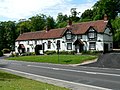
 Altisidora Public House - geograph.org.uk - 5459921.jpg 1,200 × 799; 397 KB
-
 Altisidora Public House - geograph.org.uk - 5459926.jpg 895 × 1,200; 285 KB
-
 Altisidora Public House, Bishop Burton - geograph.org.uk - 3254809.jpg 1,600 × 1,200; 402 KB
-
 Approaching Bishop Burton from the East - geograph.org.uk - 3403203.jpg 640 × 425; 148 KB
-
 Approaching Bishop Burton on the A1079 - geograph.org.uk - 5012751.jpg 4,608 × 3,456; 6.41 MB
-
 Approaching Killingwoldgraves roundabout - geograph.org.uk - 2122294.jpg 800 × 600; 238 KB
-
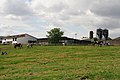
 Ashfield Farm - geograph.org.uk - 1013124.jpg 640 × 377; 184 KB
-
 Ashfield Farm - geograph.org.uk - 1013130.jpg 640 × 380; 182 KB
-
 Autumn on Cow Wold Road - geograph.org.uk - 4209145.jpg 899 × 1,024; 202 KB
-
 Back entrance to Bishop Burton College - geograph.org.uk - 6260712.jpg 1,024 × 768; 197 KB
-
 Bales near Bishop Burton - geograph.org.uk - 2575116.jpg 614 × 640; 211 KB
-
 Bales still in a field in January - geograph.org.uk - 3375846.jpg 4,000 × 3,000; 3.35 MB
-
 Barley in Flowery Dale - geograph.org.uk - 869768.jpg 480 × 640; 173 KB
-
 Barn conversion - geograph.org.uk - 3140563.jpg 640 × 427; 119 KB
-
 Barn House - The Green - geograph.org.uk - 2432074.jpg 640 × 480; 87 KB
-
 Barn, bench and bin - geograph.org.uk - 4208952.jpg 1,024 × 764; 166 KB
-
 Bend in the road towards Bishop Burton - geograph.org.uk - 6360736.jpg 800 × 600; 192 KB
-
 Beverley Road, Bishop Burton, Yorkshire - geograph.org.uk - 5177848.jpg 2,424 × 3,246; 3.65 MB
-
 Beverley Road, Bishop Burton, Yorkshire - geograph.org.uk - 5177857.jpg 2,424 × 3,246; 3.58 MB
-
 Beverley Road, Bishop Burton, Yorkshire - geograph.org.uk - 5206337.jpg 3,224 × 2,392; 3.62 MB
-
 Beverley Road, Bishop Burton, Yorkshire - geograph.org.uk - 5206342.jpg 3,228 × 2,398; 4.21 MB
-
 Beverley Road, Bishop Burton, Yorkshire - geograph.org.uk - 5206359.jpg 3,248 × 2,428; 4.06 MB
-
 Beverley Road, Bishop Burton, Yorkshire - geograph.org.uk - 5206367.jpg 3,218 × 2,386; 4.79 MB
-
 Beverley Road, Bishop Burton, Yorkshire - geograph.org.uk - 5206374.jpg 3,242 × 2,420; 4.29 MB
-
 Beverley Road, Bishop Burton, Yorkshire - geograph.org.uk - 5206380.jpg 3,264 × 2,448; 3.84 MB
-
 Beverley Road, Bishop Burton, Yorkshire - geograph.org.uk - 5206557.jpg 3,264 × 2,448; 3.71 MB
-
 Beverley Road, Bishop Burton, Yorkshire - geograph.org.uk - 5206561.jpg 3,260 × 2,444; 4.17 MB
-
 Big old tree bites the dust - geograph.org.uk - 3829556.jpg 640 × 427; 77 KB
-
 Bishop Burton - panoramio (1).jpg 979 × 734; 223 KB
-
 Bishop Burton - panoramio.jpg 2,000 × 603; 601 KB
-
 Bishop Burton - SE - geograph.org.uk - 97620.jpg 640 × 480; 153 KB
-
 Bishop Burton - SW - geograph.org.uk - 97622.jpg 640 × 480; 104 KB
-
 Bishop Burton across the Village Pond - geograph.org.uk - 184465.jpg 640 × 480; 109 KB
-
 Bishop Burton and the 'Altisidora' Inn - geograph.org.uk - 75981.jpg 640 × 469; 91 KB
-
 Bishop Burton bale - geograph.org.uk - 2575112.jpg 640 × 426; 191 KB
-
 Bishop Burton Barn and Bench - geograph.org.uk - 3140553.jpg 640 × 427; 70 KB
-

-
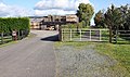
 Bishop Burton College - geograph.org.uk - 2992783.jpg 3,872 × 2,592; 3.34 MB
-
 Bishop Burton College Main Entrance - geograph.org.uk - 3166161.jpg 1,706 × 1,137; 560 KB
-
-

-

-
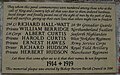 Bishop Burton First World War Memorial Plaque - geograph.org.uk - 5459934.jpg 1,200 × 751; 438 KB
-
 Bishop Burton First World War Memorial Plaque - geograph.org.uk - 5459936.jpg 1,200 × 799; 538 KB
-
 Bishop Burton Grange - geograph.org.uk - 6507459.jpg 1,024 × 709; 1.2 MB
-
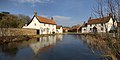
 Bishop Burton Houses and Small Pond - geograph.org.uk - 302652.jpg 640 × 427; 116 KB
-
 Bishop Burton Methodist Chapel - geograph.org.uk - 302678.jpg 640 × 427; 83 KB
-
 Bishop Burton Milestone - geograph.org.uk - 2264014.jpg 3,648 × 2,736; 4.83 MB
-
 Bishop Burton pond - geograph.org.uk - 2575340.jpg 640 × 446; 190 KB
-
 Bishop Burton Road - geograph.org.uk - 6260707.jpg 1,024 × 678; 213 KB
-
 Bishop Burton Road dipping down through woodland - geograph.org.uk - 5012667.jpg 3,018 × 2,232; 3.15 MB
-
 Bishop Burton Road toward Cherry Burton - geograph.org.uk - 5012732.jpg 2,928 × 2,095; 2.19 MB
-
 Bishop Burton UK parish locator map.svg 1,425 × 1,107; 1.68 MB
-
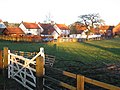
 Bishop Burton Village Pond - geograph.org.uk - 184464.jpg 640 × 480; 116 KB
-
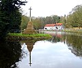
 Bishop Burton village pond and war memorial - geograph.org.uk - 4630881.jpg 1,600 × 1,200; 339 KB
-
 Bishop Burton village pond and war memorial - geograph.org.uk - 4675454.jpg 3,606 × 4,837; 3.9 MB
-
-
 Bishop Burton Wold - geograph.org.uk - 796548.jpg 640 × 480; 199 KB
-
 Bishop Burton Wold - geograph.org.uk - 99927.jpg 640 × 480; 160 KB
-
 Bishop Burton Wold - geograph.org.uk - 99930.jpg 640 × 480; 106 KB
-
 Bishop Burton Wold - North - geograph.org.uk - 99932.jpg 640 × 480; 106 KB
-

-
 Bishop Burton, Northend - panoramio.jpg 1,100 × 552; 242 KB
-
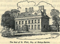 BishopBurtonHall BeverleyYorks 1829.png 787 × 581; 1.02 MB
-
 Boxing Day Hunt - geograph.org.uk - 97631.jpg 640 × 480; 101 KB
-
 Bridleway to Bishop Burton - geograph.org.uk - 4530469.jpg 1,024 × 768; 178 KB
-
 Bridleway to Bishop Burton - geograph.org.uk - 4845830.jpg 1,024 × 768; 163 KB
-
 Bryan Mere, Bishop Burton - geograph.org.uk - 6507413.jpg 1,024 × 837; 1.43 MB
-
 Bryan Mere, Bishop Burton, Yorkshire - geograph.org.uk - 5182604.jpg 3,264 × 2,448; 2.75 MB
-
 Bryan Mere, Bishop Burton, Yorkshire - geograph.org.uk - 5182607.jpg 3,248 × 2,428; 2.34 MB
-
 Bryan Mere, Bishop Burton, Yorkshire - geograph.org.uk - 5182610.jpg 3,264 × 2,448; 3.19 MB
-
 Bryan Mere, Bishop Burton, Yorkshire - geograph.org.uk - 5206566.jpg 3,248 × 2,428; 2.97 MB
-
 Bryan Mere, Bishop Burton, Yorkshire - geograph.org.uk - 5206570.jpg 3,264 × 2,448; 3.27 MB
-
 Bryan Mere, Bishop Burton, Yorkshire - geograph.org.uk - 5206712.jpg 3,264 × 2,448; 3.98 MB
-
 Bryan Mere, Bishop Burton, Yorkshire - geograph.org.uk - 5206713.jpg 3,264 × 2,448; 4.23 MB
-
 Bryan Mere, Bishop Burton, Yorkshire - geograph.org.uk - 5206716.jpg 3,224 × 2,392; 3.4 MB
-
 Burton Bradstock village centre, East Riding - geograph.org.uk - 2118159.jpg 1,600 × 1,200; 314 KB
-
 Burton Gatehouse from the Westwood - geograph.org.uk - 4444545.jpg 4,606 × 3,454; 7.48 MB
-
 Burton Rakes - geograph.org.uk - 99928.jpg 640 × 480; 158 KB
-
 Burton Rakes Farm - geograph.org.uk - 1861799.jpg 640 × 480; 58 KB
-

-
 Bus stop and shelter on York Road, Bishop Burton - geograph.org.uk - 6354143.jpg 5,184 × 3,888; 6.73 MB
-
 Bus stop and shelter on York Road, Bishop Burton - geograph.org.uk - 6354146.jpg 5,184 × 3,888; 6.36 MB
-
 Bus stop on York Road, Bishop Burton - geograph.org.uk - 6354145.jpg 5,184 × 3,888; 6.43 MB
-
 By Mere Cottage, Bishop Burton - geograph.org.uk - 4675455.jpg 3,698 × 4,683; 4.75 MB
-
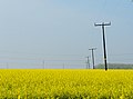 Cables and rape - geograph.org.uk - 796688.jpg 640 × 473; 156 KB
-
 Calais Croft, Bishop Burton, Yorkshire - geograph.org.uk - 5206720.jpg 3,248 × 2,428; 3.46 MB
-
 Calais Croft, Bishop Burton, Yorkshire - geograph.org.uk - 5206723.jpg 3,256 × 2,436; 3.47 MB
-
 Callas, Bishop Burton, Yorkshire - geograph.org.uk - 5179156.jpg 3,256 × 2,436; 2.98 MB
-
 Callas, Bishop Burton, Yorkshire - geograph.org.uk - 5179191.jpg 3,264 × 2,448; 2.63 MB
-
 Callas, Bishop Burton, Yorkshire - geograph.org.uk - 5179200.jpg 3,264 × 2,448; 2.68 MB
-
 Callas, Bishop Burton, Yorkshire - geograph.org.uk - 5182619.jpg 3,194 × 2,352; 2.78 MB
-
 Callas, Bishop Burton, Yorkshire - geograph.org.uk - 5182628.jpg 3,228 × 2,398; 2.4 MB
-
 Callas, Bishop Burton, Yorkshire - geograph.org.uk - 5206727.jpg 3,264 × 2,448; 2.58 MB
-
 Callas, Bishop Burton, Yorkshire - geograph.org.uk - 5206738.jpg 3,242 × 2,420; 2.84 MB
-
 Callas, Bishop Burton, Yorkshire - geograph.org.uk - 5206928.jpg 3,264 × 2,448; 2.66 MB
-

-
 Cherry Burton Road, Bishop Burton, Yorkshire - geograph.org.uk - 5207053.jpg 3,264 × 2,448; 3.16 MB
-
 Cherry Burton Road, Bishop Burton, Yorkshire - geograph.org.uk - 5207059.jpg 3,264 × 2,448; 3.52 MB
-
 Cherry Burton Road, Bishop Burton, Yorkshire - geograph.org.uk - 5207061.jpg 3,264 × 2,448; 3.93 MB
-
 Cherry Burton Wold - geograph.org.uk - 761404.jpg 640 × 480; 179 KB
-
 Church Hill - geograph.org.uk - 4215712.jpg 1,024 × 768; 173 KB
-
 Church Hill - School Green - geograph.org.uk - 2432059.jpg 480 × 640; 53 KB
-
 Church Lane, Bishop Burton - geograph.org.uk - 5459981.jpg 1,200 × 799; 523 KB
-
 Church Lane, Bishop Burton - geograph.org.uk - 634322.jpg 640 × 625; 168 KB
-
 Church Lane, Bishop Burton, Yorkshire - geograph.org.uk - 3254933.jpg 1,600 × 1,200; 379 KB
-
 Church Lane, Bishop Burton, Yorkshire - geograph.org.uk - 5177868.jpg 3,264 × 2,448; 3.91 MB
-
 Church Lane, Bishop Burton, Yorkshire - geograph.org.uk - 5177876.jpg 3,264 × 2,448; 3.08 MB
-
 Church Lane, Bishop Burton, Yorkshire - geograph.org.uk - 5177880.jpg 2,783 × 2,146; 3.43 MB
-
 Church Lane, Bishop Burton, Yorkshire - geograph.org.uk - 5177885.jpg 3,262 × 2,446; 2.77 MB
-
 Church Lane, Bishop Burton, Yorkshire - geograph.org.uk - 5177903.jpg 3,224 × 2,392; 3.4 MB
-
 Church Lane, Bishop Burton, Yorkshire - geograph.org.uk - 5177917.jpg 3,264 × 2,448; 3.31 MB
-
 Church Lane, Bishop Burton, Yorkshire - geograph.org.uk - 5177938.jpg 3,240 × 2,414; 2.85 MB
-
 Church Lane, Bishop Burton, Yorkshire - geograph.org.uk - 5177943.jpg 3,246 × 2,424; 3.32 MB
-
 Church Lane, Bishop Burton, Yorkshire - geograph.org.uk - 5178116.jpg 3,242 × 2,420; 3.01 MB
-
 Church Lane, Bishop Burton, Yorkshire - geograph.org.uk - 5179366.jpg 2,940 × 2,433; 2.44 MB
-
 Church Lane, Bishop Burton, Yorkshire - geograph.org.uk - 5179393.jpg 3,240 × 2,414; 3.4 MB
-
 Church Lane, Bishop Burton, Yorkshire - geograph.org.uk - 5179400.jpg 3,242 × 2,420; 3.4 MB
-
 Church Lane, Bishop Burton, Yorkshire - geograph.org.uk - 5179406.jpg 2,161 × 3,045; 2.54 MB
-
 Church Lane, Bishop Burton, Yorkshire - geograph.org.uk - 5179420.jpg 3,264 × 2,448; 3.21 MB
-
 Church Lane, Bishop Burton, Yorkshire - geograph.org.uk - 5179448.jpg 4,304 × 3,276; 5.1 MB
-
 Church Lane, Bishop Burton, Yorkshire - geograph.org.uk - 5182634.jpg 3,264 × 2,448; 2.81 MB
-
 Church Lane, Bishop Burton, Yorkshire - geograph.org.uk - 5206326.jpg 2,278 × 3,115; 3.7 MB
-
 Church Lane, Bishop Burton, Yorkshire - geograph.org.uk - 5206332.jpg 2,386 × 3,218; 4.17 MB
-
 Church Lane, Bishop Burton, Yorkshire - geograph.org.uk - 5207067.jpg 3,264 × 2,448; 3.64 MB
-
 Church Lane, Bishop Burton, Yorkshire - geograph.org.uk - 5207072.jpg 2,424 × 3,246; 3.32 MB
-
 Church Lane, Bishop Burton, Yorkshire - geograph.org.uk - 5207078.jpg 3,264 × 2,448; 2.86 MB
-

-
 Church Side, Bishop Burton - geograph.org.uk - 2996822.jpg 3,872 × 2,592; 4.21 MB
-
 Church Side, Bishop Burton - geograph.org.uk - 481088.jpg 640 × 449; 96 KB
-
 Church Side, Bishop Burton - geograph.org.uk - 698515.jpg 640 × 480; 91 KB
-
 Church Side, Bishop Burton, Yorkshire - geograph.org.uk - 5178144.jpg 3,240 × 2,414; 3.33 MB
-
 Church Side, Bishop Burton, Yorkshire - geograph.org.uk - 5178220.jpg 3,248 × 2,428; 3.66 MB
-
 Church Side, Bishop Burton, Yorkshire - geograph.org.uk - 5178233.jpg 3,188 × 2,344; 3.22 MB
-
 Church Side, Bishop Burton, Yorkshire - geograph.org.uk - 5179436.jpg 3,228 × 2,398; 2.87 MB
-
 Church Side, Bishop Burton, Yorkshire - geograph.org.uk - 5179455.jpg 3,252 × 2,430; 3.77 MB
-
 Church Side, Bishop Burton, Yorkshire - geograph.org.uk - 5179469.jpg 1,932 × 2,463; 2.2 MB
-
 Church Side, Bishop Burton, Yorkshire - geograph.org.uk - 5179491.jpg 3,076 × 2,420; 3.3 MB
-
 Church Side, Bishop Burton, Yorkshire - geograph.org.uk - 5182640.jpg 2,160 × 1,611; 2.13 MB
-
 Church Side, Bishop Burton, Yorkshire - geograph.org.uk - 5207090.jpg 3,242 × 2,420; 3.3 MB
-
 Church Side, Bishop Burton, Yorkshire - geograph.org.uk - 5207099.jpg 3,214 × 2,380; 3.24 MB
-
 Climbing to the sky on the High Hunsley Circuit - geograph.org.uk - 6152167.jpg 1,024 × 768; 172 KB
-

-
 Close up, Elizabeth II postbox on York Road, Bishop Burton - geograph.org.uk - 6354140.jpg 2,185 × 4,185; 2.16 MB
-
 Cold Harbour - geograph.org.uk - 99924.jpg 640 × 480; 119 KB


_-_geograph.org.uk_-_2389834.jpg)


.jpg)


