Category:Bishop's Caundle
Jump to navigation
Jump to search
English: Bishop's Caundle is a small village and civil parish in the West Dorset district of Dorset in South West England; situated 6 miles south-east of Sherborne. The local travel links are located 4 miles from the village to Sherborne railway station and 28 miles to Bournemouth International Airport. The main road running through the village is the A3030, connecting Bishop's Caundle to Sherborne. The village has a population of 369 according to the 2001 Census.
village in United Kingdom  | |||||
| Upload media | |||||
| Instance of | |||||
|---|---|---|---|---|---|
| Location | Dorset, South West England, England | ||||
| Population |
| ||||
| Said to be the same as | Bishop's Caundle (Wikimedia duplicated page, civil parish) | ||||
 | |||||
Subcategories
This category has the following 2 subcategories, out of 2 total.
Media in category "Bishop's Caundle"
The following 42 files are in this category, out of 42 total.
-
 A3030 entering Bishops Caundle - geograph.org.uk - 3422194.jpg 640 × 441; 43 KB
-
 Barnes Cross near Holwell - geograph.org.uk - 380082.jpg 640 × 480; 200 KB
-
 Bend at Blind Lane - geograph.org.uk - 3422184.jpg 640 × 463; 60 KB
-
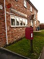 Bishop's Caundle, postbox № DT9 65 - geograph.org.uk - 1553884.jpg 480 × 640; 91 KB
-

-
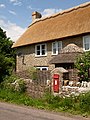
 Bishop's Caundle, the post office - geograph.org.uk - 1553879.jpg 640 × 480; 64 KB
-
 Bishops Caundle - geograph.org.uk - 1018793.jpg 640 × 428; 55 KB
-
 Bishops Caundle, entrance sign - geograph.org.uk - 2415023.jpg 640 × 402; 43 KB
-

-
-
 BT Exchange, Bishops Caundle - geograph.org.uk - 1018792.jpg 640 × 428; 58 KB
-

-
 Cemetery opposite SS Peter ^ Paul - geograph.org.uk - 3146196.jpg 640 × 480; 74 KB
-
 Cornford Bridge - geograph.org.uk - 386194.jpg 640 × 480; 140 KB
-
 Cottage near Bishop's Caundle - geograph.org.uk - 1095317.jpg 640 × 480; 155 KB
-
 Cottages in Bishop's Caundle - geograph.org.uk - 4832138.jpg 1,600 × 1,068; 311 KB
-
 Cottages, Bishop's Caundle - geograph.org.uk - 2063538.jpg 640 × 480; 70 KB
-
 Countryside near Bishops Caundle - geograph.org.uk - 1018794.jpg 640 × 428; 72 KB
-
 Countryside near Bishops Caundle - geograph.org.uk - 1018795.jpg 640 × 428; 49 KB
-
 Countryside near Bishops Caundle - geograph.org.uk - 1018811.jpg 640 × 428; 49 KB
-

-
 Derelict Barn, Bishops Caundle - geograph.org.uk - 1018812.jpg 640 × 428; 61 KB
-

-
 Evening in Bishops Caundle - geograph.org.uk - 3422216.jpg 640 × 415; 56 KB
-

-
 House on Milburn Lane - geograph.org.uk - 5186716.jpg 1,600 × 1,030; 535 KB
-
 Kissing gate, Bishop's Caundle - geograph.org.uk - 2063564.jpg 640 × 480; 77 KB
-

-
-
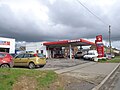 Murco filling station, Bishop's Caundle - geograph.org.uk - 4832131.jpg 1,600 × 1,200; 234 KB
-
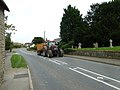
 Repairing Higher Wood Bridge, Bishop's Caundle - geograph.org.uk - 4832142.jpg 1,600 × 1,067; 364 KB
-
 Road junction near Bishop's Caundle - geograph.org.uk - 1093524.jpg 640 × 458; 110 KB
-
 Ryall's Farmhouse Bishops Caundle - geograph.org.uk - 549177.jpg 640 × 480; 154 KB
-
 Stony Fields Near Bishops Caundle - geograph.org.uk - 3494662.jpg 640 × 480; 82 KB
-

-
-
 Traffic jam at Bishop's Caundle - geograph.org.uk - 3146200.jpg 640 × 480; 76 KB
-
 Village store and houses, Bishop's Caundle - geograph.org.uk - 4832135.jpg 1,600 × 956; 196 KB
-
 Bishop's Caundle - geograph.org.uk - 380068.jpg 640 × 480; 175 KB
-
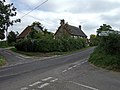 Crossroads near Bishop's Caundle - geograph.org.uk - 549153.jpg 640 × 480; 157 KB
-
 Eldersfield House Bishop's Caundle - geograph.org.uk - 549172.jpg 640 × 473; 150 KB
-
 Rowditch Wood near Bishop's Caundle - geograph.org.uk - 664944.jpg 640 × 480; 37 KB


