Category:Birr, County Offaly
Appearance
town in County Offaly, Ireland | |||||
| Upload media | |||||
| Instance of | |||||
|---|---|---|---|---|---|
| Location | County Offaly, Leinster, Ireland | ||||
| Elevation above sea level |
| ||||
| official website | |||||
 | |||||
Subcategories
This category has the following 15 subcategories, out of 15 total.
B
C
- Cavanagh Foundry Birr (4 F)
- Cumberland Column, Birr (10 F)
J
- John's Hall (4 F)
L
- Leap Castle (6 F)
M
- Marian Hall, Birr (4 F)
O
- Oxmantown School (5 F)
P
S
W
- Wesleyan Chapel, Birr (1 F)
Media in category "Birr, County Offaly"
The following 154 files are in this category, out of 154 total.
-
3-foot Telescope - Sim illustrated-london-news 1843-09-09 3 71 0004 (cropped).jpg 1,106 × 1,424; 459 KB
-
3-foot telescope, Birr castle (bw, crop).jpg 3,699 × 4,938; 6.78 MB
-
3-foot telescope, Birr castle.jpg 3,917 × 5,424; 7.3 MB
-
948 Birr, County Offaly.jpg 3,264 × 2,448; 1.88 MB
-
952 Birr, County Offaly.jpg 3,264 × 2,448; 1.69 MB
-
Access to undeveloped industrial estate - geograph.org.uk - 4591367.jpg 1,024 × 768; 168 KB
-
Birr - Emmet Square - geograph.org.uk - 6503401.jpg 1,799 × 1,199; 313 KB
-
Birr - Main Street looking towards O'Connell Street - geograph.org.uk - 6503402.jpg 1,799 × 1,199; 358 KB
-
Birr Castle - geograph.org.uk - 4917476.jpg 640 × 481; 216 KB
-
Birr Castle - geograph.org.uk - 5744404.jpg 4,896 × 3,672; 6.43 MB
-
Birr Castle - geograph.org.uk - 6503103.jpg 1,799 × 1,199; 373 KB
-
Birr Castle and gardens - geograph.org.uk - 6503114.jpg 1,199 × 1,799; 426 KB
-
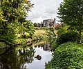
Birr Castle and the River Camcor - geograph.org.uk - 5141582.jpg 2,000 × 1,665; 1.27 MB
-
Birr Castle Telescope - geograph.org.uk - 6503107.jpg 1,799 × 1,199; 366 KB
-
Birr Civic Offices - geograph.org.uk - 4591316.jpg 1,024 × 768; 229 KB
-
Birr Credit Union - geograph.org.uk - 4597397.jpg 1,024 × 768; 116 KB
-
Birr crest.png 256 × 296; 16 KB
-
Birr Demesne wall - geograph.org.uk - 4600510.jpg 768 × 1,024; 295 KB
-
Birr Methodist Church - geograph.org.uk - 4598815.jpg 1,024 × 768; 155 KB
-
Birr Oil Company depot - geograph.org.uk - 4599636.jpg 1,024 × 768; 215 KB
-
Birr Telescope - geograph.org.uk - 5744417.jpg 3,672 × 4,896; 6.58 MB
-
Birr Telescope - geograph.org.uk - 6516687.jpg 2,319 × 3,455; 1.59 MB
-
Birr telescope in castle grounds - geograph.org.uk - 6516684.jpg 2,319 × 3,455; 1.52 MB
-
Birr Theatre and Arts Centre - geograph.org.uk - 4917507.jpg 479 × 640; 234 KB
-
Birr Town Library - geograph.org.uk - 4598330.jpg 1,024 × 768; 145 KB
-
Bridge over water lilies - geograph.org.uk - 5140985.jpg 2,000 × 1,360; 1.33 MB
-
Castle in the Park - Birr, County Offaly - geograph.org.uk - 6281476.jpg 1,024 × 651; 144 KB
-
Castles of Leinster, Ballymooney, Offaly - geograph.org.uk - 2494240.jpg 1,024 × 683; 663 KB
-
Castles of Leinster, Curralanty, Offaly - geograph.org.uk - 2494193.jpg 1,024 × 703; 1.04 MB
-
Castles of Leinster, Garry, Offaly (1) - geograph.org.uk - 4074531.jpg 1,024 × 683; 727 KB
-
Castles of Leinster, Garry, Offaly (2) - geograph.org.uk - 4074538.jpg 1,024 × 643; 667 KB
-
Castles of Leinster, Garry, Offaly (3) - geograph.org.uk - 4074540.jpg 1,024 × 683; 912 KB
-
Cemetery, Birr, Co. Offaly - geograph.org.uk - 1386805.jpg 640 × 463; 125 KB
-
Church Street, Birr, Co. Offaly - geograph.org.uk - 6471216.jpg 769 × 1,024; 181 KB
-
Club House, Frank O'Connell Park - geograph.org.uk - 4599626.jpg 1,024 × 768; 99 KB
-
Colourful houses on Main Street, Birr - geograph.org.uk - 4917488.jpg 640 × 480; 232 KB
-
Connaught Street, Birr - geograph.org.uk - 4973760.jpg 3,240 × 4,320; 2.68 MB
-
Converted water mill - geograph.org.uk - 4591340.jpg 1,024 × 768; 165 KB
-
Cottages, Burke's Hill - geograph.org.uk - 4544318.jpg 1,024 × 768; 148 KB
-
County Offaly - Birr Post Office - 20220911121624.jpg 4,032 × 3,024; 3.2 MB
-
Cumberland Terrace, Emmet Street, Birr - geograph.org.uk - 4600537.jpg 1,024 × 560; 105 KB
-
Demesne wall south of Birr - geograph.org.uk - 4544403.jpg 1,024 × 768; 251 KB
-
Dr. Waters Lane - geograph.org.uk - 4598227.jpg 1,024 × 768; 212 KB
-
Driveway to Woodlands House - geograph.org.uk - 4599684.jpg 1,024 × 768; 322 KB
-
Emmet Square - geograph.org.uk - 4598283.jpg 1,024 × 768; 110 KB
-
Emmet Square - geograph.org.uk - 4918812.jpg 640 × 480; 224 KB
-
Emmet Square Birr - geograph.org.uk - 1364760.jpg 640 × 457; 244 KB
-
Emmet Square Birr - geograph.org.uk - 1364764.jpg 640 × 457; 275 KB
-
Emmet Square, Birr - geograph.org.uk - 4973809.jpg 4,320 × 3,240; 2.13 MB
-
Emmet Street, Birr - geograph.org.uk - 4598826.jpg 1,024 × 768; 169 KB
-
Emmet Street, Birr - geograph.org.uk - 4918813.jpg 640 × 479; 230 KB
-
Emmet Street, Birr - geograph.org.uk - 4918814.jpg 640 × 481; 249 KB
-
Entrance to former quarry - geograph.org.uk - 4599612.jpg 1,024 × 768; 205 KB
-
Entrance to High Park House - geograph.org.uk - 4598846.jpg 1,024 × 768; 214 KB
-
Fallen tree, Birr Castle gardens - geograph.org.uk - 5141570.jpg 2,000 × 1,333; 1.3 MB
-
Field on the outskirts of Birr - geograph.org.uk - 4541955.jpg 1,024 × 768; 183 KB
-
Former St. John's Convent of Mercy - geograph.org.uk - 4591313.jpg 1,024 × 768; 246 KB
-
Former water mill - geograph.org.uk - 4600565.jpg 1,024 × 768; 205 KB
-
Gate to an abandoned burial ground - geograph.org.uk - 4598836.jpg 1,024 × 768; 222 KB
-
Gateway to Birr Castle - geograph.org.uk - 4917495.jpg 640 × 480; 245 KB
-
Georgian House - geograph.org.uk - 167189.jpg 640 × 480; 63 KB
-
Grazing cattle - geograph.org.uk - 4599691.jpg 1,024 × 768; 135 KB
-
Green Street Birr - geograph.org.uk - 1364773.jpg 640 × 457; 303 KB
-
High Street, Birr - geograph.org.uk - 4544390.jpg 1,024 × 768; 144 KB
-
Hoare's Field - geograph.org.uk - 2490061.jpg 640 × 480; 90 KB
-
Hole in a wall - geograph.org.uk - 4598876.jpg 1,024 × 768; 192 KB
-
Hollypark Drive - geograph.org.uk - 4598869.jpg 1,024 × 768; 162 KB
-
John Farrell's Field, Birr, Co. Offaly - geograph.org.uk - 6474148.jpg 1,024 × 672; 163 KB
-
John's Mall Birr - geograph.org.uk - 1364752.jpg 640 × 457; 277 KB
-
John's Mall Birr - geograph.org.uk - 1364755.jpg 640 × 457; 298 KB
-
John's Mall Birr - geograph.org.uk - 1364757.jpg 640 × 457; 277 KB
-
Lake at Birr Castle - geograph.org.uk - 5744424.jpg 4,896 × 3,672; 5.89 MB
-
Lake at Birr Castle grounds - geograph.org.uk - 6503117.jpg 1,799 × 1,199; 426 KB
-
Little Brosna River - geograph.org.uk - 4600521.jpg 1,024 × 768; 254 KB
-
Lodge at Clonoghill Cemetery - geograph.org.uk - 4541951.jpg 1,024 × 768; 214 KB
-
Main Street Birr Co. Offaly - geograph.org.uk - 1365957.jpg 640 × 457; 341 KB
-
Main Street Birr Co. Offaly - geograph.org.uk - 1365963.jpg 640 × 457; 280 KB
-
Main Street, Birr - geograph.org.uk - 4597392.jpg 1,024 × 768; 130 KB
-
Main Street, Birr - geograph.org.uk - 4917485.jpg 640 × 480; 216 KB
-
Manchester Square Birr Co. Offaly - geograph.org.uk - 1365968.jpg 640 × 457; 320 KB
-
Meteorological station, Birr - geograph.org.uk - 4541942.jpg 1,024 × 768; 145 KB
-
Midland Web Printing Limited - geograph.org.uk - 4591390.jpg 1,024 × 768; 141 KB
-
Monument to Robert Emmet, Emmet Square, Birr - geograph.org.uk - 5141013.jpg 2,000 × 2,000; 1,005 KB
-
N52 road, Birr, Co. Offaly - geograph.org.uk - 6475291.jpg 1,024 × 677; 146 KB
-
New house on the corner - geograph.org.uk - 4541938.jpg 1,024 × 768; 169 KB
-
Newbridge over the Camcor River - geograph.org.uk - 4591361.jpg 1,024 × 768; 287 KB
-
Office and Warehouse for sale - geograph.org.uk - 4591380.jpg 1,024 × 768; 164 KB
-
Outbuilding to No. 1 Oxmantown Mall - geograph.org.uk - 4598255.jpg 1,024 × 768; 239 KB
-
Oxmanton Mall - geograph.org.uk - 1364803.jpg 640 × 457; 321 KB
-
Oxmantown House - geograph.org.uk - 4598237.jpg 1,024 × 768; 123 KB
-
Oxmantown Mall, Birr - geograph.org.uk - 4544295.jpg 1,024 × 768; 172 KB
-
Oxmantown Mall, Birr - geograph.org.uk - 4598250.jpg 1,024 × 768; 229 KB
-
Oxmantown Mall, Birr - geograph.org.uk - 4917500.jpg 640 × 480; 359 KB
-
Parsons Earls of Rosse (33611696510).jpg 2,448 × 3,264; 2.52 MB
-
Passageway off Main Street, Birr - geograph.org.uk - 5140970.jpg 2,000 × 1,473; 1.37 MB
-
Path alongside the Camcor River - geograph.org.uk - 4591351.jpg 1,024 × 768; 290 KB
-
Plaque Birr Little Theatre.png 1,727 × 1,727; 5.12 MB
-
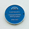
Plaque Birr Lord Snowdon.png 1,204 × 1,204; 1.8 MB
-
Plaque Birr Thomas Lalor Cooke.png 1,172 × 1,172; 2.37 MB
-
River Camcor - geograph.org.uk - 5744440.jpg 4,896 × 3,672; 5.51 MB
-
Riverside houses at Birr - geograph.org.uk - 4917469.jpg 640 × 480; 241 KB
-
Riverstown Bridge, Riverstown, Co. Tipperary - geograph.org.uk - 4589879.jpg 1,024 × 661; 157 KB
-
Ruins of St Brendan's Church - geograph.org.uk - 1364808.jpg 457 × 640; 370 KB
-
Sculpture on the approach to Birr - geograph.org.uk - 4541902.jpg 768 × 1,024; 105 KB
-
Sign-1040151, Leixlip, Co. Kildare, Ireland.jpg 4,557 × 3,363; 4.02 MB
-
Sim illustrated-london-news 1843-09-09 3 71 0004.jpg 4,288 × 6,040; 3.07 MB
-
St Brendan's Church of Ireland - geograph.org.uk - 4918816.jpg 640 × 480; 219 KB
-
St Brendan's Roman Catholic Church - geograph.org.uk - 1364741.jpg 640 × 457; 413 KB
-
St. Brendan's Church of Ireland church - geograph.org.uk - 4600557.jpg 768 × 1,024; 134 KB
-
St. Brendan's Roman Catholic Church, Birr - geograph.org.uk - 4591291.jpg 1,024 × 768; 119 KB
-
St. Ciaran's Bush - geograph.org.uk - 2186166.jpg 2,448 × 3,264; 2.79 MB
-
Suspension bridge, Birr Castle - geograph.org.uk - 5141558.jpg 1,335 × 2,000; 1.39 MB
-
Tesco Superstore, Railway Road, Birr, Co. Offaly - geograph.org.uk - 6471240.jpg 1,024 × 680; 120 KB
-
The Birr Stone - geograph.org.uk - 4598347.jpg 1,024 × 768; 300 KB
-
The Camcor River at Birr - geograph.org.uk - 4591330.jpg 1,024 × 768; 225 KB
-
The County Arms Hotel, Birr - geograph.org.uk - 4544354.jpg 1,024 × 768; 174 KB
-
The Green Birr - geograph.org.uk - 1364777.jpg 640 × 457; 295 KB
-
The Maltings - geograph.org.uk - 167195.jpg 640 × 480; 100 KB
-
The Midland Mineral Water Company - geograph.org.uk - 4598243.jpg 1,024 × 768; 136 KB
-
The N52 road at Riverstown near Birr, Co. Offaly - geograph.org.uk - 4580142.jpg 1,024 × 672; 179 KB
-
The Old Distillery - geograph.org.uk - 4591344.jpg 1,024 × 768; 181 KB
-
The ornamental lake, Birr Castle - geograph.org.uk - 5137220.jpg 2,000 × 1,333; 1.47 MB
-
The Square, Parsonstown (Birr, Co Offaly) (23380992132).jpg 2,000 × 1,531; 1.22 MB
-
Thomas W. Enright, Solicitors - geograph.org.uk - 4598324.jpg 1,024 × 768; 106 KB
-
Track and rough pasture on the edge of Birr - geograph.org.uk - 4599599.jpg 1,024 × 768; 163 KB
-
Victorian Letter Box - geograph.org.uk - 4598268.jpg 768 × 1,024; 336 KB
-
View towards Riverstown - geograph.org.uk - 4597416.jpg 1,024 × 768; 126 KB
-
View towards the Little Brosna River - geograph.org.uk - 4598861.jpg 1,024 × 768; 168 KB
-
Vintage Petrol Pump, Birr - geograph.org.uk - 5744410.jpg 3,672 × 4,896; 5.05 MB
-
Waiting for the bus to Tullamore - geograph.org.uk - 5141026.jpg 2,000 × 1,206; 1.3 MB
-
Water Feature, Birr Castle - geograph.org.uk - 5744432.jpg 4,896 × 3,672; 5.32 MB
-
Woodlands mobile home site - geograph.org.uk - 4599593.jpg 1,024 × 768; 126 KB
-
Birr Theatre and Arts Centre - geograph.org.uk - 167190.jpg 640 × 480; 104 KB
-
Georgian Houses - geograph.org.uk - 167192.jpg 640 × 480; 112 KB
-
The Bridewell, Birr - geograph.org.uk - 167198.jpg 640 × 480; 83 KB


