Category:Birnam, Perth and Kinross
Jump to navigation
Jump to search
town in Perthshire, Scotland, UK  | |||||
| Upload media | |||||
| Instance of | |||||
|---|---|---|---|---|---|
| Part of |
| ||||
| Location |
| ||||
 | |||||
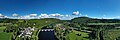
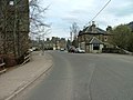
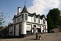
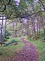
English: Birnam is a town in Perthshire, Scotland. The town originated from the Victorian era with the coming of the railway in 1856, although the place and name is well known because William Shakespeare mentioned Birnam Wood in Macbeth.
日本語: バーナム のほとりに位置する。
Subcategories
This category has the following 6 subcategories, out of 6 total.
B
- Birnam Hotel (37 F)
- Birnam Oak (17 F)
- Birnam Sycamore (4 F)
D
Media in category "Birnam, Perth and Kinross"
The following 116 files are in this category, out of 116 total.
-
 Acers at their best. - geograph.org.uk - 1586510.jpg 640 × 427; 107 KB
-
 Birnam - geograph.org.uk - 912712.jpg 640 × 480; 74 KB
-
 Birnam Autopoint - geograph.org.uk - 2338233.jpg 640 × 480; 66 KB
-
 Birnam Falls, Dunkeld (titel op object), RP-F-2016-125.jpg 4,292 × 2,132; 1.23 MB
-
 Birnam Institute - geograph.org.uk - 1976288.jpg 640 × 480; 95 KB
-
 Birnam Lodge - geograph.org.uk - 912708.jpg 640 × 480; 98 KB
-
 Birnam, Perthshire - geograph.org.uk - 3716437.jpg 640 × 480; 63 KB
-
 Car showroom, Birnam - geograph.org.uk - 2664821.jpg 640 × 480; 102 KB
-
 Double barrier - geograph.org.uk - 166741.jpg 480 × 640; 113 KB
-
 Erigmore House - geograph.org.uk - 1586467.jpg 640 × 427; 75 KB
-
 Former Drill Hall in Birnam - geograph.org.uk - 4144012.jpg 640 × 480; 66 KB
-
 Hugh William Williams - Birnam Wood - B1977.14.5783 - Yale Center for British Art.jpg 1,920 × 1,469; 341 KB
-
 Hyacinthoides non-scripta - geograph.org.uk - 440265.jpg 640 × 480; 152 KB
-
 Ladywell Cottages, Birnam (geograph 6570081).jpg 3,648 × 2,432; 5.59 MB
-
 Main road through Birnam - geograph.org.uk - 4375750.jpg 1,600 × 1,200; 426 KB
-
 Main Street, Birnam, Scotland.jpg 3,072 × 2,304; 1.46 MB
-
 Meikle Obney - geograph.org.uk - 166799.jpg 640 × 480; 42 KB
-
 Murthly Terrace, Birnam - geograph.org.uk - 4411208.jpg 2,500 × 2,500; 1.92 MB
-
 Perth and Kinross Dunkeld Aerial Pan180.jpg 8,192 × 2,746; 19.76 MB
-
 Perth and Kinross Dunkeld Aerial.jpg 5,472 × 3,648; 16.4 MB
-
 Perth Road and Station Road, Birnam - geograph.org.uk - 2983460.jpg 800 × 530; 105 KB
-
 Perth Road, Birnam - geograph.org.uk - 2338238.jpg 640 × 480; 75 KB
-
 Perthshire.-- Dunkeld and Birnam (NBY 444240).jpg 3,600 × 2,286; 1.53 MB
-
 Red telephone kiosk, Birnam - geograph.org.uk - 4000037.jpg 3,456 × 4,608; 3.32 MB
-
 St Columba's Roman Catholic Church, Birnam (95).jpg 640 × 427; 78 KB
-
 Stare Dam, Rohallion Loch - geograph.org.uk - 85021.jpg 640 × 480; 87 KB
-
 Station Road, Birnam (geograph 6570075).jpg 3,379 × 2,253; 1.98 MB
-
 The Merryburn Hotel - geograph.org.uk - 2538941.jpg 3,456 × 2,304; 1.15 MB
-
 The scene at Birnam in Perthshire - geograph.org.uk - 3063329.jpg 640 × 480; 72 KB
-
 Tower Buildings, Perth Road, Birnham (geograph 6570077).jpg 3,546 × 2,364; 1.34 MB
-
 View from the bridge - geograph.org.uk - 1593616.jpg 640 × 427; 62 KB
-
 Woodland by Mill Dam - geograph.org.uk - 278640.jpg 640 × 480; 161 KB
-
 A9 and River Tay - geograph.org.uk - 1035436.jpg 640 × 373; 89 KB
-
 Arable land, Darnoch. - geograph.org.uk - 440301.jpg 640 × 480; 103 KB
-
 Balhomish Farm - geograph.org.uk - 166738.jpg 640 × 480; 63 KB
-
 Balhomish Farm Road - geograph.org.uk - 166715.jpg 640 × 480; 62 KB
-
 Big trees - geograph.org.uk - 1506137.jpg 640 × 480; 184 KB
-
 Birnam Hill from Obney Hill - geograph.org.uk - 99431.jpg 640 × 480; 82 KB
-
 Birnam Hill from Torchuaig Hill - geograph.org.uk - 736968.jpg 640 × 480; 70 KB
-
 Birnam Hill path - geograph.org.uk - 1505949.jpg 480 × 640; 204 KB
-
 Birnam Hill path - geograph.org.uk - 1506005.jpg 640 × 480; 146 KB
-
 Birnam Post Office - geograph.org.uk - 315177.jpg 640 × 480; 74 KB
-
 Birnam Post Office - geograph.org.uk - 409367.jpg 640 × 409; 117 KB
-
 Birnam Wood - geograph.org.uk - 1505994.jpg 640 × 480; 113 KB
-
 Birnam Wood and Rohallion Lodge - geograph.org.uk - 99562.jpg 640 × 480; 70 KB
-
 Birnam Wood and the railway - geograph.org.uk - 1505955.jpg 640 × 480; 150 KB
-
 Birnam Wood and the Tay Valley - geograph.org.uk - 1506035.jpg 640 × 480; 124 KB
-
 Boulder on Torchuaig Hill - geograph.org.uk - 736992.jpg 640 × 480; 63 KB
-
 Bracken filled ride, Ring Wood - geograph.org.uk - 237699.jpg 640 × 480; 138 KB
-
 Bridge at The Hermitage - geograph.org.uk - 108561.jpg 640 × 480; 62 KB
-
 Bungalows, Pass of Birnam - geograph.org.uk - 278738.jpg 640 × 480; 70 KB
-
 Darnoch - geograph.org.uk - 540755.jpg 640 × 480; 73 KB
-
 Disused slate quarry waste - geograph.org.uk - 364322.jpg 640 × 480; 184 KB
-
 Ditch, Ring Wood - geograph.org.uk - 237698.jpg 640 × 480; 134 KB
-
 Douglas Firs - geograph.org.uk - 166747.jpg 480 × 640; 87 KB
-
 Dungarthill Estate road - geograph.org.uk - 540757.jpg 640 × 480; 119 KB
-

-
 Falls of Braan - geograph.org.uk - 55326.jpg 640 × 427; 132 KB
-
 Footpath by the River Tay - geograph.org.uk - 414294.jpg 638 × 640; 227 KB
-
 Footpath diversion - geograph.org.uk - 598174.jpg 640 × 480; 160 KB
-
 Forest gate - geograph.org.uk - 603802.jpg 640 × 480; 84 KB
-
 Forest track - geograph.org.uk - 603777.jpg 640 × 480; 83 KB
-
 Forest track - geograph.org.uk - 603786.jpg 640 × 480; 67 KB
-
 Forestry, Birnam - geograph.org.uk - 71719.jpg 640 × 480; 76 KB
-
 Gate, West Cult - geograph.org.uk - 440270.jpg 640 × 480; 65 KB
-
 Glen Garr - geograph.org.uk - 166724.jpg 640 × 480; 81 KB
-
 Glen Garr - geograph.org.uk - 631124.jpg 640 × 427; 45 KB
-
 Glen Garr - geograph.org.uk - 631127.jpg 640 × 427; 62 KB
-
 Glen Garr - geograph.org.uk - 638914.jpg 640 × 427; 54 KB
-
 Glen Garr - geograph.org.uk - 99448.jpg 640 × 480; 96 KB
-
 Glenn Garr - geograph.org.uk - 638907.jpg 640 × 427; 48 KB
-
 Highland Boundary Fault - geograph.org.uk - 166746.jpg 640 × 480; 75 KB
-
 Ice Sculptures on the Inchewan Burn - geograph.org.uk - 134779.jpg 640 × 480; 129 KB
-
 Large reentrant - geograph.org.uk - 440279.jpg 640 × 480; 81 KB
-
 Last control, Newtyle Hill - geograph.org.uk - 440228.jpg 640 × 480; 108 KB
-
 Lochan on Newtyle Hill - geograph.org.uk - 547930.jpg 640 × 480; 93 KB
-
 Lone birch - geograph.org.uk - 440284.jpg 640 × 480; 60 KB
-
 Lost village - geograph.org.uk - 166718.jpg 640 × 480; 146 KB
-
 Obney Hill - geograph.org.uk - 621408.jpg 640 × 426; 47 KB
-
 Obney Hill - geograph.org.uk - 99443.jpg 640 × 480; 105 KB
-
 Old Tree, Birnam Wood - geograph.org.uk - 85136.jpg 480 × 640; 339 KB
-
 Pastures on the banks of the Tay - geograph.org.uk - 364308.jpg 640 × 480; 77 KB
-
 Path by the River Tay - geograph.org.uk - 414323.jpg 640 × 639; 224 KB
-
 Pedestrian by-pass - geograph.org.uk - 166717.jpg 640 × 480; 125 KB
-
 Picnic table - geograph.org.uk - 166729.jpg 480 × 640; 117 KB
-
 Reentrant - geograph.org.uk - 440267.jpg 640 × 480; 154 KB
-
 Rhododendrons, Dungarthill - geograph.org.uk - 440252.jpg 640 × 480; 171 KB
-
 River Braan - geograph.org.uk - 132020.jpg 640 × 480; 118 KB
-
 River Braan, Perthshire - geograph.org.uk - 83403.jpg 640 × 480; 162 KB
-
 River Tay near Dunkeld - geograph.org.uk - 414320.jpg 639 × 640; 210 KB
-
 River Tay, Dunkeld. - geograph.org.uk - 562870.jpg 640 × 425; 115 KB
-
 Rocky slate outcrop - geograph.org.uk - 364312.jpg 640 × 480; 97 KB
-
 Rumbling Bridge - geograph.org.uk - 6471.jpg 640 × 480; 174 KB
-
 Ruthvens Dam - geograph.org.uk - 9253.jpg 620 × 466; 168 KB
-
 Scotland's tallest tree - geograph.org.uk - 363728.jpg 480 × 640; 118 KB
-
 Sheep track in Glen Garr - geograph.org.uk - 166725.jpg 640 × 480; 98 KB
-
 Stare Dam - geograph.org.uk - 330211.jpg 640 × 480; 78 KB
-
 Stare Dam - geograph.org.uk - 498948.jpg 640 × 426; 58 KB
-
 Strath Tay - geograph.org.uk - 99436.jpg 640 × 480; 92 KB
-
 Summer comes to Dungarthill - geograph.org.uk - 440242.jpg 640 × 480; 164 KB
-

-
 The Hermitage - geograph.org.uk - 18459.jpg 640 × 480; 196 KB
-
 The pub Birnam, Perth and Kinross - geograph.org.uk - 675897.jpg 480 × 640; 488 KB
-
 The River Braan - geograph.org.uk - 50588.jpg 640 × 480; 179 KB
-

-
 Track alongside Inchewan Burn - geograph.org.uk - 134780.jpg 640 × 480; 119 KB
-
 Track below Silver Side - geograph.org.uk - 552652.jpg 640 × 480; 125 KB
-
 Tree Bark - geograph.org.uk - 118306.jpg 480 × 640; 185 KB
-
 Tree felling in Birnam Wood - geograph.org.uk - 603770.jpg 640 × 480; 77 KB
-
 Trees by the burn - geograph.org.uk - 166734.jpg 640 × 480; 110 KB
-
 Waterfall at the Hermitage - geograph.org.uk - 132030.jpg 464 × 640; 90 KB
-
 Way out - geograph.org.uk - 440246.jpg 640 × 480; 146 KB
-
 West Cult - geograph.org.uk - 440277.jpg 640 × 480; 68 KB
-
 Woodland, Dungarthill - geograph.org.uk - 440235.jpg 640 × 480; 155 KB
-
 Woodland, Dungarthill - geograph.org.uk - 440239.jpg 480 × 640; 154 KB
-
 Worked out quarry - geograph.org.uk - 166721.jpg 640 × 480; 99 KB


,_RP-F-2016-125.jpg)


.jpg)


.jpg)

.jpg)

.jpg)


.jpg)


