Category:Birgittenessenklooster (Uden)
Jump to navigation
Jump to search
| Object location | | View all coordinates using: OpenStreetMap |
|---|
 | |||||
| Upload media | |||||
| Instance of | |||||
|---|---|---|---|---|---|
| Location | Uden, Maashorst, North Brabant, Netherlands | ||||
| Street address |
| ||||
| Located on street |
| ||||
| Heritage designation |
| ||||
| Inception |
| ||||
 | |||||
|
This is a category about rijksmonument number 35830
|
| Address |
|
Subcategories
This category has the following 2 subcategories, out of 2 total.
M
- Museum voor Religieuze Kunst (1 P, 12 F)
Media in category "Birgittenessenklooster (Uden)"
The following 29 files are in this category, out of 29 total.
-
 After Jheronimus Bosch Ecce Homo (Uden).jpg 934 × 1,255; 177 KB
-
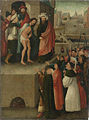
 Anonymous (Brabant) Ecce Homo c. 1520.jpg 1,698 × 2,328; 1.45 MB
-
 Birgittenessenklooster - Uden - 20210877 - RCE.jpg 938 × 1,200; 304 KB
-
 Birgittenessenklooster - Uden - 20210878 - RCE.jpg 954 × 1,200; 363 KB
-
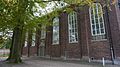
 Birgittinessenklooster "Maria Refugie". - panoramio.jpg 1,944 × 2,592; 758 KB
-
 Klooster - Uden - 20210879 - RCE.jpg 1,200 × 951; 282 KB
-
 Klooster - Uden - 20210880 - RCE.jpg 1,200 × 949; 352 KB
-
 Maria Refugie.. - panoramio.jpg 2,592 × 1,944; 894 KB
-
 Overzicht kloostercomplex met noordoostgevel kapel - Uden - 20348254 - RCE.jpg 1,188 × 1,200; 380 KB
-

-

-
 Reproductie van schilderij - Uden - 20210874 - RCE.jpg 1,200 × 950; 203 KB
-
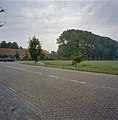
 Uden, Netherlands - panoramio (10).jpg 2,048 × 1,148; 806 KB
-
 Uden, Netherlands - panoramio (2).jpg 2,048 × 1,148; 646 KB
-
 Uden, Netherlands - panoramio (3).jpg 2,048 × 1,148; 663 KB
-
 Uden, Netherlands - panoramio (4).jpg 2,048 × 1,148; 833 KB
-
 Uden, Netherlands - panoramio (5).jpg 2,048 × 1,148; 637 KB
-
 Uden, Netherlands - panoramio (6).jpg 1,148 × 2,048; 517 KB
-
 Uden, Netherlands - panoramio (8).jpg 2,048 × 1,148; 759 KB
-
 Uden, Netherlands - panoramio (9).jpg 2,048 × 1,148; 616 KB
-
 Uden, Netherlands - panoramio.jpg 2,048 × 1,148; 547 KB
-
 Vorstenburgh.jpg 2,121 × 1,466; 556 KB
-

-

-

-

-
-

-

.jpg)
_Ecce_Homo_c._1520.jpg)


.jpg)
.jpg)
.jpg)
.jpg)
.jpg)
.jpg)
.jpg)
.jpg)


