Category:Birdsall, North Yorkshire
Jump to navigation
Jump to search
village in the United Kingdom Mar2006.jpg) | |||||
| Upload media | |||||
| Instance of | |||||
|---|---|---|---|---|---|
| Location | Ryedale, North Yorkshire, Yorkshire and the Humber, England | ||||
| Population |
| ||||
 | |||||
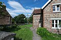
English: Birdsall is a village and civil parish in the Ryedale district of North Yorkshire, England. According to the 2001 census it had a population of 180. The village is about four miles south of Malton.
Subcategories
This category has the following 3 subcategories, out of 3 total.
Media in category "Birdsall, North Yorkshire"
The following 200 files are in this category, out of 404 total.
(previous page) (next page)-
 A bullock on top of Birdsall Brow - geograph.org.uk - 2620861.jpg 800 × 600; 257 KB
-
 A carpet of wild garlic in the plantation - geograph.org.uk - 5777951.jpg 4,606 × 3,454; 7.26 MB
-
 A cattle grid on Luddith Road - geograph.org.uk - 2657808.jpg 800 × 586; 296 KB
-
 A distant view of Malton - geograph.org.uk - 6088941.jpg 4,320 × 2,554; 1.2 MB
-
 A farm track off Salents Lane - geograph.org.uk - 2138380.jpg 800 × 600; 301 KB
-
 A gap in the trees - geograph.org.uk - 6088983.jpg 4,300 × 3,010; 2.46 MB
-
 A minor road towards Wharram le Street - geograph.org.uk - 2138391.jpg 800 × 600; 228 KB
-
 A signpost for the Centenary Way Walk - geograph.org.uk - 2620873.jpg 800 × 600; 328 KB
-
 A track leading to Oxpasture Wood - geograph.org.uk - 2326440.jpg 800 × 600; 326 KB
-
 Access track to Toisland Farm - geograph.org.uk - 5776931.jpg 4,598 × 3,444; 5.54 MB
-
 Accommodation underbridge - geograph.org.uk - 5074770.jpg 5,600 × 3,733; 6.53 MB
-

-

-
 Across the Vale - geograph.org.uk - 3484033.jpg 640 × 427; 50 KB
-
 Aldro chalk quarry - geograph.org.uk - 6089002.jpg 4,320 × 3,240; 2.03 MB
-
 Aldro Farm - geograph.org.uk - 1999596.jpg 640 × 479; 68 KB
-
 Aldro Farm - geograph.org.uk - 2650553.jpg 1,024 × 768; 243 KB
-
 Aldro Farm - geograph.org.uk - 3942430.jpg 640 × 427; 66 KB
-
 Aldro Farm - geograph.org.uk - 3942436.jpg 640 × 427; 70 KB
-
 Aldro Farm - geograph.org.uk - 6089020.jpg 4,320 × 3,240; 2.56 MB
-
 Aldro farm near Leavening - geograph.org.uk - 2138316.jpg 800 × 600; 191 KB
-
 Aldro farm near Leavening - geograph.org.uk - 2262143.jpg 800 × 600; 214 KB
-
 Aldro Plantation - geograph.org.uk - 2556802.jpg 3,800 × 3,250; 2.64 MB
-
 Along a dusty track - geograph.org.uk - 6088929.jpg 4,299 × 2,863; 1.76 MB
-
 Along Birdsall Dale - geograph.org.uk - 5427597.jpg 640 × 427; 235 KB
-
 Along Centenary Way - geograph.org.uk - 2241200.jpg 1,024 × 768; 203 KB
-
 Along Centenary Way - geograph.org.uk - 2241252.jpg 1,024 × 768; 193 KB
-
 Along Cordike Lane - geograph.org.uk - 3483913.jpg 640 × 427; 117 KB
-
 Along Stonepit Lane - geograph.org.uk - 3483898.jpg 640 × 427; 76 KB
-
 Along the lane north of Birdsall (2) - geograph.org.uk - 2241236.jpg 1,024 × 768; 324 KB
-
 Along the lane north of Birdsall - geograph.org.uk - 2241228.jpg 1,024 × 768; 153 KB
-
 Along the lane towards Mill Farm - geograph.org.uk - 2241216.jpg 1,024 × 768; 252 KB
-
 Along Toftings Lane - geograph.org.uk - 3483944.jpg 640 × 427; 133 KB
-
 And Over We Go ^ - geograph.org.uk - 2241382.jpg 1,024 × 768; 144 KB
-
 Apple tree - geograph.org.uk - 5089853.jpg 5,000 × 3,333; 7.58 MB
-
 Approaching Aldro Farm - geograph.org.uk - 3942428.jpg 640 × 427; 68 KB
-

-
 Approaching Toisland Farm - geograph.org.uk - 2241386.jpg 1,024 × 768; 231 KB
-
 Arable field toward Vessey Pasture Belt - geograph.org.uk - 5776918.jpg 4,564 × 3,398; 5.53 MB
-
 B1248 into North Grimston - geograph.org.uk - 6632868.jpg 3,888 × 2,916; 2.95 MB
-
 B1248 toward Malton at Stonepit Lane junction - geograph.org.uk - 4138128.jpg 4,608 × 3,456; 4.2 MB
-
 B1248 towards Wharram le Street - geograph.org.uk - 1955258.jpg 640 × 480; 74 KB
-
 Bales above Birdsall - geograph.org.uk - 3484008.jpg 640 × 427; 71 KB
-
 Bales near Acklam Wold - geograph.org.uk - 3484050.jpg 640 × 427; 109 KB
-
 Barn at Toisland Farm - geograph.org.uk - 5997371.jpg 1,024 × 768; 198 KB
-
 Bee on a Thistle - geograph.org.uk - 1053079.jpg 640 × 480; 121 KB
-
 Beech tree in Birdsall Park - geograph.org.uk - 2240908.jpg 1,024 × 768; 192 KB
-
 Beef cattle in a very large field - geograph.org.uk - 4146293.jpg 3,072 × 2,048; 1.63 MB
-
 Behind the pub - geograph.org.uk - 5089858.jpg 5,000 × 3,333; 7.43 MB
-
 Beside Aldro Plantation - geograph.org.uk - 5308557.jpg 640 × 427; 197 KB
-
 Beware of Bull and Cattle - geograph.org.uk - 5063653.jpg 5,600 × 3,733; 7.48 MB
-
 Birdsall - geograph.org.uk - 5772162.jpg 2,048 × 1,536; 691 KB
-
 Birdsall Brow - geograph.org.uk - 1836633.jpg 2,816 × 2,112; 2.67 MB
-
 Birdsall Brow - geograph.org.uk - 5579958.jpg 2,048 × 1,536; 1,017 KB
-

-
 Birdsall Dale - geograph.org.uk - 3942440.jpg 640 × 427; 76 KB
-
 Birdsall House - geograph.org.uk - 3483995.jpg 640 × 427; 86 KB
-
 Birdsall House Birdsall - geograph.org.uk - 3448402.jpg 4,000 × 3,000; 3.1 MB
-
 Birdsall Village Hall - geograph.org.uk - 2240878.jpg 1,024 × 768; 237 KB
-
 Birdsall Village Hall - geograph.org.uk - 3536527.jpg 1,024 × 720; 500 KB
-
 Birdsall, north end - geograph.org.uk - 5378867.jpg 640 × 481; 473 KB
-
 Bridge over Centenary Way - geograph.org.uk - 2241120.jpg 1,024 × 768; 233 KB
-
 Brownmoor Dale - geograph.org.uk - 3942446.jpg 640 × 427; 67 KB
-
 Brownmoor Dale - geograph.org.uk - 6022121.jpg 1,024 × 768; 214 KB
-
 Buildings at Stud Farm - geograph.org.uk - 5089839.jpg 5,000 × 3,333; 7.31 MB
-
 By Centenary Way - geograph.org.uk - 2241125.jpg 1,024 × 768; 209 KB
-
 Cattle grid near Grimston - geograph.org.uk - 5997396.jpg 1,024 × 768; 175 KB
-
 Cattle Grid on Luddith Road - geograph.org.uk - 2241128.jpg 1,024 × 768; 152 KB
-
 Centenary Way at SE821665 - geograph.org.uk - 133116.jpg 640 × 480; 170 KB
-

-
 Centenary Way heading east - geograph.org.uk - 1999274.jpg 640 × 479; 143 KB
-
 Centenary Way near Birdsall - geograph.org.uk - 5997376.jpg 1,024 × 768; 220 KB
-
 Centenary Way near Toisland Farm - geograph.org.uk - 2241405.jpg 1,024 × 768; 159 KB
-
 Centenary Way towards Toisland Farm - geograph.org.uk - 1999337.jpg 640 × 479; 98 KB
-
 Cereal fields near Grimston Fields Farm - geograph.org.uk - 6129206.jpg 1,024 × 768; 210 KB
-
 Chalk containing field - geograph.org.uk - 3942304.jpg 640 × 427; 97 KB
-
 Chalky farmland - geograph.org.uk - 3942293.jpg 640 × 427; 93 KB
-
 Clump of trees near Centenary Way - geograph.org.uk - 2241271.jpg 1,024 × 768; 169 KB
-
 Collapsing barn by the Centenary Way - geograph.org.uk - 5997394.jpg 1,024 × 768; 225 KB
-
 Cordike Lane - geograph.org.uk - 3482718.jpg 640 × 427; 110 KB
-
 Cordike Lane towards North Grimston - geograph.org.uk - 6490928.jpg 4,839 × 3,280; 2.22 MB
-
 Cow and calves at Birdsall - geograph.org.uk - 5777938.jpg 3,817 × 2,859; 5.16 MB
-
 Crossroads at Albro Plantation - geograph.org.uk - 5416211.jpg 1,200 × 799; 356 KB
-
 Crossroads at Aldro Plantation - geograph.org.uk - 3484037.jpg 640 × 427; 111 KB
-
 Culverted stream - geograph.org.uk - 5063673.jpg 5,600 × 3,733; 7.79 MB
-
 Cut field - geograph.org.uk - 3484055.jpg 640 × 427; 97 KB
-
 Cutting timber at Birdsall - geograph.org.uk - 2240932.jpg 1,024 × 768; 278 KB
-
 Derelict buildings - geograph.org.uk - 4498918.jpg 1,024 × 768; 247 KB
-
 Derelict Farmhouse - geograph.org.uk - 1852574.jpg 2,900 × 1,964; 2.13 MB
-
 Derelict Farmhouse - geograph.org.uk - 1852589.jpg 2,976 × 2,236; 2.54 MB
-
 Descending from Toisland Farm - geograph.org.uk - 2241286.jpg 1,024 × 768; 227 KB
-
 Descent to Birdsall - geograph.org.uk - 6089844.jpg 4,320 × 3,240; 2.77 MB
-
 Dimple Hole - geograph.org.uk - 1999730.jpg 640 × 479; 118 KB
-

-
 Disused Pit on Toisland Wold - geograph.org.uk - 2241408.jpg 1,024 × 768; 357 KB
-
-
 Domestic details - geograph.org.uk - 5089850.jpg 5,000 × 3,333; 7.17 MB
-

-

-
 Embankment Cross - geograph.org.uk - 3483999.jpg 640 × 427; 87 KB
-
 English Flag - geograph.org.uk - 5089404.jpg 5,600 × 3,733; 5.96 MB
-
 Enjoying the Sun - geograph.org.uk - 2241384.jpg 1,024 × 768; 299 KB
-
 Entering Birdsall - geograph.org.uk - 2138357.jpg 800 × 600; 342 KB
-
 Entering Birdsall - geograph.org.uk - 3483932.jpg 640 × 427; 96 KB
-
 Entering Birdsall - geograph.org.uk - 5378864.jpg 640 × 480; 541 KB
-
 Estate office, Birdsall - geograph.org.uk - 5997384.jpg 1,024 × 768; 158 KB
-
 Farm building at Fox House - geograph.org.uk - 2432372.jpg 1,024 × 768; 209 KB
-
 Farm buildings - geograph.org.uk - 3942439.jpg 640 × 427; 74 KB
-
 Farm buildings - geograph.org.uk - 5089846.jpg 5,000 × 3,333; 7.11 MB
-
 Farm Buildings at Stud Farm - geograph.org.uk - 5089835.jpg 5,000 × 3,333; 7.04 MB
-
 Farm buildings, North Grimston - geograph.org.uk - 6594438.jpg 800 × 600; 128 KB
-
 Farm buildings, North Grimston - geograph.org.uk - 6594439.jpg 1,024 × 768; 168 KB
-
 Farm near Birdsall - geograph.org.uk - 5379814.jpg 640 × 427; 357 KB
-
 Farm track (Centenary Way footpath) - geograph.org.uk - 1999306.jpg 640 × 479; 78 KB
-
 Farm track at Birdsall - geograph.org.uk - 2240896.jpg 1,024 × 768; 267 KB
-
 Farm track beside Picksharp Wood - geograph.org.uk - 1999327.jpg 640 × 479; 81 KB
-
 Farm track near Wharram Grange - geograph.org.uk - 1955232.jpg 640 × 480; 87 KB
-
 Farm track, Vessey Pasture - geograph.org.uk - 1999614.jpg 640 × 479; 67 KB
-
 Farmland above Birdsall - geograph.org.uk - 3484002.jpg 640 × 427; 76 KB
-
 Farmland looking towards Lund Wood - geograph.org.uk - 1955236.jpg 640 × 480; 77 KB
-

-
 Farmland near Aldro Farm - geograph.org.uk - 1999597.jpg 640 × 479; 79 KB
-
 Farmland near Birdsall - geograph.org.uk - 1999309.jpg 640 × 479; 76 KB
-
 Farmland near Stonepit Lane - geograph.org.uk - 3483880.jpg 640 × 427; 76 KB
-
 Farmland near Stonepit Lane - geograph.org.uk - 3483884.jpg 640 × 427; 94 KB
-
 Farmland near Toisland Farm - geograph.org.uk - 1999625.jpg 640 × 479; 69 KB
-
 Farmland north of Birdsall - geograph.org.uk - 1999282.jpg 640 × 479; 79 KB
-
 Farmland, Birdsall Dale - geograph.org.uk - 1999606.jpg 640 × 479; 64 KB
-
 Farmland, East Wold - geograph.org.uk - 1955213.jpg 640 × 480; 56 KB
-
 Farmland, Grimston Fields Farm - geograph.org.uk - 1999268.jpg 640 × 479; 89 KB
-
 Farmland, Lang Hill - geograph.org.uk - 1999575.jpg 640 × 479; 63 KB
-
 Farmland, Toft House Farm - geograph.org.uk - 1999312.jpg 640 × 479; 48 KB
-
 Farmland, Toisland Wold - geograph.org.uk - 1999616.jpg 640 × 479; 68 KB
-
 Fencing work on Leavening Brow - geograph.org.uk - 6033545.jpg 1,024 × 768; 202 KB
-
 Field by the Centenary Way - geograph.org.uk - 5997392.jpg 1,024 × 768; 260 KB
-
 Field edge and earthworks - geograph.org.uk - 5776945.jpg 4,556 × 3,386; 4.71 MB
-
 Field edge footpath toward Birdsall - geograph.org.uk - 4146307.jpg 4,608 × 3,456; 3.95 MB
-
 Field gate under the trees - geograph.org.uk - 5063650.jpg 5,600 × 3,733; 7.31 MB
-
 Field of cows - geograph.org.uk - 3482716.jpg 640 × 427; 78 KB
-
 Field track to Birdsall Ings - geograph.org.uk - 3951773.jpg 3,002 × 2,027; 1.3 MB
-

-
 Five Acres Plantation - geograph.org.uk - 1999593.jpg 640 × 479; 66 KB
-
 Flying for England - geograph.org.uk - 5089403.jpg 5,600 × 3,733; 6.09 MB
-
 Footpath sign - geograph.org.uk - 5088830.jpg 5,000 × 3,333; 7.2 MB
-
 Fox House (2) - geograph.org.uk - 2432362.jpg 1,024 × 768; 251 KB
-
 Fox House - geograph.org.uk - 2431354.jpg 1,024 × 768; 204 KB
-

-
 Gallops near Beverley Road - geograph.org.uk - 6523359.jpg 1,024 × 683; 512 KB
-
 Garden at Keeper's cottage - geograph.org.uk - 5089864.jpg 5,600 × 3,733; 6.13 MB
-
 Garden Gate - geograph.org.uk - 5039458.jpg 6,480 × 4,320; 7.79 MB
-
 Gate on Centenary Way - geograph.org.uk - 2241210.jpg 1,024 × 768; 320 KB
-
 Gate on Centenary Way - geograph.org.uk - 2241277.jpg 1,024 × 768; 212 KB
-
 Gate on the path - geograph.org.uk - 6523368.jpg 1,024 × 683; 778 KB
-
 Gates on Centenary Way - geograph.org.uk - 2241139.jpg 1,024 × 768; 332 KB
-

-
 Gravel mound - geograph.org.uk - 6523372.jpg 1,024 × 683; 572 KB
-
 Grazing near North Grimston House - geograph.org.uk - 6594441.jpg 1,024 × 768; 101 KB
-
 Grimston Brow - geograph.org.uk - 5579963.jpg 2,048 × 1,536; 1.04 MB
-
 Grimston Fields Farm - geograph.org.uk - 1999264.jpg 640 × 479; 66 KB
-
 Grimston Fields Farm - geograph.org.uk - 3483900.jpg 640 × 427; 82 KB
-
 Heading towards the tunnel - geograph.org.uk - 2242199.jpg 1,024 × 768; 249 KB
-
 Hogg Lane (B1248), North Grimston - geograph.org.uk - 6455658.jpg 5,184 × 3,888; 5.78 MB
-
 Hogg Lane, North Grimston - geograph.org.uk - 6490929.jpg 5,456 × 3,632; 2.44 MB
-
 Home Farm - geograph.org.uk - 3483990.jpg 640 × 427; 93 KB
-
 Home Farm, Birdsall - geograph.org.uk - 2138365.jpg 800 × 600; 281 KB
-
 Home Farm, Birdsall - geograph.org.uk - 2240920.jpg 1,024 × 768; 135 KB
-
 I've got stripes in my field - geograph.org.uk - 3933603.jpg 4,000 × 3,000; 3.34 MB
-
 Junction of paths - geograph.org.uk - 3942289.jpg 640 × 427; 65 KB
-
 Lane into Birdsall - geograph.org.uk - 3448416.jpg 4,000 × 3,000; 4.35 MB
-
 Lane near Birdsall - geograph.org.uk - 5379811.jpg 640 × 427; 435 KB
-
 Lane to Mill Farm - geograph.org.uk - 5997387.jpg 1,024 × 706; 246 KB
-
 Leavening from Leavening Wold - geograph.org.uk - 1970394.jpg 3,580 × 2,507; 2.7 MB
-
 Leaving Birdsall on Salents Lane - geograph.org.uk - 4572530.jpg 1,024 × 768; 748 KB
-
 Long narrow field on Centenary Way - geograph.org.uk - 4146318.jpg 4,608 × 3,456; 3.86 MB
-
 Looking north from Cow Wold - geograph.org.uk - 2287156.jpg 800 × 600; 222 KB
-
 Looking North On Wolds Way - geograph.org.uk - 2075281.jpg 1,744 × 1,308; 1.35 MB
-
 Looking south along Luddith Road - geograph.org.uk - 2622482.jpg 800 × 600; 280 KB
-
 Looking towards Aldro Plantation - geograph.org.uk - 5772171.jpg 2,048 × 1,536; 961 KB
-
 Luddith Road towards Grimston Brow - geograph.org.uk - 2657814.jpg 800 × 600; 206 KB
-
 Lund Wood from Luddith Road - geograph.org.uk - 5997402.jpg 1,024 × 768; 233 KB
-
 Male or female not sure, being disturbed at rest - geograph.org.uk - 5777933.jpg 3,845 × 2,880; 6.04 MB
-
 Meadow - geograph.org.uk - 5038354.jpg 11,078 × 1,998; 6.14 MB
-
 Meadow from the shade - geograph.org.uk - 5039450.jpg 4,000 × 2,992; 5.39 MB
-
 Memorial bench - geograph.org.uk - 5088837.jpg 6,000 × 4,000; 6.48 MB
-
 Mill Bridge - geograph.org.uk - 1330633.jpg 480 × 640; 126 KB
-
 Mill Farm near Birdsall - geograph.org.uk - 5777917.jpg 4,608 × 3,456; 6.31 MB
-

-
 Minor road passing Picksharp House Farm - geograph.org.uk - 3951791.jpg 4,000 × 3,000; 3.14 MB
-
 Minor road towards Birdsall - geograph.org.uk - 1955216.jpg 640 × 480; 64 KB
-
 Minor road towards Birdsall - geograph.org.uk - 1999277.jpg 640 × 479; 128 KB
-
 Minor road towards Birdsall - geograph.org.uk - 1999287.jpg 640 × 479; 124 KB
-
 Minor road towards Leavening - geograph.org.uk - 1999589.jpg 640 × 479; 67 KB
-
 Minor road towards Leavening - geograph.org.uk - 1999594.jpg 640 × 479; 82 KB
-
 Minor road towards Mount Ferrant Farm - geograph.org.uk - 1999578.jpg 640 × 479; 101 KB
-
 Minor road towards North Grimston - geograph.org.uk - 1955237.jpg 640 × 480; 76 KB
-
 Modern Bungalow - geograph.org.uk - 5089868.jpg 5,000 × 3,333; 7.17 MB
-
 Mount Ferrant Farm - geograph.org.uk - 6033547.jpg 1,024 × 768; 302 KB
-
 Muddy footpath towards Grimston - geograph.org.uk - 5997398.jpg 1,024 × 801; 245 KB
-
 Near Aldro - geograph.org.uk - 6642918.jpg 2,048 × 1,536; 842 KB
-
 Near Grimston Fields Farm - geograph.org.uk - 5772154.jpg 2,048 × 1,536; 900 KB


_-_geograph.org.uk_-_2241236.jpg)


_-_geograph.org.uk_-_1999306.jpg)


_-_geograph.org.uk_-_2432362.jpg)


,_North_Grimston_-_geograph.org.uk_-_6455658.jpg)


