
Category:Birdforth
village and civil parish in North Yorkshire, United Kingdom  | |||||
| Upload media | |||||
| Instance of | |||||
|---|---|---|---|---|---|
| Location | Hambleton, North Yorkshire, Yorkshire and the Humber, England | ||||
| Population |
| ||||
 | |||||
English: Birdforth is a village and civil parish in the Hambleton district of North Yorkshire, England. According to the 2001 census it had a population of 13. The village is on the A19 road, about six miles south of Thirsk.
Media in category "Birdforth"
The following 37 files are in this category, out of 37 total.
-
 A19 towards Thirsk - geograph.org.uk - 6704233.jpg 1,024 × 665; 128 KB
-
 Access to Burtree House Farm - geograph.org.uk - 5060584.jpg 1,600 × 1,067; 504 KB
-
 Approaching the A19 - geograph.org.uk - 6987191.jpg 1,024 × 683; 401 KB
-
 Avoiding the heat - geograph.org.uk - 1875466.jpg 1,635 × 2,177; 822 KB
-
 Birdforth Bridge - geograph.org.uk - 1522027.jpg 640 × 480; 102 KB
-
 Birdforth Milestone - geograph.org.uk - 1522028.jpg 640 × 468; 77 KB
-
 Cross Lanes junction - geograph.org.uk - 5834442.jpg 4,320 × 2,820; 2.11 MB
-
 Farmland at Burtree House - geograph.org.uk - 4618155.jpg 4,315 × 2,160; 1.82 MB
-
 Farmland beside Burtree House - geograph.org.uk - 5060581.jpg 1,600 × 1,067; 531 KB
-
 Farmland, Cross Lanes - geograph.org.uk - 6704198.jpg 640 × 446; 80 KB
-
 Field alongside Quarry Wood - geograph.org.uk - 1963825.jpg 1,024 × 768; 170 KB
-
 Field entrance with footpath sign - geograph.org.uk - 1963795.jpg 1,024 × 768; 189 KB
-
 Field entrance, Quarry Banks - geograph.org.uk - 1963787.jpg 1,024 × 768; 188 KB
-
 Field with footpath, Quarry Banks - geograph.org.uk - 1963807.jpg 1,024 × 768; 192 KB
-
 Fields near Burtree House - geograph.org.uk - 6987249.jpg 1,024 × 683; 373 KB
-
 Gas installation west of Carlton Husthwaite - geograph.org.uk - 6214334.jpg 1,600 × 1,200; 650 KB
-
 Grassland towards Burtree House Farm - geograph.org.uk - 6704191.jpg 1,024 × 768; 198 KB
-
 Hutton Sessay, Cross Lanes - geograph.org.uk - 7415229.jpg 1,024 × 551; 144 KB
-
 Hutton Sessay, Windmere Hill - geograph.org.uk - 7415211.jpg 1,024 × 626; 105 KB
-
 Junction with the A19 - geograph.org.uk - 6987244.jpg 1,024 × 683; 396 KB
-

-
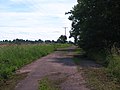 Old road at Birdforth - geograph.org.uk - 2570888.jpg 3,264 × 2,448; 1.85 MB
-
 Pylon beside Spring Lane - geograph.org.uk - 6987257.jpg 1,024 × 683; 368 KB
-
 Quarry Banks (1) - geograph.org.uk - 1963777.jpg 1,024 × 768; 179 KB
-
 Quarry Banks (2) - geograph.org.uk - 1963818.jpg 1,024 × 768; 124 KB
-
 Quarry Banks - geograph.org.uk - 6704195.jpg 1,024 × 768; 188 KB
-
 Quarry Banks - geograph.org.uk - 6987250.jpg 683 × 1,024; 385 KB
-
 Road on Windmere Hill - geograph.org.uk - 6987188.jpg 1,024 × 683; 413 KB
-
 Roadside cafe at Birdforth - geograph.org.uk - 320757.jpg 640 × 480; 84 KB
-
 St Mary, Birdforth - geograph.org.uk - 6430058.jpg 3,264 × 1,836; 2.94 MB
-
 The A19 at Cross Lanes - geograph.org.uk - 3524414.jpg 1,024 × 768; 209 KB
-
 The Corner Cupboard, Birdforth - geograph.org.uk - 1522034.jpg 640 × 399; 60 KB
-
 The view from Spring Lane - geograph.org.uk - 5209082.jpg 3,994 × 2,580; 1.91 MB
-
 Track to Burtree House Farm - geograph.org.uk - 6704193.jpg 1,024 × 768; 167 KB
-
 Windmere Hill triangulation pillar - geograph.org.uk - 6987185.jpg 1,024 × 683; 342 KB
-
 Wooden pylons crossing field - geograph.org.uk - 1963835.jpg 1,024 × 768; 90 KB
-
 Thirkleby Barugh - geograph.org.uk - 97527.jpg 550 × 412; 51 KB


_-_geograph.org.uk_-_1963777.jpg)
_-_geograph.org.uk_-_1963818.jpg)


