Category:Biosphere reserves with IDs
Jump to navigation
Jump to search
Subcategories
This category has the following 19 subcategories, out of 19 total.
Media in category "Biosphere reserves with IDs"
The following 200 files are in this category, out of 1,475 total.
(previous page) (next page)-
 Hawaiian Beach.jpg 1,920 × 1,272; 1.26 MB
-
 Yellowstone Lower Fall.jpg 3,936 × 2,624; 11.2 MB
-
-
 Jiuzhai Ditch.jpg 5,184 × 2,921; 3.64 MB
-

-
 Rizhaigou.jpg 5,184 × 3,456; 11.46 MB
-
 Anisoptera near Joranda Water Fall Simlipal Biosphere Reserve.jpg 3,733 × 2,588; 2.07 MB
-
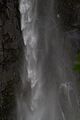
 Barehipani Water Fall of perennial stream Budha Balang Simlipal Biosphere Reserve.jpg 3,648 × 2,736; 4.15 MB
-
 Forest near Chahala Simlipal Biosphere Reserve.jpg 5,184 × 3,240; 6.29 MB
-
 Joranda Water Fall Simlipal Biosphere Reserve.jpg 3,648 × 2,736; 4.36 MB
-
 Velebit Biosphere Reserve.jpg 3,648 × 2,736; 3.48 MB
-
 East Carpathians Biosphere Reserve, Poland Slovakia Ukraine (10).jpg 4,928 × 3,264; 11.64 MB
-
 East Carpathians Biosphere Reserve, Poland Slovakia Ukraine (12).jpg 4,288 × 2,848; 7.56 MB
-
 East Carpathians Biosphere Reserve, Poland Slovakia Ukraine (2).jpg 4,288 × 2,848; 6.03 MB
-
 East Carpathians Biosphere Reserve, Poland Slovakia Ukraine (3).jpg 4,928 × 3,264; 12.14 MB
-
 East Carpathians Biosphere Reserve, Poland Slovakia Ukraine (7).jpg 4,928 × 3,264; 11.51 MB
-
 East Carpathians Biosphere Reserve, Poland Slovakia Ukraine (9).jpg 4,928 × 3,264; 15.19 MB
-
 Cesky Raj Prachov Rocks 1.jpg 4,608 × 3,456; 11.18 MB
-
 Trail through Prachov Rocks, Cesky Raj.jpg 3,456 × 4,608; 7.6 MB
-
 Trosky Castle Cesky Raj.jpg 4,608 × 3,456; 11.07 MB
-
 Black-naped Monarch in Sinharaja National Park.jpg 2,816 × 2,112; 1.3 MB
-
 Birds come calling.jpg 1,365 × 2,048; 413 KB
-
 Butterflies are not shy.jpg 2,048 × 1,365; 136 KB
-
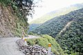 Dangerous road.jpg 2,048 × 1,365; 528 KB
-
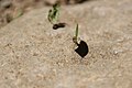 Laborous ant.jpg 2,048 × 1,365; 166 KB
-
 Manu cloud forest.jpg 2,048 × 1,365; 391 KB
-
 Manu flower.jpg 2,048 × 1,365; 220 KB
-
 Manu River.jpg 2,048 × 1,365; 534 KB
-
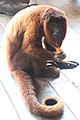 Monkey raiding the larder.jpg 1,365 × 2,048; 228 KB
-
 The butterfly trail.jpg 2,048 × 1,365; 290 KB
-
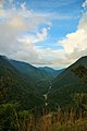 Valley viewpoint.jpg 1,365 × 2,048; 195 KB
-
 Altai reserve.jpg 2,288 × 1,712; 702 KB
-
 Eve with flora & fauna.jpg 3,264 × 2,448; 1.79 MB
-
 Forest near Sudhanyakhali Camp Sundarbans National Park in India.jpg 5,184 × 3,456; 5.28 MB
-

-
 Kingfisher on Boat.jpg 2,816 × 2,112; 1.06 MB
-
 Kingfisher on Oar.jpg 2,816 × 2,112; 1.17 MB
-
 Royal Bengal Tiger in Sundarbans National Park.jpg 2,816 × 2,112; 1.76 MB
-
 Royal Bengal Tiger walking down Mangrove Island in Sundarbans 1.jpg 2,816 × 2,112; 1.75 MB
-
 Royal Bengal Tiger walking down Mangrove Island in Sundarbans 2.jpg 2,816 × 2,112; 1.63 MB
-
 Royal Bengal Tiger walking down Mangrove Island in Sundarbans 3.jpg 2,816 × 2,112; 1.72 MB
-
 Lasiocampa serrula 2601.jpg 3,264 × 2,448; 2.58 MB
-
 Lycosa hispanica 2601.jpg 3,648 × 2,736; 2.21 MB
-
 Periploca angustifolia 2601.jpg 3,648 × 2,736; 2.07 MB
-
 Salsola vermiculata 2601.JPG 3,648 × 2,736; 2.18 MB
-
 Utetheisa pulchella 2601.JPG 3,648 × 2,736; 2.28 MB
-
 The Babia Gora Biosphere Reserve, Poland (1).jpg 4,928 × 3,264; 8.92 MB
-
 The Babia Gora Biosphere Reserve, Poland (2).jpg 4,928 × 3,264; 11.05 MB
-
 The Babia Gora Biosphere Reserve, Poland (3).jpg 4,928 × 3,264; 12.11 MB
-
 The Babia Gora Biosphere Reserve, Poland (4).jpg 4,928 × 3,264; 10.56 MB
-
 The Babia Gora Biosphere Reserve, Poland (5).jpg 4,928 × 3,264; 17.63 MB
-
 The Babia Gora Biosphere Reserve, Poland (6).jpg 4,928 × 3,264; 3.17 MB
-
 Lama4.jpg 240 × 320; 25 KB
-
 Птица которая улыбается.jpg 2,560 × 1,920; 1.14 MB
-
 Cerro Chachahuate.jpg 5,445 × 2,889; 3.21 MB
-
 Guacamayos rojas.jpg 3,186 × 2,194; 1.5 MB
-
 Kruta national park banner.jpg 4,800 × 686; 521 KB
-
 Patuca banner.jpg 4,800 × 686; 522 KB
-
 Patuca medio e indígena Miskito (cropped).jpg 6,000 × 858; 767 KB
-
 Patuca medio e indígena Miskito.jpg 6,000 × 4,000; 3.27 MB
-
 Rana Lechosa.jpg 3,168 × 4,752; 6.34 MB
-
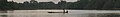
 Río Patuca.jpg 4,752 × 2,299; 3.56 MB
-
 Sistema de humedales y sabanas.jpg 4,000 × 5,308; 3.44 MB
-
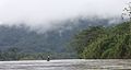 Sobre el Patuca.jpg 4,752 × 2,521; 1.73 MB
-
 Zona nucleo de la RHBRP, sitio Tilopo.jpg 1,024 × 683; 208 KB
-
 Chameleon lizard.jpg 240 × 320; 23 KB
-
 20150823 Großer Hundstod, Nationalpark Berchtesgaden (01924).jpg 4,912 × 3,264; 7.85 MB
-
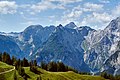 20150823 Königsbachalm mit Hachelwand und Hundstod, NP Berchtesgaden (01911).jpg 4,912 × 3,264; 9.94 MB
-
 20150823 Königsbachalm mit Watzmann, Nationalpark Berchtesgaden (DSC01906).jpg 4,912 × 3,264; 10.03 MB
-
 20150823 Königsbachalm mit Watzmann, Nationalpark Berchtesgaden (DSC01914).jpg 4,912 × 3,264; 10.41 MB
-
 20150823 Priesberg-Alm, Nationalpark Berchtesgaden (01934).jpg 4,912 × 3,264; 18.04 MB
-
 20150823 Untersberg, Nationalpark Berchtesgaden (01946).jpg 4,722 × 2,329; 7.05 MB
-
 20150823 Watzmann, Nationalpark Berchtesgaden (01912).jpg 4,543 × 3,086; 9.25 MB
-
 20150823 Watzmann, Nationalpark Berchtesgaden (DSC01900).jpg 4,912 × 3,264; 15.09 MB
-
 20150823 Watzmann, Nationalpark Berchtesgaden (DSC01922).jpg 4,912 × 3,264; 12.88 MB
-
 20150823 Watzmann-Ostwand, Nationalpark Berchtesgaden (DSC01925).jpg 4,912 × 3,264; 11.31 MB
-
 Biosphärenregion Berchtesgadener Land Lattengebirge Juni 2017 1.jpg 2,880 × 2,143; 4.34 MB
-
 Biosphärenregion Berchtesgadener Land Lattengebirge Juni 2017 2.jpg 3,000 × 2,250; 6.49 MB
-
 Biosphärenregion Berchtesgadener Land Listsee Juni 2017 1.jpg 3,000 × 2,201; 8.87 MB
-
 Biosphärenregion Berchtesgadener Land Reiteralpe Juni 2017 1.jpg 2,880 × 2,160; 3.89 MB
-
 Biosphärenregion Berchtesgadener Land Reiteralpe Juni 2017 2.jpg 2,880 × 2,141; 4.3 MB
-
 Biosphärenregion Berchtesgadener Land Sankt Pankraz Juni 2017 1.jpg 2,634 × 1,783; 3.1 MB
-
 Biosphärenregion Berchtesgadener Land Weißbachklamm Juni 2017 1.jpg 2,078 × 2,714; 4.93 MB
-
 Biosphärenregion Berchtesgadener Land Weißbachklamm Juni 2017 2.jpg 2,800 × 2,087; 7.14 MB
-
 Blick auf den Königssee im Nationalpark Berchtesgaden.jpg 3,456 × 1,840; 1.13 MB
-
 Großer Hundstod von SO.jpg 4,394 × 2,199; 4.44 MB
-
 Ingolstädter Haus mit Hubschrauberversorgung von NO.jpg 2,667 × 2,000; 2.61 MB
-
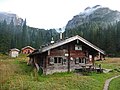
 Kärlingerhaus von NW 2018-09 (1).jpg 2,390 × 1,793; 2.21 MB
-
 Kärlingerhaus von NW 2018-09 (2).jpg 2,184 × 1,523; 1.63 MB
-
 Wasseralm in der Röth 2018-09 (1).jpg 3,264 × 2,016; 2.32 MB
-
 Wasseralm in der Röth 2018-09 (2).jpg 3,264 × 2,106; 2.47 MB
-
 Wasseralm in der Röth 2018-09 (3).jpg 3,264 × 2,448; 3.18 MB
-
 Wasseralm in der Röth 2018-09 (4).jpg 3,264 × 2,448; 3.1 MB
-
 Gersfeld Gersfeld Hochstrasse Cantharis sp.png 5,200 × 3,468; 40.2 MB
-
 Gersfeld Gersfeld Hochstrasse Hoefe Pano Cy N.png 5,585 × 2,338; 22.09 MB
-
 Gersfeld Gersfeld Hochstrasse Rodenbacher Kueppel SW.png 4,779 × 2,073; 15.31 MB
-
 Gersfeld Gersfeld Hochstrasse Sandberg Pano Cy N.png 8,256 × 2,374; 29.77 MB
-
 Gersfeld Gersfeld Hochstrasse SCI 555578052 Simmelsberg Pano Cy.png 9,660 × 2,356; 35.24 MB
-
 Gersfeld Moosbach Tributary Feldbach N.png 3,468 × 5,200; 30.74 MB
-
 Gersfeld Obernhausen SCI 555578052 Centaurea montana a.png 3,468 × 5,200; 42.87 MB
-
 Gersfeld Obernhausen SCI 555578052 Centaurea montana b.png 3,468 × 5,200; 43.21 MB
-
 Gersfeld Obernhausen SCI 555578052 Pasture W.png 5,200 × 3,468; 32.74 MB
-
 Gersfeld Sandberg Obernhausen SCI 555578052 Fulda Stream Pano Cy.png 3,980 × 1,916; 16.97 MB
-
 Gersfeld Sandberg Obernhausen SCI 555578052 Fulda Stream.png 3,468 × 5,200; 35 MB
-
 Gersfeld Sommersberg Poppenhausen Pano Cyl.png 22,971 × 2,111; 80.97 MB
-
 Gersfeld Sommersberg Wachtkueppel E.png 5,200 × 3,468; 24.27 MB
-
 Poppenhausen Wasserkuppe Heckenhoefchen Pferdskopf Wasserkuppenweg Pasture E.png 5,175 × 3,410; 28.07 MB
-
 Poppenhausen Wasserkuppe Heckenhoefchen Pferdskopf Wasserkuppenweg Pasture SE Pano.png 7,919 × 2,162; 34.37 MB
-
 Poppenhausen Wasserkuppe Heckenhoefchen Pferdskopf Wasserkuppenweg Pasture SE.png 5,200 × 3,468; 31 MB
-
 Poppenhausen Wasserkuppe Kohlstoecken Gukaisee Eube Pastures.png 3,468 × 5,200; 30.57 MB
-
 Poppenhausen Wasserkuppe Kohlstoecken K160 Eube Pano Cyl SE.png 9,134 × 2,252; 33.67 MB
-
 Poppenhausen Wasserkuppe Kohlstoecken K160 Eube SE.png 5,200 × 3,468; 23.82 MB
-
-
 Poppenhausen Wasserkuppe Kohlstoecken Pferdskopf Gukaisee Pasture N.png 5,200 × 3,468; 32.06 MB
-
 Poppenhausen Wasserkuppe Pferdskopf Gukaisee Eube Pasture Moo NE.png 5,703 × 2,410; 26.99 MB
-
 Poppenhausen Wasserkuppe Weihersberg Weiherskuppe N.png 5,200 × 3,468; 23.69 MB
-
 Poppenhausen Wasserkuppe Weihersberg Weiherskuppe Sieblos Pano N.png 11,418 × 2,365; 46.91 MB
-
 North Vidzeme Biosphere Reserve, Łotwa (1).jpg 4,928 × 3,264; 9.06 MB
-
 North Vidzeme Biosphere Reserve, Łotwa (2).jpg 4,928 × 3,264; 7.31 MB
-
 North Vidzeme Biosphere Reserve, Łotwa (3).jpg 4,928 × 3,264; 10.87 MB
-
 North Vidzeme Biosphere Reserve, Łotwa (4).jpg 4,928 × 3,264; 10.29 MB
-
 North Vidzeme Biosphere Reserve, Łotwa (5).jpg 4,928 × 3,264; 9.02 MB
-
 North Vidzeme Biosphere Reserve, Łotwa (6).jpg 4,928 × 3,264; 8.16 MB
-
 Barzlin 02.jpg 5,472 × 3,249; 11.36 MB
-
 Barzlin 04.jpg 5,472 × 3,648; 16.59 MB
-
 Barzlin 05.jpg 5,319 × 3,648; 9.15 MB
-
 Burg Neue Spree 01.jpg 5,472 × 3,648; 17.07 MB
-
 Luebben Kockrowsberg 07.jpg 5,472 × 3,648; 12.76 MB
-
 Luebben Kockrowsberg 22.jpg 5,278 × 3,382; 10.61 MB
-
 Luebben Kockrowsberg Libellula fulva female 01.jpg 3,437 × 2,553; 4.42 MB
-
 Luebben Kockrowsberg Libellula fulva female 01.tif 3,437 × 2,553; 50.23 MB
-
 Luebben Pfaffenberge 01.jpg 5,472 × 3,648; 13.55 MB
-
 Muehlendorf 12.jpg 5,472 × 3,648; 14.74 MB
-
 Muehlendorf 15.jpg 5,472 × 3,648; 11.75 MB
-
 Neu Zauche Wiese 02.jpg 5,472 × 3,525; 15.51 MB
-
 NSG Innerer Oberspreewald (1).jpg 4,224 × 2,816; 6.38 MB
-
 NSG Innerer Oberspreewald (5).jpg 4,224 × 2,816; 6.86 MB
-
 NSG Innerer Oberspreewald 04.JPG 5,027 × 3,488; 16.51 MB
-
 Ragow Luebben Ribocka 01.jpg 5,472 × 3,249; 15.23 MB
-
 Ragow Ribocka 01.tif 5,472 × 3,249; 101.75 MB
-
 Ragower Heide 02.jpg 5,287 × 3,443; 15.38 MB
-
 Schwarzerlenwald bei Neu Zauche.jpg 3,240 × 4,320; 4.08 MB
-
 Siedlung 02.jpg 5,472 × 2,062; 8.32 MB
-
 Spreewald Burg Luebbener Kanal 17.jpg 4,623 × 3,423; 19.38 MB
-
 Spreewald Burg Luebbener Kanal 19.jpg 5,174 × 3,504; 19.69 MB
-
 Spreewald Burg Luebbener Kanal Schleuse 09.jpg 5,471 × 3,269; 14.95 MB
-
 Spreewald Eschenfliess 02.jpg 5,124 × 3,474; 22.04 MB
-
 Spreewald Eschenfliess 06.jpg 5,380 × 3,597; 23.89 MB
-
 Spreewald Leipe Hauptspree 01.jpg 5,472 × 3,648; 19.99 MB
-
 Spreewald Wehrkanal 15.jpg 4,899 × 3,443; 19.35 MB
-
 Spreewald Wehrkanal 15.tif 4,899 × 3,443; 96.55 MB
-
 Spreewald Wehrkanal Buergerfliess 01.jpg 5,441 × 3,494; 21.91 MB
-
 Straupitz 32.jpg 5,397 × 3,289; 12.46 MB
-
 Straupitz 33.jpg 5,472 × 3,556; 18.35 MB
-
 Straupitz 43.jpg 5,472 × 2,952; 9.18 MB
-
 Sellin Seebrücke 001 2006 09 06.jpg 2,007 × 2,489; 1.56 MB
-
 Beech and spruce on a rocky slope in Vessertal.jpg 2,828 × 4,242; 11.68 MB
-
 Deadwood with fungi in Vessertal.jpg 2,968 × 4,043; 11.18 MB
-
 Flower in Vessertal.jpg 2,828 × 4,242; 6.87 MB
-
 Forest in the inner area of Vessertal nature reserve.jpg 2,725 × 4,402; 10.97 MB
-
 Group of trees on a clearing in Vessertal valley.jpg 4,242 × 2,828; 8.24 MB
-
 Nature reserve sign Vessertal (middle area) beside a street.jpg 4,242 × 2,828; 6.05 MB
-
 Plant in Vessertal.jpg 4,242 × 2,828; 5.81 MB
-
 River vesser flowing over rocks.jpg 4,242 × 2,828; 12.04 MB
-
 River Vesser in the inner area of Vessertal nature reserve.jpg 4,242 × 2,828; 10.77 MB
-
 Tree on a meadow in Vessertal.jpg 4,296 × 2,793; 11.68 MB
-
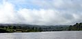
 Sanqingshan south slope fog 1.jpg 4,608 × 3,456; 5.77 MB
-
 Sanqingshan south slope fog 2.jpg 4,608 × 3,456; 7.8 MB
-
 Sanqingshan sunrise python.jpg 4,608 × 3,456; 8.53 MB
-
 A landscape without comparison Tuparro Natural Park.jpg 1,848 × 2,768; 2.21 MB
-
 Disfrutando de un Hotel de Mil Estrellas.jpg 2,768 × 1,848; 1.63 MB
-
 Este sería el perfecto para Trabajar.jpg 5,168 × 3,448; 2.43 MB
-
 Flying Partners.jpg 4,823 × 3,218; 2.36 MB
-
 I'm Watching you.jpg 5,168 × 3,448; 1.62 MB
-
 Looking for Breakfast.jpg 5,168 × 3,448; 2.22 MB
-
 Over the currents.jpg 5,168 × 3,448; 2.43 MB
-
 The Eighth Wonder of the World Tuparro Natural Park.jpg 2,768 × 1,848; 2.95 MB
-
 The perfect balance in nature Tuparro Natural Park.jpg 1,848 × 2,768; 3.11 MB
-
 Dehesa in Daimiel.jpg 4,608 × 3,072; 3.51 MB
-
 Pair of Coots.jpg 4,608 × 3,072; 3.49 MB
-
 Karibik-326.jpg 3,456 × 5,184; 14.12 MB
-
 Karibik-329.jpg 5,760 × 3,840; 13.71 MB
-
 Karibik-348.jpg 3,456 × 5,184; 9.97 MB
-
 Karibik-349.jpg 3,456 × 5,184; 10.24 MB
-
 PN de la Guadeloupe.jpg 5,760 × 3,840; 19.67 MB
-
 Sacred mountain Xiannairi Yading Biosphere Reserve.jpg 2,407 × 1,605; 1.71 MB
-
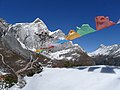
 Valley near sacred mountain Xiannairi Yading Biosphere Reserve.jpg 3,263 × 2,177; 2.24 MB
-
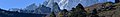 Yading Banner.jpg 3,648 × 521; 712 KB
-
 Yading Sacred Mountain 2017-11-08.jpg 3,648 × 2,736; 3.22 MB
-
 Yading Sacred Mountain.jpg 3,648 × 2,736; 2.7 MB
-
 Bear Prints In Sand.jpg 480 × 640; 217 KB
-
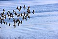 Birds in Provincial Park on Flores Island.jpg 2,592 × 1,728; 1.41 MB
-
 Black Bear Coast.jpg 640 × 480; 152 KB
-
 Carving Kids.jpg 1,024 × 430; 119 KB
-
 Flores Island Provincial Park.jpg 2,592 × 1,728; 1.39 MB
-
 Frog Pacific Rim.jpg 4,256 × 2,832; 3.05 MB
-
 Grasslands in Estuary.jpg 4,000 × 3,000; 1.71 MB
-
 Office view.jpg 4,032 × 3,024; 3.12 MB
-
 Passage or Channel.jpg 3,024 × 4,032; 2.74 MB
-
 Provincial Park on Flores Island.jpg 2,592 × 1,728; 2.07 MB


.jpg)

.jpg)


.jpg)
.jpg)
.jpg)
.jpg)
.jpg)
.jpg)


.jpg)
.jpg)
.jpg)
.jpg)
.jpg)
.jpg)


.jpg)
.jpg)
.jpg)
.jpg)
.jpg)
.jpg)
.jpg)
.jpg)
.jpg)
.jpg)


.jpg)
.jpg)
.jpg)
.jpg)
.jpg)
.jpg)


.jpg)
.jpg)
.jpg)
.jpg)
.jpg)
.jpg)


.jpg)
.jpg)


_beside_a_street.jpg)


.jpg)