Category:Biogeographical maps of the Czech Republic
Jump to navigation
Jump to search
Media in category "Biogeographical maps of the Czech Republic"
The following 21 files are in this category, out of 21 total.
-
 Czech Republic species distribution map grid blank.png 1,744 × 1,020; 136 KB
-
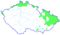 Apodemus agrarius CZ distribution map.png 600 × 352; 89 KB
-
 Apodemus flavicollis ČR rozšíření.png 600 × 352; 101 KB
-
 Apodemus sylvaticus ČR rozšíření.png 600 × 352; 95 KB
-
 Apodemus uralensis CZ distribution map.png 600 × 352; 84 KB
-
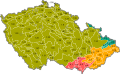
 Biogeograficke cleneni CR.svg 1,202 × 744; 340 KB
-
 Biogeografické podprovincie.svg 1,202 × 744; 145 KB
-
 Biogeografické provincie.svg 1,202 × 744; 144 KB
-
 Bioregiony.svg 1,202 × 744; 593 KB
-
 Chondrina avenacea grid map.png 1,744 × 1,020; 136 KB
-
 Fyzicka mapa Ceska prv 02.jpg 795 × 461; 227 KB
-
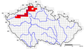
 Hercynska podprovincie.svg 1,202 × 744; 145 KB
-
 Polonska podprovincie.svg 1,202 × 744; 145 KB
-
 Primula veris - mapka rozšíření.jpg 800 × 468; 275 KB
-
 Rattus norvegicus CZ distribution map.png 600 × 352; 124 KB
-
 Rattus rattus CZ distribution map.png 600 × 352; 83 KB
-
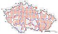
 Salmo salar CZ distribution grid map 2006.png 1,744 × 1,020; 113 KB
-
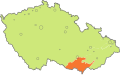
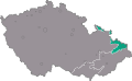
 Severopanonska podprovincie.svg 1,202 × 744; 146 KB
-
 Vegetacni stupne CR.svg 1,488 × 937; 540 KB
-
 Vegetační stupně v Česku.svg 1,458 × 902; 430 KB
-
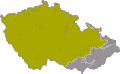
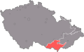
 Zapadokarpatska podprovincie.svg 1,202 × 744; 145 KB


