Category:Bilingual German-Low German city limit signs in Lower Saxony
Jump to navigation
Jump to search
Federal states of Germany:
Media in category "Bilingual German-Low German city limit signs in Lower Saxony"
The following 121 files are in this category, out of 121 total.
-
 2-sprachiges Ortsschild Wirdum (2024).jpg 4,800 × 2,700; 10.3 MB
-
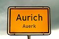 Aurich schild.jpg 1,368 × 896; 299 KB
-
 Oortsschild Bornbarg.jpg 2,304 × 1,728; 922 KB
-
 Buxthu - Schild.jpg 4,471 × 2,263; 3.63 MB
-
 DE-NDS-Bad Fallingbostel-Ortsschild.jpg 484 × 355; 103 KB
-
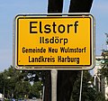 DE-NDS-Elstorf-Ortsschild.JPG 2,845 × 2,644; 2.25 MB
-
 DE-NDS-Emmen-Ortsschild.jpg 3,264 × 2,962; 1.49 MB
-
 DE-NDS-Neu Wulmstorf-Ortsschild.jpg 1,182 × 1,231; 645 KB
-
 DE-NDS-Norderney-Ortsschild.jpg 2,448 × 3,264; 2.09 MB
-
 DE-NDS-Ohlenbüttel-Ortsschild.JPG 3,675 × 2,765; 2.89 MB
-
 DE-NDS-Schwiederstorf-Ortsschild.JPG 5,184 × 3,456; 4.25 MB
-
 DE-NDS-Wohlesbostel-Ortsschild.jpg 3,024 × 4,032; 7.05 MB
-
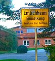 Ortsschild Emlichheim - Emmelkamp cropped.jpg 759 × 839; 326 KB
-
 Ortsschild Emlichheim - Emmelkamp.jpg 2,592 × 1,944; 658 KB
-
 Fototour Beers 05.jpg 4,032 × 3,024; 3.44 MB
-
 Fototour Beers 06.jpg 3,024 × 4,032; 3.88 MB
-
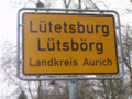 Luetetsburg.gif 160 × 120; 13 KB
-
 Oortsingang Bornbarg, Bundsstraat 73 vun Heekthusen, links.jpg 2,304 × 1,728; 1.45 MB
-
 Oortsingang Bornbarg, Bundsstraat 73 vun Heekthusen, rechts.jpg 2,304 × 1,728; 1.14 MB
-
 Oortsingang Bornbarg, Bundsstraat 73 vun Hemmoor, links.jpg 2,304 × 1,728; 1.38 MB
-
 Oortsingang Bornbarg, Bundsstraat 73 vun Hemmoor, rechts.jpg 2,304 × 1,728; 1.28 MB
-
 Oortsingang Bornbarg, Kanalstraat-An’n Kanal.jpg 2,304 × 1,728; 1.43 MB
-
 Oortsingang Bornbarg, Laumöhlener Straat.jpg 2,304 × 1,728; 1.17 MB
-
 Oortsschild Bliersdörp 2.jpg 2,592 × 1,944; 1.65 MB
-
 Oortsschild Bliersdörp-Postmoor 2.jpg 2,592 × 1,944; 1.53 MB
-
 Oortsschild Bliersdörp-Postmoor.jpg 1,944 × 2,592; 1.82 MB
-
 Oortsschild Bliersdörp.jpg 1,944 × 2,592; 1.86 MB
-
 Oortsschild Buxthu, Landkreis Stood 1.jpg 2,592 × 1,944; 1.72 MB
-
 Oortsschild Buxthu, Landkreis Stood 2.jpg 1,944 × 2,592; 1.56 MB
-
 Oortsschild Buxthu, Landkreis Stood 3.jpg 2,592 × 1,944; 1.22 MB
-
 Oortsschild Dammhusen, Landkreis Stood 1.jpg 1,944 × 2,592; 2.42 MB
-
 Oortsschild Dammhusen, Landkreis Stood 2.jpg 2,592 × 1,944; 1.46 MB
-
 Oortsschild Heendörp, Landkreis Stood 1.jpg 2,592 × 1,944; 1.84 MB
-
 Oortsschild Heendörp, Landkreis Stood 2.jpg 2,592 × 1,944; 1.94 MB
-
 Oortsschild Heendörp, Landkreis Stood 3.jpg 1,944 × 2,592; 1.95 MB
-
 Oortsschild Heendörp, Landkreis Stood 4.jpg 2,592 × 1,944; 1.65 MB
-
 Oortsschild Imbeek, Landkreis Stood 1.jpg 2,592 × 1,944; 1.57 MB
-
 Oortsschild Imbeek, Landkreis Stood 2.jpg 2,592 × 1,944; 1.39 MB
-
 Oortsschild Ketzendörp, Landkreis Stood 1.jpg 1,944 × 2,592; 1.97 MB
-
 Oortsschild Ketzendörp, Landkreis Stood 2.jpg 2,592 × 1,944; 2.57 MB
-
 Oortsschild Ketzendörp, Landkreis Stood 3.jpg 2,592 × 1,944; 1.64 MB
-
 Oortsschild Ketzendörp, Landkreis Stood 4.jpg 2,592 × 1,944; 1.81 MB
-
 Oortsschild Ketzendörp, Landkreis Stood 5.jpg 2,592 × 1,944; 1.5 MB
-
 Oortsschild Kumbarg 2.jpg 1,944 × 2,592; 1.12 MB
-
 Oortsschild Kumbarg.jpg 1,944 × 2,592; 1.38 MB
-
 Oortsschild Neeklooster, Landkreis Stood 1.jpg 2,592 × 1,944; 2.53 MB
-
 Oortsschild Neeklooster, Landkreis Stood 2.jpg 2,592 × 1,944; 2.56 MB
-
 Oortsschild Neeklooster, Landkreis Stood 3.jpg 1,944 × 2,592; 2.09 MB
-
 Oortsschild Neeklooster, Landkreis Stood 4.jpg 1,944 × 2,592; 1.63 MB
-
 Oortsschild Neeklooster, Landkreis Stood 5.jpg 2,592 × 1,944; 2.2 MB
-
 Oortsschild von Alfs 1.jpg 3,024 × 4,032; 5.79 MB
-
 Oortsschild von Alfs 2.jpg 4,032 × 3,024; 4.51 MB
-
 Oortsschild von Alfs 3.jpg 4,032 × 3,024; 4.68 MB
-
 Oortsschild von Alfs 4.jpg 3,024 × 4,032; 5.75 MB
-
 Oortsschild von Alfs 5.jpg 4,032 × 3,024; 5.69 MB
-
 Oortsschild von Alfs 6.jpg 3,024 × 4,032; 5.86 MB
-
 Oortsschild von Cuxhoben, Landkreis Cuxhoben 1.jpg 2,592 × 1,944; 2.1 MB
-
 Oortsschild von Cuxhoben, Landkreis Cuxhoben 2.jpg 2,592 × 1,944; 2.04 MB
-
 Oortsschild von de Worth, Landkreis Cuxhoben 1.jpg 2,592 × 1,944; 2.42 MB
-
 Oortsschild von de Worth, Landkreis Cuxhoben 2.jpg 1,944 × 2,592; 2.32 MB
-
 Oortsschild von de Worth, Landkreis Cuxhoben 3.jpg 2,592 × 1,944; 1.5 MB
-
 Oortsschild von de Worth, Landkreis Cuxhoben 4.jpg 2,592 × 1,944; 1.62 MB
-
 Oortsschild von de Worth, Landkreis Cuxhoben 5.jpg 1,944 × 2,592; 1.68 MB
-
 Oortsschild von de Worth, Landkreis Cuxhoben 6.jpg 2,592 × 1,944; 1.52 MB
-
 Oortsschild von Issell, Landkreis Heidkreis 1.jpg 1,944 × 2,592; 2.53 MB
-
 Oortsschild von Issell, Landkreis Heidkreis 2.jpg 1,944 × 2,592; 2.53 MB
-
 Oortsschild von Issell, Landkreis Heidkreis 3.jpg 2,592 × 1,944; 2.72 MB
-
 Oortsschild von Issell, Landkreis Heidkreis 4.jpg 2,592 × 1,944; 1.96 MB
-
 Oortsschild von Kamp, Landkreis Horborg 1.jpg 2,592 × 1,944; 1.74 MB
-
 Oortsschild von Kamp, Landkreis Horborg 2.jpg 1,944 × 2,592; 1.97 MB
-
 Oortsschild von Kamp, Landkreis Horborg 3.jpg 2,592 × 1,944; 1.79 MB
-
 Oortsschild von Kuhs, Landkreis Rodenborg 1.jpg 4,032 × 3,024; 2.2 MB
-
 Oortsschild von Kuhs, Landkreis Rodenborg 2.jpg 3,024 × 4,032; 2.14 MB
-
 Oortsschild von Kuhs, Landkreis Rodenborg 3.jpg 4,032 × 3,024; 1.86 MB
-
 Oortsschild von Kuhs, Landkreis Rodenborg 4.jpg 4,032 × 3,024; 1.78 MB
-
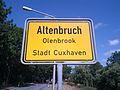
 Oortsschild von Olenbrook, Landkreis Cuxhoben 1.jpg 2,592 × 1,944; 2.28 MB
-
 Oortsschild von Olenbrook, Landkreis Cuxhoben 2.jpg 1,944 × 2,592; 1.99 MB
-
 Oortsschild von Olenbrook, Landkreis Cuxhoben 3.jpg 2,592 × 1,944; 2.21 MB
-
 Oortsschild von Olenbrook, Landkreis Cuxhoben 4.jpg 2,592 × 1,944; 1.76 MB
-
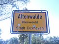
 Oortsschild von Olenwoold, Landkreis Cuxhoben 1.jpg 2,592 × 1,944; 2.23 MB
-
 Oortsschild von Olenwoold, Landkreis Cuxhoben 2.jpg 2,592 × 1,944; 2.06 MB
-
 Oortsschild von Olenwoold, Landkreis Cuxhoben 3.jpg 1,944 × 2,592; 2.1 MB
-
 Oortsschild von Olenwoold, Landkreis Cuxhoben 4.jpg 2,592 × 1,944; 1.54 MB
-
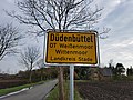
 Oortsschild von Wittenmoor, Gemeen Düünbeudel, Landkreis Stood 1.jpg 3,024 × 4,032; 6.73 MB
-
 Oortsschild von Wittenmoor, Gemeen Düünbeudel, Landkreis Stood 2.jpg 4,032 × 3,024; 4.69 MB
-
 Oortsschild von Wittenmoor, Gemeen Düünbeudel, Landkreis Stood 3.jpg 4,032 × 3,024; 5.94 MB
-
 Oortsschild von Wittenmoor, Gemeen Düünbeudel, Landkreis Stood 4.jpg 4,032 × 3,024; 3.99 MB
-
 Oortsschild von Wittenmoor, Gemeen Düünbeudel, Landkreis Stood 5.jpg 4,032 × 3,024; 3.66 MB
-
 Oortsschild Will, Landkreis Horborg 1.jpg 2,592 × 1,944; 2.49 MB
-
 Oortsschild Will, Landkreis Horborg 2.jpg 2,592 × 1,944; 1.77 MB
-
 Oortsschild Will, Landkreis Horborg 3.jpg 2,592 × 1,944; 2.32 MB
-
 Oortsschild Will, Landkreis Horborg 4.jpg 2,592 × 1,944; 2.12 MB
-
 Oortsschild Wintemaur an de Chaussee, Landkreis Heidkreis 1.jpg 2,592 × 1,944; 2.29 MB
-
 Oortsschild Wintemaur an de Chaussee, Landkreis Heidkreis 2.jpg 2,592 × 1,944; 2.5 MB
-
 Oortsschild Wintemaur an de Chaussee, Landkreis Heidkreis 3.jpg 2,592 × 1,944; 2.78 MB
-
 Oortsschild Wintemaur an de Chaussee, Landkreis Heidkreis 4.jpg 2,592 × 1,944; 2.57 MB
-
 Oortsschild Wintemaur-Gäbesdörp, Landkreis Heidkreis 1.jpg 2,592 × 1,944; 2.49 MB
-
 Oortsschild Wintemaur-Gäbesdörp, Landkreis Heidkreis 2.jpg 2,592 × 1,944; 2.38 MB
-
 Oortsschild Wintemaur-Gäbesdörp, Landkreis Heidkreis 3.jpg 2,592 × 1,944; 2 MB
-
 Oortsschild Wintemaur-Gäbesdörp, Landkreis Heidkreis 4.jpg 2,592 × 1,944; 2.53 MB
-
 Oortsschild Öbergünn, Landkreis Stood 1.jpg 2,592 × 1,944; 2.27 MB
-
 Oortsschild Öbergünn, Landkreis Stood 2.jpg 1,944 × 2,592; 2.21 MB
-
 Oortsschild Öbergünn, Landkreis Stood 3.jpg 2,592 × 1,944; 2.15 MB
-
 Oortsschild Öbergünn, Landkreis Stood 4.jpg 2,592 × 1,944; 1.76 MB
-
 Ortseingang Ohlenbüttel.JPG 3,456 × 5,184; 9.65 MB
-
 Ortseingang Schwiederstorf.JPG 5,184 × 3,456; 6.68 MB
-
 Ortsschild von Gauderhandviddel, Landkreis Stood 2.jpg 1,944 × 2,592; 1.28 MB
-
 Ortsschild von Gauderhandviddel, Landkreis Stood 3.jpg 2,592 × 1,944; 1.56 MB
-
 Ortsschild von Gauderhandviddel, Landkreis Stood.jpg 1,944 × 2,592; 1.34 MB
-
 Ortsschild von Gothenborg, Landkreis Stood 2.jpg 2,592 × 1,944; 1.45 MB
-
 Ortsschild von Gothenborg, Landkreis Stood 3.jpg 2,592 × 1,944; 1.97 MB
-
 Ortsschild von Gothenborg, Landkreis Stood.jpg 1,944 × 2,592; 1.79 MB
-
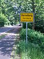
 Ortsschild von Hornborg, Landkreis Stood 2.jpg 2,592 × 1,944; 2.53 MB
-
 Ortsschild von Hornborg, Landkreis Stood 3.jpg 2,592 × 1,944; 1.98 MB
-
 Ortsschild von Hornborg, Landkreis Stood.jpg 1,944 × 2,592; 2.57 MB
-
 Ortsschild von Neekark, Landkreis Stood 2.jpg 2,592 × 1,944; 1.36 MB
-
 Ortsschild von Neekark, Landkreis Stood 3.jpg 2,592 × 1,944; 1.61 MB
-
 Ortsschild von Neekark, Landkreis Stood.jpg 2,592 × 1,944; 1.15 MB
-
 Ortstafel Mengebostel bei Allerhop.jpg 4,000 × 2,672; 4.76 MB
-
 OsterhagenIhlpohl Orsteingangsschild.jpg 1,476 × 954; 257 KB
-
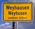 Weyh(a)usen, zweisprachiges Ortsschild, 1.jpeg 1,812 × 1,500; 843 KB
.jpg)


usen,_zweisprachiges_Ortsschild,_1.jpeg)