Category:Bilborough
Jump to navigation
Jump to search
suburb of the city of Nottingham, England  | |||||
| Upload media | |||||
| Instance of | |||||
|---|---|---|---|---|---|
| Location |
| ||||
| Different from | |||||
 | |||||
Subcategories
This category has the following 3 subcategories, out of 3 total.
M
- Martin's Pond (14 F)
Media in category "Bilborough"
The following 91 files are in this category, out of 91 total.
-
 A view from Moor Road bus stop - geograph.org.uk - 3484877.jpg 1,200 × 918; 1.61 MB
-
 Aagrah Indian Restaurant, Street Houses (geograph 6197903).jpg 5,177 × 3,375; 5.21 MB
-
 Arable land on Catstone Hill - geograph.org.uk - 1768320.jpg 640 × 480; 128 KB
-
 Autumn Colours - geograph.org.uk - 1027891.jpg 465 × 640; 131 KB
-
 Balloon Wood Adventure Playground - geograph.org.uk - 916170.jpg 640 × 480; 97 KB
-
 Barn on Strelley Road - geograph.org.uk - 5328643.jpg 640 × 464; 48 KB
-
 Beechdale Road - geograph.org.uk - 5327781.jpg 640 × 480; 73 KB
-

-
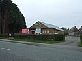
 Bilborough College - geograph.org.uk - 916247.jpg 640 × 480; 70 KB
-
 Bilborough College - Side Entrance - geograph.org.uk - 916252.jpg 480 × 640; 64 KB
-
 Bilborough College - Sports Centre - geograph.org.uk - 916257.jpg 640 × 311; 41 KB
-
 Bilborough Road - geograph.org.uk - 1588351.jpg 640 × 415; 88 KB
-
 Bilborough Road - geograph.org.uk - 916178.jpg 640 × 480; 120 KB
-
 BILBOROUGH, St John the Baptist Ext (51744257353).jpg 1,920 × 1,352; 666 KB
-
 Bramhall Road, Bilborough - geograph.org.uk - 877948.jpg 640 × 480; 72 KB
-
 Bridleway to Strelley - geograph.org.uk - 916184.jpg 640 × 480; 137 KB
-
 Broxtowe Children's Centre - geograph.org.uk - 5327785.jpg 640 × 418; 64 KB
-
 Broxtowe Police Station - geograph.org.uk - 3903285.jpg 1,280 × 960; 297 KB
-
 Burned out car on Aspley Lane - geograph.org.uk - 5327741.jpg 640 × 480; 104 KB
-
 Burnside Road, Bilborough - geograph.org.uk - 842502.jpg 640 × 427; 202 KB
-

-

-
 Bus stop on Aspley Lane - geograph.org.uk - 5327743.jpg 640 × 480; 59 KB
-
 Bus stop on Wigman Road, Bilborough - geograph.org.uk - 5326517.jpg 640 × 480; 55 KB
-
 Business on Broxtowe Lane, Broxtowe - geograph.org.uk - 5326501.jpg 640 × 480; 63 KB
-

-
 Close up, George VI postbox on St Martins Road - geograph.org.uk - 5328642.jpg 1,337 × 2,376; 600 KB
-
 Co-op superstore, Strelley Road - geograph.org.uk - 3399715.jpg 1,024 × 768; 105 KB
-
 Concreted area in King George’s Park - geograph.org.uk - 6172494.jpg 1,024 × 768; 288 KB
-
 Costcutter store on Aspley Lane - geograph.org.uk - 5327738.jpg 640 × 480; 50 KB
-
 Council Estate Roundabout - geograph.org.uk - 842511.jpg 640 × 427; 187 KB
-
 Cut Fence by Bridlepath - geograph.org.uk - 842529.jpg 640 × 427; 358 KB
-
 Fircroft Avenue - geograph.org.uk - 5326507.jpg 640 × 480; 46 KB
-
 Flamsteed Road, Strelley Estate - geograph.org.uk - 3280927.jpg 1,024 × 768; 220 KB
-
 George VI postbox and telephone box on Broxtowe Road - geograph.org.uk - 5328620.jpg 2,136 × 2,848; 1.38 MB
-
 George VI postbox on Broxtowe Road - geograph.org.uk - 5328616.jpg 1,979 × 2,731; 1.21 MB
-
 George VI postbox on St Martins Road - geograph.org.uk - 5328640.jpg 640 × 480; 97 KB
-
 Harvey Haddon Sports Stadium - geograph.org.uk - 520232.jpg 640 × 480; 104 KB
-
 Harvey Haddon Sports Stadium - geograph.org.uk - 520236.jpg 640 × 480; 93 KB
-
 Houses on Aspley Lane - geograph.org.uk - 5327739.jpg 640 × 480; 57 KB
-
 Houses on Aspley Lane - geograph.org.uk - 5327778.jpg 640 × 480; 107 KB
-
 Houses on Beechdale Road - geograph.org.uk - 5326504.jpg 640 × 480; 62 KB
-
 Houses on Exbourne Road - geograph.org.uk - 5327747.jpg 640 × 480; 53 KB
-
 Houses on Strelley Road - geograph.org.uk - 5327796.jpg 640 × 480; 50 KB
-
 Houses on Wigman Road, Bilborough - geograph.org.uk - 5326516.jpg 640 × 480; 48 KB
-

-
 Housing, Strelley Estate - geograph.org.uk - 6103627.jpg 1,024 × 768; 467 KB
-
 Miniature sandstone caves - geograph.org.uk - 3903307.jpg 1,280 × 960; 302 KB
-

-
 Path to Balloon Woods - geograph.org.uk - 1711353.jpg 1,600 × 1,067; 553 KB
-
 Primary Substation, Bilborough - geograph.org.uk - 18959.jpg 640 × 423; 58 KB
-

-

-
 Shops on Broxtowe Lane, Broxtowe - geograph.org.uk - 5326499.jpg 640 × 480; 62 KB
-
 Shops on Strelley Road, Nottingham - geograph.org.uk - 5327783.jpg 640 × 480; 49 KB
-
 Sign for the Beacon Hotel, Aspley - geograph.org.uk - 5326497.jpg 599 × 640; 43 KB
-
 Sign for the Rose public house - geograph.org.uk - 5327801.jpg 549 × 640; 52 KB
-
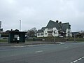
 St Martin's Church, Bilborough - geograph.org.uk - 5326511.jpg 640 × 480; 65 KB
-
 St Martin's Cottages, Bilborough - geograph.org.uk - 3903294.jpg 1,280 × 960; 280 KB
-
 St Martin's Cottages, Strelley - geograph.org.uk - 3280950.jpg 1,024 × 768; 229 KB
-
 St Martin's Road, Bilborough - geograph.org.uk - 606892.jpg 640 × 480; 108 KB
-
 St Martin's Road, Strelley estate - geograph.org.uk - 3280955.jpg 1,024 × 768; 254 KB
-
 St Martins Cottages, Bilborough - geograph.org.uk - 606890.jpg 640 × 480; 101 KB
-
 St Michael's Avenue - geograph.org.uk - 3903289.jpg 1,280 × 960; 318 KB
-
 St Michael's Avenue - geograph.org.uk - 3903310.jpg 1,280 × 960; 370 KB
-
 Strelley Health Centre - geograph.org.uk - 3903315.jpg 1,280 × 960; 258 KB
-
 Strelley Health Centre - geograph.org.uk - 5327803.jpg 640 × 420; 38 KB
-
 Strelley Health Centre - geograph.org.uk - 5327804.jpg 640 × 480; 80 KB
-
 Strelley Road at Wigman Road - geograph.org.uk - 3902763.jpg 1,280 × 960; 294 KB
-
 Strelley Road Library - geograph.org.uk - 4349776.jpg 640 × 480; 84 KB
-
 Strelley Road, Strelley estate - geograph.org.uk - 3280942.jpg 1,024 × 768; 130 KB
-

-
 Tangmere Crescent, Strelley estate - geograph.org.uk - 3280933.jpg 1,024 × 768; 128 KB
-
 The Ark Church - geograph.org.uk - 5327795.jpg 640 × 480; 53 KB
-
 The Beacon - geograph.org.uk - 6231801.jpg 1,280 × 853; 272 KB
-
 The Plaza, Bilborough - geograph.org.uk - 916264.jpg 640 × 480; 66 KB
-
 The Rose at Strelley - geograph.org.uk - 3903318.jpg 1,280 × 949; 263 KB
-
 The Rose public house - geograph.org.uk - 5327798.jpg 640 × 480; 49 KB
-
 The Rose public house - geograph.org.uk - 5327799.jpg 640 × 480; 43 KB
-
 The sign of The Beacon - geograph.org.uk - 6231805.jpg 1,034 × 1,280; 323 KB
-
 Top of Wigman Road, Bilborough estate - geograph.org.uk - 3280964.jpg 1,024 × 768; 233 KB
-
 Track to M1 Subway - geograph.org.uk - 1161260.jpg 640 × 427; 91 KB
-
 Twitchell - geograph.org.uk - 1717852.jpg 1,024 × 683; 288 KB
-
 Wigman Road, Bilborough - geograph.org.uk - 5327806.jpg 640 × 480; 52 KB
-
 Wyrale Drive, Strelley estate - geograph.org.uk - 3280937.jpg 1,024 × 768; 190 KB
-
 Bridleway and Motorway - geograph.org.uk - 612342.jpg 640 × 427; 91 KB
-
 Catstone Hill Reservoir - geograph.org.uk - 612357.jpg 640 × 427; 74 KB
-

-
 Public footpath sign, Robin Hood Way - geograph.org.uk - 660481.jpg 640 × 427; 119 KB
-

-
 The Farmhouse, Bilborough - geograph.org.uk - 606874.jpg 640 × 480; 103 KB

.jpg)


.jpg)


