Category:Bij de Put 15, Leeuwarden
Jump to navigation
Jump to search
| Object location | | View all coordinates using: OpenStreetMap |
|---|
building in Leeuwarden, Netherlands .jpg) | |||||
| Upload media | |||||
| Instance of | |||||
|---|---|---|---|---|---|
| Location | Leeuwarden, Friesland, Netherlands | ||||
| Located on street | |||||
| Heritage designation |
| ||||
 | |||||
|
This is a category about rijksmonument number 24121
|
| Address |
|
Media in category "Bij de Put 15, Leeuwarden"
The following 8 files are in this category, out of 8 total.
-
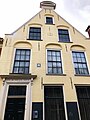 Foto Voorgevel pand Bij de Put 15 Leeuwarden mei 2021.jpg 3,024 × 4,032; 2.17 MB
-
 Overzicht - Leeuwarden - 20346830 - RCE.jpg 1,200 × 806; 186 KB
-
 Overzicht Bij de Put - Leeuwarden - 20130498 - RCE.jpg 1,181 × 1,200; 302 KB
-
 Overzicht Bij de Put - Leeuwarden - 20130499 - RCE.jpg 1,188 × 1,200; 320 KB
-
 RM24121 Leeuwarden - Bij de Put 15 (foto 1).jpg 1,944 × 2,592; 1.04 MB
-
 RM24121 Leeuwarden - Bij de Put 15 (foto 2).jpg 2,592 × 1,944; 846 KB
-
 Voorgevels - Leeuwarden - 20132263 - RCE.jpg 1,200 × 807; 177 KB
-
 Voortgevels - Leeuwarden - 20132262 - RCE.jpg 1,200 × 808; 178 KB


.jpg)

