Category:Big Burro Mountains
Jump to navigation
Jump to search
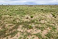
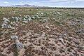
A moderate length 35-mile (56 km) long, mountain range located in central Grant County, New Mexico, United States.
Subcategories
This category has the following 2 subcategories, out of 2 total.
Media in category "Big Burro Mountains"
The following 47 files are in this category, out of 47 total.
-
 Aspidoscelis flagellicauda - Flickr - aspidoscelis (1).jpg 3,600 × 2,400; 2.99 MB
-
 Aspidoscelis flagellicauda - Flickr - aspidoscelis.jpg 3,600 × 2,400; 3.49 MB
-
 Big Burro Mountains - Flickr - aspidoscelis.jpg 3,600 × 2,400; 4.74 MB
-
 East of Jacks Peak - Flickr - aspidoscelis.jpg 3,600 × 2,400; 4.03 MB
-
 East-northeast of Jacks Peak - Flickr - aspidoscelis.jpg 5,550 × 3,700; 7.93 MB
-
 East-northeast of Ninemile Hill.jpg 3,600 × 2,400; 4.36 MB
-
 Gold Gulch - Flickr - aspidoscelis (1).jpg 3,600 × 2,400; 3.57 MB
-
 Near C Bar Canyon - Flickr - aspidoscelis (1).jpg 3,600 × 2,400; 4.56 MB
-
 Near C Bar Canyon - Flickr - aspidoscelis (2).jpg 3,600 × 2,400; 4.79 MB
-
 Near C Bar Canyon - Flickr - aspidoscelis.jpg 3,600 × 2,400; 4.14 MB
-
 Near Gold Gulch - Flickr - aspidoscelis (1).jpg 3,600 × 2,400; 4.29 MB
-
 Near Gold Gulch - Flickr - aspidoscelis.jpg 3,600 × 2,400; 4.63 MB
-
 Near Keese Canyon - Flickr - aspidoscelis.jpg 3,600 × 2,400; 3.54 MB
-
 Near Peterson Canyon - Flickr - aspidoscelis.jpg 3,600 × 2,400; 3.48 MB
-
 Near Sawmill Canyon - Flickr - aspidoscelis.jpg 3,600 × 2,400; 4.72 MB
-
 Near Thompson Canyon - Flickr - aspidoscelis.jpg 3,600 × 2,400; 4.55 MB
-
 Near Three Sisters - Flickr - aspidoscelis.jpg 3,600 × 2,400; 3.81 MB
-
 Near Walking X Canyon - Flickr - aspidoscelis (1).jpg 3,600 × 2,400; 4.76 MB
-
 Near Walking X Canyon - Flickr - aspidoscelis (2).jpg 3,600 × 2,400; 4.6 MB
-
 Near Walking X Canyon - Flickr - aspidoscelis.jpg 3,600 × 2,400; 4.91 MB
-
 Near Whitetail Canyon - Flickr - aspidoscelis.jpg 3,600 × 2,400; 3.54 MB
-
 Near Wood Canyon - Flickr - aspidoscelis.jpg 3,600 × 2,400; 4.78 MB
-
 North of Lordsburg - 50353942823.jpg 3,600 × 2,400; 4.11 MB
-
 North of Lordsburg - 50354645046.jpg 3,600 × 2,400; 4.51 MB
-
 North of Lordsburg - 50354645296.jpg 3,600 × 2,400; 4.04 MB
-
 North of Lordsburg.jpg 3,600 × 2,400; 4.53 MB
-
 Sceloporus poinsettii - Flickr - aspidoscelis.jpg 1,800 × 1,200; 665 KB
-
 South of Jacks Peak - Flickr - aspidoscelis.jpg 3,600 × 2,400; 4.4 MB
-
 South-southeast of Jacks Peak - Flickr - aspidoscelis.jpg 3,600 × 2,400; 4.01 MB
-
 Southeast of Jacks Peak - Flickr - aspidoscelis.jpg 3,600 × 2,400; 4.91 MB
-
 West of Apache Mountain - 50353943863.jpg 3,600 × 2,400; 4.78 MB
-
 West of Apache Mountain - 50354646036.jpg 3,600 × 2,400; 4.15 MB
-
 West of Apache Mountain - 50354647741.jpg 3,600 × 2,400; 4.52 MB
-
 West of Apache Mountain - 50354803462.jpg 3,600 × 2,400; 4.34 MB
-
 West of Apache Mountain.jpg 3,600 × 2,400; 4.61 MB
-
 West-northwest of Apache Mountain - 50353942583.jpg 3,600 × 2,400; 4.41 MB
-
 West-northwest of Apache Mountain - 50353944318.jpg 3,600 × 2,400; 4.38 MB
-
 West-northwest of Apache Mountain - 50354643896.jpg 3,600 × 2,400; 4.48 MB
-
 West-northwest of Apache Mountain - 50354644186.jpg 3,600 × 2,400; 4.68 MB
-
 West-northwest of Apache Mountain - 50354804307.jpg 3,600 × 2,400; 4.36 MB
-
 West-northwest of Apache Mountain - 50354804477.jpg 3,600 × 2,400; 4.13 MB
-
 West-northwest of Apache Mountain - 50354807117.jpg 3,600 × 2,400; 4.59 MB
-
 West-northwest of Apache Mountain - 50354807437.jpg 3,600 × 2,400; 4.45 MB
-
 West-northwest of Apache Mountain - 50354807672.jpg 3,600 × 2,400; 4.31 MB
-
 West-northwest of Apache Mountain.jpg 3,600 × 2,400; 4.64 MB
-
 West-southwest of Jacks Peak - Flickr - aspidoscelis (1).jpg 3,600 × 2,400; 5.02 MB
-
 West-southwest of Jacks Peak - Flickr - aspidoscelis.jpg 3,600 × 2,400; 4.13 MB
.jpg)


.jpg)
.jpg)
.jpg)

.jpg)


.jpg)
.jpg)


.jpg)
