Category:Bideford
Jump to navigation
Jump to search
town in Devon, England  | |||||
| Upload media | |||||
| Instance of | |||||
|---|---|---|---|---|---|
| Location | Torridge, Devon, South West England, England | ||||
| Different from | |||||
| Said to be the same as | Bideford (Wikimedia duplicated page, civil parish) | ||||
| official website | |||||
 | |||||
Subcategories
This category has the following 19 subcategories, out of 19 total.
4
A
- Charles Kingsley Ackland (3 F)
B
- Bideford Higher Cemetery (12 F)
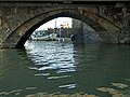
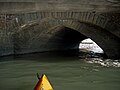
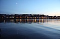
- Bideford Long Bridge (35 F)
- Bideford War Memorial (9 F)
- Burton Art Gallery, Bideford (5 F)
- Buses in Bideford (9 F)
C
E
G
- Gammaton Moor (1 F)
K
- Kingsley School, Bideford (5 F)
P
R
- Royal Hotel, Bideford (4 F)
S
V
- Victoria Park, Bideford (9 F)
Media in category "Bideford"
The following 200 files are in this category, out of 931 total.
(previous page) (next page)-

-
 18 of the 24 Arches of Bideford Long Bridge - geograph.org.uk - 3187888.jpg 1,600 × 1,063; 199 KB
-

-
 A balancing pond at the top of Watkins Way - geograph.org.uk - 5780399.jpg 6,000 × 4,000; 4.63 MB
-
 A Boards in Allhalland Street, Bideford - geograph.org.uk - 3762045.jpg 3,456 × 4,608; 4.6 MB
-

-

-
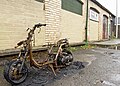 A burnt-out motorbike in Littlejohn's coal yard - geograph.org.uk - 5987594.jpg 3,671 × 2,622; 4.82 MB
-

-
 A dead shrew on the Tarka Trail at Bideford - geograph.org.uk - 4085452.jpg 3,648 × 2,736; 5.06 MB
-
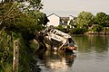 A derelict boat on the River Torridge at East the Water - geograph.org.uk - 5780421.jpg 6,000 × 4,000; 4.62 MB
-

-
 A Helping Hand - geograph.org.uk - 4156772.jpg 1,600 × 1,200; 748 KB
-
 A helping hand... - geograph.org.uk - 2824702.jpg 1,024 × 680; 297 KB
-
 A listed building at 73 The High Street, Bideford - geograph.org.uk - 3418783.jpg 1,063 × 1,600; 425 KB
-
 A listed building at 73 The High Street, Bideford - geograph.org.uk - 3418790.jpg 1,600 × 1,067; 572 KB
-
 A McDonald's restaurant ^ a Premier Inn - geograph.org.uk - 5235072.jpg 6,000 × 4,000; 5.37 MB
-

-
 A painting of 18th Century ships on the River Torridge.jpg 800 × 504; 89 KB
-
 A place for food by the Tarka Trail - geograph.org.uk - 4322065.jpg 1,600 × 1,200; 2.01 MB
-

-

-
 A plaque showing the North end of Bideford quay in 1663 - geograph.org.uk - 4809018.jpg 4,000 × 6,000; 5.19 MB
-

-
 A rusting boat on the River Torridge at Bideford - geograph.org.uk - 4862824.jpg 3,870 × 2,903; 4.14 MB
-

-
 A view from Costa Coffee, Bideford High Street - geograph.org.uk - 6323623.jpg 4,560 × 3,456; 5.43 MB
-
 A view of the South of Bideford - geograph.org.uk - 1588243.jpg 640 × 480; 57 KB
-

-

-
 A wet day in Mill Street - geograph.org.uk - 4254558.jpg 4,000 × 3,000; 5.04 MB
-
 A380 southbound - geograph.org.uk - 3127136.jpg 640 × 390; 37 KB
-
 A386 at Landcross Bridge - geograph.org.uk - 1009523.jpg 640 × 442; 92 KB
-
 A386 Kingsley Road - geograph.org.uk - 5298361.jpg 3,072 × 2,048; 1.03 MB
-
 A386 south of Bideford - geograph.org.uk - 5478968.jpg 2,060 × 1,456; 1.84 MB
-
 A39 bridge over Abbotsham-Bideford road - geograph.org.uk - 3641695.jpg 1,024 × 768; 93 KB
-
 A39 near Kenwith Castle - geograph.org.uk - 4128734.jpg 1,024 × 602; 145 KB
-
 Abandoned boats on the River Torridge - geograph.org.uk - 1359428.jpg 640 × 480; 112 KB
-
 Abandoned boats on the Torridge - geograph.org.uk - 1359442.jpg 640 × 480; 114 KB
-
 Abbotsham Road, Bideford - geograph.org.uk - 2773901.jpg 4,320 × 3,240; 3.77 MB
-

-
 Access to the river known as Binney's Slip - geograph.org.uk - 1933077.jpg 1,024 × 680; 214 KB
-
 Ackland family, general practitioners, Bideford, Devon. Wellcome L0028845.jpg 1,734 × 1,218; 736 KB
-
 Across the Horwood Stream valley - geograph.org.uk - 5298913.jpg 1,569 × 798; 236 KB
-
 Admiralty Chart No 1160 Barnstaple and Bideford Published 1953.jpg 7,989 × 6,146; 5.8 MB
-

-
 All-purpose war memorial, Bideford - geograph.org.uk - 4045560.jpg 1,152 × 1,536; 1.42 MB
-
 Allhalland Street - High Street - geograph.org.uk - 5391861.jpg 640 × 541; 72 KB
-
 Alverdiscott Road, East the Water - geograph.org.uk - 3361621.jpg 1,600 × 1,200; 600 KB
-
 Alverdiscott Road, East-The-Water - geograph.org.uk - 5298844.jpg 3,072 × 2,048; 1.08 MB
-
 An appeal to the electorate on Northam Road - geograph.org.uk - 5438037.jpg 3,628 × 3,000; 5.47 MB
-

-

-
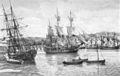
 An ice breaker and a Thames tug moored at Bideford.jpg 800 × 533; 78 KB
-
 An incident in Cooper Street, Bideford - geograph.org.uk - 5591979.jpg 5,130 × 3,664; 4.24 MB
-
 An incident on Bideford High Street - geograph.org.uk - 5715840.jpg 4,000 × 3,000; 4.3 MB
-

-

-
 Angling by the stream outflow - geograph.org.uk - 1009505.jpg 480 × 640; 127 KB
-
 Anti seagull measures - geograph.org.uk - 4238592.jpg 1,600 × 1,063; 168 KB
-
 Antiques centre, Bideford - geograph.org.uk - 601431.jpg 480 × 640; 94 KB
-
 Antiques shop in Mill Street - geograph.org.uk - 4553582.jpg 480 × 640; 74 KB
-

-
 Arable field near Gammaton Barton - geograph.org.uk - 4438848.jpg 1,024 × 680; 277 KB
-
 Asda supermarket and Atlantic Village centre - geograph.org.uk - 4045479.jpg 1,536 × 1,152; 901 KB
-
 Asda supermarket and car park - geograph.org.uk - 4045476.jpg 1,536 × 1,152; 903 KB
-

-
 Assorted garages - geograph.org.uk - 4238585.jpg 1,600 × 1,063; 436 KB
-
 Astro sports pitch at Bideford College.jpg 640 × 480; 57 KB
-

-
 Atlantis Village Adventure Park - geograph.org.uk - 4156793.jpg 1,600 × 1,200; 589 KB
-
 Atlantis^ - geograph.org.uk - 210824.jpg 640 × 480; 103 KB
-
 Austin Healey (3562081483).jpg 2,216 × 2,439; 2.01 MB
-
 Bakers in Mill Street - geograph.org.uk - 4553437.jpg 480 × 640; 65 KB
-
 Baptist Church, Mill Street - geograph.org.uk - 4553443.jpg 480 × 640; 52 KB
-
 Barclays Bank, High Street - geograph.org.uk - 4553756.jpg 640 × 480; 56 KB
-
 Barker Restaurant Bideford - geograph.org.uk - 5538010.jpg 427 × 640; 62 KB
-
 Barkers Restaurant, High Street - geograph.org.uk - 4553732.jpg 480 × 640; 70 KB
-
 Barn at Greatwood Farm - geograph.org.uk - 749895.jpg 640 × 480; 99 KB
-
 Barn near Eastwood Cross - geograph.org.uk - 6333781.jpg 4,261 × 2,588; 1.49 MB
-
 Barnardo's, High Street - geograph.org.uk - 4553751.jpg 480 × 640; 84 KB
-

-
 Bend in the road on the A386 - geograph.org.uk - 1800692.jpg 640 × 480; 78 KB
-
 BevilGrenvilleOvermantleBideford.JPG 3,379 × 1,625; 3.51 MB
-
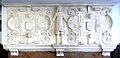
 BevilGrenvilleReliefBideford.JPG 1,931 × 3,419; 4.27 MB
-
 Bideford , Atlantic Village - Christmas Tree - geograph.org.uk - 4255894.jpg 2,848 × 4,288; 5.23 MB
-
 Bideford , Atlantic Village - geograph.org.uk - 4255887.jpg 4,288 × 2,848; 6.03 MB
-
 Bideford , Atlantic Village - geograph.org.uk - 4255892.jpg 4,288 × 2,848; 4.86 MB
-
 Bideford , Atlantic Village - geograph.org.uk - 4255895.jpg 4,288 × 2,848; 5.49 MB
-
 Bideford , Atlantic Village - geograph.org.uk - 4255903.jpg 4,288 × 2,848; 4.46 MB
-
 Bideford , Atlantic Village - Marks ^ Spencer - geograph.org.uk - 4255897.jpg 4,288 × 2,848; 5.57 MB
-
 Bideford , Atlantic Village - Poundland - geograph.org.uk - 4255902.jpg 4,288 × 2,848; 6.24 MB
-
 Bideford , Atlantic Village - Rectella - geograph.org.uk - 4255900.jpg 2,848 × 4,288; 5.01 MB
-
 Bideford , Barnstaple Street Car Park - geograph.org.uk - 3355484.jpg 4,180 × 2,676; 3.58 MB
-
 Bideford , Bideford Long Bridge - geograph.org.uk - 3355421.jpg 4,288 × 2,848; 5.51 MB
-
 Bideford , Car Park - geograph.org.uk - 3355280.jpg 4,288 × 2,848; 6.14 MB
-
 Bideford , Car Park - geograph.org.uk - 3355297.jpg 4,044 × 2,410; 3.57 MB
-
 Bideford , Car Park - geograph.org.uk - 3355304.jpg 4,224 × 2,750; 4.05 MB
-
 Bideford , Car Park - geograph.org.uk - 3355308.jpg 4,288 × 2,848; 5.9 MB
-
 Bideford , Car Park - geograph.org.uk - 3355313.jpg 4,014 × 2,338; 3.17 MB
-
 Bideford , Car Park - geograph.org.uk - 3355316.jpg 4,260 × 2,804; 4.6 MB
-
 Bideford , Car Park - geograph.org.uk - 3359276.jpg 4,288 × 2,848; 4.94 MB
-
 Bideford , Fencing - geograph.org.uk - 3594564.jpg 4,288 × 2,848; 6.38 MB
-
 Bideford , Grassy Field - geograph.org.uk - 3594584.jpg 4,288 × 2,848; 5.34 MB
-
 Bideford , House Rooftops - geograph.org.uk - 3594577.jpg 4,288 × 2,848; 4.38 MB
-
 Bideford , House Rooftops - geograph.org.uk - 3594580.jpg 4,288 × 2,848; 4.68 MB
-
 Bideford , Kingsley Road - Bideford Half Marathon - geograph.org.uk - 3355325.jpg 4,288 × 2,848; 4.81 MB
-
 Bideford , Kingsley Road - Bideford Half Marathon - geograph.org.uk - 3355328.jpg 4,288 × 2,848; 4.3 MB
-
 Bideford , Kingsley Road - Bideford Half Marathon - geograph.org.uk - 3355332.jpg 4,288 × 2,848; 5.44 MB
-
 Bideford , Kingsley Road - Bideford Half Marathon - geograph.org.uk - 3355334.jpg 4,288 × 2,848; 4.65 MB
-
 Bideford , Kingsley Road - Bideford Half Marathon - geograph.org.uk - 3355348.jpg 4,288 × 2,848; 4.79 MB
-
 Bideford , Kingsley Road A386 - geograph.org.uk - 3355320.jpg 4,288 × 2,848; 4.68 MB
-
 Bideford , Kingsley Road A386 - geograph.org.uk - 3359281.jpg 4,288 × 2,848; 5 MB
-
 Bideford , Moreton Park Road - geograph.org.uk - 4255904.jpg 4,288 × 2,848; 4.54 MB
-
 Bideford , Moreton Park Road - geograph.org.uk - 4255906.jpg 4,288 × 2,848; 4.36 MB
-
 Bideford , River Torridge Scenery - geograph.org.uk - 3359261.jpg 4,288 × 2,848; 4.69 MB
-
 Bideford , Road Junction ^ Roundabout - geograph.org.uk - 3355450.jpg 4,230 × 2,758; 3.29 MB
-
 Bideford , Sunnyside - geograph.org.uk - 3359270.jpg 4,288 × 2,848; 5.21 MB
-
 Bideford , Texaco Petrol Station - geograph.org.uk - 3359283.jpg 4,288 × 2,848; 4.64 MB
-
 Bideford , The Quay - Bideford Half Marathon - geograph.org.uk - 3355354.jpg 4,288 × 2,848; 4.88 MB
-
 Bideford , The Quay - geograph.org.uk - 3355323.jpg 4,288 × 2,848; 5.61 MB
-
 Bideford , The Quay - geograph.org.uk - 3355399.jpg 4,288 × 2,848; 5.27 MB
-
 Bideford , The Quay ^ Bus Stop - geograph.org.uk - 3355377.jpg 4,236 × 2,768; 3.3 MB
-
 Bideford , The River Torridge - geograph.org.uk - 3355413.jpg 4,288 × 2,848; 4.14 MB
-
 Bideford , The River Torridge - geograph.org.uk - 3355468.jpg 4,288 × 2,848; 4.67 MB
-
 Bideford , The River Torridge - geograph.org.uk - 3359262.jpg 4,288 × 2,848; 4.58 MB
-
 Bideford , The Tarka Trail - geograph.org.uk - 3355504.jpg 4,288 × 2,848; 5.73 MB
-
 Bideford , The Tarka Trail - geograph.org.uk - 3355544.jpg 4,288 × 2,848; 5.17 MB
-
 Bideford , The Tarka Trail - geograph.org.uk - 3355665.jpg 4,288 × 2,848; 4.63 MB
-
 Bideford , The Tarka Trail - geograph.org.uk - 3355673.jpg 4,288 × 2,848; 5.64 MB
-
 Bideford , The Tarka Trail - geograph.org.uk - 3359265.jpg 4,122 × 2,570; 3.07 MB
-
 Bideford , The Tarka Trail - geograph.org.uk - 3359267.jpg 4,288 × 2,848; 5.36 MB
-
 Bideford - geograph.org.uk - 5538000.jpg 640 × 427; 50 KB
-
 Bideford AFC decorative wall - geograph.org.uk - 4238582.jpg 1,600 × 1,063; 572 KB
-
 Bideford AFC floodlights - geograph.org.uk - 4128739.jpg 1,024 × 715; 101 KB
-
 Bideford AFC football ground - geograph.org.uk - 4238595.jpg 1,600 × 1,063; 423 KB
-
 Bideford AFC v St Neots Town AFC - geograph.org.uk - 4258539.jpg 1,024 × 768; 126 KB
-
 Bideford Amateur Rowing Club HQ - geograph.org.uk - 1324504.jpg 640 × 480; 121 KB
-
 Bideford and Bridge, From The East.jpg 4,048 × 1,928; 5.57 MB
-

-

-
 Bideford Baptist Church, Mill St, Bideford EX39 2JR - geograph.org.uk - 5855914.jpg 2,964 × 2,982; 4.16 MB
-
 Bideford bowls club - geograph.org.uk - 5013138.jpg 640 × 384; 48 KB
-

-

-

-
-

-

-

-

-

-

-

-

-

-

-

-
-

-

-

-

-

-

-

-
-
 Bideford Café, Mill Street - geograph.org.uk - 4553805.jpg 480 × 640; 71 KB
-
 Bideford College ^ Asda Supermarket - geograph.org.uk - 5234631.jpg 6,000 × 4,000; 6.33 MB
-
 Bideford Devon DomesdayBook.png 729 × 191; 87 KB
-
 Bideford from East-The-Water - geograph.org.uk - 1387497.jpg 640 × 414; 40 KB
-
 Bideford from East-The-Water - geograph.org.uk - 1392868.jpg 640 × 427; 80 KB
-
 Bideford from East-the-Water 1 - geograph.org.uk - 749952.jpg 640 × 480; 54 KB
-
 Bideford from East-the-Water 2 - geograph.org.uk - 749955.jpg 640 × 480; 43 KB
-
 Bideford from East-the-Water 3 - geograph.org.uk - 749957.jpg 640 × 480; 38 KB
-
 Bideford from Seven Oaks.jpg 3,780 × 2,702; 3.62 MB
-

-
 Bideford Hospital on Abbottsham Road - geograph.org.uk - 5326867.jpg 6,000 × 4,000; 6.07 MB
-
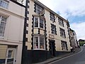 Bideford Liberal Club - High Street - geograph.org.uk - 5391969.jpg 640 × 480; 64 KB
-
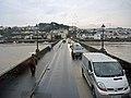
 Bideford Long Bridge - geograph.org.uk - 3948055.jpg 1,280 × 851; 235 KB
-
 Bideford Long Bridge - geograph.org.uk - 4254564.jpg 4,000 × 3,000; 3.99 MB
-
 Bideford Long Bridge - geograph.org.uk - 6400855.jpg 1,800 × 1,200; 421 KB
-
 Bideford Long Bridge BG.webp 2,000 × 708; 46 KB
-

-
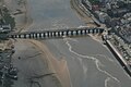 Bideford Long Bridge, aerial 2018 - geograph.org.uk - 5960448.jpg 640 × 427; 58 KB
-
 Bideford Main Post Office - geograph.org.uk - 4192913.jpg 800 × 600; 85 KB
-
 Bideford Market - geograph.org.uk - 4192908.jpg 800 × 600; 93 KB
-
 Bideford Pannier Market - geograph.org.uk - 1006534.jpg 640 × 480; 114 KB
-
 Bideford Pannier Market - geograph.org.uk - 1009484.jpg 640 × 480; 91 KB
-
 Bideford Pannier market - geograph.org.uk - 1611865.jpg 640 × 464; 66 KB
-
 Bideford Pannier Market - geograph.org.uk - 2773932.jpg 4,320 × 3,240; 4.58 MB
-
 Bideford Post Office - geograph.org.uk - 4435674.jpg 800 × 531; 89 KB
-
-
 Bideford Public Cemetery on Old Town - geograph.org.uk - 1934754.jpg 1,024 × 680; 240 KB
-
 Bideford Quakers - geograph.org.uk - 4192916.jpg 600 × 800; 98 KB
-
 Bideford Quay (Geograph).jpg 640 × 428; 85 KB
-
 Bideford Quay - geograph.org.uk - 1832096.jpg 1,024 × 768; 206 KB
-
 Bideford Quay - geograph.org.uk - 3436072.jpg 480 × 640; 68 KB
-
 Bideford Quay - geograph.org.uk - 3936488.jpg 573 × 382; 37 KB
-
 Bideford Quay - geograph.org.uk - 3948072.jpg 1,280 × 851; 266 KB


_-_geograph.org.uk_-_1934778.jpg)


.jpg)


.jpg)


