Category:Bicknor
Jump to navigation
Jump to search
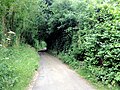
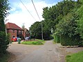
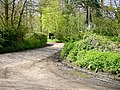
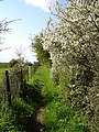
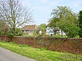
English: Bicknor is a village and civil parish in the Maidstone district of Kent, England, north-east of Maidstone and south-west of Sittingbourne. It had a population of 68 according to the 2001 census.
village and civil parish in Kent, United Kingdom | |||||
| Upload media | |||||
| Instance of | |||||
|---|---|---|---|---|---|
| Location | Maidstone, Kent, South East England, England | ||||
| Population |
| ||||
 | |||||
Subcategories
This category has the following 2 subcategories, out of 2 total.
J
- St James's Church, Bicknor (8 F)
O
- Oasts in Bicknor (4 F)
Media in category "Bicknor"
The following 68 files are in this category, out of 68 total.
-
 Back of Bicknor Court - geograph.org.uk - 1150305.jpg 640 × 481; 69 KB
-
 Beech Tree on Hollingbourne Hill - geograph.org.uk - 25070.jpg 480 × 640; 148 KB
-
 Bicknor Lane, Bicknor - geograph.org.uk - 5025899.jpg 3,264 × 2,448; 2.94 MB
-
 Bicknor Lane, Bicknor - geograph.org.uk - 5025904.jpg 3,264 × 2,448; 2.04 MB
-
 Bicknor Lane, Bicknor - geograph.org.uk - 5026046.jpg 3,264 × 2,448; 3.37 MB
-
 Bicknor Road, Bicknor - geograph.org.uk - 5026052.jpg 3,264 × 2,448; 1.8 MB
-
 Bluebells - geograph.org.uk - 6535.jpg 640 × 480; 150 KB
-
 Captain's House - geograph.org.uk - 1150282.jpg 640 × 481; 65 KB
-
 Church Lane, Bicknor - geograph.org.uk - 5025891.jpg 3,264 × 2,448; 2.69 MB
-
 Church Lane, Bicknor - geograph.org.uk - 5025895.jpg 3,264 × 2,448; 2.89 MB
-

-
 Fourayes Farm, South Green - geograph.org.uk - 1080351.jpg 640 × 481; 73 KB
-
 Front of Bicknor Court - geograph.org.uk - 1150301.jpg 640 × 481; 86 KB
-

-
 Hollingbourne Hill - geograph.org.uk - 25066.jpg 640 × 480; 101 KB
-
 Hucking Hill House - geograph.org.uk - 161776.jpg 640 × 483; 108 KB
-
 Kennel Barn Road, near Bicknor - geograph.org.uk - 5014840.jpg 3,264 × 2,448; 2.12 MB
-
 Kennel Barn Road, near Bicknor - geograph.org.uk - 5015652.jpg 3,264 × 2,448; 2.04 MB
-
 Lane leading from South Green towards Bicknor - geograph.org.uk - 5015648.jpg 3,264 × 2,448; 3.31 MB
-
 Packing Cases at Swanton Farm - geograph.org.uk - 1150271.jpg 640 × 481; 61 KB
-
 Poplars along Bicknor Road - geograph.org.uk - 2346205.jpg 480 × 640; 192 KB
-
 Sheep near Bedmonton - geograph.org.uk - 6190.jpg 640 × 480; 78 KB
-
 St. James, Bicknor - geograph.org.uk - 5025898.jpg 3,264 × 2,448; 2.04 MB
-
 The road through Church Wood - geograph.org.uk - 1366129.jpg 640 × 480; 118 KB
-
 Track off Bicknor Road - geograph.org.uk - 2346214.jpg 640 × 480; 162 KB
-
 Violets by the Pilgrim's Way - geograph.org.uk - 149091.jpg 640 × 482; 158 KB
-
 Wye Valley Walk - geograph.org.uk - 454828.jpg 640 × 480; 145 KB
-
 Ash Tree on Ringlestone Road - geograph.org.uk - 230773.jpg 480 × 640; 127 KB
-
 Blackthorn blossom - geograph.org.uk - 161795.jpg 640 × 480; 150 KB
-
 Bracket fungus - geograph.org.uk - 327339.jpg 640 × 480; 147 KB
-
 Colyers Wents - geograph.org.uk - 6157.jpg 640 × 480; 151 KB
-
 Cowslips - geograph.org.uk - 162433.jpg 640 × 477; 128 KB
-
 Deep hole in the wood - geograph.org.uk - 230600.jpg 480 × 640; 168 KB
-
 Drake Lane - closed for refurbishment - geograph.org.uk - 326485.jpg 640 × 478; 118 KB
-
 Drake Lane - geograph.org.uk - 230510.jpg 480 × 640; 177 KB
-
 Footpath to Wormshill - geograph.org.uk - 326514.jpg 483 × 640; 111 KB
-
 Gottridge Wood - geograph.org.uk - 6168.jpg 640 × 307; 38 KB
-
 Hollingbourne Down - geograph.org.uk - 141892.jpg 640 × 344; 56 KB
-
 Hollingbourne Hill - geograph.org.uk - 141882.jpg 640 × 486; 82 KB
-

-

-
 Hollingbourne Zero Station - geograph.org.uk - 230645.jpg 480 × 640; 98 KB
-
 Hollingbourne Zero Station - ground level - geograph.org.uk - 230671.jpg 480 × 640; 133 KB
-

-

-
 Ladies smock - geograph.org.uk - 161784.jpg 483 × 640; 192 KB
-
 Lambs near Wheatsheaf Farm - geograph.org.uk - 149507.jpg 640 × 480; 115 KB
-

-
 Mordenden Wood - geograph.org.uk - 6163.jpg 640 × 480; 69 KB
-
 Muddy puddle on Drake Lane - geograph.org.uk - 230217.jpg 640 × 480; 181 KB
-
 Mushrooms on Drake Lane - geograph.org.uk - 230517.jpg 640 × 480; 166 KB
-
 Mysterious buildings - geograph.org.uk - 6160.jpg 640 × 480; 65 KB
-
 North Downs in early April - geograph.org.uk - 149101.jpg 640 × 480; 102 KB
-
 North Downs Way - geograph.org.uk - 161904.jpg 480 × 640; 164 KB
-
 North Downs Way crosses the road - geograph.org.uk - 162445.jpg 480 × 640; 145 KB
-
 Not just apples - geograph.org.uk - 5038.jpg 640 × 480; 106 KB
-
 Ox-eye daisies, Hucking Estate - geograph.org.uk - 204702.jpg 640 × 480; 101 KB
-
 Poplar windbreak - geograph.org.uk - 6167.jpg 640 × 523; 149 KB
-
 Snowdrops (Galanthus nivalis) - geograph.org.uk - 327337.jpg 640 × 480; 149 KB
-
 Stile onto North Downs Way - geograph.org.uk - 5504.jpg 640 × 470; 92 KB
-
 Sunflowers on the Downs - geograph.org.uk - 230760.jpg 640 × 480; 109 KB
-
 West of Drake Lane - geograph.org.uk - 230709.jpg 640 × 480; 138 KB
-
 Wheatsheaf Farm - geograph.org.uk - 5091.jpg 640 × 480; 99 KB
-
 White Campion and buttercups - geograph.org.uk - 204691.jpg 640 × 480; 110 KB
-
 White Post revisited - geograph.org.uk - 149120.jpg 640 × 480; 133 KB
-
 White Post, Hollingbourne Hill - geograph.org.uk - 6156.jpg 640 × 480; 139 KB
-
 Woodland west of Broad Street Hill - geograph.org.uk - 161791.jpg 480 × 640; 201 KB
-
 Wormshill Telephone Exchange - geograph.org.uk - 6537.jpg 640 × 454; 109 KB


_-_geograph.org.uk_-_327337.jpg)


