Category:Bhutan-China border
Jump to navigation
Jump to search
divides the territories of Bhutan and China  | |||||
| Upload media | |||||
| Instance of |
| ||||
|---|---|---|---|---|---|
| Part of | |||||
| Location |
| ||||
| Applies to jurisdiction | |||||
| Has part(s) | |||||
| Length |
| ||||
 | |||||
Media in category "Bhutan-China border"
The following 22 files are in this category, out of 22 total.
-
 1898 map of Chumbi Valley by Waddell.jpg 1,671 × 1,505; 1.01 MB
-
 1898 Sikhim and Adjoining Territories by Waddell.jpg 4,669 × 5,142; 2.08 MB
-
 1963 China-India Border (30848757436).jpg 1,472 × 956; 1.01 MB
-
 1965 Relief map of Bhutan. 3-65. LOC 75695011 (cropped).tif 6,466 × 3,664; 67.78 MB
-
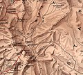
 2015 map detail, Bhutan Physiography (cropped).jpg 2,500 × 1,440; 699 KB
-
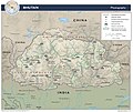 Bhutan Physiography.jpg 2,632 × 2,215; 948 KB
-
 Bhutan. 3-65. LOC 75695011.tif 6,864 × 4,150; 81.5 MB
-
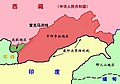
 Bhutan–China border.png 800 × 522; 76 KB
-
 Doklam plateau and vicinity.jpg 834 × 697; 205 KB
-
 Doklam-LSIB-vs-Chinese-claims-with-Pangda-village.jpg 824 × 660; 90 KB
-
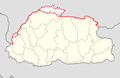
 Location of Nathula.svg 800 × 740; 70 KB
-
 MacMahon Line.jpg 750 × 528; 46 KB
-
 Map of Doklam EN.svg 632 × 464; 182 KB
-
 Map of Doklam.svg 474 × 455; 185 KB
-
 Operational Navigation Chart H-10, 7th edition.jpg 9,254 × 6,712; 18.94 MB
-
 Operational Navigation Chart H-9, 7th edition.jpg 9,254 × 6,713; 21.95 MB
-
 Tibet-Bhutan border (JC White, 1910).jpg 888 × 567; 389 KB
-
 Tsona County and vicinity.jpg 807 × 797; 121 KB
-
 Txu-oclc-6654394-ng-45-8th-ed.jpg 5,000 × 4,830; 10.14 MB
-
 Txu-oclc-6654394-ng-46-6th-ed.jpg 5,000 × 4,752; 9.55 MB
-
 Txu-oclc-6654394-nh-46-2nd-ed.jpg 5,548 × 4,516; 6.29 MB
-
 Txu-pclmaps-oclc-6654394-tsangpo-nh-45.jpg 5,636 × 5,052; 8.08 MB


.jpg)
.jpg)


.jpg)


