Category:Bezmiechowa Airfield
Jump to navigation
Jump to search
| Object location | | View all coordinates using: OpenStreetMap |
|---|
 | |||||
| Upload media | |||||
| Instance of | |||||
|---|---|---|---|---|---|
| Location | Gmina Lesko, Lesko County, Subcarpathian Voivodeship, Poland | ||||
| Elevation above sea level |
| ||||
| official website | |||||
 | |||||
Subcategories
This category has only the following subcategory.
G
Media in category "Bezmiechowa Airfield"
The following 27 files are in this category, out of 27 total.
-
 Bezmiechowa DSM 3D 2010-05-29 Pteryx UAV.jpg 1,012 × 868; 146 KB
-
 Bezmiechowa Górna - Airport 01.jpg 4,272 × 2,848; 4.24 MB
-
 Bezmiechowa Górna - Airport 02.jpg 4,272 × 2,848; 4.17 MB
-
 Bezmiechowa Górna - Airport 03.jpg 2,848 × 4,272; 4.72 MB
-
 Bezmiechowa Górna - Airport 04.jpg 4,272 × 2,848; 6.58 MB
-
 Bezmiechowa Górna - Airport 05.jpg 2,812 × 1,872; 1.22 MB
-
 Bezmiechowa Górna - Airport 06.jpg 4,272 × 2,848; 3.83 MB
-
 Bezmiechowa Górna - Airport 07.jpg 4,272 × 2,848; 3.78 MB
-
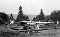
 Bezmiechowa landing field (-1939).JPG 829 × 640; 67 KB
-
 Bezmiechowa tablica tadeusz gora.jpg 2,592 × 1,986; 4.32 MB
-
 Female pilot in Bezmiechowa (-1937).jpg 843 × 561; 235 KB
-
 Poland, Bezmiechowa Fortepan 31108.jpg 5,071 × 3,410; 7.27 MB
-
 Sailplane, airport, hangar, W.W.S.-brand Fortepan 31109.jpg 5,164 × 3,002; 5.89 MB
-
 Sailplane, airport Fortepan 31110.jpg 5,089 × 3,153; 7.67 MB
-
 Vitorlázórepülőtér. Fortepan 31111.jpg 2,483 × 3,958; 4.12 MB
-
 1939 Fortepan 31113.jpg 2,488 × 2,940; 4.01 MB
-
 Vitorlázórepülőtér. W.W.S.-1 típusú lengyel vitorlázó repülőgép. Fortepan 31114.jpg 4,860 × 3,240; 6.57 MB
-
 Bezmiechowa vitorlázórepülőtér, 1939. Fortepan 31115.jpg 5,006 × 3,428; 8.11 MB
-
 Bezmiechowa vitorlázórepülőtér, 1939, PWS-101 típusú vitorlázó repülőgép. Fortepan 31116.jpg 5,028 × 3,376; 5.02 MB
-
 Bezmiechowa vitorlázórepülőtér, 1939. Fortepan 31117.jpg 5,168 × 3,323; 7.9 MB
-
 Bezmiechowa vitorlázórepülőtér, 1939, csoportkép. Fortepan 31118.jpg 4,862 × 3,343; 7 MB
-
 Bezmiechowa vitorlázórepülőtér, 1939. . Fortepan 31119.jpg 5,060 × 3,367; 7.05 MB
-
 Bezmiechowa 1939, vitorlázórepülőtér. Fortepan 31120.jpg 3,452 × 3,543; 4.36 MB
-

-
 Vitorlázórepülőtér. Fortepan 31138.jpg 4,889 × 2,906; 6.11 MB
-
 Obóz modelarzy LOPP w Bezmiechowej (-1937).jpg 805 × 502; 130 KB
-


.JPG)

.jpg)


.jpg)
.jpg)