Category:Beyin (Ghana)
Jump to navigation
Jump to search
| Object location | | View all coordinates using: OpenStreetMap |
|---|
village in Western Region, Ghana  Форт Аполлония[en] в Бейине | |||||
| Upload media | |||||
| Instance of | |||||
|---|---|---|---|---|---|
| Location | Jomoro Municipal District, Western Region, Ghana | ||||
| Elevation above sea level |
| ||||
 | |||||
historically also called Apollonia
Media in category "Beyin (Ghana)"
The following 7 files are in this category, out of 7 total.
-
 De chief van Beyin - 20651731 - RCE.jpg 1,178 × 1,200; 277 KB
-
 Fort St. Apollonia, bouwvakkers tijdens restauratie - 20651736 - RCE.jpg 1,181 × 1,200; 418 KB
-
 The National Archives UK - CO 1069-34-126.jpg 1,016 × 1,674; 321 KB
-
 The National Archives UK - CO 1069-34-25-1-001.jpg 635 × 537; 71 KB
-
 The National Archives UK - CO 1069-34-25.jpg 1,006 × 1,672; 265 KB
-
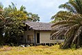 Wooden house in Beyin.jpg 6,036 × 4,020; 11.51 MB
-
 Zanddraagsters op het strand - 20651732 - RCE.jpg 1,190 × 1,200; 377 KB


