Category:Beverly Hills Oil Field
Jump to navigation
Jump to search
Media in category "Beverly Hills Oil Field"
The following 4 files are in this category, out of 4 total.
-
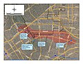
 BeverlyHillsOilFieIdStructureMap.png 760 × 560; 247 KB
-
 BeverlyHillsOilField.png 2,200 × 1,700; 2.13 MB
-
 BHDetail.jpg 3,300 × 2,550; 1.73 MB
-
 Breitburn Drilling Rig.jpg 183 × 324; 12 KB


Categories:
- Oil fields in California
- Oil fields in Los Angeles County, California
- Oil fields associated with the Repetto Formation (United States)
- Beverly Hills, California
- Bentwood-Las Cienegas Fault
- Santa Monica Fault
- Los Angeles Basin
- Modelo Formation (U.S. geology)
- D/M Sands (Modelo Formation)
- Hauser Sands (Modelo Formation)
- Ogden Sands (Modelo Formation)
- Shale member of the Modelo Formation