Category:Besthorpe, Norfolk
Jump to navigation
Jump to search
English: Besthorpe is a village and civil parish in the Breckland district of Norfolk, England, about a mile east of Attleborough, on the A11 road. According to the 2001 census it had a population of 561.
village and civil parish in Norfolk, England, UK  | |||||
| Upload media | |||||
| Instance of | |||||
|---|---|---|---|---|---|
| Location | Breckland, Norfolk, East of England, England | ||||
| Area |
| ||||
| Said to be the same as | Besthorpe (civil parish) | ||||
 | |||||
Subcategories
This category has the following 3 subcategories, out of 3 total.
A
B
Media in category "Besthorpe, Norfolk"
The following 157 files are in this category, out of 157 total.
-
 A glimpse of Beech House - geograph.org.uk - 2040257.jpg 640 × 466; 285 KB
-

-
 A shallow pond - geograph.org.uk - 5324224.jpg 640 × 360; 411 KB
-
 A11 - geograph.org.uk - 3372389.jpg 640 × 430; 85 KB
-

-
 A11 approaching the services - geograph.org.uk - 3362188.jpg 640 × 430; 57 KB
-
 A11 towards Norwich - geograph.org.uk - 5515107.jpg 640 × 480; 61 KB
-
 A11, northbound - geograph.org.uk - 3784791.jpg 640 × 430; 53 KB
-
 A11, Silver Street Bridge - geograph.org.uk - 3365855.jpg 640 × 430; 58 KB
-
 A11, Silver Street Bridge - geograph.org.uk - 3372378.jpg 640 × 378; 62 KB
-
 A11, Silver Street Bridge - geograph.org.uk - 3805505.jpg 640 × 430; 52 KB
-
 Access to the Old Hall - geograph.org.uk - 773269.jpg 480 × 640; 165 KB
-

-
 Barn, White House Farm - geograph.org.uk - 4601922.jpg 640 × 366; 72 KB
-
 Besthorpe Carr - geograph.org.uk - 2040222.jpg 640 × 480; 251 KB
-
 Besthorpe Carr Heading towards Black Carr - geograph.org.uk - 6404780.jpg 4,000 × 3,000; 4.18 MB
-
 Besthorpe Road - geograph.org.uk - 5167905.jpg 640 × 480; 91 KB
-
 Besthorpe Road, Besthorpe - geograph.org.uk - 5165142.jpg 3,072 × 2,304; 1.88 MB
-
 Besthorpe Road, Besthorpe - geograph.org.uk - 5165161.jpg 3,072 × 2,304; 1.9 MB
-
 Black Carr House and the lane to Hideaway Farm - geograph.org.uk - 6183853.jpg 3,456 × 2,592; 3.95 MB
-
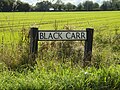 Black Carr sign - geograph.org.uk - 5165172.jpg 2,928 × 2,196; 5.44 MB
-
 Black Carr, Besthorpe Carr, south of Spooner Row - geograph.org.uk - 6183858.jpg 3,456 × 2,592; 3.88 MB
-
 Black Carr, Spooner Row - geograph.org.uk - 5165170.jpg 3,072 × 2,304; 1.88 MB
-
 Black clouds over Besthorpe - geograph.org.uk - 2039218.jpg 640 × 480; 202 KB
-
 Black gate at Willow Farm, Black Carr, Besthorpe Carr - geograph.org.uk - 6183849.jpg 3,456 × 2,592; 3.92 MB
-
 Blackthorn and hawthorn berries - geograph.org.uk - 2040266.jpg 480 × 640; 242 KB
-
 Bunwell Road - geograph.org.uk - 5167907.jpg 640 × 480; 77 KB
-
 Bunwell Road - geograph.org.uk - 5167909.jpg 640 × 480; 61 KB
-
 Bunwell Road sign - geograph.org.uk - 5165147.jpg 2,966 × 2,224; 5.52 MB
-
 Bunwell Road, Besthorpe - geograph.org.uk - 5165150.jpg 3,072 × 2,304; 1.88 MB
-
 Bunwell Road, Besthorpe - geograph.org.uk - 5165153.jpg 3,072 × 2,304; 3.4 MB
-
 Bunwell Road, Besthorpe - geograph.org.uk - 5167913.jpg 640 × 480; 79 KB
-
 Bunwell Road, Besthorpe - geograph.org.uk - 5170305.jpg 640 × 480; 85 KB
-
 Bunwell Road, Spooner Row - geograph.org.uk - 5165165.jpg 3,072 × 2,304; 1.83 MB
-
 Bunwell Road, Spooner Row - geograph.org.uk - 5165176.jpg 3,072 × 2,304; 1.93 MB
-

-

-
 Corner of Moat, Besthorpe - geograph.org.uk - 363967.jpg 640 × 480; 128 KB
-
 Cottages by the entrance to Heron Farm - geograph.org.uk - 2026544.jpg 640 × 496; 228 KB
-
 Crop field and drain, Attleborough - geograph.org.uk - 4608369.jpg 640 × 420; 50 KB
-
 Crop field, Besthorpe - geograph.org.uk - 4601920.jpg 640 × 434; 59 KB
-
 Crop fields by Besthorpe - geograph.org.uk - 5324216.jpg 640 × 360; 349 KB
-
 Crop fields by Besthorpe - geograph.org.uk - 5324219.jpg 640 × 360; 270 KB
-
 Crop fields north of Old Buckenham - geograph.org.uk - 5324231.jpg 640 × 360; 320 KB
-

-

-

-

-
-
 Elizabeth II postbox on Bunwell Road, Besthorpe - geograph.org.uk - 5170303.jpg 2,848 × 2,136; 1.46 MB
-
 Entering Attleborough on B1077 - geograph.org.uk - 363950.jpg 640 × 480; 84 KB
-
 Entrance drive to Heron's Farm - geograph.org.uk - 4518255.jpg 1,024 × 768; 350 KB
-
 Entrance to Flaxton Barn - geograph.org.uk - 2026548.jpg 640 × 480; 214 KB
-
 Farm track off Bunwell Road - geograph.org.uk - 5324211.jpg 640 × 360; 323 KB
-
 Farmland near Glebe Farm - geograph.org.uk - 4601921.jpg 640 × 383; 50 KB
-
 Farmland near Rose Farm - geograph.org.uk - 4608366.jpg 640 × 400; 56 KB
-
 Field by Black Carr, Besthorpe - geograph.org.uk - 2040241.jpg 480 × 640; 149 KB
-
 Field next to the Attleborough Bypass - geograph.org.uk - 5412197.jpg 1,990 × 1,454; 1.35 MB
-

-
 Fields by Black Carr, Besthorpe - geograph.org.uk - 2040230.jpg 640 × 480; 174 KB
-
 Fields north of Bunwell Road - geograph.org.uk - 2026552.jpg 640 × 480; 168 KB
-
 Fields south of Black Carr - geograph.org.uk - 2040237.jpg 640 × 480; 166 KB
-
 Filling station by the A11 - geograph.org.uk - 2595385.jpg 640 × 346; 43 KB
-
 Flat field north of Bunwell Road - geograph.org.uk - 5167908.jpg 640 × 480; 60 KB
-
 Flat field, Besthorpe - geograph.org.uk - 5167911.jpg 640 × 480; 62 KB
-
 Footpath around fields by Black Carr - geograph.org.uk - 2040234.jpg 640 × 480; 213 KB
-
 Footpath around fields by Black Carr - geograph.org.uk - 2040274.jpg 640 × 480; 187 KB
-
 Footpath leading north past Flaxton Barn - geograph.org.uk - 2026553.jpg 640 × 480; 178 KB
-
 Footpath past Beech House - geograph.org.uk - 2040253.jpg 640 × 480; 168 KB
-
 Footpath south of Black Carr, Besthorpe - geograph.org.uk - 2040251.jpg 480 × 640; 184 KB
-
 Gated entrance - geograph.org.uk - 772808.jpg 480 × 640; 158 KB
-

-
 Hawthorn berries - geograph.org.uk - 2040271.jpg 640 × 569; 321 KB
-
 Heading west on Bunwell Road - geograph.org.uk - 5167910.jpg 640 × 480; 93 KB
-
 Heaps of muck on a hardstanding - geograph.org.uk - 5324209.jpg 640 × 360; 255 KB
-
 Houses along Bunwell Road, Besthorpe - geograph.org.uk - 223306.jpg 640 × 480; 130 KB
-
 Houses on Slutshole Lane, Besthorpe - geograph.org.uk - 5866622.jpg 3,051 × 2,288; 1.13 MB
-
 Last year's cabbage crop - geograph.org.uk - 5324218.jpg 640 × 360; 391 KB
-
 Last year's cabbage crop - geograph.org.uk - 5324230.jpg 640 × 360; 388 KB
-
 Lay by, A11 - geograph.org.uk - 2706588.jpg 640 × 430; 58 KB
-
 Layby on the Attleborough Bypass - geograph.org.uk - 5412194.jpg 1,990 × 1,454; 929 KB
-
 Layby on the Attleborough Bypass - geograph.org.uk - 5412195.jpg 1,990 × 1,454; 1,008 KB
-
 Level Crossing - geograph.org.uk - 1866910.jpg 1,600 × 1,200; 328 KB
-
 Level crossing on Bunwell Road - geograph.org.uk - 5167915.jpg 640 × 480; 62 KB
-
 LMS Class 5 ("Black Five") 4-6-0 - geograph.org.uk - 2039225.jpg 640 × 515; 142 KB
-
 LMS Class 5 ("Black Five") 4-6-0 - geograph.org.uk - 2039231.jpg 640 × 491; 129 KB
-
-
 Minor road bridge over A11 north-east of Besthorpe - geograph.org.uk - 5980509.jpg 1,600 × 1,198; 984 KB
-
 Mr D's Diner - geograph.org.uk - 4412815.jpg 4,608 × 3,456; 2.55 MB
-
 Mr D's Diner - geograph.org.uk - 5515097.jpg 640 × 480; 66 KB
-
 New House,Hall Road - geograph.org.uk - 2236611.jpg 640 × 480; 85 KB
-
 Oak trees on a field's edge - geograph.org.uk - 2040249.jpg 640 × 480; 226 KB
-
 Old airfield buildings, Old Buckenham - geograph.org.uk - 366661.jpg 640 × 424; 131 KB
-
 Old Nissen huts - Old Buckenham airfield - geograph.org.uk - 366599.jpg 640 × 424; 128 KB
-
 Outgrown cabbage - geograph.org.uk - 5324227.jpg 640 × 360; 332 KB
-
 Plank bridge and ladder over ditch - geograph.org.uk - 2040240.jpg 480 × 640; 331 KB
-
 Pond on the edge of a small wood - geograph.org.uk - 5324221.jpg 640 × 360; 409 KB
-
 Railway towards Ely - geograph.org.uk - 5167916.jpg 640 × 480; 86 KB
-
 Railway towards Norwich - geograph.org.uk - 5167917.jpg 640 × 480; 70 KB
-
 Rose Farm on Slutshole Lane - geograph.org.uk - 2009247.jpg 800 × 531; 72 KB
-

-
 Service station on the A11 westbound - geograph.org.uk - 5515093.jpg 640 × 480; 64 KB
-
 Services by the A11 - geograph.org.uk - 3372380.jpg 640 × 430; 71 KB
-
 Services, A11 - geograph.org.uk - 3805506.jpg 640 × 430; 57 KB
-
 Shallow cutting for A11 north-east of Besthorpe - geograph.org.uk - 5980515.jpg 1,600 × 1,140; 857 KB
-
 Shell filling station by A11 near Besthorpe - geograph.org.uk - 5980504.jpg 1,600 × 1,200; 920 KB
-
 Signpost on Besthorpe Road - geograph.org.uk - 5165157.jpg 2,240 × 2,978; 3.22 MB
-
 Signpost on Bunwell Road - geograph.org.uk - 5165177.jpg 2,253 × 2,995; 5.94 MB
-

-
 Silver Street bridge over the A11 - geograph.org.uk - 5515103.jpg 640 × 480; 66 KB
-
 Silver Street Bridge, A11 - geograph.org.uk - 2595389.jpg 640 × 430; 56 KB
-
 Silver Street Bridge, A11 - geograph.org.uk - 2706584.jpg 640 × 430; 65 KB
-
 Silver Street Bridge, A11 - geograph.org.uk - 3784792.jpg 640 × 430; 46 KB
-
 Sluts Hole Lane, Besthorpe, Norfolk - Flickr - Trojan Llama.jpg 2,800 × 2,804; 2.28 MB
-
 Slutshole Lane - geograph.org.uk - 2009243.jpg 800 × 531; 70 KB
-
 Slutshole Lane - geograph.org.uk - 5867487.jpg 3,456 × 2,592; 3.84 MB
-
 Slutshole Lane, Besthorpe - geograph.org.uk - 5866621.jpg 3,456 × 2,592; 3.85 MB
-

-
 Small service area by A11 (Route 11 Kitchen) - geograph.org.uk - 5980500.jpg 1,600 × 1,200; 985 KB
-
 Southcroft junction near Black Carr - geograph.org.uk - 4518263.jpg 1,024 × 768; 423 KB
-
 The A11 - geograph.org.uk - 3362187.jpg 640 × 446; 81 KB
-
 The A11 before Wymondham - geograph.org.uk - 5416516.jpg 2,048 × 1,536; 1.6 MB
-

-
 The Old School, Besthorpe - geograph.org.uk - 2026585.jpg 640 × 480; 258 KB
-
 Timberland boots loaded up.jpg 3,120 × 4,160; 3.54 MB
-
 To Besthorpe on Bunwell Road - geograph.org.uk - 2026542.jpg 480 × 640; 191 KB
-
 To Besthorpe on Bunwell Road - geograph.org.uk - 5324207.jpg 640 × 360; 288 KB
-
 Track along a field's edge - geograph.org.uk - 5324234.jpg 640 × 360; 315 KB
-
 Trees growing in a pond - geograph.org.uk - 5324223.jpg 640 × 360; 416 KB
-

-

-
 View towards Black Carr - geograph.org.uk - 2040248.jpg 640 × 480; 119 KB
-
 View towards Byways, Besthorpe - geograph.org.uk - 2026559.jpg 640 × 480; 221 KB
-
 Walnut Tree Farm to Attleborough, aerial 2018 - geograph.org.uk - 5835915.jpg 683 × 1,024; 139 KB
-
 White House railway crossing, Attleborough - geograph.org.uk - 4518244.jpg 1,024 × 768; 385 KB
-
 Whitehouse Lane - geograph.org.uk - 5167918.jpg 640 × 480; 95 KB
-
 Wide concrete roadway off Bunwell Road - geograph.org.uk - 4518250.jpg 1,024 × 768; 314 KB
-
 Young crop field near Oaks Farm - geograph.org.uk - 5167904.jpg 640 × 480; 69 KB
-

-
 A11, towards services from Flyover - geograph.org.uk - 363960.jpg 640 × 480; 79 KB
-
 Access to the Old Hall - geograph.org.uk - 772772.jpg 640 × 480; 189 KB
-
 Cottages on Attleborough Road - geograph.org.uk - 772873.jpg 640 × 463; 128 KB
-
 Dead tree beside driveway - geograph.org.uk - 772789.jpg 480 × 640; 193 KB
-
 Decoy Farm - geograph.org.uk - 772870.jpg 640 × 458; 126 KB
-
 Field, Slutshole Lane, Spooner Row - geograph.org.uk - 277502.jpg 640 × 480; 212 KB
-
 Field, Slutshole Lane, Spooner Row - geograph.org.uk - 277510.jpg 640 × 480; 242 KB
-
 Food for gamebirds - geograph.org.uk - 772821.jpg 480 × 640; 131 KB
-
 Footbridge across ditch - geograph.org.uk - 772849.jpg 480 × 640; 175 KB
-
 Footbridge across ornate pond - geograph.org.uk - 773184.jpg 640 × 480; 145 KB
-
 Footbridge over Moat - geograph.org.uk - 364819.jpg 640 × 480; 136 KB
-
 Hook Wood Farm - geograph.org.uk - 772800.jpg 640 × 449; 118 KB
-
 Mayfield Farm, Besthorpe - geograph.org.uk - 364801.jpg 640 × 480; 126 KB
-

-
 Road Intersections, Morley - geograph.org.uk - 364793.jpg 640 × 480; 96 KB
-
 Sign and Track to Fisheries - geograph.org.uk - 363964.jpg 640 × 480; 130 KB
-
 Slip Road onto A11 - geograph.org.uk - 364775.jpg 640 × 480; 67 KB
-


_flowering_in_crop_field_-_geograph.org.uk_-_5324232.jpg)


_4-6-0_-_geograph.org.uk_-_2039225.jpg)
_4-6-0_-_geograph.org.uk_-_2039231.jpg)


_-_geograph.org.uk_-_5980500.jpg)


