Category:Bertha-von-Suttner-Straße (Chemnitz)
Jump to navigation
Jump to search
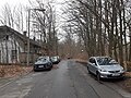
street in Chemnitz, Germany  view along Bertha-von-Suttner-Straße twoards south  Abendlicher Blick vom Adalbert-Stifter-Weg in die Bertha-von-Suttner-Straße | |||||
| Upload media | |||||
| Instance of | |||||
|---|---|---|---|---|---|
| Named after | |||||
| Location | Ebersdorf, Chemnitz, Saxony, Germany | ||||
| Connects with | |||||
 | |||||
Deutsch: Die Bertha-von-Suttner-Straße begrenzt das frühere Kasernengelände an seiner östlichen Seite. Sie ist im Straßennamenverzeichnis der Stadt Chemnitz unter der Schlüsselnummer 03121 verzeichnet, ihr sind keine eigenen Hausnummern zugeordnet. Mit Stand Februar 2024 ist die Bertha-von-Suttner-Straße vor Ort nicht namentlich ausgeschildert.
Media in category "Bertha-von-Suttner-Straße (Chemnitz)"
The following 4 files are in this category, out of 4 total.
-
 2024-01-27-Chemnitz-Bertha-von-Suttner-Straße.jpg 4,032 × 3,024; 6.47 MB
-
 2024-02-10-Chemnitz-Bertha-von-Suttner-Straße-1.jpg 4,608 × 3,456; 8.65 MB
-
 2024-02-10-Chemnitz-Bertha-von-Suttner-Straße-2.jpg 4,608 × 3,456; 8.4 MB
-
 2024-02-10-Chemnitz-Bertha-von-Suttner-Straße-3.jpg 4,608 × 3,456; 8.73 MB

