Category:Berry Pomeroy
Jump to navigation
Jump to search
English: Berry Pomeroy is a village and civil parish in the South Hams district of Devon, England, about two miles east of Totnes. According to the 2001 census it had a population of 973. Berry Pomeroy is part of the Totnes constituency, although it is in fact larger than the neighbouring town (in terms of the geographic size of the parish, not comparative population).
village in the United Kingdom  | |||||
| Upload media | |||||
| Instance of | |||||
|---|---|---|---|---|---|
| Location | South Hams, Devon, South West England, England | ||||
| Population |
| ||||
| Said to be the same as | Berry Pomeroy (Wikimedia duplicated page, civil parish) | ||||
 | |||||
Subcategories
This category has the following 5 subcategories, out of 5 total.
Media in category "Berry Pomeroy"
The following 200 files are in this category, out of 746 total.
(previous page) (next page)-
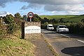
 '6 Knots' speed limit sign - geograph.org.uk - 6189048.jpg 2,064 × 1,351; 841 KB
-
 'Dart Explorer' mid-stream to Totnes - geograph.org.uk - 6207903.jpg 3,648 × 2,432; 2.59 MB
-
 6 Knots Max on River Dart - geograph.org.uk - 6207897.jpg 3,648 × 2,432; 3.62 MB
-
 A memorial seat carved with a picture and verse - geograph.org.uk - 3726841.jpg 1,152 × 1,536; 1.14 MB
-
 A View Across the Valley - geograph.org.uk - 2864103.jpg 1,024 × 768; 204 KB
-
 A381 near Red Post - geograph.org.uk - 3716830.jpg 1,536 × 1,153; 998 KB
-
 A381 south of Red Post - geograph.org.uk - 3716826.jpg 1,151 × 1,536; 1.03 MB
-
 A385 at Glazegate Lane - geograph.org.uk - 6019685.jpg 2,716 × 1,551; 487 KB
-
 A385 at Glazegate Lane - geograph.org.uk - 913459.jpg 640 × 480; 72 KB
-
 A385 near Longcombe - geograph.org.uk - 3894945.jpg 4,327 × 2,856; 4.61 MB
-
 A385 passing Longcombe Nursery - geograph.org.uk - 3894963.jpg 4,443 × 2,833; 4.62 MB
-
 A385 passing Southfield Wood - geograph.org.uk - 3894949.jpg 4,406 × 2,894; 4.75 MB
-
 Abandoned Sawmill - geograph.org.uk - 4550627.jpg 800 × 532; 185 KB
-
 Above Millcombe Barn - geograph.org.uk - 1142048.jpg 640 × 471; 76 KB
-
 Across Longcombe - geograph.org.uk - 5451504.jpg 2,919 × 1,545; 1,011 KB
-
 Across the Bourton valley - geograph.org.uk - 6693801.jpg 1,426 × 803; 120 KB
-
 Across the Dart from Sharpham - geograph.org.uk - 4653166.jpg 1,920 × 1,154; 520 KB
-
 Across the Dart from Sharpham Drive - geograph.org.uk - 4852684.jpg 1,920 × 1,210; 762 KB
-
 Across the Dart valley - geograph.org.uk - 6463513.jpg 4,284 × 2,634; 1.77 MB
-
 Across the Dart valley - geograph.org.uk - 6463851.jpg 4,288 × 2,848; 1.86 MB
-
 Across the Fleet Mill valley - geograph.org.uk - 1142224.jpg 640 × 456; 83 KB
-
 Across the River Dart - geograph.org.uk - 4852573.jpg 1,920 × 1,394; 606 KB
-
 Afton - geograph.org.uk - 1588862.jpg 640 × 480; 112 KB
-
 Afton Bridge - geograph.org.uk - 983432.jpg 640 × 427; 122 KB
-
 Afton Farm - geograph.org.uk - 2996038.jpg 640 × 426; 69 KB
-
 Afton Farm - geograph.org.uk - 804560.jpg 495 × 640; 100 KB
-
 Afton Tor Wood - geograph.org.uk - 4590343.jpg 2,679 × 2,020; 1.14 MB
-
 Afton Tor Wood - geograph.org.uk - 4590619.jpg 1,920 × 1,372; 646 KB
-
 Approaching a bend in the river Dart - geograph.org.uk - 5077213.jpg 640 × 480; 147 KB
-
 Approaching Berry Pomeroy - geograph.org.uk - 1012491.jpg 640 × 427; 107 KB
-
 Approaching Berry Pomeroy - geograph.org.uk - 1143165.jpg 640 × 439; 86 KB
-
 Approaching Berry Pomeroy - geograph.org.uk - 5411135.jpg 4,000 × 3,000; 5.12 MB
-
 Approaching Netherton - geograph.org.uk - 982681.jpg 640 × 427; 123 KB
-
 Approaching Shadrack - geograph.org.uk - 4241247.jpg 1,768 × 1,534; 1,004 KB
-
 Approaching Shadrack - geograph.org.uk - 860660.jpg 480 × 640; 109 KB
-

-
 Aptor - geograph.org.uk - 2088913.jpg 640 × 371; 48 KB
-
 Aptor - geograph.org.uk - 6554961.jpg 2,920 × 1,816; 748 KB
-
 Ash tree by Loventor Lane - geograph.org.uk - 6554959.jpg 4,288 × 2,848; 2.38 MB
-
 At Afton - geograph.org.uk - 4240860.jpg 1,920 × 1,359; 643 KB
-
 At Loventor - geograph.org.uk - 1588802.jpg 640 × 480; 135 KB
-
 At Weekaborough Oak Cross - geograph.org.uk - 6629217.jpg 4,288 × 2,848; 2.02 MB
-
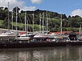 Baltic Wharf - geograph.org.uk - 5092797.jpg 2,048 × 1,536; 564 KB
-
 Baltic Wharf Boatyard slipway - geograph.org.uk - 6189083.jpg 3,648 × 2,432; 3 MB
-
 Banks of The Dart near Totnes - geograph.org.uk - 2444265.jpg 4,000 × 3,000; 3.87 MB
-
 Barley by Glazegate Lane - geograph.org.uk - 913048.jpg 640 × 480; 144 KB
-
 Barley by the John Musgrave Heritage Trail - geograph.org.uk - 6555149.jpg 4,288 × 2,848; 2.46 MB
-
 Barley near Gatcombe - geograph.org.uk - 804377.jpg 640 × 480; 86 KB
-
 Barn near Bourton - geograph.org.uk - 803914.jpg 640 × 480; 99 KB
-
 Barn near Bourton - geograph.org.uk - 803942.jpg 640 × 457; 91 KB
-
 Barn with bales near Herhill Copse - geograph.org.uk - 6643284.jpg 2,986 × 2,004; 593 KB
-
 Barn, Berry Pomeroy - geograph.org.uk - 1143229.jpg 640 × 414; 103 KB
-
 Barn, Berry Pomeroy - geograph.org.uk - 6737064.jpg 4,288 × 2,848; 2.18 MB
-
 Barn, Berry Pomeroy - geograph.org.uk - 6737067.jpg 4,091 × 2,601; 1.56 MB
-
 Barn, True Street - geograph.org.uk - 6693356.jpg 4,288 × 2,848; 1.93 MB
-
 Barn, True Street - geograph.org.uk - 6693674.jpg 4,035 × 2,699; 2.23 MB
-
 Barn. Afton - geograph.org.uk - 4240719.jpg 1,920 × 2,560; 1.7 MB
-
 Barns at Netherton - geograph.org.uk - 152395.jpg 640 × 480; 104 KB
-
 Barns at Netherton - geograph.org.uk - 4922311.jpg 1,920 × 1,290; 1.1 MB
-
 Barns, Afton - geograph.org.uk - 6612328.jpg 3,878 × 2,297; 1.55 MB
-
 Beech tree, Berry Pomeroy - geograph.org.uk - 4241659.jpg 1,920 × 2,560; 1.87 MB
-
 Below Netherground Copse - geograph.org.uk - 913435.jpg 640 × 480; 77 KB
-
 Bend, in the River Dart - geograph.org.uk - 1881960.jpg 1,024 × 768; 267 KB
-
 Berry Castle Lodge - geograph.org.uk - 1012857.jpg 640 × 427; 125 KB
-
 Berry Court - Berry Pomeroy - geograph.org.uk - 35779.jpg 640 × 480; 177 KB
-
 Berry Pomeroy , Countryside Scenery - geograph.org.uk - 6262069.jpg 6,000 × 4,000; 7.34 MB
-
 Berry Pomeroy , Countryside Scenery - geograph.org.uk - 6262071.jpg 6,000 × 4,000; 7.01 MB
-
 Berry Pomeroy , Grassy Field - geograph.org.uk - 6262073.jpg 6,000 × 4,000; 6.76 MB
-
 Berry Pomeroy , The A385 - geograph.org.uk - 6262067.jpg 6,000 × 4,000; 7.23 MB
-
 Berry Pomeroy , The A385 - geograph.org.uk - 6262068.jpg 6,000 × 4,000; 7.43 MB
-
 Berry Pomeroy , The A385 - geograph.org.uk - 6262070.jpg 6,000 × 4,000; 6.44 MB
-
 Berry Pomeroy - geograph.org.uk - 915422.jpg 480 × 640; 87 KB
-
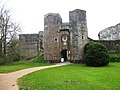
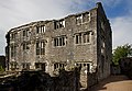
 Berry Pomeroy Castle (1) - geograph.org.uk - 5427581.jpg 4,320 × 3,240; 4.14 MB
-
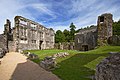
 Berry Pomeroy Castle (2) - geograph.org.uk - 5427592.jpg 4,320 × 3,240; 4.35 MB
-
 Berry Pomeroy Castle (3) - geograph.org.uk - 5427598.jpg 4,320 × 3,240; 3.57 MB
-
 Berry Pomeroy Castle (4) - geograph.org.uk - 5427600.jpg 4,213 × 3,160; 2.83 MB
-
 Berry Pomeroy Castle (5) - geograph.org.uk - 5427758.jpg 4,320 × 3,240; 3.49 MB
-
 Berry Pomeroy Castle (6) - geograph.org.uk - 5427767.jpg 4,320 × 3,240; 3.36 MB
-
 Berry Pomeroy Castle (7) - geograph.org.uk - 5427772.jpg 4,320 × 3,240; 2.99 MB
-
 Berry Pomeroy Castle - geograph.org.uk - 3412475.jpg 640 × 480; 90 KB
-
 Berry Pomeroy Castle - geograph.org.uk - 3412479.jpg 640 × 480; 68 KB
-
 Berry Pomeroy Castle - geograph.org.uk - 3412486.jpg 640 × 480; 83 KB
-
 Berry Pomeroy Castle - geograph.org.uk - 4590704.jpg 1,920 × 1,326; 630 KB
-
 Berry Pomeroy Castle - geograph.org.uk - 4661269.jpg 1,024 × 683; 218 KB
-
 Berry Pomeroy Castle - geograph.org.uk - 4661497.jpg 1,024 × 683; 250 KB
-
 Berry Pomeroy Castle - geograph.org.uk - 4661504.jpg 683 × 1,024; 199 KB
-
 Berry Pomeroy Castle - geograph.org.uk - 4661514.jpg 1,024 × 683; 290 KB
-
 Berry Pomeroy Castle - geograph.org.uk - 4661518.jpg 1,024 × 683; 329 KB
-
 Berry Pomeroy Castle - geograph.org.uk - 4661524.jpg 1,024 × 683; 246 KB
-

-
-
-
 Berry Pomeroy Castle - the gatehouse - geograph.org.uk - 3540046.jpg 640 × 427; 370 KB
-

-
 Berry Pomeroy Castle from the valley - geograph.org.uk - 3034516.jpg 1,000 × 750; 730 KB
-
 Berry Pomeroy Church - geograph.org.uk - 3034604.jpg 1,000 × 750; 496 KB
-
 Blagdon Ford - geograph.org.uk - 5140843.jpg 6,000 × 4,000; 6.6 MB
-
 Blagdon Road - geograph.org.uk - 6667108.jpg 768 × 1,024; 187 KB
-
 Blagdon Road - geograph.org.uk - 6667118.jpg 768 × 1,024; 211 KB
-
 Blossom in Berry Pomeroy - geograph.org.uk - 171504.jpg 640 × 480; 112 KB
-
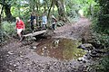
 Boardwalk on Longmarsh path - geograph.org.uk - 6207932.jpg 3,648 × 2,432; 3.8 MB
-
 Boardwalk over drainage ditch on Longmarsh - geograph.org.uk - 6207910.jpg 3,648 × 2,432; 3.93 MB
-
 Boardwalk, Longmarsh salt marsh, Totnes - geograph.org.uk - 6207908.jpg 1,600 × 1,067; 462 KB
-
 Boardwalk, Longmarsh, Totnes - geograph.org.uk - 3726845.jpg 1,024 × 768; 177 KB
-
 Boat on the Dart - geograph.org.uk - 5078541.jpg 1,346 × 909; 317 KB
-
 Boat remains, Fleet Mill Quay - geograph.org.uk - 1062851.jpg 480 × 640; 118 KB
-
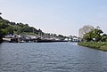
 Boatyard on the Dart - geograph.org.uk - 5923717.jpg 1,600 × 1,066; 355 KB
-
 Boatyard, on the River Dart, east of Totnes - geograph.org.uk - 1882058.jpg 1,024 × 695; 140 KB
-
 Bob's View - geograph.org.uk - 3989155.jpg 1,920 × 1,289; 522 KB
-
 Boggy ground, Mems Valley - geograph.org.uk - 5749651.jpg 640 × 426; 80 KB
-
 Bourton Bridge - geograph.org.uk - 803859.jpg 480 × 640; 119 KB
-
 Bourton Farm - geograph.org.uk - 982453.jpg 640 × 427; 111 KB
-
 Bourton Lane - geograph.org.uk - 4550463.jpg 800 × 532; 196 KB
-
 Bourton Lane - geograph.org.uk - 4798304.jpg 1,920 × 1,339; 585 KB
-
 Bourton Lane - geograph.org.uk - 6593806.jpg 4,288 × 2,848; 2.11 MB
-
 Bourton Lane - geograph.org.uk - 6600123.jpg 4,288 × 2,848; 2.14 MB
-
 Bourton Lane - geograph.org.uk - 803893.jpg 480 × 640; 123 KB
-
 Bourton Lane - geograph.org.uk - 803904.jpg 640 × 480; 113 KB
-
 Bourton Lane - geograph.org.uk - 803909.jpg 640 × 480; 95 KB
-
 Bourton Lane - geograph.org.uk - 982472.jpg 640 × 427; 110 KB
-
 Bourton Lane from Sand Lane - geograph.org.uk - 804139.jpg 640 × 480; 107 KB
-
 Bourton road - north of Totnes - geograph.org.uk - 39141.jpg 640 × 480; 157 KB
-
 Bourton valley - geograph.org.uk - 803885.jpg 640 × 480; 116 KB
-
 Bourton, Totnes - geograph.org.uk - 803802.jpg 640 × 514; 87 KB
-
 Breach in the Channel Wall - geograph.org.uk - 2444254.jpg 4,000 × 3,000; 3.49 MB
-
 Broadmoor Plantation - geograph.org.uk - 6600714.jpg 2,818 × 1,585; 422 KB
-
 Broadmoor Plantation - geograph.org.uk - 6600730.jpg 1,674 × 1,032; 241 KB
-
 Buildings at Shadrack - geograph.org.uk - 4241343.jpg 1,920 × 1,440; 630 KB
-
 Bull, Berry Pomeroy - geograph.org.uk - 915404.jpg 640 × 480; 96 KB
-
 Bullocks by Hazel Wood - geograph.org.uk - 6555351.jpg 4,021 × 1,677; 940 KB
-
 Bullocks by Hazel Wood - geograph.org.uk - 6555362.jpg 3,986 × 1,874; 623 KB
-
 Bus stop at True Street - geograph.org.uk - 3804419.jpg 1,024 × 767; 137 KB
-
 Bus Stop on the Junction - geograph.org.uk - 1012465.jpg 640 × 427; 89 KB
-
 Butterball Copse - geograph.org.uk - 6554585.jpg 2,637 × 3,951; 2.4 MB
-
 By the Dart at Longmarsh - geograph.org.uk - 5092787.jpg 1,737 × 1,165; 483 KB
-
 By the tidal lagoon - geograph.org.uk - 1062699.jpg 640 × 480; 114 KB
-
 Canada geese near Afton - geograph.org.uk - 1333028.jpg 556 × 640; 152 KB
-
 Car Park - geograph.org.uk - 5907466.jpg 1,024 × 680; 207 KB
-
 Car park on Steamer Quay Road - geograph.org.uk - 6189053.jpg 1,600 × 1,067; 463 KB
-
 Cardiff Castle passing Fleet Mill Quay - geograph.org.uk - 4651458.jpg 1,920 × 1,274; 499 KB
-
 Cardiff Castle passing Sharpham - geograph.org.uk - 4651441.jpg 3,895 × 2,634; 3.61 MB
-
 Cast photoThe Tale of Reverend John Prince Totnes.JPG 3,008 × 2,000; 1.51 MB
-
 Castle Wood - geograph.org.uk - 1332872.jpg 480 × 640; 110 KB
-
 Cattle and barn, Berry Pomeroy - geograph.org.uk - 847736.jpg 640 × 454; 86 KB
-
 Cattle by Corner Copse - geograph.org.uk - 6612338.jpg 1,088 × 497; 82 KB
-
 Cattle near Burrow Orchard - geograph.org.uk - 2089014.jpg 640 × 476; 122 KB
-
 Cattle near Gatcombe Mill - geograph.org.uk - 1332993.jpg 640 × 480; 96 KB
-
 Cattle pasture by the John Musgrave Heritage Trail - geograph.org.uk - 6555234.jpg 3,697 × 2,396; 1.76 MB
-
 Cattle pasture, Butterball Copse - geograph.org.uk - 4589674.jpg 1,920 × 1,396; 752 KB
-
 Cemetery, Berry Pomeroy - geograph.org.uk - 915412.jpg 640 × 480; 122 KB
-
 Church meadow - geograph.org.uk - 4672147.jpg 1,024 × 683; 208 KB
-
 Combe House - geograph.org.uk - 6629029.jpg 2,203 × 1,527; 356 KB
-
 Comma near Aish - geograph.org.uk - 6548119.jpg 1,042 × 766; 178 KB
-
 Commemorative bench along the River Dart - geograph.org.uk - 6189073.jpg 3,648 × 2,432; 3.65 MB
-
 Conifers, East Hill Wood - geograph.org.uk - 4922011.jpg 1,920 × 2,730; 1.71 MB
-
 Cottage at Afton - geograph.org.uk - 4240803.jpg 1,920 × 1,458; 636 KB
-
 Countryside around Fleet Mill - geograph.org.uk - 4635142.jpg 1,920 × 1,282; 927 KB
-
 Countryside by Loventor Copse - geograph.org.uk - 4590594.jpg 1,920 × 1,401; 731 KB
-
 Countryside east of Loventor - geograph.org.uk - 6554641.jpg 3,040 × 1,327; 414 KB
-
 Countryside east of Loventor - geograph.org.uk - 6554865.jpg 1,723 × 939; 421 KB
-
 Countryside east of Totnes - geograph.org.uk - 914401.jpg 640 × 480; 94 KB
-
 Countryside near Aptor - geograph.org.uk - 2088966.jpg 640 × 446; 73 KB
-
 Countryside near Berry Pomeroy - geograph.org.uk - 847720.jpg 640 × 480; 84 KB
-
 Countryside near Bourton - geograph.org.uk - 803973.jpg 640 × 480; 102 KB
-
 Countryside near Netherton - geograph.org.uk - 2088826.jpg 640 × 403; 59 KB
-
 Countryside near True Street - geograph.org.uk - 6693649.jpg 2,603 × 1,424; 490 KB
-
 Countryside north of Loventor - geograph.org.uk - 4589648.jpg 1,920 × 1,404; 676 KB
-
 Countryside northeast of Totnes - geograph.org.uk - 6600760.jpg 2,765 × 1,330; 355 KB
-
 Countryside, Longcombe - geograph.org.uk - 6020857.jpg 2,322 × 1,185; 349 KB
-
 Cowslips, Berry Pomeroy - geograph.org.uk - 3941453.jpg 1,920 × 2,467; 1.14 MB
-
 Cowslips, Berry Pomeroy - geograph.org.uk - 3941465.jpg 3,407 × 2,448; 1.19 MB
-

-
 Crossroads ahead - geograph.org.uk - 1638164.jpg 640 × 439; 77 KB
-
 Damselfly below Berry Pomeroy Castle - geograph.org.uk - 3098961.jpg 433 × 640; 33 KB
-
 Dart at Baltic Wharf - geograph.org.uk - 5092810.jpg 2,048 × 1,536; 742 KB
-
 Dart at Baltic Wharf - geograph.org.uk - 5092825.jpg 1,485 × 1,052; 286 KB
-
 Dart at Sharpham - geograph.org.uk - 3097236.jpg 640 × 448; 72 KB
-

-
 Dead boughs, Fleet valley tidal lagoon - geograph.org.uk - 1062810.jpg 488 × 640; 121 KB
-
 Dead tree near the Dart - geograph.org.uk - 1062749.jpg 480 × 640; 121 KB
-
 Dennin's Linhay - geograph.org.uk - 804353.jpg 640 × 320; 59 KB
-
 Dennin's Linhay - geograph.org.uk - 804387.jpg 640 × 480; 82 KB
-
 Detail of the rood screen in the church - geograph.org.uk - 3034614.jpg 1,000 × 750; 651 KB
-
 Detail of the Seymour monument in the church - geograph.org.uk - 3034612.jpg 750 × 1,000; 585 KB
-
 Devon and moors stitch.jpg 7,500 × 1,376; 4.37 MB
-
 Devon fields stitch.jpg 9,000 × 1,307; 6.33 MB
-
 Devon over a gate - geograph.org.uk - 2532110.jpg 1,280 × 960; 1.08 MB
-
 Disused Riflerange - geograph.org.uk - 947838.jpg 640 × 428; 104 KB
-
 Dogwood on Longmarsh - geograph.org.uk - 1131705.jpg 480 × 640; 102 KB
-
 Double fastening, Castle Mill Farm - geograph.org.uk - 4241556.jpg 1,920 × 1,903; 1.46 MB
-
 Down a Devon Lane - geograph.org.uk - 3016586.jpg 4,368 × 2,912; 1.98 MB
-
 Down Plantation - geograph.org.uk - 1142546.jpg 640 × 480; 134 KB
-
 Duckpond, Berry Pomeroy - geograph.org.uk - 1143144.jpg 640 × 480; 109 KB
-
 East Hill Wood - geograph.org.uk - 2996821.jpg 476 × 640; 142 KB
-
 East Hill Wood - geograph.org.uk - 4922239.jpg 1,920 × 2,880; 1.96 MB
-
 Elizabethan House, Berry Pomeroy Castle - geograph.org.uk - 4172786.jpg 1,121 × 1,681; 647 KB
-
 False oxlips, Berry Pomeroy - geograph.org.uk - 3941462.jpg 1,920 × 1,405; 328 KB
-
 Farm Buildings at Longcombe - geograph.org.uk - 3016594.jpg 640 × 450; 108 KB
-
 Farm buildings, Netherton - geograph.org.uk - 4550559.jpg 800 × 532; 161 KB
-
 Farm sign, Berry Pomeroy - geograph.org.uk - 6737061.jpg 4,288 × 2,848; 1.34 MB


_-_geograph.org.uk_-_5427581.jpg)
_-_geograph.org.uk_-_5427592.jpg)
_-_geograph.org.uk_-_5427598.jpg)
_-_geograph.org.uk_-_5427600.jpg)
_-_geograph.org.uk_-_5427758.jpg)
_-_geograph.org.uk_-_5427767.jpg)
_-_geograph.org.uk_-_5427772.jpg)


_-_geograph.org.uk_-_3540041.jpg)


