Category:Berneray
Jump to navigation
Jump to search
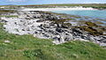
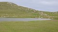
Berneray is an island in the Outer Hebrides, connected to North Uist by a causeway.
The name Berneray may also be associated with:
- Barra Head or Berneray is the southernmost island of the Outer Hebrides - see Category:Barra Head.
- Great Bernera is an island connected to Lewis by a bridge - see Category:Great Bernera.
island in the Sound of Harris, Outer Hebrides, Scotland, UK  _OH.svg) | |||||
| Upload media | |||||
| Instance of | |||||
|---|---|---|---|---|---|
| Part of | |||||
| Location |
| ||||
| Located in or next to body of water |
| ||||
| Highest point | |||||
| Population |
| ||||
| Area |
| ||||
| Different from | |||||
 | |||||
Subcategories
This category has the following 9 subcategories, out of 9 total.
B
- Beinn Shleibhe (20 F)
- Berneray Ferry Terminal (15 F)
- Berneray Harbour (11 F)
- Berneray Youth Hostel (16 F)
- Borgh, Berneray (8 F)
C
- Cladh Maolrithe (6 F)
- Cnoc Bhuirgh (12 F)
W
- Berneray West Beach (29 F)
Media in category "Berneray"
The following 200 files are in this category, out of 230 total.
(previous page) (next page)-
 'New' Graveyard on Berneray - geograph.org.uk - 840928.jpg 640 × 360; 53 KB
-
 A Long Beach on Berneray - geograph.org.uk - 2905731.jpg 4,000 × 3,000; 813 KB
-
 Aird Ma-Ruibhe - geograph.org.uk - 1343651.jpg 640 × 412; 225 KB
-
 Angus Macaskill memorial - geograph.org.uk - 2996626.jpg 1,600 × 1,064; 366 KB
-
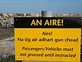 Attention^ - geograph.org.uk - 1361638.jpg 640 × 480; 65 KB
-
 Backhill.jpg 2,048 × 1,536; 285 KB
-
 Beach at Baile - East Berneray - geograph.org.uk - 4540904.jpg 1,800 × 1,013; 1.28 MB
-
 Beach At Baile on the Island Of Berneray - geograph.org.uk - 2658904.jpg 4,000 × 3,000; 2.23 MB
-
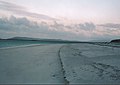
 Beach on Berneray - geograph.org.uk - 938026.jpg 640 × 419; 79 KB
-
 Beach on the south coast of Berneray - geograph.org.uk - 6224785.jpg 1,024 × 760; 580 KB
-
 Beasdaire Bay and Beinn Ghainche - geograph.org.uk - 1301631.jpg 640 × 480; 56 KB
-
 Berneray (hazelisles).jpg 2,272 × 1,704; 844 KB
-
 Berneray (Mingulay) OH.svg 1,083 × 1,424; 2.36 MB
-
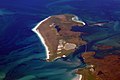
 Berneray and Mingulay from the air - geograph.org.uk - 5376402.jpg 3,024 × 2,274; 2.56 MB
-
 Berneray Beach - geograph.org.uk - 2904980.jpg 4,000 × 3,000; 935 KB
-
 Berneray Beach Harris 2.jpg 640 × 480; 45 KB
-
 Berneray Beach North Uist.jpg 640 × 456; 73 KB
-
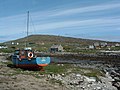 Berneray Borgh Boat.jpg 640 × 480; 105 KB
-
 Berneray Borgh.jpg 640 × 480; 65 KB
-
 Berneray causeway (hazelisles).jpg 2,272 × 1,704; 896 KB
-
 Berneray Causeway - geograph.org.uk - 301774.jpg 640 × 427; 44 KB
-
 Berneray Causeway - geograph.org.uk - 623954.jpg 640 × 480; 80 KB
-
 Berneray Causeway Eider.jpg 640 × 480; 133 KB
-
 Berneray Causeway.jpg 640 × 480; 89 KB
-
 Berneray Ferry.jpg 640 × 359; 39 KB
-
 Berneray Forecasting Stone.jpg 640 × 480; 109 KB
-
 Berneray Harris.jpg 640 × 412; 91 KB
-

-
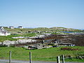
 Berneray Houses North Uist.jpg 640 × 480; 70 KB
-
 Berneray Houses.jpg 640 × 480; 155 KB
-
 Berneray in Afternoon Sunshine - geograph.org.uk - 2904993.jpg 4,000 × 3,000; 884 KB
-
 Berneray Last House East Beach (hazelisles).jpg 2,272 × 1,704; 904 KB
-
 Berneray Loch a Bàigh.jpg 640 × 480; 87 KB
-
 Berneray Loch Bhuirgh.jpg 640 × 480; 84 KB
-
 Berneray Machair (hazelisles).jpg 2,272 × 1,704; 854 KB
-
 Berneray Machair 1.jpg 640 × 483; 57 KB
-
 Berneray Machair.jpg 640 × 423; 62 KB
-
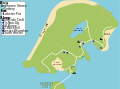
 Berneray map.png 1,193 × 888; 42 KB
-
 Berneray near hostel (hazelisles).jpg 2,272 × 866; 714 KB
-
 Berneray north beach - geograph.org.uk - 2044655.jpg 3,049 × 1,847; 1.07 MB
-
 Berneray North Uist Rubha Bhoisnis Boat.jpg 640 × 359; 61 KB
-
 Berneray old cemetery.jpg 2,272 × 1,704; 891 KB
-
 Berneray Port Ludaig.jpg 640 × 331; 37 KB
-
 Berneray Radio Station.jpg 640 × 480; 106 KB
-
 Berneray Rubha Bhoisnis Beach.jpg 640 × 480; 49 KB
-
 Berneray Rubha Bhoisnis North Uist.jpg 640 × 480; 97 KB
-
 Berneray Rubha Bhoisnis Pabbay.jpg 640 × 415; 52 KB
-
 Berneray Rubha Bhoisnis.jpg 640 × 359; 64 KB
-
 Berneray Ruin Cemetery.jpg 640 × 480; 101 KB
-
 Berneray ruins opposite hostel (hazelisles).jpg 2,272 × 1,704; 885 KB
-
 Berneray School.jpg 640 × 441; 49 KB
-
 Berneray Seals - geograph.org.uk - 3634720.jpg 640 × 480; 88 KB
-
 Berneray Seals.jpg 640 × 441; 50 KB
-
 Berneray sheep (cropped).jpg 812 × 601; 175 KB
-
 Berneray sheep (hazelisles).jpg 2,272 × 1,704; 861 KB
-
 Berneray Sheeps Pabbay.jpg 640 × 408; 73 KB
-
 Berneray Sheeps.jpg 640 × 359; 59 KB
-
 Berneray Shop.jpg 640 × 480; 78 KB
-
 Berneray South.jpg 640 × 480; 125 KB
-
 Berneray Spit Port Lateral Buoy - geograph.org.uk - 4684417.jpg 2,554 × 1,915; 1.16 MB
-
 Berneray, beachside grazing - geograph.org.uk - 3271629.jpg 640 × 480; 63 KB
-
 Berneray, east side - geograph.org.uk - 2044726.jpg 3,264 × 2,448; 1.34 MB
-
 Berneray, North Beach - geograph.org.uk - 2591760.jpg 2,560 × 1,920; 1.59 MB
-
 Berneray, North Uist.jpg 3,504 × 2,336; 6.51 MB
-
 Berneray, Sound of Harris, OH.svg 388 × 236; 3.92 MB
-
 Berneray, West Beach - geograph.org.uk - 2591835.jpg 2,560 × 1,920; 1.72 MB
-
 Berneray.svg 398 × 296; 71 KB
-
 Berneray01LB.jpg 4,608 × 3,456; 4.99 MB
-
 Between the dunes - geograph.org.uk - 889915.jpg 640 × 490; 80 KB
-
 Beàrnaraigh Causeway - geograph.org.uk - 1343624.jpg 640 × 404; 216 KB
-
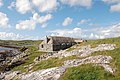 Blackhouse - geograph.org.uk - 1573694.jpg 640 × 426; 79 KB
-
 Borgh, Berneray - geograph.org.uk - 1467280.jpg 640 × 480; 109 KB
-
 Breaking waves, Berneray - geograph.org.uk - 840843.jpg 640 × 360; 51 KB
-
 Church ruins, Berneray (geograph 2044712).jpg 2,448 × 3,264; 1.73 MB
-
 Coastal village of Borgh, Berneray - geograph.org.uk - 861259.jpg 640 × 414; 60 KB
-

-
 Community Centre, Borgh - geograph.org.uk - 1512863.jpg 640 × 426; 226 KB
-
 Crofting agriculture on the machair - geograph.org.uk - 1512879.jpg 640 × 426; 287 KB
-
 Crowded Beach on Berneray - geograph.org.uk - 2591774.jpg 2,560 × 1,920; 1.66 MB
-
 Dangerous waters - geograph.org.uk - 1512970.jpg 640 × 426; 200 KB
-
 Disrespectful camping - geograph.org.uk - 1467365.jpg 640 × 480; 99 KB
-
 Dry stone wall on Berneray - geograph.org.uk - 1290863.jpg 480 × 640; 74 KB
-
 DSCN3966 Pol an Oir panorama.jpg 4,800 × 920; 1.01 MB
-
 DSCN4082 Berneray Post Office.jpg 4,608 × 3,456; 6.16 MB
-
 DSCN4097 Panorama next Berneray graveyard.jpg 4,800 × 920; 1.02 MB
-
 DSCN4098 North Uist from Berneray graveyard.jpg 4,608 × 3,456; 6.67 MB
-
 DSCN4099 Berneray Graveyard.jpg 4,608 × 3,456; 6.56 MB
-
 DSCN6002 Berneray Parliamentary Church.jpg 4,608 × 3,456; 6.29 MB
-
 DSCN7607 Berneray Parliamentary Church.jpg 4,608 × 3,456; 6.62 MB
-
 DSCN7617 Cnoc an Dudain.jpg 4,608 × 3,456; 4 MB
-
 DSCN7618 Cnoc an Dudain 7b Ruisgarry.jpg 4,608 × 3,456; 6.6 MB
-
 DSCN7619 Cnoc an Dudain 7b Ruisgarry.jpg 4,608 × 3,456; 6.87 MB
-
 DSCN7620 Cnoc an Dudain 7a & 7b Ruisgarry.jpg 4,608 × 3,456; 6.59 MB
-
 DSCN7670 Cnoc an Dudain.jpg 4,608 × 3,456; 6.38 MB
-
 DSCN7703 Cnoc an Dudain.jpg 4,608 × 3,456; 6.19 MB
-
 DSCN7704 Cnoc an Dudain.jpg 4,608 × 3,456; 6.26 MB
-
 DSCN7708 Cnoc an Dudain Adjoining Cottage.jpg 4,608 × 3,456; 6.33 MB
-
 DSCN7775 Cnoc an Dudain Adjoining Cottage.jpg 4,608 × 3,456; 6.91 MB
-
 DSCN7776 Cnoc an Dudain Adjoining Cottage.jpg 4,608 × 3,456; 6.56 MB
-
 Dune stabilization - geograph.org.uk - 862267.jpg 640 × 360; 52 KB
-
 Early morning over Bays Loch - geograph.org.uk - 2904520.jpg 1,200 × 696; 122 KB
-
 East beach - Berneray - geograph.org.uk - 4537289.jpg 1,800 × 1,013; 1.14 MB
-
 Eilean an Dunain - geograph.org.uk - 842179.jpg 640 × 360; 67 KB
-
 Eroding machair - geograph.org.uk - 1467436.jpg 640 × 480; 106 KB
-
 Fruition.jpg 2,592 × 1,944; 376 KB
-
 Gatliff Trust hostel on Berneray - geograph.org.uk - 2903454.jpg 1,200 × 755; 232 KB
-
 Giant MacAskill Cairn (hazelisles).jpg 2,272 × 1,704; 866 KB
-
 Going ashore on Berneray - geograph.org.uk - 2062561.jpg 2,448 × 3,264; 1.98 MB
-
 Growing beach - geograph.org.uk - 1467414.jpg 640 × 480; 80 KB
-

-
 It's such a hard life being a seal^ - geograph.org.uk - 1498851.jpg 640 × 480; 113 KB
-
 Kayakers in Loch a' Bhàigh - geograph.org.uk - 2905710.jpg 4,000 × 3,000; 1.07 MB
-
 Kelp stones, Berneray - geograph.org.uk - 840874.jpg 360 × 640; 86 KB
-
 Kelp Stones, Berneray - geograph.org.uk - 840883.jpg 360 × 640; 67 KB
-
 Loch a'Bhàigh - geograph.org.uk - 1498850.jpg 640 × 452; 81 KB
-
 Loch Bhrusda from Beinn Shleibhe.jpg 1,200 × 617; 185 KB
-

-
 Looking Back to Berneray - panoramio.jpg 4,320 × 3,240; 2.65 MB
-
 Low Water Mark, Berneray - geograph.org.uk - 2591806.jpg 2,560 × 1,920; 1.65 MB
-
 Machair and Eilean an Dunain - geograph.org.uk - 840921.jpg 640 × 360; 42 KB
-
 Machair and Loch Bhrusda - geograph.org.uk - 862269.jpg 640 × 360; 62 KB
-
 Machair and Sand, Berneray - geograph.org.uk - 2905020.jpg 4,000 × 3,000; 1.41 MB
-
 Machair, Sand and Sky, Berneray - geograph.org.uk - 2905024.jpg 4,000 × 3,000; 1.76 MB
-
 Mystic Cemetery (32987043).jpeg 2,048 × 1,154; 476 KB
-
 North Beach End, Berneray - geograph.org.uk - 2591749.jpg 2,560 × 1,920; 2.35 MB
-
 North Beach, Berneray - geograph.org.uk - 2591754.jpg 2,560 × 1,920; 1.48 MB
-
 North Beach, Berneray - geograph.org.uk - 2599139.jpg 640 × 486; 81 KB
-
 North coast of Berneray - geograph.org.uk - 817315.jpg 1,600 × 1,050; 585 KB
-
 Northern coastline of Berneray - geograph.org.uk - 817380.jpg 640 × 414; 49 KB
-
 Old graveyard on Berneray.jpg 2,048 × 1,536; 437 KB
-
 Old harbour Berneray - geograph.org.uk - 853096.jpg 640 × 410; 99 KB
-
 On Berneray's western coast - geograph.org.uk - 2904582.jpg 1,200 × 900; 195 KB
-
 On the beach, Berneray - geograph.org.uk - 5411809.jpg 1,024 × 757; 144 KB
-
 Ordnance Survey One-inch Sheet 17 North Uist, Published 1959.jpg 8,264 × 9,882; 7.13 MB
-
 Out in all weathers - geograph.org.uk - 890023.jpg 640 × 327; 33 KB
-
 Outer Hebrides - Berneray, Baile, 'teampull' - 20040723165149.jpg 1,600 × 1,200; 356 KB
-
 Outer Hebrides - Berneray, Baile, 'teampull' - 20040723165327.jpg 1,600 × 1,200; 404 KB
-
 Outer Hebrides - Berneray, Baile, 'teampull' - 20060725141942.jpg 1,600 × 1,200; 351 KB
-
 Outer Hebrides - Berneray, Baile, 'teampull' - 20160722094725.jpg 4,608 × 3,456; 6.3 MB
-
 Outer Hebrides - Berneray, Baile, 'teampull' - 20160722094741.jpg 4,608 × 3,456; 6.34 MB
-
 Outer Hebrides - Berneray, Baile, 'teampull' - 20160722094817.jpg 4,608 × 3,456; 6.84 MB
-
 Outer Hebrides - Berneray, Baile, 'teampull' - 20180721161132.jpg 4,608 × 3,456; 6.42 MB
-
 Outer Hebrides - Berneray, Baile, 'teampull' - 20180721161158.jpg 4,608 × 3,456; 5.57 MB
-
 Outer Hebrides - Berneray, Baile, Ruisgarry, Barn - 20040723165332.jpg 1,600 × 1,200; 397 KB
-
 Outer Hebrides - Berneray, Baile, Ruisgarry, Barn - 20160722094801.jpg 4,608 × 3,456; 6.68 MB
-
 Outer Hebrides - Berneray, Baile, Ruisgarry, Barn - 20160722094813.jpg 4,608 × 3,456; 6.48 MB
-
 Outer Hebrides - Berneray, Baile, Ruisgarry, Barn - 20160722094918.jpg 4,608 × 3,456; 5.81 MB
-
 Outer Hebrides - Berneray, Baile, Ruisgarry, Barn - 20180721161125.jpg 4,608 × 3,456; 6.06 MB
-
 Outer Hebrides - Berneray, Church Road, Berneray War Memorial - 20150724112231.jpg 3,456 × 4,608; 5.99 MB
-
 Outer Hebrides - Berneray, Church Road, Berneray War Memorial - 20150724112246.jpg 3,456 × 4,608; 5.83 MB
-
 Outer Hebrides - Berneray, Church Road, Berneray War Memorial - 20150724112301.jpg 3,456 × 4,608; 4.9 MB
-
 Outer Hebrides - Berneray, Church Road, Berneray War Memorial - 20150724112314.jpg 4,608 × 3,456; 5.7 MB
-
 Outer Hebrides - Davaar Cottage, Pol An Oir, Berneray, Harris - 20230718214210.jpg 4,896 × 3,672; 3.66 MB
-
 Outer Hebrides - Davaar Cottage, Pol An Oir, Berneray, Harris - 20230719094906.jpg 3,672 × 4,896; 3.88 MB
-
 Outer Hebrides - Davaar Cottage, Pol An Oir, Berneray, Harris - 20230719094911.jpg 3,672 × 4,896; 3.9 MB
-
 Outer Hebrides - Davaar Cottage, Pol An Oir, Berneray, Harris - 20230719094927.jpg 3,672 × 4,896; 3.9 MB
-
 Outer Hebrides - Davaar Cottage, Pol An Oir, Berneray, Harris - 20230719094958.jpg 3,672 × 4,896; 3.84 MB
-
 Outer Hebrides - Davaar Cottage, Pol An Oir, Berneray, Harris - 20230719095024.jpg 4,896 × 3,672; 3.81 MB
-

-

-
 Outer Hebrides - Harris, Bernaray, Thatched Cottage At Laimrig Ruadh - 20150723170009.jpg 4,608 × 3,456; 5.96 MB
-
 Pabbay and boat.jpg 2,592 × 1,944; 585 KB
-
 Picnic Area, Berneray Ferry Terminal - geograph.org.uk - 1361678.jpg 640 × 480; 76 KB
-
 Pier At Berneray-Bearnaraigh - geograph.org.uk - 3962319.jpg 2,560 × 1,920; 2.11 MB
-

-
 Poll An Oir Harbour - geograph.org.uk - 845885.jpg 640 × 360; 77 KB
-
 Portain Port Buoy - geograph.org.uk - 5098250.jpg 3,264 × 2,448; 5.22 MB
-
 Reflections on the beach - geograph.org.uk - 2599105.jpg 640 × 481; 90 KB
-
 Renovation project - geograph.org.uk - 1512947.jpg 640 × 426; 284 KB
-
 Road Signs on Berneray - geograph.org.uk - 2590621.jpg 2,560 × 1,920; 2.37 MB
-
 Rubh' a' Chorrain - geograph.org.uk - 1435540.jpg 640 × 475; 100 KB
-
 Rubh'a Chorrain - geograph.org.uk - 1512891.jpg 640 × 426; 164 KB
-
 Rubha Bhoisnis - geograph.org.uk - 1512802.jpg 640 × 426; 278 KB
-
 Rubha Bhoisnis - geograph.org.uk - 840790.jpg 640 × 360; 64 KB
-
 Rubha Bhoisnis - geograph.org.uk - 840804.jpg 640 × 360; 33 KB
-
 Rubha Mhanais, Berneray - geograph.org.uk - 1512928.jpg 640 × 426; 233 KB
-
 Ruined blackhouse at Baile - geograph.org.uk - 1498852.jpg 640 × 480; 74 KB
-
 Ruined building - geograph.org.uk - 761556.jpg 640 × 480; 98 KB
-
 Ruined crofthouse, Poll an Oir - geograph.org.uk - 840943.jpg 640 × 360; 48 KB
-

-
 Sand Dunes, Berneray - geograph.org.uk - 2591849.jpg 2,560 × 1,920; 2.11 MB
-
 Sand Dunes, Berneray - geograph.org.uk - 2904975.jpg 4,000 × 3,000; 1.18 MB
-
 Sand, Berneray - geograph.org.uk - 3486098.jpg 3,008 × 2,000; 485 KB
-
 Sandhill, Berneray - geograph.org.uk - 1512983.jpg 640 × 426; 225 KB
-
 Sandy shores on Berneray - geograph.org.uk - 6210720.jpg 5,013 × 3,759; 3.7 MB
-
 Scale Model - geograph.org.uk - 2592894.jpg 1,920 × 2,560; 2.35 MB
-
 Sea and Sand - geograph.org.uk - 2591816.jpg 2,560 × 1,920; 1.8 MB
-
 Seals in Berneray - geograph.org.uk - 1905557.jpg 1,024 × 768; 108 KB
-
 Seascape on West Berneray - geograph.org.uk - 2905930.jpg 4,000 × 3,000; 696 KB
-
 Shoreline, Eilean an Dunain - geograph.org.uk - 842194.jpg 640 × 360; 93 KB
-
 Slope of Cnoc Bhuirgh - geograph.org.uk - 840986.jpg 640 × 360; 52 KB
-
 Small fishing boat off the beach - geograph.org.uk - 2933843.jpg 1,306 × 979; 273 KB
-
 Sound of Harris 12.jpg 3,904 × 2,860; 4.88 MB
-
 Square Cairn - geograph.org.uk - 1343632.jpg 640 × 409; 232 KB
-
 Standing stone, Berneray - geograph.org.uk - 845908.jpg 640 × 360; 57 KB
-
 Stay Beautiful (32994585).jpeg 2,048 × 1,154; 934 KB
-
 Stubble field on the Machair - geograph.org.uk - 1512810.jpg 640 × 426; 277 KB
-
 Ten Spined Stickleback - geograph.org.uk - 862256.jpg 640 × 360; 97 KB
-
 The beach at Baile - geograph.org.uk - 2933104.jpg 1,142 × 857; 190 KB
-
 The eastern sandy bay of Berneray - geograph.org.uk - 2903676.jpg 1,200 × 900; 263 KB


.jpg)
_OH.svg)


.jpg)


.jpg)


.jpg)


.jpg)


.jpg)
.jpg)


.jpg)


.jpg)


.jpeg)


.jpeg)


.jpg)