Category:Bern city map of 1882
Jump to navigation
Jump to search
Media in category "Bern city map of 1882"
The following 25 files are in this category, out of 25 total.
-
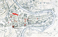
 Plan Bern 1882.jpg 1,938 × 1,270; 764 KB
-
 Bern Amthausgasse.PNG 1,184 × 747; 1.92 MB
-
 Bern Baerenplatz.PNG 1,184 × 747; 1.92 MB
-
 Bern Bahnhofplatz.PNG 1,184 × 747; 1.9 MB
-
 Bern Bubenbergplatz.PNG 1,184 × 747; 1.91 MB
-
 Bern Bundesplatz.PNG 1,184 × 747; 1.91 MB
-
 Bern Gerechtigkeitsgasse.PNG 1,184 × 747; 1.91 MB
-
 Bern Junkerngasse.PNG 1,184 × 747; 1.92 MB
-
 Bern Kochergasse.PNG 1,184 × 747; 1.91 MB
-
 Bern Kornhausplatz.PNG 1,184 × 747; 1.92 MB
-
 Bern Kramgasse.PNG 1,184 × 747; 1.92 MB
-
 Bern Marktgasse.PNG 1,184 × 747; 1.92 MB
-
 Bern Muensterplatz.PNG 1,184 × 747; 1.92 MB
-
 Bern Munstergasse.PNG 1,184 × 747; 1.92 MB
-
 Bern Neuengasse.PNG 1,184 × 747; 1.92 MB
-
 Bern Nydeggstalden.PNG 1,184 × 747; 1.92 MB
-
 Bern Postgasse.PNG 1,184 × 747; 1.92 MB
-
 Bern Rathausgasse.PNG 1,184 × 747; 1.92 MB
-
 Bern Schauplatzgasse.PNG 1,184 × 747; 1.91 MB
-
 Bern Spitalgasse.PNG 1,184 × 747; 1.92 MB
-
 Bern Waisenhausplatz.PNG 1,184 × 747; 1.91 MB
-
 Bern Zeughausgasse.PNG 1,184 × 747; 1.92 MB
-
 Berne Aarbergergasse.PNG 1,184 × 747; 1.91 MB
-
 Berne Herrengasse 1882.PNG 1,184 × 747; 1.92 MB
-
 Berne Kramgasse.PNG 1,184 × 747; 1.92 MB


