Category:Bern-Blumenfeld
Jump to navigation
Jump to search
| Object location | | View all coordinates using: OpenStreetMap |
|---|
Deutsch: Blumenfeld ist ein Gebräuchliches Quartier und Teil des grösseren Quartiers oder Statistischen Bezirks Bethlehem im Stadtteil Bümpliz-Oberbottigen, der auch als Stadtteil VI bekannt ist, in der Stadt Bern in der Schweiz
English: This category has media for Blumenfeld as a part of Berne Switzerland
common quarter in the district Bümpliz-Oberbottigen/ district VI in the city of Bern, Switzerland  | |||||
| Upload media | |||||
| Instance of | |||||
|---|---|---|---|---|---|
| Part of | |||||
| Location | Bethlehem, Bümpliz-Oberbottigen, Bern, Bern-Mittelland administrative district, Bernese Mittelland administrative region, Bern, Switzerland | ||||
| Area |
| ||||
| Elevation above sea level |
| ||||
 | |||||
Media in category "Bern-Blumenfeld"
The following 6 files are in this category, out of 6 total.
-
 Blumenfeld Bebauung1(links).jpg 2,964 × 2,458; 1.57 MB
-
 Blumenfeld Bebauung2.jpg 2,963 × 1,850; 1.27 MB
-
 Blumenfeld Bebauung3.jpg 2,963 × 2,387; 1.29 MB
-
 Blumenfeld beerhaus.jpg 2,963 × 2,624; 1.72 MB
-
 Blumenfeld Brocki.jpg 2,963 × 1,772; 1.47 MB
-
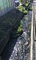 Blumenfeld Stadtbach.jpg 2,252 × 3,766; 2.81 MB
.jpg)


