Category:Benton, Newcastle upon Tyne
Jump to navigation
Jump to search
area in Tyne and Wear, England | |||||
| Upload media | |||||
| Instance of | |||||
|---|---|---|---|---|---|
| Location | Newcastle upon Tyne, Tyne and Wear, North East England, England | ||||
| Different from | |||||
 | |||||
English: Benton is a district to the north east of Newcastle upon Tyne. A section of this district is administratively part of the City, but the greater part, which lies inside the Parish of St Bartholomew, Longbenton, is within North Tyneside.
Subcategories
This category has the following 4 subcategories, out of 4 total.
B
- Benton Metro station (2 P, 11 F)
- Benton railway station (1 F)
R
- Rising Sun Country Park (13 F)
Media in category "Benton, Newcastle upon Tyne"
The following 10 files are in this category, out of 10 total.
-
 Benton Hypermarket - geograph.org.uk - 69412.jpg 640 × 475; 68 KB
-
 Milepost - geograph.org.uk - 222808.jpg 640 × 475; 104 KB
-
 St Aidan's Church - geograph.org.uk - 222815.jpg 640 × 475; 90 KB
-
 St Aidan's Church, Benton - geograph.org.uk - 5287867.jpg 2,000 × 1,500; 685 KB
-
 The Black Bull Public House - geograph.org.uk - 992940.jpg 640 × 427; 64 KB
-

-
 Benton Industrial Estate - geograph.org.uk - 69452.jpg 640 × 475; 86 KB
-
 Dog and Cat Shelter - geograph.org.uk - 69488.jpg 640 × 475; 84 KB
-
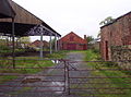 East Benton Farm - geograph.org.uk - 69409.jpg 640 × 475; 118 KB
-
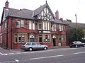 Ship Inn - geograph.org.uk - 222814.jpg 640 × 475; 96 KB


