Category:Bentley, East Riding of Yorkshire
Jump to navigation
Jump to search
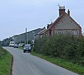
English: Bentley is a hamlet in the civil parish of Rowley in the East Riding of Yorkshire, England. It is situated approximately 2.5 miles (4 km) south of the market town of Beverley.
It lies to the west of the A164 road though there is no access from the main road apart from agricultural vehicles.
village in East Riding of Yorkshire, United Kingdom | |||||
| Upload media | |||||
| Instance of | |||||
|---|---|---|---|---|---|
| Location | Rowley, East Riding of Yorkshire, Yorkshire and the Humber, England | ||||
 | |||||
Media in category "Bentley, East Riding of Yorkshire"
The following 43 files are in this category, out of 43 total.
-
A1079 beverley eastbound enh.png 300 × 225; 120 KB
-
A1079 beverley eastbound.jpg 1,695 × 1,225; 252 KB
-
A1079, Beverley Bypass (geograph 6361408).jpg 800 × 600; 67 KB
-
A164 - A1079 - geograph.org.uk - 97636.jpg 640 × 480; 135 KB
-
Bentley - geograph.org.uk - 97612.jpg 640 × 480; 165 KB
-
Bentley, eastern end - geograph.org.uk - 577229.jpg 640 × 578; 162 KB
-
Beverley sisters - geograph.org.uk - 629385.jpg 640 × 472; 184 KB
-
Chapel, Bentley - geograph.org.uk - 576668.jpg 640 × 472; 180 KB
-
Coppleflat Lane (geograph 6756123).jpg 1,024 × 768; 148 KB
-
Coppleflat Lane in the gloaming - geograph.org.uk - 614544.jpg 640 × 490; 159 KB
-
Coppleflat Lane, Bentley - geograph.org.uk - 1733523.jpg 800 × 600; 126 KB
-
Cottages, Bentley - geograph.org.uk - 3253456.jpg 1,024 × 768; 139 KB
-
Cycleway near Skidby - geograph.org.uk - 577180.jpg 538 × 640; 195 KB
-
Duck Pond, Bentley - geograph.org.uk - 1733520.jpg 800 × 600; 182 KB
-
East along Coppleflat Lane, Bentley - geograph.org.uk - 2231485.jpg 800 × 600; 180 KB
-
Farmland near Bentley - geograph.org.uk - 1733522.jpg 800 × 600; 80 KB
-
Farmland near Park Farm - geograph.org.uk - 1733512.jpg 800 × 600; 117 KB
-
Farmland North of Bentley - geograph.org.uk - 716816.jpg 640 × 385; 180 KB
-
Farmland North of Bentley - geograph.org.uk - 97614.jpg 640 × 480; 118 KB
-
Lay-by on Coppleflat Lane (geograph 6756132).jpg 1,024 × 768; 171 KB
-
Leaving the A1079 Beverley Bypass - geograph.org.uk - 836608.jpg 640 × 496; 170 KB
-
Manor Farm, Bentley (2) - geograph.org.uk - 3257143.jpg 1,024 × 768; 192 KB
-
Manor Farm, Bentley - geograph.org.uk - 3253463.jpg 1,024 × 768; 208 KB
-
Manor Farm, Bentley - geograph.org.uk - 679358.jpg 640 × 480; 90 KB
-
Minor Road towards Walkington - geograph.org.uk - 1733514.jpg 800 × 600; 130 KB
-
Moor Lane (geograph 6756117).jpg 1,024 × 768; 209 KB
-
Park Farm - geograph.org.uk - 1733516.jpg 800 × 600; 95 KB
-
Park Farm - geograph.org.uk - 97626.jpg 640 × 480; 154 KB
-
Platwoods Fields - geograph.org.uk - 1733527.jpg 800 × 600; 131 KB
-
Platwoods Fields - geograph.org.uk - 662061.jpg 640 × 442; 201 KB
-
Platwoods Fields - geograph.org.uk - 662069.jpg 640 × 427; 179 KB
-
Pond and house, Bentley.jpg 640 × 474; 175 KB
-
St Peter Church Bentley.jpg 640 × 487; 74 KB
-
St. Peter's, Bentley - geograph.org.uk - 3253440.jpg 1,024 × 768; 162 KB
-
The A1079 Beverley Bypass - geograph.org.uk - 836604.jpg 640 × 322; 110 KB
-
The Anlaby to Beverley road. - geograph.org.uk - 63732.jpg 640 × 480; 95 KB
-
The Beverley Bypass - geograph.org.uk - 778073.jpg 640 × 522; 171 KB
-
The Last House in Bentley - geograph.org.uk - 679351.jpg 640 × 480; 60 KB
-
The pond on Coppleflat Lane, Bentley - geograph.org.uk - 2229488.jpg 800 × 600; 335 KB
-
The Village Pond, Bentley - geograph.org.uk - 698022.jpg 640 × 459; 80 KB
-
Tree near Bentley - geograph.org.uk - 3955472.jpg 480 × 640; 174 KB
-
Water infrastructure (geograph 6456719).jpg 1,024 × 768; 168 KB
-
White Cottage, Bentley - geograph.org.uk - 698042.jpg 640 × 480; 59 KB


