Category:Benfleet
Jump to navigation
Jump to search
unparished area in Castle Point, Essex, England | |||||
| Upload media | |||||
| Instance of | |||||
|---|---|---|---|---|---|
| Location | Castle Point, Essex, East of England, England | ||||
| Has part(s) | |||||
| Replaces |
| ||||
| |||||
Subcategories
This category has the following 4 subcategories, out of 4 total.
H
S
T
Media in category "Benfleet"
The following 78 files are in this category, out of 78 total.
-

-

-

-

-

-
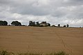
 Aerial view of SEEVIC, Benfleet - geograph.org.uk - 1574012.jpg 640 × 510; 314 KB
-

-

-
 Allhallows Pillbox - geograph.org.uk - 268428.jpg 640 × 426; 99 KB
-
 Benfleet Baptist Church - geograph.org.uk - 1600414.jpg 640 × 480; 130 KB
-
 Benfleet Creek in morning mist - geograph.org.uk - 1111730.jpg 640 × 480; 110 KB
-
 Benfleet Veterinary Surgery - geograph.org.uk - 1505649.jpg 640 × 480; 167 KB
-
 Benfleet, Downer Road North - geograph.org.uk - 962732.jpg 640 × 480; 104 KB
-
 Big Al's Furniture Kingdom - geograph.org.uk - 1525575.jpg 640 × 480; 196 KB
-

-
 Bus stop by Benfleet station - geograph.org.uk - 1524232.jpg 640 × 480; 145 KB
-
 Butcher's Broom in suburbia - geograph.org.uk - 1562494.jpg 640 × 480; 277 KB
-
 C2C train approaching Benfleet station - geograph.org.uk - 1524227.jpg 640 × 480; 147 KB
-
 Cemetery, Cemetery Corner, Benfleet - geograph.org.uk - 937342.jpg 640 × 425; 88 KB
-
 Coppicing in Hadleigh Country Park - geograph.org.uk - 1567789.jpg 640 × 430; 231 KB
-
 Coppicing in Hadleigh Country Park - geograph.org.uk - 1567792.jpg 640 × 433; 270 KB
-
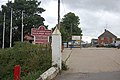
 Daws Heath Road and Hadleigh allotments - geograph.org.uk - 1656981.jpg 640 × 505; 201 KB
-
 Doctors' Surgery, Hadleigh - geograph.org.uk - 905171.jpg 640 × 425; 98 KB
-
 Empty House, Hadleigh - geograph.org.uk - 928503.jpg 640 × 425; 38 KB
-
 Entrance to 'The Close', Benfleet - geograph.org.uk - 1586310.jpg 640 × 480; 106 KB
-
 Essex Way doctors' surgery - geograph.org.uk - 1569282.jpg 640 × 405; 130 KB
-

-

-
 Hadleigh Castle, Hadleigh, United Kingdom (Unsplash EObuHoP0L U).jpg 6,000 × 4,000; 15.82 MB
-
 Hadleigh Marsh - geograph.org.uk - 1297567.jpg 428 × 640; 81 KB
-
 Holy Family Church, Tarpots, Benfleet - geograph.org.uk - 937332.jpg 640 × 425; 61 KB
-

-
 Home Farm Colony tea room - geograph.org.uk - 1584949.jpg 640 × 480; 106 KB
-
-

-
 Iron-Age Roundhouse replica - geograph.org.uk - 1100805.jpg 640 × 480; 110 KB
-

-
 Kents Hill Primary Schools - geograph.org.uk - 1553253.jpg 640 × 507; 189 KB
-

-
 Little Haven Hospice - geograph.org.uk - 906255.jpg 640 × 425; 92 KB
-
 Little Haven Nature Reserve - geograph.org.uk - 906252.jpg 640 × 425; 43 KB
-
 Look, countryside - geograph.org.uk - 910169.jpg 640 × 480; 113 KB
-
 Looking out across the marshes - geograph.org.uk - 1584952.jpg 640 × 360; 29 KB
-
 Looking up Benfleet Creek - geograph.org.uk - 1524211.jpg 640 × 480; 126 KB
-
 Manor Cottage, Benfleet - geograph.org.uk - 911997.jpg 640 × 425; 78 KB
-
 Manor Trading Estate, Benfleet - geograph.org.uk - 912335.jpg 640 × 425; 53 KB
-
 Manor Trading Estate, New Thundersley - geograph.org.uk - 1546656.jpg 640 × 506; 214 KB
-
 Moorcroft Hall, Daws Heath - geograph.org.uk - 1153063.jpg 640 × 425; 97 KB
-

-
 Old borrow dyke, Hadleigh Marshes - geograph.org.uk - 1519317.jpg 640 × 411; 178 KB
-
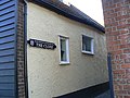
 Old Signpost - geograph.org.uk - 1152944.jpg 640 × 425; 112 KB
-

-
 Path on Benfleet Downs in the sixties - geograph.org.uk - 1473810.jpg 428 × 640; 170 KB
-

-
 Rear Entrance, Appleton School - geograph.org.uk - 937348.jpg 640 × 425; 39 KB
-
 Round Hill, Benfleet - geograph.org.uk - 923819.jpg 640 × 425; 68 KB
-

-
 Scrub bashing in Hadleigh Country Park - geograph.org.uk - 1565271.jpg 640 × 426; 199 KB
-
 Sea Clubrush on the Hadleigh Marshes - geograph.org.uk - 1578118.jpg 640 × 414; 58 KB
-
 Sea wall construction, Hadleigh Marshes - geograph.org.uk - 1519306.jpg 640 × 409; 133 KB
-
 Seawall Footpath - geograph.org.uk - 1028994.jpg 640 × 425; 55 KB
-
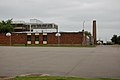
 Seevic College - geograph.org.uk - 746857.jpg 640 × 384; 139 KB
-
 Shops at the Tarpots road junction - geograph.org.uk - 1514088.jpg 625 × 474; 133 KB
-
 Shops at the Tarpots road junction - geograph.org.uk - 1525581.jpg 640 × 320; 106 KB
-

-
 Solby's House, Hadleigh - geograph.org.uk - 905177.jpg 640 × 425; 66 KB
-
 South Benfleet unparished area UK locator map.svg 1,345 × 1,266; 276 KB
-
 The Chase - geograph.org.uk - 905483.jpg 640 × 425; 101 KB
-
 The King John School, Thundersley - geograph.org.uk - 905481.jpg 640 × 425; 73 KB
-
 Thundersley Glen footpath - geograph.org.uk - 1565262.jpg 640 × 427; 217 KB
-
 Thundersley Oaks - geograph.org.uk - 1458522.jpg 640 × 428; 118 KB
-

-
 Thundersley pond after filling - geograph.org.uk - 1514926.jpg 640 × 421; 140 KB
-
 Thundersley pond before filling - geograph.org.uk - 1514917.jpg 640 × 422; 185 KB
-

-
 View from Hadleigh Farm - geograph.org.uk - 1297593.jpg 640 × 428; 79 KB
-

-
 Willow tree on Hadleigh Marsh - geograph.org.uk - 1561514.jpg 640 × 426; 114 KB


.jpg)


